- Dupo, Illinois
-
Dupo Village Country United States State Illinois County St. Clair Coordinates 38°30′57″N 90°12′29″W / 38.51583°N 90.20806°W Area 4.4 sq mi (11 km2) - land 4.4 sq mi (11 km2) Population 3,933 (2000) Density 888.6 / sq mi (343 / km2) Timezone CST (UTC-6) - summer (DST) CDT (UTC-5) Postal code 62239 Area code 618 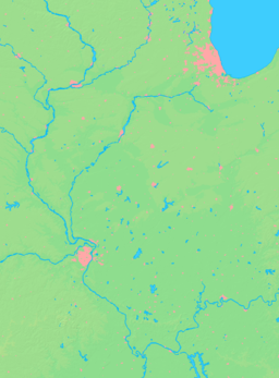

 Location of Dupo within Illinois
Wikimedia Commons: Dupo, Illinois Dupo is a village in St. Clair County, Illinois, United States. The population was 3,933 at the 2000 census. The village was settled in about 1750 and was incorporated in 1876. Its name is derived from Prairie du Pont (French: Bridge Prairie).
Contents
Geography
Dupo is located at 38°30′57″N 90°12′29″W / 38.51583°N 90.20806°W (38.515702, -90.207992).[1] It is located in the American Bottom floodplain of the Mississippi River.
According to the United States Census Bureau, the village has a total area of 4.4 square miles (11 km2),
History
From St. Clair County History, (Philadelphia: Brink, McDonough, and Company, 1881):
 Falling Springs, near Dupo.
- "The village received its name from the following circumstance: The first settlement was made on the present site, which is on the south bank of the creek, and about one mile (1.6 km) south of the village of Cahokia. At this point a rude bridge, constructed of logs, was built across the stream. An open prairie extended from the bridge south to the bluff. Pont is a French word, and means bridge in English. Hence the name, Prairie du Pont, or, Prairie Bridge [actually Bridge Prairie]. It was settled about 1750, by people from Cahokia. The origin of its settlement is undoubtedly due to the inundations to which the bottom was subject during high waters. Prairie du Pont is about ten or twelve feet higher than Cahokia, and in the time of the floods, the people of the Latter village were obliged to flee to the bluffs and higher grounds for safety. Tradition, in Prairie du Pont, substantiates the above theory."
- "However some will argue that the name actually came from a mispronunciation of the word Depot when the first train tracks were laid through that area. It's said that a railroad engineer (Lee Goudey) with a speech impediment said they "needed to build a dupo in this area" instead of depot. The name stuck and became an official town called Dupo."
- "According to Reynolds, the village contained fourteen families in 1765. Among the early settlers was Jean François Perry, who was a native of France, and emigrated to this country in 1792. He was a classical scholar, and was a descendant of one of the first families in France."
- Falling Springs "is one of the romantic spots in Illinois. It is situated at the bluff, one mile (1.6 km) south-east of Prairie du Pont village. It derives its name from a spring that gushes out of a perpendicular rock of the bluff, with a fall of sixty or seventy feet. The bluff at this point is a solid wall of limestone, about one hundred and thirty feet in height. The spring flows from an orifice situated midway between the top of the bluff and the rocky bottom beneath. Many years ago a grist mill was constructed at this point, and the water utilized for a power, but no trace of it remains at this time to be seen. Several years ago a hotel was built near the spring, and the place was made a summer resort by the people of East St. Louis and other towns."
Demographics
As of the census[2] of 2000, there were 3,933 people, 1,557 households, and 1,063 families residing in the village. The population density was 888.6 people per square mile (342.8/km²). There were 1,668 housing units at an average density of 376.9 per square mile (145.4/km²). The racial makeup of the village was 97.20% White, 1.17% African American, 0.31% Native American, 0.25% Asian, 0.36% from other races, and 0.71% from two or more races. Hispanic or Latino of any race were 0.69% of the population.
There were 1,557 households out of which 32.6% had children under the age of 18 living with them, 52.9% were married couples living together, 11.0% had a female householder with no husband present, and 31.7% were non-families. 26.1% of all households were made up of individuals and 10.9% had someone living alone who was 65 years of age or older. The average household size was 2.53 and the average family size was 3.04.
In the village the population was spread out with 25.2% under the age of 18, 10.7% from 18 to 24, 30.5% from 25 to 44, 21.4% from 45 to 64, and 12.1% who were 65 years of age or older. The median age was 35 years. For every 100 females there were 96.0 males. For every 100 females age 18 and over, there were 92.9 males.
The median income for a household in the village was $43,036, and the median income for a family was $47,000. Males had a median income of $35,529 versus $24,135 for females. The per capita income for the village was $18,505. About 2.9% of families and 4.3% of the population were below the poverty line, including 5.2% of those under age 18 and 3.8% of those age 65 or over.
See also
References
- ^ "US Gazetteer files: 2010, 2000, and 1990". United States Census Bureau. 2011-02-12. http://www.census.gov/geo/www/gazetteer/gazette.html. Retrieved 2011-04-23.
- ^ "American FactFinder". United States Census Bureau. http://factfinder.census.gov. Retrieved 2008-01-31.
External links
Municipalities and communities of St. Clair County, Illinois Cities Belleville | Centreville | Collinsville‡ | Columbia‡ | East St. Louis | Fairview Heights | Lebanon | Madison‡ | Mascoutah | O'Fallon

Villages Alorton | Brooklyn | Cahokia | Caseyville | Dupo | East Carondelet | Fairmont City‡ | Fayetteville | Freeburg | Hecker‡ | Lenzburg | Marissa | Millstadt | New Athens | New Baden‡ | Sauget | Shiloh | Smithton | St. Libory | Summerfield | Swansea | Washington Park
Townships Canteen | Caseyville | Centreville | Engelmann | Fayetteville | Freeburg | Lebanon | Lenzburg | Marissa | Mascoutah | Millstadt | New Athens | O’Fallon | Prairie du Long | Shiloh Valley | Smithton | St. Clair | Stites | Stookey | Sugarloaf
CDPs Unincorporated
communitiesDouglas | Imbs | Westview
Footnotes ‡This populated place also has portions in an adjacent county or counties
Categories:- Populated places in St. Clair County, Illinois
- Villages in Illinois


Wikimedia Foundation. 2010.