Cloutierville, Louisiana

Cloutierville, Louisiana
Cloutierville
City
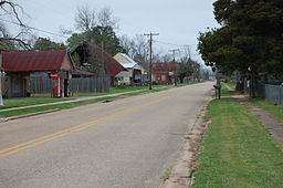
Louisiana Route 495 through Cloutierville
Country United States
State Louisiana
Parish Natchitoches
Established 1822
Timezone CST (UTC-6)
 - summer (DST) CDT (UTC-5)

Cloutierville is an unincorporated community in Natchitoches Parish, Louisiana, United States. It lies about 20 miles (32 km) south of the city of Natchitoches on exit 119 at Interstate 49. The community is part of the Natchitoches Micropolitan Statistical Area.

This is a homeland of many multiracial Louisiana Creole people.

The town was built on the plantation of Alexis Cloutier and incorporated in 1822. The plantation was later owned by Kate Chopin. The town is home to the Chopin House, Bayou Folk Museum, and the St. John Catholic Church and cemetery.

Leopold Caspari, a Natchitoches businessman and banker who served in both houses of the Louisiana State Legislature between 1884 and 1914, was a merchant in Cloutierville between 1849 and 1858.[1]

References

  1. ^ "Caspari, Leopold". Louisiana Historical Association, A Dictionary of Louisiana Biography (lahistory.org). http://www.lahistory.org/site20.php. Retrieved December 22, 2010. 

Coordinates: 31°32′36″N 92°55′06″W / 31.54333°N 92.91833°W / 31.54333; -92.91833


Wikimedia Foundation. 2010.

Игры ⚽ Поможем написать реферат

Look at other dictionaries:

  • Louisiana Creole people — Ethnic group group=Louisiana Creoles poptime=Unknown popplace=Louisiana, East Texas [ [http://www.ethnologue.com/show language.asp?code=lou Ethnologue report for language code:lou ] ] , Los Angeles County, California, coastal Mississippi, Chicago …   Wikipedia

  • National Register of Historic Places listings in Natchitoches Parish, Louisiana — Location of Natchitoches Parish in Louisiana This is a list of the National Register of Historic Places listings in Natchitoches Parish, Louisiana. This is intended to be a complete list of the properties and districts on the National Register of …   Wikipedia

  • Natchitoches Parish, Louisiana — Natchitoches Parish Courthouse (completed 1939) …   Wikipedia

  • Natchitoches, Louisiana — Coordinates: 31°44′35″N 93°05′42″W / 31.74306°N 93.095°W / 31.74306; 93.095 …   Wikipedia

  • Clarence, Louisiana — Coordinates: 31°49′13″N 93°01′44″W / 31.82028°N 93.02889°W / 31.82028; 93.02889 …   Wikipedia

  • Natchez, Louisiana — Coordinates: 31°40′27″N 93°02′41″W / 31.67417°N 93.04472°W / 31.67417; 93.04472 …   Wikipedia

  • Melrose, Louisiana — Coordinates: 31°35′56″N 92°58′02″W / 31.59889°N 92.96722°W / 31.59889; 92.96722 …   Wikipedia

  • Chopin, Louisiana — Chopin   Unincorporated community   …   Wikipedia

  • Marthaville, Louisiana — Coordinates: 31°44′20″N 93°23′48″W / 31.73889°N 93.39667°W / 31.73889; 93.39667 …   Wikipedia

  • Mink, Louisiana — Mink is an unincorporated community in Natchitoches Parish, Louisiana, United States. It is in Kisatchie National Forest. Mink is one of the last towns in the United States to get phone service. It got the service in 2005.[1] See also Timeline of …   Wikipedia

Share the article and excerpts

Direct link
Do a right-click on the link above
and select “Copy Link”