- Oketo, Hokkaidō
-
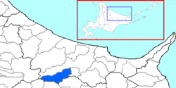 Location of Oketo in Okhotsk Subprefecture
Oketo (置戸町 Oketo-chō) is a town located in Tokoro District, Okhotsk Subprefecture, Hokkaido, Japan.
As of 2008, the town has an estimated population of 3,527 and a population density of 7.27 persons per km². The total area is 527.54 km².
Oketo was originally a logging community, and is currently involved in farming as well. Popular crops include potatoes, white flower beans and beets. Dairy farming and cattle farming are also practiced. Oketo was the tug-of-war champion of Japan for a number of years in the 1960s. That tradition of showing strength continues today in the Ningen Banba festival which is held in July every year. During the Ningen Bamba, teams of 5 or 7 men pull sleds of logs over man-made hills to the finished line.
As of April 2009, there are two elementary schools in Oketo: Oketo Elementary School, which covers the areas of Oketo, Sakaino, and Akita, and Katsuyama Elementary School. Oketo Junior High School is the only junior high school in town. There is also a prefectural high school located in Oketo, Oketo High School, which offers a social welfare course of study.
Oketo is well known in Japan for its wood crafts, called Oke-Craft. The majority of these crafts are household objects such as plates and bowls. They are usually made from a local white pine.
External links
- Official website (Japanese)
Categories:- Towns in Hokkaidō

Wikimedia Foundation. 2010.