- Otterbein, Indiana
-
Otterbein, Indiana — Town — The view north along Main Street. Benton County's location in Indiana
 Map of Otterbein
 Otterbein's location in Benton County
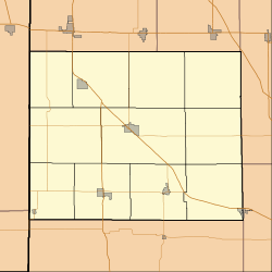
 Otterbein, Indiana
Coordinates: 40°29′20″N 87°5′43″W / 40.48889°N 87.09528°WCoordinates: 40°29′20″N 87°5′43″W / 40.48889°N 87.09528°W Country United States State Indiana Counties Benton, Tippecanoe Townships Bolivar, Shelby Area – Total 0.6 sq mi (1.5 km2) – Land 0.6 sq mi (1.5 km2) – Water 0.0 sq mi (0.0 km2) Elevation[1] 705 ft (215 m) Population (2010) – Total 1,262 – Density 2,293.7/sq mi (884.7/km2) Time zone EST (UTC-5) – Summer (DST) EDT (UTC-4) ZIP code 47970 Area code(s) 765 FIPS code 18-57258[2] GNIS feature ID 0440751[3] Otterbein is a town in Bolivar Township, Benton County and Shelby Township, Tippecanoe County, Indiana, named for William Otterbein Brown who donated land for the town. As of the 2010 census, its population was 1,262. It is part of the Lafayette, Indiana Metropolitan Statistical Area.
Contents
History
Originally a site known as Pond Grove, Otterbein's first 60 lots were laid out by John Levering and his wife on October 25, 1872, with an addition by Mary A. Clancey on April 24, 1883. The first home was built by Dr. John K. Thompson and the first business, a general store, by Henry H. Moore. William Otterbein Brown, the farmer and stock-dealer for whom the town was named, held the office of postmaster until his death on February 18, 1879. Otterbein High School ran from 1910-1966 when the rest of the high schools in the county were consolidated for Benton Central. The gym and most of the building burned in a fire in 1972.
Geography
Otterbein is located at 40°29′20″N 87°5′43″W / 40.48889°N 87.09528°W (40.488919, -87.095355)[4]. It occupies mostly flat, open farm land on the eastern border of Benton County in Bolivar Township, with eastern sections of the community extending into Tippecanoe County. U.S. Route 52 passes along its north side and the Kankakee, Beaverville and Southern Railroad cuts through town to the south.
According to the United States Census Bureau, the town has a total area of 0.6 square miles (1.6 km2), all of it land.
Oxford Street, old US 52, is the central E-W street and the only blinking traffic light in town is located at its junction with Main Street. Otterbein is known for its extremely wide, block long Main Street that accommodates two rows of parallel parking in the middle of the street.
A Centennial celebration was held over the July 4th holiday in 1972. During the festivities the town elevator, located at the west end of town, burned. As of this entry on 02/27/2009 there are two churches in town; Catholic and United Methodist. A fire in the last three years destroyed Denny's Pharmacy at the corner of First and Main and damaged the adjoining building to the north, the Shoemaker Funeral Home. Students attend Otterbein Elementary School and then move to Benton Central Jr-Sr School which has an Oxford, Indiana address.
The town had two sets of Nickel Plate railroad tracks and a depot until the nationalization of the railroads in the 1970s. One set of tracks has since been removed and the private KBS railroad uses the track primarily for grain transport. Since the end of 2008 the railroad right-of-way has been used for the placement of poles that carry electric power from the wind turbines in western Benton County to the substation at Montmorenci.
Haan Crafts, the Frontier Machine Company and the Kerkhoff Truss Plant were the initial occupants in the Industrial Park at the east edge of town which is actually in Tippecanoe County.
Demographics
 The Otterbein water tower.
As of the census[2] of 2000, there were 1,312 people, 498 households, and 359 families residing in the town. The population density was 2,291.9 people per square mile (888.7/km²). There were 518 housing units at an average density of 904.9 per square mile (350.9/km²). The racial makeup of the town was 98.02% White, 0.23% African American, 0.23% Native American, 0.61% from other races, and 0.91% from two or more races. Hispanic or Latino of any race were 1.07% of the population.
There were 498 households out of which 42.4% had children under the age of 18 living with them, 54.2% were married couples living together, 12.2% had a female householder with no husband present, and 27.9% were non-families. 24.5% of all households were made up of individuals and 11.8% had someone living alone who was 65 years of age or older. The average household size was 2.63 and the average family size was 3.11.
In the town the population was spread out with 30.8% under the age of 18, 8.8% from 18 to 24, 31.6% from 25 to 44, 17.1% from 45 to 64, and 11.6% who were 65 years of age or older. The median age was 32 years. For every 100 females there were 96.1 males. For every 100 females age 18 and over, there were 86.8 males.
The median income for a household in the town was $40,524, and the median income for a family was $45,341. Males had a median income of $31,000 versus $20,944 for females. The per capita income for the town was $17,128. About 4.8% of families and 6.9% of the population were below the poverty line, including 6.8% of those under age 18 and 9.9% of those age 65 or over.
Notable natives
- Adam Kennedy (1922–1997), American actor, author, and painter
- Neal Musser, professional baseball player
- Richard Atha, OHS Graduate, NBA player, member Indiana Basketball Hall of Fame
- Donald E. Williams, OHS Graduate, Commander NASA space shuttle
Education
References
- ^ "USGS detail on Otterbein". http://geonames.usgs.gov/pls/gnispublic/f?p=gnispq:3:::NO::P3_FID:440751. Retrieved 2007-10-03.
- ^ a b "American FactFinder". United States Census Bureau. http://factfinder.census.gov. Retrieved 2008-01-31.
- ^ "US Board on Geographic Names". United States Geological Survey. 2007-10-25. http://geonames.usgs.gov. Retrieved 2008-01-31.
- ^ "US Gazetteer files: 2010, 2000, and 1990". United States Census Bureau. 2011-02-12. http://www.census.gov/geo/www/gazetteer/gazette.html. Retrieved 2011-04-23.
Further reading
- Mossman, Ed (1883), "History of Benton County: Past Events -- Present Condition" in Counties of Warren, Benton, Jasper and Newton, Indiana: Historical and Biographical, Chicago: F. A. Battey & Co.
Municipalities and communities of Benton County, Indiana Towns 
Townships Unincorporated
communitiesAtkinson | Barce | Chase | Dunn | Dunnington | Free | Freeland Park | Handy | Lochiel | Raub | Swanington | Talbot | Templeton | Wadena
Footnotes ‡This populated place also has portions in an adjacent county or counties
Municipalities and communities of Tippecanoe County, Indiana Cities 
Towns Battle Ground | Clarks Hill | Dayton | Otterbein‡ | Shadeland
Townships Unincorporated
communitiesAmericus | Ash Grove | Buck Creek | Cairo | Colburn | Concord | Monitor | Monroe | Montmorenci | North Crane | Odell | Pettit | Romney | South Raub | Stockwell | Westpoint
Ghost towns Footnotes ‡This populated place also has portions in an adjacent county or counties
Categories:- Populated places in Benton County, Indiana
- Populated places in Tippecanoe County, Indiana
- Towns in Indiana
- Lafayette, Indiana metropolitan area


Wikimedia Foundation. 2010.