- Waterloo, Indiana
Infobox Settlement
official_name = Town of Waterloo, Indiana
settlement_type =Town
nickname =
motto =
imagesize =
image_caption =
image_
imagesize =
image_caption =
image_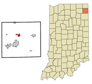
mapsize = 250x200px
map_caption = Location of Waterloo in the state ofIndiana
mapsize1 =
map_caption1 =subdivision_type = Country
subdivision_name =United States
subdivision_type1 = State
subdivision_name1 =Indiana
subdivision_type2 = County
subdivision_name2 = DeKalb
subdivision_type3 = Township
subdivision_name3 = Grant, Smithfield
government_footnotes =
government_type =
leader_title =
leader_name =
leader_title1 =
leader_name1 =
established_title =
established_date =area_footnotes =
unit_pref = Imperial
area_magnitude =
area_total_km2 = 3.9
area_land_km2 = 3.9
area_water_km2 = 0.0
area_total_sq_mi = 1.5
area_land_sq_mi = 1.5
area_water_sq_mi = 0.0population_as_of = 2000
population_footnotes =
population_total = 2200
population_density_km2 = 566.3
population_density_sq_mi = 1466.6timezone = Eastern (EST)
utc_offset = -5
timezone_DST = EDT
utc_offset_DST = -4
elevation_footnotes =
elevation_m = 276
elevation_ft = 906
latd = 41 |latm = 25 |lats = 53 |latNS = N
longd = 85 |longm = 1 |longs = 21 |longEW = Wpostal_code_type =
ZIP code
postal_code = 46793
area_code = 260
blank_name = FIPS code
blank_info = 18-81278GR|2
blank1_name = GNIS feature ID
blank1_info = 0445542GR|3
website =
footnotes =Waterloo is a town in Grant and Smithfield townships, DeKalb County,
Indiana ,United States . The population was 2,200 at the 2000 census.Geography
Waterloo is located at coor dms|41|25|53|N|85|1|21|W.
According to the
United States Census Bureau , the town has a total area of 1.5square mile s (3.9km² ), all of it land.Demographics
As of the
census GR|2 of 2000, there were 2,200 people, 832 households, and 584 families residing in the town. Thepopulation density was 1,466.6 people per square mile (566.3/km²). There were 898 housing units at an average density of 598.7/sq mi (231.1/km²). The racial makeup of the town was 95.50% White, 0.23% African American, 0.45% Native American, 0.18% Asian, 2.82% from other races, and 0.82% from two or more races. Hispanic or Latino of any race were 3.68% of the population.There were 832 households out of which 39.1% had children under the age of 18 living with them, 52.3% were married couples living together, 11.8% had a female householder with no husband present, and 29.7% were non-families. 23.8% of all households were made up of individuals and 8.4% had someone living alone who was 65 years of age or older. The average household size was 2.64 and the average family size was 3.10.
In the town the population was spread out with 30.4% under the age of 18, 9.5% from 18 to 24, 33.0% from 25 to 44, 18.8% from 45 to 64, and 8.4% who were 65 years of age or older. The median age was 31 years. For every 100 females there were 106.4 males. For every 100 females age 18 and over, there were 100.8 males.
The median income for a household in the town was $39,831, and the median income for a family was $45,625. Males had a median income of $35,035 versus $24,635 for females. The
per capita income for the town was $16,248. About 7.9% of families and 12.4% of the population were below thepoverty line , including 16.8% of those under age 18 and 17.8% of those age 65 or over.Education
Waterloo lies in the Dekalb County Central United School District. Public schools serving Waterloo are:
*Waterloo Elementary School
*DeKalb Middle School
*DeKalb High SchoolRail transportation
Waterloo is located on the old
Lake Shore and Michigan Southern Railway , and is now on theNorfolk Southern Railway . The town is now served daily by twoAmtrak trains: the "Capitol Limited " and the "Lake Shore Limited ".Other facts
* A nearly complete
mastodon skeleton discovered near Waterloo in1888 is displayed at the [http://www.carnegiemnh.org/vp/history.html Carnegie Museum of Natural History] in Pittsburgh.
* Charles A.O. McClellan (1835-1898), a member of U.S. House of Representatives, 1889-1892, is buried in Waterloo.
* WINT-TV, Channel 15, which becameWANE-TV , Fort Wayne, in1956 , began broadcasting from studios in Waterloo in1954 .References
External links
* [http://www.waterloochamber.com/index.htm Waterloo Chamber of Commerce]
* [http://www.dekalb.k12.in.us/ DeKalb County Central United School District]
* [http://www.waterloo150.org/ Waterloo 150th Celebration 2006]
* [http://mywaterloo-in.com/ My Home Town of Waterloo Forums]
Wikimedia Foundation. 2010.