- Markle, Indiana
-
Markle, Indiana — Town — Location of Markle in the state of Indiana
Coordinates: 40°49′35″N 85°20′17″W / 40.82639°N 85.33806°WCoordinates: 40°49′35″N 85°20′17″W / 40.82639°N 85.33806°W Country United States State Indiana Counties Huntington, Wells Township Rockcreek, Rock Creek Area – Total 1.0 sq mi (2.6 km2) – Land 1.0 sq mi (2.6 km2) – Water 0.0 sq mi (0.1 km2) Elevation 810 ft (247 m) Population (2010) – Total 1,095 – Density 1,116.3/sq mi (431.0/km2) Time zone Eastern (EST) (UTC-5) – Summer (DST) EDT (UTC-4) ZIP code 46770 Area code(s) 260 FIPS code 18-47160[1] GNIS feature ID 0438624[2] Markle is a town in Huntington and Wells Counties in the U.S. state of Indiana. The population was 1,095 at the 2010 census. It lies along Interstate 69, U.S. Route 224, Indiana State Road 116 and Indiana State Road 3 .
Contents
Geography
Markle is located at 40°49′35″N 85°20′17″W / 40.82639°N 85.33806°W (40.826477, -85.338076)[3]. The Wabash River flows through the south edge of the town.
According to the United States Census Bureau, the town has a total area of 1.0 square mile (2.6 km2), of which, 1.0 square mile (2.6 km2) of it is land and 0.04 square miles (0.10 km2) of it (2.94%) is water.
Demographics
As of the census[1] of 2000, there were 1,102 people, 434 households, and 289 families residing in the town. The population density was 1,116.3 people per square mile (429.8/km²). There were 471 housing units at an average density of 477.1 per square mile (183.7/km²). The racial makeup of the town was 99.27% White, 0.36% African American, and 0.36% from two or more races. Hispanic or Latino of any race were 0.64% of the population.
 View of the intersection of State Road 3 and US 224 at Markle
There were 434 households out of which 28.8% had children under the age of 18 living with them, 53.7% were married couples living together, 9.7% had a female householder with no husband present, and 33.4% were non-families. 28.6% of all households were made up of individuals and 12.0% had someone living alone who was 65 years of age or older. The average household size was 2.42 and the average family size was 2.98.
In the town the population was spread out with 24.3% under the age of 18, 9.4% from 18 to 24, 27.4% from 25 to 44, 20.5% from 45 to 64, and 18.3% who were 65 years of age or older. The median age was 38 years. For every 100 females there were 90.0 males. For every 100 females age 18 and over, there were 84.9 males.
The median income for a household in the town was $37,039, and the median income for a family was $48,654. Males had a median income of $35,163 versus $20,813 for females. The per capita income for the town was $18,504. About 3.6% of families and 6.7% of the population were below the poverty line, including 9.4% of those under age 18 and 3.1% of those age 65 or over.
References
- ^ a b "American FactFinder". United States Census Bureau. http://factfinder.census.gov. Retrieved 2008-01-31.
- ^ "US Board on Geographic Names". United States Geological Survey. 2007-10-25. http://geonames.usgs.gov. Retrieved 2008-01-31.
- ^ "US Gazetteer files: 2010, 2000, and 1990". United States Census Bureau. 2011-02-12. http://www.census.gov/geo/www/gazetteer/gazette.html. Retrieved 2011-04-23.
External links
Municipalities and communities of Huntington County, Indiana City 
Towns Andrews | Markle‡ | Mount Etna | Roanoke | Warren
Townships Clear Creek | Dallas | Huntington | Jackson | Jefferson | Lancaster | Polk | Rock Creek | Salamonie | Union | Warren | Wayne
Unincorporated
communitiesBanquo | Bippus | Bowerstown | Bracken | Buckeye | Goblesville | Harlansburg | Lancaster | Mahon | Majenica | Makin | Mardenis | Milo | Pleasant Plain | Plum Tree | Roanoke Station | Simpson
Footnotes ‡This populated place also has portions in an adjacent county or counties
Municipalities and communities of Wells County, Indiana City 
Towns Markle‡ | Ossian | Poneto | Uniondale | Vera Cruz | Zanesville‡
Townships Unincorporated
communitiesCraigville | Curryville | Dillman | Domestic | Five Points | Greenville | Greenwood | Jeff | Keystone | Kingsland | Liberty Center | McNatts | Mount Zion | Murray | North Oaks | Nottingham | Petroleum | Phenix | Reiffsburg | Riverside | Rockford | Tocsin | Toll Gate Heights | Travisville | Wellsburg
Footnotes ‡This populated place also has portions in an adjacent county or counties
Counties 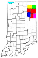
Municipalities with population
over 10,000 in 2000Municipalities with population
1,000-10,000 in 2000Albion · Andrews · Ashley · Avilla · Berne · Bluffton · Butler · Churubusco · Columbia City · Decatur · Garrett · Geneva · Grabill · Hamilton · Harlan · Huntertown · Kendallville · Leo-Cedarville · Ligonier · Markle · Monroeville · Ossian · Roanoke · Rome City · South Whitley · Warren · Waterloo · WoodburnMunicipalities with population
under 1,000 in 2000Altona · Cromwell · Corunna · Monroe · Mount Etna · Larwill · Poneto · Saint Joe · Uniondale · Vera Cruz · Wolcottville · ZanesvilleCategories:- Populated places in Huntington County, Indiana
- Populated places in Wells County, Indiana
- Towns in Indiana
- Fort Wayne metropolitan area


Wikimedia Foundation. 2010.