- Bargersville, Indiana
Infobox Settlement
official_name = Town of Bargersville, Indiana
mapsize = 250x200px
settlement_type =Town
imagesize =
image_caption =
imagesize =
image_caption =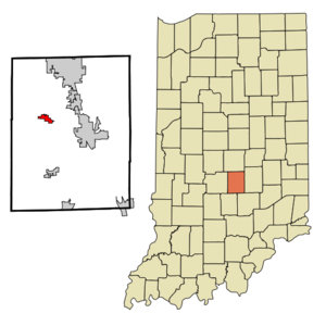
map_caption = Location in the state ofIndiana
mapsize1 =
map_caption1 =
subdivision_type = Country
subdivision_name =United States
area_note =
subdivision_type1 = State
subdivision_name1 =Indiana
subdivision_type2 = County
subdivision_name2 = Johnson
subdivision_type3 = Townships
subdivision_name3 = White River, Union
government_type =
leader_title =
leader_name =
established_date =
area_magnitude = 1 E6
area_total_km2 = 2.8
area_land_km2 = 2.8
area_water_km2 = 0.0
population_as_of = 2000
population_note =
population_total = 2890population_density_km2 = 751.0
timezone = EST
utc_offset = -5
timezone_DST = EST
utc_offset_DST = -5
area_total_sq_mi = 1.1
area_land_sq_mi = 1.1
area_water_sq_mi = 0.0
elevation_m = 250
elevation_ft = 820
latd = 39 |latm = 31 |lats = 12 |latNS = N
longd = 86 |longm = 9 |longs = 56 |longEW = W
postal_code_type =ZIP code
postal_code = 46106
area_code = 317
blank_name = FIPS code
blank_info = 18-03394GR|2
blank1_name = GNIS feature ID
blank1_info = 0430487GR|3
footnotes =
website =Bargersville is a town in White River and Union townships, Johnson County,
Indiana ,United States . The population was 2,120 at the 2000 census.Geography
Bargersville is located at coor dms|39|31|12|N|86|9|56|W|city (39.519928, -86.165570)GR|1.
According to the
United States Census Bureau , the town has a total area of 1.1square mile s (2.8km² ), all of it land.Demographics
As of the
census GR|2 of 2000, there were 2,120 people, 770 households, and 588 families residing in the town. Thepopulation density was 1,941.4 people per square mile (751.0/km²). There were 787 housing units at an average density of 720.7/sq mi (278.8/km²). The racial makeup of the town was 99.10% White, 0.05% African American, 0.19% Native American, 0.14% Asian, 0.05% from other races, and 0.47% from two or more races. Hispanic or Latino of any race were 0.47% of the population.There were 770 households out of which 43.0% had children under the age of 18 living with them, 60.3% were married couples living together, 11.6% had a female householder with no husband present, and 23.6% were non-families. 18.8% of all households were made up of individuals and 5.1% had someone living alone who was 65 years of age or older. The average household size was 2.74 and the average family size was 3.12.
In the town the population was spread out with 30.4% under the age of 18, 8.8% from 18 to 24, 35.0% from 25 to 44, 19.4% from 45 to 64, and 6.5% who were 65 years of age or older. The median age was 31 years. For every 100 females there were 100.9 males. For every 100 females age 18 and over, there were 97.6 males.
The median income for a household in the town was $48,264, and the median income for a family was $50,417. Males had a median income of $37,139 versus $24,205 for females. The
per capita income for the town was $19,499. About 3.7% of families and 4.3% of the population were below thepoverty line , including 5.1% of those under age 18 and 1.3% of those age 65 or over.References
External links
Wikimedia Foundation. 2010.