- Schererville, Indiana
Infobox Settlement
official_name = Town of Schererville, Indiana
settlement_type =Town
nickname = Crossroads of the Nation
mapsize = 250x200px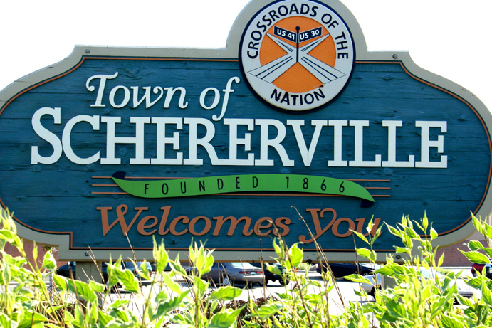
|thumb|center
imagesize =
image_caption =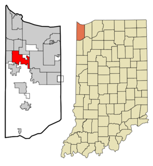
map_caption = Location in the state ofIndiana
mapsize1 =
map_caption1 =
subdivision_type = Country
subdivision_name =United States
area_footnotes =
unit_pref = Imperial
subdivision_type1 = State
subdivision_name1 =Indiana
subdivision_type2 = County
subdivision_name2 = Lake
subdivision_type3 = Township
subdivision_name3 = St. John
government_type = Town
leader_title = Town Manager
leader_name = Robert Volkmann
established_date =
area_magnitude = 1 E7
area_total_km2 = 35.3
area_land_km2 = 35.2
area_water_km2 = 0.1
population_as_of = 2000
population_note =
population_total = 24851
population_density_km2 = 705.0
timezone = CST
utc_offset = -6
timezone_DST = CDT
utc_offset_DST = -5
area_total_sq_mi = 13.6
area_land_sq_mi = 13.6
area_water_sq_mi = 0.0
elevation_m = 204
elevation_ft = 669
latd = 41 |latm = 29 |lats = 21 |latNS = N
longd = 87 |longm = 26 |longs = 35 |longEW = W
postal_code_type =ZIP code
postal_code = 46375
area_code = 219
blank_name = FIPS code
blank_info = 18-68220GR|2
blank1_name = GNIS feature ID
blank1_info = 0443066GR|3
footnotes =
website = schererville.org
established_title = Founded
established_date = 1866Schererville is a town in St. John Township, Lake County,
Indiana ,United States . It is part of theChicago metropolitan area . The population was 24,851 at the 2000 census and an estimated 28,394 as of July 2005.History
Long before Indiana became a state, long before the founding of Schererville, people called this place the "Crossroads." The name was appropriate, for several Indian trails that later became routes for the wagons of settlers traveling west intersected here.
One of those settlers was Nicholas Scherer, who arrived in the U.S. from Germany in 1846. When he came to this place at the southern tip of Lake Michigan in 1866, he founded the community that bears his name.
Today, trails still cross at Schererville, the modern trails of a motorized society, U.S. Highways 41 and 30. Nearby are newer trails, I-80/94 and I-65. All these are primary transcontinental routes and gives Schererville its slogan: "Crossroads of the Nation."
Since the 1990s, Schererville has attracted many former Illinois residents. The town's strategic location, reasonable housing costs, and high level of municipal services have contributed to its growth in recent years.
The town was named one of the "100 Best Places to Live in the U.S." by
Money Magazine in 2007.Geography
Schererville is located at coor dms|41|29|21|N|87|26|35|W|city (41.489135, -87.443137)GR|1.
According to the
United States Census Bureau , the town has a total area of 13.6square mile s (35.3km² ), of which, 13.6 square miles (35.2 km²) of it is land and 0.04 square miles (0.1 km²) of it (0.22%) is water.The ridge south of Route 30 is the
Glenwood Shoreline .Many residents of Schererville commute to work in downtown Chicago due to the city's proximity.
Demographics
As of the
census GR|2 of 2000, there were 24,851 people, 9,660 households, and 6,829 families residing in the town. Thepopulation density was 1,825.9 people per square mile (705.0/km²). There were 10,006 housing units at an average density of 735.2/sq mi (283.9/km²). The racial makeup of the town was 91.45% White, 2.14% African American, 0.11% Native American, 2.56% Asian, 0.04% Pacific Islander, 2.03% from other races, and 1.66% from two or more races. Hispanic or Latino of any race were 6.34% of the population.There were 9,660 households out of which 32.6% had children under the age of 18 living with them, 59.0% were married couples living together, 8.3% had a female householder with no husband present, and 29.3% were non-families. 24.2% of all households were made up of individuals and 6.5% had someone living alone who was 65 years of age or older. The average household size was 2.56 and the average family size was 3.08.
In the town the population was spread out with 24.3% under the age of 18, 8.7% from 18 to 24, 30.6% from 25 to 44, 26.1% from 45 to 64, and 10.4% who were 65 years of age or older. The median age was 37 years. For every 100 females there were 96.7 males. For every 100 females age 18 and over, there were 92.9 males.
The median income for a household in the town was $59,243, and the median income for a family was $70,474. Males had a median income of $50,732 versus $30,745 for females. The
per capita income for the town was $28,528. About 1.4% of families and 3.1% of the population were below thepoverty line , including 1.9% of those under age 18 and 2.2% of those age 65 or over.Education
Schererville is served by the Lake Central School Corporation, which also services the adjacent towns of St. John and Dyer.
List of schools - Lake Central School Corporation:
*Lake Central High School
*Grimmer Middle School
*Kahler Middle School
*Clark Middle School
*Peifer Elementary
*Bibich Elementary
*Kolling Elementary
*Homan Elementary
*Protsman Elementary
*Watson ElementaryPrivate schools in the town include St. Michael School and the Forest Ridge Academy. The campus of Hammond Baptist Schools, affiliated with the
First Baptist Church of Hammond , is also located in Schererville.Police Department - Fallen Officers
In the history of the Schererville Police Department, two officers have been killed in the line of duty.
Newspaper
Schererville is served by
The Times of Northwest Indiana , the fastest-growing English-language newspaper in the United States, according to an April, 2008 report by theAudit Bureau of Circulations .Transportation
The closest commercial airport to Schererville is the
Gary/Chicago International Airport in Gary.References
External links
* [http://www.schererville.org/ Official town website]

Wikimedia Foundation. 2010.