Dún na Rí Forest Park

Dún na Rí Forest Park
Map showing the location of Dún na Rí Forest Park
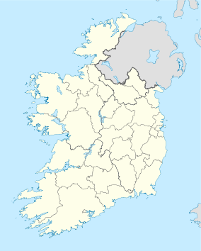
Location Clonee, Cavan,  Ireland
Coordinates 53°55′05″N 6°47′43″W / 53.91804°N 6.79522°W / 53.91804; -6.79522Coordinates: 53°55′05″N 6°47′43″W / 53.91804°N 6.79522°W / 53.91804; -6.79522
Area 565 acres (2.3 km2)
Governing body Coillte

Dún na Rí Forest Park is a forest park is situated on the County Cavan-County Monaghan border, in Ireland. The park itself borders the Shercock and Carrickmacross roads more specifically at Magheracloone and Kingscourt.

Fauna and Location

Dún na Rí Forest Park is a place of surprising contrasts. Situated in a tranquil glen, Dún na Rí is home to stoat, hare, mink, rabbit and otter, as well as red and grey squirrel along the banks of the River Cabra. It is a peaceful place with a lake and many attractions. Many people come to see the park each year.


Wikimedia Foundation. 2010.

Игры ⚽ Поможем написать курсовую

Look at other dictionaries:

  • Dartrey Forest — Dartrey Heritage Dartrey Forest, County Monaghan, Ireland was formerly the estate of the Dawson family, who had the title Earl of Dartrey from 1866 to 1933. It is currently managed by Coillte as a commercial forest. The Forest is bordered by a… …   Wikipedia

  • Jim Corbett National Park —   national park   IUCN Category II (National Park) …   Wikipedia

  • Marlay Park — Contents 1 Marlay House 2 Marlay Craft Centre 3 Wicklow Way 4 …   Wikipedia

  • Kaziranga National Park — Infobox Indian Jurisdiction type = national park native name = Kaziranga National Park other name = as. কাজিৰঙা ৰাষ্ট্ৰীয় উদ্যান iucn category = II state name = Assam district= Golaghat, Nagaon nearest city = Golaghat latd=26 |latm=40 |lats=00… …   Wikipedia

  • Kaziranga National Park — Parc national de Kaziranga Parc national de Kaziranga Catégorie II de la CMAP (Parc national) [1] …   Wikipédia en Français

  • Rajaji National Park — Infobox protected area name = Rajaji National Park caption = Rajaji National Park, Uttarakhand iucn category = II locator x = 100 locator y = 83 location = Uttarakhand, India nearest city = Haridwar and Dehra Dun lat degrees = 30 lat minutes = 03 …   Wikipedia

  • White Park — The White Park (also known as the Ancient White Park [http://bbar.com/www/parkcattle/] B Bar Ranch] [http://www.albc usa.org/cpl/wtchlist.html#cattle] American Livestock Breeds Conservancy] [http://www.whiteparkbeef.com/] White Park Grass Fed… …   Wikipedia

  • Fenwick High School (Oak Park, Illinois) — Infobox School name = Fenwick High School native name = latin name = imagesize = 200 caption = location = streetaddress = 505 W. Washington Blvd. region = city = Oak Park state = Illinois province = county = postcode = postalcode = zipcode =… …   Wikipedia

  • Climate of Kaziranga National Park — Kaziranga National Park (Assamese: কাজিৰঙা ৰাষ্ট্ৰীয় উদ্যান Kazirônga Rastriyô Uddyan, IPA: [kaziɹɔŋa ɹastɹijɔ udːjan]) is an Indian national park and a World Heritage Site in Golaghat and Nagaon districts of Assam, India. It is refuge for… …   Wikipedia

  • County Monaghan — Coordinates: 54°14′37″N 7°02′22″W / 54.243563°N 7.039490°W / 54.243563; 7.039490 …   Wikipedia

Share the article and excerpts

Direct link
Do a right-click on the link above
and select “Copy Link”