- Churubusco, Indiana
-
Town of Churubusco, Indiana — Town — Turtle Town, U.S.A.
Nickname(s): 'Busco, Turtle Town, U.S.A. Location in the state of Indiana
Coordinates: 41°13′53″N 85°19′10″W / 41.23139°N 85.31944°WCoordinates: 41°13′53″N 85°19′10″W / 41.23139°N 85.31944°W Country United States State Indiana County Whitley Township Smith Government – Type council-clerk – President Vivian Rosswurm Area – Total 0.9 sq mi (2.3 km2) – Land 0.9 sq mi (2.3 km2) – Water 0.0 sq mi (0.0 km2) Elevation 899 ft (274 m) Population (2010) – Total 1,796 – Density 1,871.8/sq mi (722.7/km2) – Demonym Busconian Time zone EST (UTC−5) – Summer (DST) EDT (UTC−4) ZIP code 46723 Area code(s) 260 FIPS code 18-12610[1] GNIS feature ID 0432516[2] Website http://www.churubusco.net Churubusco (
 /ˌtʃɛrəˈbʌskoʊ/ or /ˌtʃɛriˈbʌsɡoʊ/); often shortened to Busco /ˈbʌskoʊ/), is a town located near the headwaters of the Eel River in the extreme northeast corner of Whitley County, Indiana, United States, in Smith Township, about 16 miles (26 km) northwest of Fort Wayne. The population was 1,796 at the 2010 census.
Contents
Geography
Churubusco is located at 41°13′53″N 85°19′10″W / 41.23139°N 85.31944°W (41.231373, -85.319541)[3].
According to the United States Census Bureau, the town has a total area of 0.9 square miles (2.3 km2), all of it land.
Demographics
As of the census[1] of 2000, there were 1,666 people, 650 households, and 438 families residing in the town. The population density was 1,876.8 people per square mile (722.7/km²). There were 692 housing units at an average density of 779.5 per square mile (300.2/km²). The racial makeup of the town was 97.60% White, 0.06% African American, 0.60% Native American, 0.24% Asian, 0.06% Pacific Islander, 0.12% from other races, and 1.32% from two or more races. Hispanic or Latino of any race were 1.38% of the population.
There were 650 households out of which 36.0% had children under the age of 18 living with them, 50.9% were married couples living together, 13.1% had a female householder with no husband present, and 32.5% were non-families. 28.6% of all households were made up of individuals and 13.8% had someone living alone who was 65 years of age or older. The average household size was 2.54 and the average family size was 3.15.
In the town the population was spread out with 29.0% under the age of 18, 9.7% from 18 to 24, 30.4% from 25 to 44, 18.6% from 45 to 64, and 12.3% who were 65 years of age or older. The median age was 33 years. For every 100 females there were 88.9 males. For every 100 females age 18 and over, there were 83.1 males.
The median income for a household in the town was $39,583, and the median income for a family was $49,279. Males had a median income of $34,844 versus $22,161 for females. The per capita income for the town was $17,814. About 3.2% of families and 4.9% of the population were below the poverty line, including 4.0% of those under age 18 and 7.4% of those age 65 or over.
History
 An 1889 plat map of Churubsuco showing the first two towns, "Union" and "Franklin."
Originally, the area of Churubusco was made up of two towns founded in the 19th century by European Americans: Union (in honor of the union victory of the Civil War) and Franklin (in honor of the founding father, Benjamin Franklin) that bordered each other across a railroad track. In the 1840s, the populations of both Franklin and Union grew large enough to qualify each for a post office. Before that time, residents of both towns had to trek 11 miles by foot or horse and buggy to nearby Columbia City to get their mail. Since the towns were in the same location, the Postmaster General ordered the towns to apply for a joint post office. The Postmaster General denied the use of either "Union" and "Franklin" as the new post office name, since both were already used by other Indiana towns.
After a community meeting, the residents selected Churubusco for the new post office, named after the site of the 1847 Battle of Churubusco, in Mexico during the Mexican-American War. At the time, after the suggestion of local school teacher Eliza Rich, the townsfolk thought it was as patriotic a name as Union and Franklin, since the United States won a large victory there. More importantly, they were certain no other Indiana town would already have chosen such a unique name.[4]
The name Churubusco is a Spanish corruption of an indigenous Nahuatl toponym (place name) referring to a temple area celebrating the Aztec god Huitzilopochtli. It is bordered by the Rio Churubusco in Mexico City. The Spanish-Nahuatl word literally translates as "place of the hummingbirds.[5]
Law and government
Churubusco has an elected clerk and town council-style government. The Churubusco Town Council is a three-member legislative group that serve four-year terms; each are elected town-wide as at-large council members. The council elects one member from among its body to act a president of the council. That president sets agendas during council meetings. The current council members were elected on November 6, 2007, and will serve until December 31, 2011[6]:
- Vivian Rosswurm, President, Democrat
- Frank A. Kessler, Democrat
- John Hart, Republican
Republican Gerri Johnson is Churubusco's town clerk.
Culture
 Welcome sign boasting of Churubusco as "Turtle Town U.S.A."
The town has an annual festival called Turtle Days rooted in the lore of the Beast of Busco, a giant snapping turtle that reportedly haunted nearby Fulk's Lake in Allen County. Many have tried to catch the monster turtle named Oscar but no successful attempt have ever been recorded. He has been thought to be the size of a small car. The lake he is rumored to hide in has been drained before but no evidence was found. A popular theory as to why this turtle is so elusive is because the lakes and ponds around Churubusco are connected thought an extensive series of channels and streams. Some of these are actually underground tunnels. Many local have claimed to see the beast but until evidence can be found Oscar will still be a mystery of Churubusco, Indiana.
There is a pond north of Churubusco that is in the shape of the Indiana University’s symbol. It is next to a major road down in a valley so passing cars can see it. Most of the time the moss and weeds are overgrown making it hard to see, but when it is all cleaned up it looks quite nice.
Churubusco has a famous restaurant, The Magic Wand. It is a family friendly diner that also has an outside ice-cream shop. Inside and outside the building is decorated with hundreds of clowns. One of the trash cans outside is a clown where you throw trash in his mouth.
Education
Churubusco High School, Middle School, and Elementary School together form the Smith-Green Community Schools district which includes approximately 1,400 students.[7]
Climate
Climate data for Churubusco, Indiana Month Jan Feb Mar Apr May Jun Jul Aug Sep Oct Nov Dec Year Average high °F (°C) 30
(−1)34
(1)46
(8)59
(15)71
(22)80
(27)84
(29)82
(28)76
(24)63
(17)49
(9)36
(2)59
(15.1)Average low °F (°C) 14
(−10)16
(−9)26
(−3)36
(2)47
(8)57
(14)60
(16)58
(14)51
(11)40
(4)32
(0)20
(−7)38.1
(3.4)Precipitation inches (mm) 1.9
(48)1.8
(46)2.9
(74)3.6
(91)3.5
(89)4.1
(104)3.8
(97)3.4
(86)3.4
(86)2.6
(66)3.3
(84)3.1
(79)37.4
(950)Source: weatherbase.com.[8] Severe weather
- On April 25, 1929 a tornado blew the roof off of a service station in the town.[9]
Media
Newspapers
Churbusco has had seven news sources in its history, five of which have ceased publication.[10]
- BuscoVoice.com - an online community news site - was launched in June, 2008 by two local business owners.
- Churubusco News, weekly tabloid newspaper, 1994–present
- Busco Paper, weekly newspaper, 1914–1936
- Daily Busconian, daily newspaper, 1910
- Churubusco Tri-County Truth, weekly tabloid newspaper, 1891–1990, originally published as the Saturday Truth
- Churubusco Sunday People, weekly newspaper, January 17 - May 27, 1886
- Churubusco Weekly Herald, weekly newspaper, 1881–1882
Radio
- WNHT-FM 96.3 MHz Radio format: Contemporary hit radio / Rhythmic
Notable natives
- Harry Gandy, (1881–1957), former U.S. Representative from South Dakota (March 4, 1915 - March 3, 1921).[11]
- Craig W. Hartman, architect.[12]
References
- ^ a b "American FactFinder". United States Census Bureau. http://factfinder.census.gov. Retrieved 2008-01-31.
- ^ "US Board on Geographic Names". United States Geological Survey. 2007-10-25. http://geonames.usgs.gov. Retrieved 2008-01-31.
- ^ "US Gazetteer files: 2010, 2000, and 1990". United States Census Bureau. 2011-02-12. http://www.census.gov/geo/www/gazetteer/gazette.html. Retrieved 2011-04-23.
- ^ S. P. Kaler and R. H. Maring, Whitley County Indiana, B.F. Bowen & Co., 1907.
- ^ Howard LaFranchi, "How the Southwest was won", Christian Science Monitor, 20 Aug 1997, accessed 9 May 2008
- ^ Results: WHITLEY COUNTY, Fort Wayne Journal Gazette, November 6, 2007. Retrieved on July 3, 2000.
- ^ Smith-Green Community Schools. Retrieved on 2008-05-29.
- ^ "Whitley County, Indiana". http://www.weatherbase.com/weather/weather.php3?refer=&s=937121. Retrieved 2006-07-02.
- ^ Apr 25 in weather history..., National Weather Service. Retrieved on June 16, 2006.
- ^ "Whitley County Newspapers". Indiana State Library. http://www.in.gov/library/3579.htm. Retrieved 2008-09-04.
- ^ GANDY, Harry Luther, Biographical Directory of the United States Congress Retrieved on June 16, 2006.
- ^ After years bringing credit to Ball State, Venderly, Hartman honored by alma mater, Ball State University News Service, May 21, 2009. Retrieved on July 15, 2009.
External links
Municipalities and communities of Whitley County, Indiana City 
Towns Churubusco | Larwill | South Whitley
Townships Cleveland | Columbia | Etna-Troy | Jefferson | Richland | Smith | Thorncreek | Union | Washington
Unincorporated
communitiesCounties 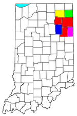
Municipalities with population
over 10,000 in 2000Municipalities with population
1,000-10,000 in 2000Albion · Andrews · Ashley · Avilla · Berne · Bluffton · Butler · Churubusco · Columbia City · Decatur · Garrett · Geneva · Grabill · Hamilton · Harlan · Huntertown · Kendallville · Leo-Cedarville · Ligonier · Markle · Monroeville · Ossian · Roanoke · Rome City · South Whitley · Warren · Waterloo · WoodburnMunicipalities with population
under 1,000 in 2000Altona · Cromwell · Corunna · Monroe · Mount Etna · Larwill · Poneto · Saint Joe · Uniondale · Vera Cruz · Wolcottville · ZanesvilleCategories:- Populated places in Whitley County, Indiana
- Towns in Indiana
- Fort Wayne metropolitan area


Wikimedia Foundation. 2010.