- Linn Grove, Iowa
Infobox Settlement
official_name = Linn Grove, Iowa
settlement_type =City
nickname =
motto =
imagesize =
image_caption =
image_
imagesize =
image_caption =
image_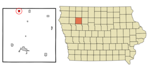
mapsize = 250x200px
map_caption = Location of Linn Grove, Iowa
mapsize1 =
map_caption1 =subdivision_type = Country
subdivision_name =
subdivision_type1 = State
subdivision_name1 =
subdivision_type2 = County
subdivision_name2 = Buena Vista
government_footnotes =
government_type =
leader_title =
leader_name =
leader_title1 =
leader_name1 =
established_title =
established_date =unit_pref = Imperial
area_footnotes =area_magnitude =
area_total_km2 = 1.6
area_land_km2 = 1.5
area_water_km2 = 0.0
area_total_sq_mi = 0.6
area_land_sq_mi = 0.6
area_water_sq_mi = 0.0population_as_of = 2000
population_footnotes =
population_total = 211
population_density_km2 = 137.1
population_density_sq_mi = 355.1timezone = Central (CST)
utc_offset = -6
timezone_DST = CDT
utc_offset_DST = -5
elevation_footnotes =
elevation_m = 389
elevation_ft = 1276
latd = 42 |latm = 53 |lats = 33 |latNS = N
longd = 95 |longm = 14 |longs = 31 |longEW = Wpostal_code_type =
ZIP code
postal_code = 51033
area_code = 712
blank_name = FIPS code
blank_info = 19-45480
blank1_name = GNIS feature ID
blank1_info = 0458415
website =
footnotes =Linn Grove is a city in Buena Vista County,
Iowa ,United States . The population was 211 at the 2000 census.Geography
Linn Grove is located at coor dms|42|53|33|N|95|14|31|W|city (42.892537, -95.241992)GR|1. It is situated near the
Little Sioux River .According to the
United States Census Bureau , the city has a total area of 0.6square mile s (1.6km² ), of which, 0.6 square miles (1.5 km²) of it is land and 1.64% is water.Demographics
As of the
census GR|2 of 2000, there were 211 people, 89 households, and 56 families residing in the city. Thepopulation density was 355.1 people per square mile (138.1/km²). There were 99 housing units at an average density of 166.6/sq mi (64.8/km²). The racial makeup of the city was 91.47% White, 8.53% from other races. Hispanic or Latino of any race were 8.53% of the population.There were 89 households out of which 27.0% had children under the age of 18 living with them, 49.4% were married couples living together, 11.2% had a female householder with no husband present, and 36.0% were non-families. 32.6% of all households were made up of individuals and 14.6% had someone living alone who was 65 years of age or older. The average household size was 2.37 and the average family size was 3.00.
In the city the population was spread out with 24.6% under the age of 18, 7.6% from 18 to 24, 26.1% from 25 to 44, 24.6% from 45 to 64, and 17.1% who were 65 years of age or older. The median age was 42 years. For every 100 females there were 86.7 males. For every 100 females age 18 and over, there were 89.3 males.
The median income for a household in the city was $33,125, and the median income for a family was $38,438. Males had a median income of $29,500 versus $24,167 for females. The
per capita income for the city was $22,945. About 3.1% of families and 5.3% of the population were below thepoverty line , including none of those under the age of eighteen and 4.2% of those sixty five or over.Community
The local newspaper that covers events and news near Linn Grove is the "
Peterson Patriot ".References
External links
Wikimedia Foundation. 2010.