- Oxley, Wolverhampton
-
Coordinates: 52°36′50″N 2°07′59″W / 52.614°N 2.133°W
Oxley 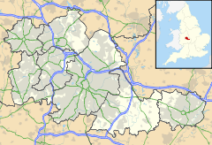
 Oxley
Oxley
Oxley shown within the West MidlandsPopulation 2,945 (2001 Census) Metropolitan borough Wolverhampton Metropolitan county West Midlands Region West Midlands Country England Sovereign state United Kingdom Post town Wolverhampton Postcode district WV Dialling code 01902 Police West Midlands Fire West Midlands Ambulance West Midlands EU Parliament West Midlands UK Parliament Wolverhampton North East List of places: UK • England • West Midlands Oxley is a suburb of Wolverhampton, West Midlands, and a ward of Wolverhampton City Council. Its area code is WV10. It is situated in the north of the city, bordering South Staffordshire and the Bushbury North, Bushbury South and Low Hill, St Peter's and Tettenhall Regis wards. It forms part of the Wolverhampton North East constituency.
Contents
Name and origins
The place name Oxley has its origins in the Old English language. 'Ox' from old English 'Oxa' (for the animal), and 'Ley' from the old English 'lēah' (recorded in the Domesday Book by the Normans as 'Oxelie'), meaning woodland clearing or meadow. The majority of Wolverhampton's place names are old English (Anglo-Saxon) in origin, and at that time, much of the land was covered in woodland. Cannock forest stretched down through Wolverhampton[1] and would have encompassed the Oxley area – so the name means a clearing in the woodland with the presence of oxen.
Up until the 20th century, Oxley was very much a rural area, sitting on the route of the Wolverhampton to Stafford road.[2]
Modern times
The focal point of Oxley is the Three Tuns Parade, a shopping area on the A449 Stafford Road, adjacent to the boundary with Bushbury North. Several shops, takeaways and banks are located here, including the Wing Wah Chinese buffet restaurant (formerly the Three Tuns Pub), a branch of the Nationwide Building Society, Lloyds TSB, a Firkins Bakery and several others. Principal local landmarks are the two towering railway viaducts crossing the Birmingham Canal Navigations Main Line Canal. A recent departure from the Oxley skyline was the blue and yellow chimney of the Goodyear tyre factory. After car tyre production ceased in 2006 the Goodyear plant went into an almost complete shutdown and, as of 2008, has now been partly reduced to rubble as part of a regeneration and housing project with the famous 81 year old chimney stack demolished on Sunday 29 June 2008. A new housing estate is being constructed here as of summer 2011.[3]
Wolverhampton Science Park is situated near Oxleys south border, on the site of the old Gas works / Gorsebrook House.
The Church of the Epiphany is the Anglican parish Church on Lymer Road, the building itself dates to the early 1960s. Installed within the Church is a fine example of a Compton Theatre organ originally installed at the Windsor Theatre in Bearwood, Birmingham. The local Polish community has its centre and Catholic Church on Stafford Road, Oxley. The suburb of Pendeford falls within Oxley ward.
Oxley is the location of a railway depot (on the site of the old Western Region 84B steam shed), currently used by Virgin Trains to service its fleet for operation on the West Coast Main Line. Pendeford High School also lies in the ward.
Its western border is also the location of Autherley Junction, where the Shropshire Union Canal meets the Staffordshire and Worcestershire Canal, and of Aldersley Junction, where the BCN Main Line meets the Staffordshire and Worcestershire Canal.References
- ^ Cannock Forest Bounds of 1286
- ^ Ordnance Survey First Series
- ^ http://www.expressandstar.com/money/property/2011/03/02/300-goodyear-homes-on-the-way/ Express & Star - 300 Goodyear homes on the way (02/03/2011)
Sources
- Canal Companion - Birmingham Canal Navigations, J. M. Pearson & Associates, 1989, ISBN 0-907864-49-X
- http://www.wolverhampton.gov.uk/NR/rdonlyres/D608419B-8BF8-493F-89B7-204FF5C8306C/0/Oxley.pdf 2001 Census
Bilston East · Bilston North · Blakenhall · Bushbury North · Bushbury South and Low Hill · East Park · Ettingshall · Fallings Park · Graiseley · Heath Town · Merry Hill · Oxley · Park · Penn · St Peter's · Spring Vale · Tettenhall Regis · Tettenhall Wightwick · Wednesfield North · Wednesfield SouthCategories:- Areas of Wolverhampton
- Wards of Wolverhampton City Council

Wikimedia Foundation. 2010.