- Lamoni, Iowa
Infobox Settlement
official_name = Lamoni, Iowa
settlement_type =City
nickname =
motto =
imagesize =
image_caption =
image_
imagesize =
image_caption =
image_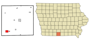
mapsize = 250px
map_caption = Location of Lamoni, Iowa
mapsize1 =
map_caption1 =subdivision_type = Country
subdivision_name =
subdivision_type1 = State
subdivision_name1 =
subdivision_type2 = County
subdivision_name2 = Decatur
government_footnotes =
government_type =
leader_title =
leader_name =
leader_title1 =
leader_name1 =
established_title =
established_date =unit_pref = Imperial
area_footnotes =area_magnitude =
area_total_km2 = 8.5
area_land_km2 = 8.3
area_water_km2 = 0.2
area_total_sq_mi = 3.3
area_land_sq_mi = 3.2
area_water_sq_mi = 0.1population_as_of = 2000
population_footnotes =
population_total = 2444
population_density_km2 = 293.9
population_density_sq_mi = 761.1timezone = Central (CST)
utc_offset = -6
timezone_DST = CDT
utc_offset_DST = -5
elevation_footnotes =
elevation_m = 343
elevation_ft = 1125
latd = 40 |latm = 37 |lats = 21 |latNS = N
longd = 93 |longm = 56 |longs = 1 |longEW = Wpostal_code_type =
ZIP code
postal_code = 50140
area_code = 641
blank_name = FIPS code
blank_info = 19-42960
blank1_name = GNIS feature ID
blank1_info = 0458214
website =
footnotes =Lamoni is a city in Decatur County,
Iowa ,United States . The population was 2,444 at the 2000 census. Lamoni is the home ofGraceland University , affiliated with theCommunity of Christ .The town is a significant historic area for the Community of Christ church with the Liberty Hall museum. In 1870 a stewardship association of church members, known as the Order of Enoch, purchased over three thousand acres (12 km²) of land in southern Iowa as a place for gathering.
The city was named after
Lamoni , a pacifist king mentioned in theBook of Mormon . Church headquarters relocated to the emerging community in 1881 andJoseph Smith III made Liberty Hall his home. Four Community of Christ church presidents lived in Liberty Hall. The church was headquartered in Lamoni, Iowa, and Liberty Hall was a center of social and religious life for the community. During the next 60 years, Liberty Hall served as a home for the aged, a farmhouse, CCC Headquarters, and a private residence. Now restored to its 1900-1905 Victorian style, Liberty Hall reflects the culture of the large, middle class Smith family living in a small, mid-western town as well as the heritage of Community of Christ. Tours are available March through December.Lamoni was named to the list of "Best 100 cities for Young People" in the nation by
Americas Promise [http://www.americaspromise.org/100Best/winning_communities.cfm]Among the significant structures in Lamoni are the Roy A.
Cheville Chapel , Closson Physical Education Center, Shaw Center for the Performing Arts, Frederick Madison Smith Library, and the Higdon Administration Building, all on the Graceland University Campus.Recently, the Lamoni area has also become home to a sizable Amish community.
Geography
Lamoni is located at coor dms|40|37|21|N|93|56|1|W|scale:10000 (40.622563, -93.933739)GR|1.
According to the
United States Census Bureau , the city has a total area of 3.3square mile s (8.5km² ), of which, 3.2 square miles (8.3 km²) of it is land and 0.1 square miles (0.2 km²) of it (1.83%) is water.Demographics
As of the
census GR|2 of 2000, there were 2,444 people, 818 households, and 428 families residing in the city. Thepopulation density was 761.1 people per square mile (294.0/km²). There were 904 housing units at an average density of 281.5/sq mi (108.7/km²). The racial makeup of the city was 91.86% White, 2.95% African American, 0.16% Native American, 1.60% Asian, 0.41% Pacific Islander, 0.82% from other races, and 2.21% from two or more races. Hispanic or Latino of any race were 2.78% of the population.There were 818 households out of which 21.4% had children under the age of 18 living with them, 44.7% were married couples living together, 5.9% had a female householder with no husband present, and 47.6% were non-families. 36.7% of all households were made up of individuals and 16.5% had someone living alone who was 65 years of age or older. The average household size was 2.14 and the average family size was 2.84.
In the city the population was spread out with 15.1% under the age of 18, 39.6% from 18 to 24, 13.9% from 25 to 44, 15.6% from 45 to 64, and 15.8% who were 65 years of age or older. The median age was 23 years. For every 100 females there were 93.2 males. For every 100 females age 18 and over, there were 92.2 males.
The median income for a household in the city was $24,735, and the median income for a family was $41,926. Males had a median income of $27,875 versus $20,781 for females. The
per capita income for the city was $13,105. About 10.5% of families and 19.6% of the population were below thepoverty line , including 12.7% of those under age 18 and 7.5% of those age 65 or over.Notable natives
*
Eddie Watt —Major League Baseball pitcher References
External links
* [http://www.lamoni-iowa.com/ Official City Website]
Wikimedia Foundation. 2010.