- Chelers
-
Chelers


 ChelersLocation within Nord-Pas-de-Calais region
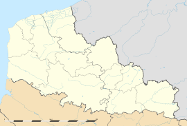 Chelers
Administration Country France Region Nord-Pas-de-Calais Department Pas-de-Calais Arrondissement Arras Canton Aubigny-en-Artois Intercommunality Communauté de communes de l'Atrébatie Mayor Raymond Wacheux
(2008–2014)Statistics Elevation 126–158 m (413–518 ft)
(avg. 148 m/486 ft)Land area1 8.04 km2 (3.10 sq mi) Population2 258 (1999) - Density 32 /km2 (83 /sq mi) INSEE/Postal code 62221/ 62127 1 French Land Register data, which excludes lakes, ponds, glaciers > 1 km² (0.386 sq mi or 247 acres) and river estuaries. 2 Population without double counting: residents of multiple communes (e.g., students and military personnel) only counted once. Coordinates: 50°22′35″N 2°29′10″E / 50.3763888889°N 2.48611111111°E
Chelers is a commune in the Pas-de-Calais department in the Nord-Pas-de-Calais region of France.
Contents
Geography
A farming village located 13 miles (22 km) west-northwest of Arras at the junction of the D77 with the D72 road.
Population
Historical population of Chelers 1962 1968 1975 1982 1990 1999 282 301 284 286 260 258 From the year 1962 on: population without double counting—residents of multiple communes (e.g. students and military personnel) are counted only once. Places of interest
- The church of St.Martin, dating from the eighteenth century.
- The Commonwealth War Graves Commission cemetery.
- An eighteenth-century chateau.
See also
References
External links
Categories:- Communes of Pas-de-Calais
- Arras arrondissement geography stubs


Wikimedia Foundation. 2010.