- Greenland
-
For other uses, see Greenland (disambiguation).
Greenland Kalaallit Nunaat (Kalaallisut)
Grønland (Danish)

Flag Coat of arms Anthem: Nunarput utoqqarsuanngoravit (Greenlandic)
"You Our Ancient Land!"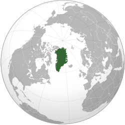
Capital
(and largest city)Nuuk (Godthåb)
64°10′N 51°44′W / 64.167°N 51.733°WOfficial language(s) Greenlandic (Kalaallisut) Ethnic groups 88% Inuit (including Inuit-Danish mixed)
12% Europeans,
mostly DanesDemonym Greenlander, Greenlandic Government Parliamentary democracy within a constitutional monarchy - Queen Margrethe II - High Commissioner Mikaela Engell - Prime Minister Kuupik Kleist Autonomy within the Kingdom of Denmark - Norwegian sovereignty[a] 1261 - Contact re-established 1721 - Ceded to Denmark[b] 14 January 1814 - Status of amt 5 June 1953 - Home rule 1 May 1979 - Further autonomy and self rule 21 June 2009[1] Area - Total 2,166,086 km2 (12th)
836,109 sq mi- Water (%) 83.1[c] Population - January 2011 estimate 56,615[2] - Density 0.027/km2 (241st)
0.069/sq miGDP (PPP) 2007 estimate - Total $2.122 billion (n/a) - Per capita $37,517[d] (n/a) HDI (1998) 0.927[3] (very high) (n/a) Currency Danish krone ( DKK)Time zone GMT (UTC+0 to −4) Drives on the right ISO 3166 code GL Internet TLD .gl Calling code +299 a. ^ Danish monarchy reached Greenland in 1380 with the reign of Olav IV in Norway.
b. ^ Greenland, the Faeroes and Iceland were formally Norwegian possessions until 1814 despite 400 years of Danish monarchy beforehand.
c. ^ As of 2000: 410,449 km2 (158,475 sq mi) ice-free; 1,755,637 km2 (677,855 sq mi) ice-covered. Density: 0.14/km2 (0.36 /sq. mi) for ice-free areas.
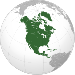
d. ^ 2001 estimate.Greenland (Kalaallisut: Kalaallit Nunaat meaning "Land of the Greenlanders"; Danish: Grønland)[4] is an autonomous country within the Kingdom of Denmark, located between the Arctic and Atlantic Oceans, east of the Canadian Arctic Archipelago. Though physiographically a part of the continent of North America, Greenland has been politically and culturally associated with Europe (specifically Norway and Denmark) for about a millennium. The largest island in Greenland is also named Greenland, and makes up most of the country's land area.
Greenland has been inhabited, though not continuously, by Inuit peoples via Canada for 4500-5000 years.[5][6] In the 10th century, Norsemen settled on the uninhabited southern part of Greenland. In the 13th century, the Inuit arrived, and in the late 15th century the Norse colonies were abandoned. In the early 18th century contact between Scandinavia and Greenland was re-established and Denmark established rule over Greenland.
Greenland became a Danish colony in 1814 after being under the rule of Denmark-Norway for centuries. With the Constitution of Denmark of 1953, Greenland became a part of the Kingdom of Denmark in a relationship known in Danish as Rigsfællesskabet (Commonwealth of the Realm).
In 1979 Denmark granted home rule to Greenland, and in 2008 Greenland voted to transfer more power from the Danish royal government to the local Greenlandic government. This became effective the following year, with the Danish royal government in charge of foreign affairs, security (defence-police-justice), and financial policy, and providing a subsidy of DKK 3.4 billion, or approximately $11,300 per Greenlander, annually.
Greenland is, by area, the world's largest island that is not a continent.[7] With a population of 56,615 (January 2011 estimate) it is one of the least densely populated dependencies or countries in the world.[8]
Contents
Etymology
The name Greenland comes from the early Scandinavian settlers. In the Icelandic sagas, it is said that Norwegian-born Erik the Red was exiled from Iceland for murder. He, along with his extended family and thralls, set out in ships to find a land rumoured to lie to the northwest. After settling there, he named the land Grønland ("Greenland"), supposedly in the hope that the pleasant name would attract settlers.[9][10]
Greenland was also called Gruntland ("Ground-land") and Engronelant (or Engroneland) on early maps[citation needed]. Whether green is an erroneous transcription of grunt ("ground"), which refers to shallow bays, or vice versa, is not known[according to whom?] . The southern portion of Greenland (not covered by glaciers) is relatively green in the summer.
History
Main article: History of Greenland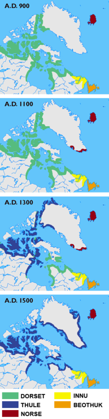

Early Paleo-Eskimo cultures
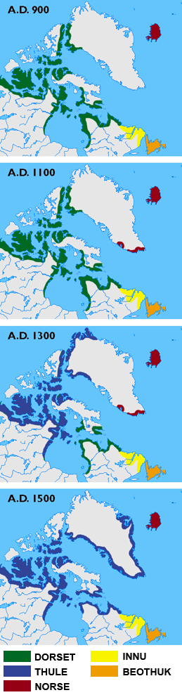
In prehistoric times Greenland was home to several successive Paleo-Eskimo cultures known primarily through archaeological findings. The earliest entry of the Paleo-Eskimo into Greenland is thought to have occurred about 2500 BC. From around 2500 BC to 800 BC, southern and western Greenland was inhabited by the Saqqaq culture. Most findings of Saqqaq period archaeological remains have been around Disko Bay. From 2400 BC to 1300 BC the Independence I culture existed in northern Greenland. It was a part of the Arctic small tool tradition.
Around 800 BC, the Saqqaq culture disappeared and the Early Dorset culture emerged in western Greenland and the Independence II culture in northern Greenland. The Dorset culture was the first culture to extend throughout the Greenlandic coastal areas, both on the west and east coasts, and it lasted until the arrival of the Thule culture in 1500 AD. The Dorset culture population lived primarily from whale hunting. The Thule culture people are the ancestors of the current Greenlandic population. They started migrating from Alaska around 1000 AD, reaching Greenland around 1300 AD. The Thule culture was the first to introduce to Greenland such technological innovations as dog sleds and toggling harpoons.
Norse settlement
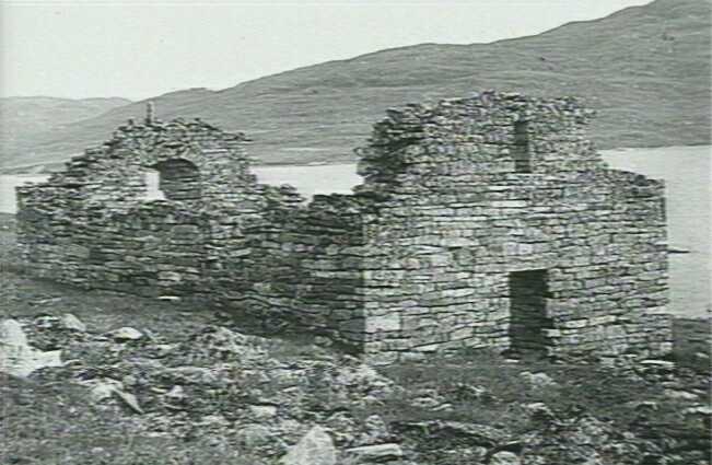
From 986 AD, Greenland's west coast was colonised by Icelanders and Norwegians in two settlements on fjords near the southwestern-most tip of the island.[11] They shared the island with the late Dorset culture inhabitants who occupied the northern and eastern parts, and later with the Thule culture arriving from the north. Norse Greenlanders submitted to Norwegian rule in the 13th century, and the kingdom of Norway entered into a personal union with Denmark in 1380 and from 1397 was a part of the Kalmar Union.[12]
The settlements, such as Brattahlíð, thrived for centuries but disappeared some time in the 15th century, perhaps at the onset of the Little Ice Age.[13] Interpretation of ice core and clam shell data suggests that between 800 and 1300 AD the regions around the fjords of southern Greenland experienced a relatively mild climate several degrees Celsius higher than usual in the North Atlantic,[14] with trees and herbaceous plants growing and livestock being farmed. Barley was grown as a crop up to the 70th degree.[15] What is verifiable is that the ice cores indicate Greenland has experienced dramatic temperature shifts many times over the past 100,000 years.[16] Similarly the Norse Book of Settlements records famines during the winters in which "the old and helpless were killed and thrown over cliffs". (Arnold 2010)
These Icelandic settlements vanished during the 14th and 15th centuries, probably as a result of famine and increasing conflicts with the Inuit.[17] The condition of human bones from this period indicates that the Norse population was malnourished, probably due to soil erosion resulting from the Norsemen's destruction of natural vegetation in the course of farming, turf-cutting, and wood-cutting, pandemic plague, a decline in temperatures during the Little Ice Age, and/or armed conflicts with the Inuit.[13]
Jared Diamond suggests that cultural practices, such as rejecting fish as a source of food and relying solely on livestock ill-adapted to Greenland's (deteriorating) climate, resulted in recurring famine which led to abandonment of the colony.[13] However, isotope analysis of the bones of inhabitants shows that marine food sources supplied more and more of the diet of the Norse Greenlanders, making up between 50% and 80% of their diet by the 14th century.[18]
1500–1814
In 1500, King Manuel I of Portugal sent Gaspar Corte-Real to Greenland in search of a Northwest Passage to Asia which, according to the Treaty of Tordesillas, was part of the Portuguese area of influence. In 1501 Corte-Real returned with his brother, Miguel Corte-Real. Finding the sea frozen, they headed south and arrived in Labrador and Newfoundland. Upon their return to Portugal the cartographic information supplied by Corte-Real was incorporated into a new map of the world which was presented to the Ercole I d'Este, Duke of Ferrara by Alberto Cantino in 1502. The Cantino planisphere, made in Lisbon, accurately depicts the southern coastline of Greenland.[19]
King Christian IV's Expeditions to Greenland was a series of expeditions in the years 1605–1607 to Greenland and Arctic waterways in order to locate the lost Eastern Norse Settlement and assert Danish sovereignty over Greenland. The expeditions were mostly unsuccessful, partly due to leaders lacking experience with the difficult arctic ice and weather conditions, and partly because the expedition leaders were given instructions to search for the Eastern Settlement on the east coast of Greenland just north of Cape Farewell, which is almost inaccessible due to southward drifting ice. The pilot on all three trips was English explorer James Hall.
However, after the Norse settlements died off, the area was de facto controlled by various Inuit groups; but the Danish government never forgot or relinquished the claims to Greenland that it had inherited from the Norwegians, and when contact with Greenland was re-established in the early 18th century, Denmark asserted its sovereignty over the island. In 1721 a joint mercantile and clerical expedition led by Danish-Norwegian missionary Hans Egede was sent to Greenland, not knowing whether a Norse civilisation remained there. The expedition can be seen as part of the Danish colonisation of the Americas. After 15 years in Greenland, Hans Egede left his son Paul Egede in charge of the mission in Greenland and returned to Denmark where he established a Greenland Seminary. This new colony was centred at Godthåb ("Good Hope") on the southwest coast. Gradually, Greenland was opened up to Danish merchants, and closed to those from other countries.
Treaty of Kiel to World War II
Eventually, when the union between Denmark and Norway was dissolved in 1814 (Treaty of Kiel), the originally officially Norwegian dependencies of Greenland, Iceland and the Faroe Islands became part of the reorganised "Kingdom of Denmark".
Norway occupied and claimed parts of the then-uninhabited eastern Greenland (also called Erik the Red's Land) in July 1931, claiming that it constituted terra nullius. Norway and Denmark agreed to submit the matter in 1933 to the Permanent Court of International Justice, which decided against Norway.[20]
Greenland's connection to Denmark was severed on 9 April 1940, early in World War II, when Denmark was occupied by Nazi Germany. On April 8, 1941, the United States occupied Greenland in order to defend it against a possible invasion by Germany.[21] The United States occupation of Greenland continued until 1945. Greenland was able to buy goods from the United States and Canada by selling cryolite from the mine at Ivittuut. During this war, the system of government changed: Governor Eske Brun ruled the island under a law of 1925 that allowed governors to take control under extreme circumstances; Governor Aksel Svane was transferred to the US to lead the commission to supply Greenland. A sledge patrol (in 1942, named the Sirius Patrol), guarding the northeastern shores of Greenland using dog sleds, detected several German weather stations and alerted American troops who then destroyed them. After the collapse of the Third Reich, Albert Speer briefly considered escaping in a small aeroplane to hide out in Greenland, but changed his mind and decided to turn himself in to the United States Armed Forces.[22]
Greenland had been a protected and very isolated society until 1940. The Danish government, which governed Greenland as its colony, had been convinced that this society would face exploitation from the outside world or even extinction if the country were opened up. Therefore, it maintained a strict monopoly of Greenlandic trade, allowing only small scale troaking with Scottish whalers. Nevertheless, wartime Greenland developed a sense of self-reliance through self-government and independent communication with the outside world.
Despite this change, in 1946 a commission (with the highest Greenlandic council, the Landsrådene, as a participant) recommended patience and no radical reform of the system. Two years later, the first step towards a change of government was initiated when a grand commission was established. A final report (G-50) was presented in 1950: Greenland was to be a modern welfare state with Denmark as sponsor and example. In 1953, Greenland was made an equal part of the Danish Kingdom. Home rule was granted in 1979.
Post World War II
 Queen Margrethe II, Head of State of the Kingdom of Denmark (of which Greenland forms an integral part)
Following World War II, the United States developed a geopolitical interest in Greenland, and in 1946 the United States offered to buy Greenland from Denmark for $100,000,000, but Denmark refused to sell.[23][24] However, in 1950 Denmark did agree to allow the United States to establish the Thule Air Base, construction of which was begun in 1951 and completed in 1953, as part of a unified NATO Cold War defense strategy.
Greenland became an integral part of the Kingdom of Denmark in 1953. It was granted home rule by the Parliament of Denmark in 1979. The law came into effect on 1 May 1979. The Queen of Denmark, Margrethe II, remains Greenland's Head of State. In 1985, Greenland left the European Economic Community (EEC) upon achieving self-rule, in view of the EEC's commercial fishing regulations and a EEC ban on seal skin products.[25] A referendum on greater autonomy[26] was approved on 25 November 2008.[27]
On 21 June 2009, Greenland assumed self-determination with responsibility for self-government of judicial affairs, policing, and natural resources. Also, Greenlanders were recognised as a separate people under international law.[28] Denmark maintains control of foreign affairs and defence matters. Denmark upholds the annual block grant of 3.2 billion Danish kroner, but as Greenland begins to collect revenues of its natural resources the grant will gradually be diminished. It is a step toward full independence from Danish rule. Greenlandic became the sole official language of Greenland at the historic ceremony.[29][30][31][32] [33]
Politics
Main article: Politics of GreenlandGreenland's Head of State is currently Margrethe II. The Queen's government in Denmark appoints a Rigsombudsmand (High Commissioner), who is as of 2011 Mikaela Engell, representing the Danish government and monarchy.
Greenland has an elected parliament of thirty-one members. The head of government is the Prime Minister, who is usually the leader of the majority party in Parliament. The current Prime Minister is Kuupik Kleist.
As part of the realm of the Kingdom of Denmark, Greenlanders elect two representatives who sit in the Parliament of Denmark.
In 1985, Greenland left the European Economic Community (EEC), unlike Denmark, which remains a member. The EEC later became the European Union (EU, it was renamed and expanded in scope in 1992). Greenland retains some ties with the EU via Denmark. However, EU law largely does not apply to Greenland except in the area of trade.
Economics and business
About half of public spending on Greenland is funded by block grants from Denmark which in 2007 totalled over 3.2 billion kr. Additional proceeds from the sale of fishing licences and the annual compensation from the EU represents 280 million DKK per year. Greenland's economy is based on a narrow professional basis with the fishing industry as the dominant sector with some 90% of its exports. In a few years, quarrying and tourism could complement the fisheries that depend on the changing prices of fish and fishing opportunities. The long-range divides the domestic market into many small units that have high operating costs. Most of the fish factories are owned by Royal Greenland.
Geography and climate
Main article: Geography of GreenlandSee also: Administrative divisions of Greenland, Territorial claims in the Arctic, Climate change in the Arctic, and Climate of the Arctic#Greenland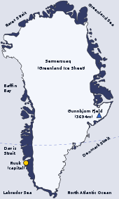 Geography of Greenland
Greenland lies between latitudes 59° and 84°N, and longitudes 11° and 74°W and is the third largest country in North America.[34] The Atlantic Ocean borders Greenland's southeast; the Greenland Sea is to the east; the Arctic Ocean is to the north; and Baffin Bay is to the west. The nearest countries are Canada, to the west across Baffin Bay, and Iceland, east of Greenland in the Atlantic Ocean. Greenland also contains the world's largest national park, and is the world's largest island and the largest dependent territory by area in the world. However, since the 1950s, scientists have postulated that the ice sheet covering the country may actually conceal three separate island land masses that have been bridged by glaciers over the last geologic cooling period.[35][36][37]
The average[clarification needed] annual temperatures of Nuuk, Greenland vary from -9 to 7 °C (16 to 45 °F)
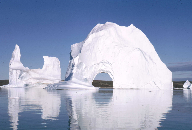
 Southeast coast of Greenland.
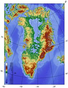
The total area of Greenland is 2,166,086 km2 (836,330 sq mi) (including other offshore minor islands), of which the Greenland ice sheet covers 1,755,637 km2 (677,855 sq mi) (81%) and has a volume of approximately 2,850,000 km3 (680,000 cu mi).[38] The highest point on Greenland is Gunnbjørn Fjeld at 3,700 m (12,139 ft). The majority of Greenland, however, is less than 1,500 m (4,921 ft) in elevation.
The weight of the massive Greenland ice sheet has depressed the central land area to form a basin lying more than 300 m (984 ft) below sea level.[39][40] The ice flows generally to the coast from the centre of the island.
All towns and settlements of Greenland are situated along the ice-free coast, with the population being concentrated along the west coast. The northeastern part of Greenland is not part of any municipality, but is the site of the world's largest national park, Northeast Greenland National Park.
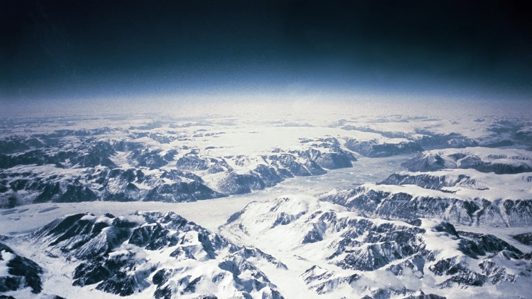
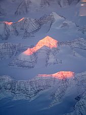 View of mountains on Greenland from the air
At least four scientific expedition stations and camps had been established on the ice sheet in the ice-covered central part of Greenland (indicated as pale blue in the map to the right): Eismitte, North Ice, North GRIP Camp and The Raven Skiway. Currently, there is a year-round station, Summit Camp, on the ice sheet, established in 1989. The radio station Jørgen Brønlund Fjord was, until 1950, the northernmost permanent outpost in the world.
 Southern Greenland scenery, near Nanortalik, where fjords and mountains dominate the landscape.
The extreme north of Greenland, Peary Land, is not covered by an ice sheet, because the air there is too dry to produce snow, which is essential in the production and maintenance of an ice sheet. If the Greenland ice sheet were to melt away completely, the world's sea level would rise by more than 7 m (23 ft).[41]

Between 1989 and 1993, U.S. and European climate researchers drilled into the summit of Greenland's ice sheet, obtaining a pair of 3 km (1.9 mi) long ice cores. Analysis of the layering and chemical composition of the cores has provided a revolutionary new record of climate change in the Northern Hemisphere going back about 100,000 years, and illustrated that the world's weather and temperature have often shifted rapidly from one seemingly stable state to another, with worldwide consequences.[42] The glaciers of Greenland are also contributing to a rise in the global sea level at a faster rate than was previously believed.[43] Between 1991 and 2004, monitoring of the weather at one location (Swiss Camp) showed that the average winter temperature had risen almost 6 °C (11 °F).[44] Other research has shown that higher snowfalls from the North Atlantic oscillation caused the interior of the ice cap to thicken by an average of 6 cm or 2.36 in/yr between 1994 and 2005.[45]
However, a recent study suggests a much warmer planet in relatively recent geological times:
Scientists who probed 2 km (1.2 mi) through a Greenland glacier to recover the oldest plant DNA on record said that the planet was far warmer hundreds of thousands of years ago than is generally believed. DNA of trees, plants and insects including butterflies and spiders from beneath the southern Greenland glacier was estimated to date to 450,000 to 900,000 years ago, according to the remnants retrieved from this long-vanished boreal forest. That view contrasts sharply with the prevailing one that a lush forest of this kind could not have existed in Greenland any later than 2.4 million years ago. These DNA samples suggest that the temperature probably reached 10 °C (50 °F) in the summer and −17 °C (1.4 °F) in the winter. They also indicate that during the last interglacial period, 130,000–116,000 years ago, when temperatures were on average 5 °C (9 °F) higher than now, the glaciers on Greenland did not completely melt away.[46]
 Greenland bedrock
In 1996, the American Top of the World expedition found the world's northernmost island off Greenland: ATOW1996. An even more northerly candidate was spotted during the return from the expedition, but its status is yet to be confirmed.
In 2007, the existence of a new island was announced. Named "Uunartoq Qeqertaq" (English: Warming Island), this island has always been present off the coast of Greenland, but was covered by a glacier. This glacier was discovered in 2002 to be shrinking rapidly, and by 2007 had completely melted away, leaving the exposed island.[47] The island was named Place of the Year by the Oxford Atlas of the World in 2007.[48] Ben Keene, the atlas's editor, commented: "In the last two or three decades, global warming has reduced the size of glaciers throughout the Arctic and earlier this year, news sources confirmed what climate scientists already knew: water, not rock, lay beneath this ice bridge on the east coast of Greenland. More islets are likely to appear as the sheet of frozen water covering the world's largest island continues to melt."
Some controversy surrounds the history of the island, specifically over whether the island might have been revealed during a brief warm period in Greenland during the mid-20th century.[49]
Topography
About 81% of Greenland's surface is covered by the Greenland ice sheet. The weight of the ice has depressed the central land area into a basin shape, whose base lies more than 300 m (984 ft) below the surrounding ocean.[40] Elevations rise suddenly and steeply near the coast.[50]
Economy
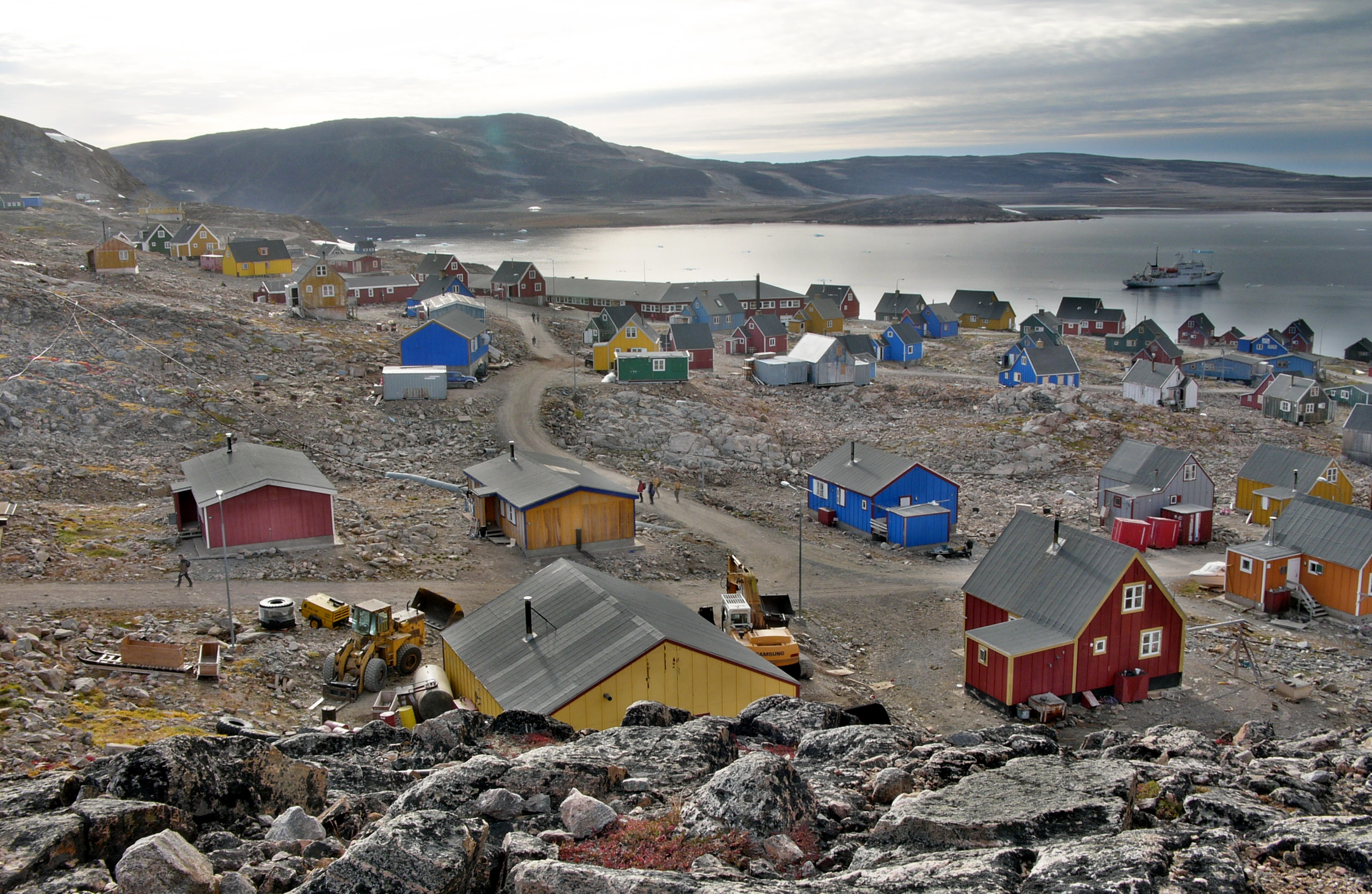
 Colourful houses dot the town of Ittoqqortoormiit
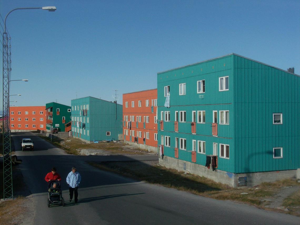
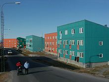 Public housing in IlulissatMain article: Economy of Greenland
Greenland today is dependent on fishing and fish exports. The shrimp fishing industry is by far the largest income earner.[citation needed] Despite resumption of several hydrocarbon and mineral exploration activities, it will take several years before hydrocarbon production can materialize. The state oil company NUNAOIL was created in order to help develop the hydrocarbon industry in Greenland. The state company Nunamineral has been launched on the Copenhagen Stock Exchange to raise more capital to increase the production of gold, started in 2007.
Mining of ruby deposits began in 2007. Other mineral prospects are improving as prices are increasing. These include uranium, aluminium, nickel, platinum, tungsten, titanium and copper.
The public sector, including publicly owned enterprises and the municipalities, plays a dominant role in Greenland's economy. About half the government revenues come from grants from the Danish government, an important supplement to the gross domestic product (GDP). Gross domestic product per capita is equivalent to that of the average economies of Europe.
Greenland suffered an economic contraction in the early 1990s, but since 1993 the economy has improved. The Greenland Home Rule Government (GHRG) has pursued a tight fiscal policy since the late 1980s which has helped create surpluses in the public budget and low inflation. Since 1990, Greenland has registered a foreign trade deficit following the closure of the last remaining lead and zinc mine that year. More recently, new sources of ruby in Greenland have been discovered promising to bring new industry and a new export to the country. (See Gemstone industry in Greenland).
Transportation
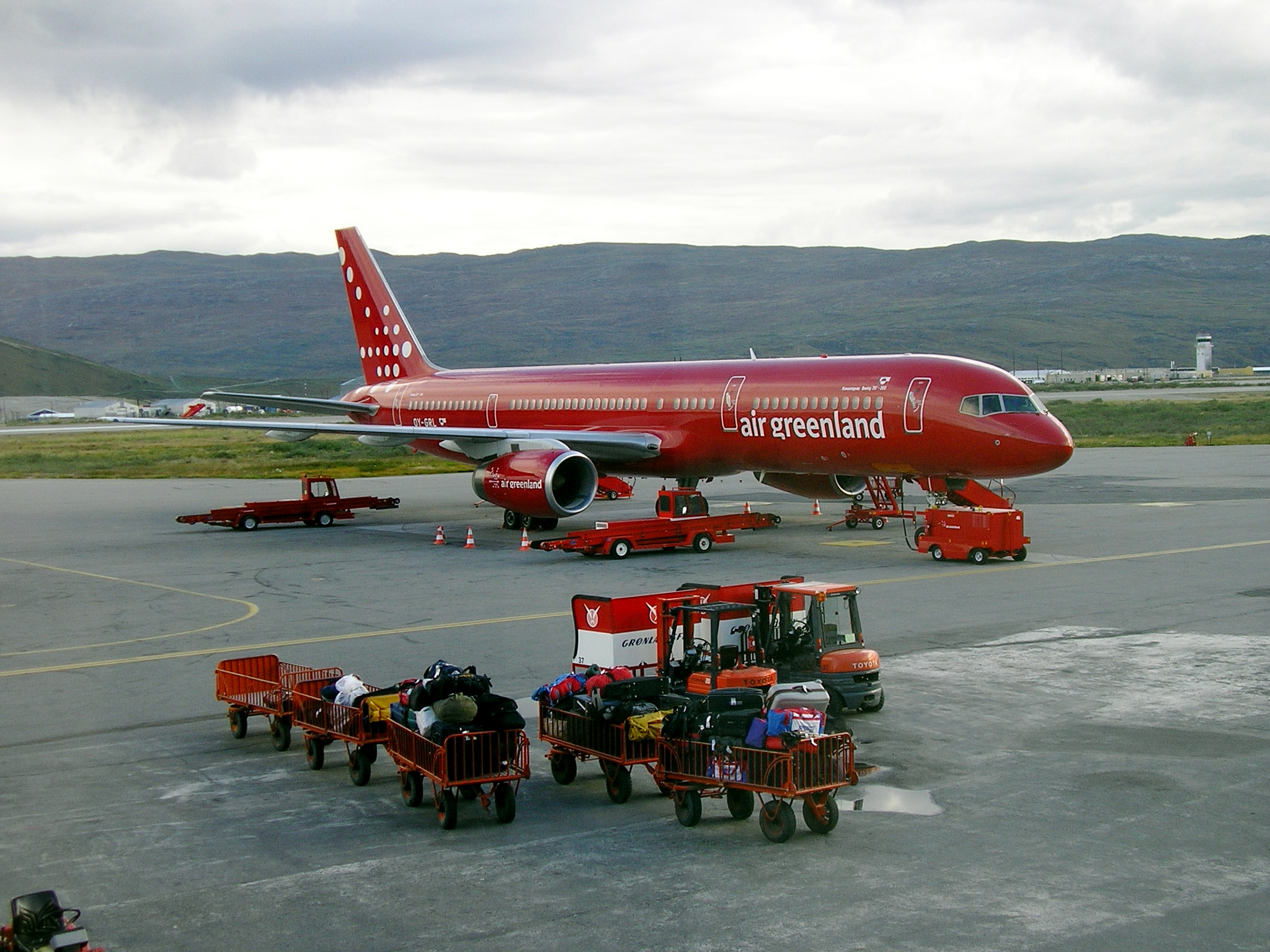
Main articles: Transport in Greenland and List of airports in Greenland Air Greenland Boeing 757-200 airplane at Kangerlussuaq Airport in 2005.
Air transportation exists both within Greenland and between the island and other nations. There is also scheduled boat traffic, but the long distances lead to long travel times and low frequency. There are no roads between cities because the coast has many fjords that would require ferry service to connect a road network.[citation needed]
Kangerlussuaq Airport on the west coast is the major airport of Greenland and the hub for domestic flights. Intercontinental flights connect mainly to Copenhagen.
In May 2007, Air Greenland initiated a seasonal route to and from Baltimore in the United States,[51] but on March 10, 2008, the route was cancelled because of financial losses.[52] Air Iceland began operating a twice-weekly Keflavík-Ilulissat route in July 2009.[53] In addition to these routes there are scheduled international flights between Narsarsuaq and Copenhagen. Air Iceland operates routes between Reykjavík and Narsarsuaq, Ilulissat, Nuuk on the west coast and Kulusuk, Ittoqqortoormiit on the east coast.
Sea passenger and freight transport is served by the coastal ferries operated by Arctic Umiaq Line. It makes a single round trip per week, taking 80 hours each direction.
Demographics
Main article: Demographics of GreenlandSee also: List of GreenlandersGreenland has a population of 57,637 (July 2010 estimate),[54] of whom 88% are Inuit (predominantly Kalaallit) or mixed Danish and Inuit. The remaining 12% are of European descent, mainly Danish. The majority of the population is Evangelical Lutheran. Nearly all Greenlanders live along the fjords in the south-west of the main island, which has a relatively mild climate.[55] Approximately 15,000 Greenlanders reside in Nuuk, the capital city.
Religion
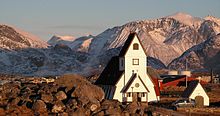 Most Greenlandic villages have their own church, such as Nanortalik.
The major religion is Lutheranism. 96.6% of the population are Christians and 2.2% are non-religious, while ethnic religions and other religions constitute 0.7% and 0.5% of the population respectively.
The New Testament was translated to Greenlandic between 1766 to 1893 and the first translation of the whole Bible was completed in 1900. A new translation was completed in 2000.[57]
Greenland was Christianized by Norwegian and Danish missionaries between the 17th and 19th centuries, but there are still Christian missionaries there, mainly from Charismatic movements. Hans Egede, Paul Egede and Samuel Kleinschmidt are important figures in the Christianisation of Greenland. Sofie Petersen serves as the Danish Lutheran Bishop of Greenland.[58]
Languages
Both Greenlandic (Kalaallisut) and Danish have been used in public affairs since the establishment of home rule in 1979, and the majority of the population can speak both languages. Greenlandic became the sole official language in June 2009.[59] In practice, Danish is still widely used in the administration, as a language of higher education, but also as the first or only language for parts of the population in Nuuk and larger towns. A debate about the role of Greenlandic and Danish in future society is ongoing. The country has a 100% literacy rate.[54]
Greenlandic
Main article: Greenlandic languageA majority of the population speaks Greenlandic, most of them bilingually, but some are monolingual. The Greenlandic language is spoken by about 50,000 people. It is the most populous of the languages of the Eskimo–Aleut language family and has as many speakers as all the other languages of the family combined.
Within Greenland, three main dialects exist: Western Greenlandic or Kalaallisut, which serves as the official standard language, the northern dialect Inuktun or Avanersuarmiutut, spoken by around 1,000 Inughuit in the region of Qaanaaq, and the eastern dialect Tunumiisut, spoken by about 3,000 people in eastern Greenland.[60] The dialects are hardly mutually intelligible and by some linguists considered to be separate languages. As the Western Greenlandic standard has become dominant, a UNESCO report has labelled the dialects as endangered, and measures are now considered to protect the Eastern Greenlandic dialect.[61]
Danish
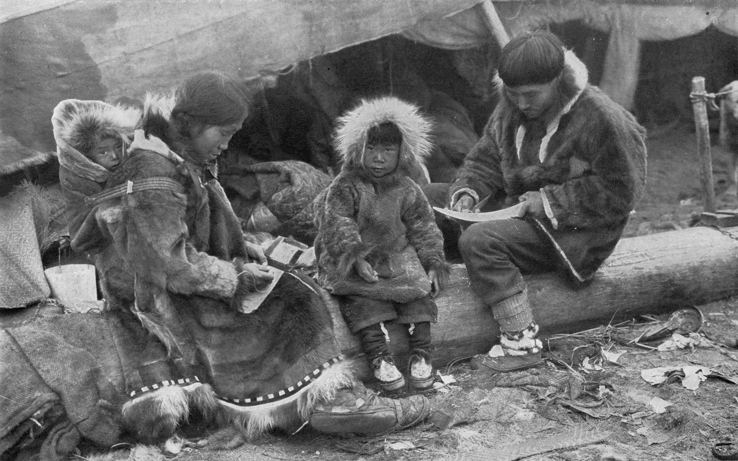
 An Inuit family in Greenland, 1917.Main article: Danish language
Danish migrants, forming about 12% of the population, many of them filling positions as administrators, professionals, academics or skilled tradesmen, speak Danish as their first, or only, language. While Greenlandic is dominant in smaller settlements, a part of the population of Inuit or mixed ancestry, especially in towns, speaks Danish as their first language. In larger towns, especially Nuuk and in the higher social strata, this is a large group. While one strategy aims at promoting Greenlandic in public life and education, developing its vocabulary and suitability for complex contexts, this approach is labelled 'Greenlandisation' by opponents who do not wish to aim at Greenlandic becoming the sole national language.
English
English is taught in schools and widely mastered as a third language.[62]
Culture
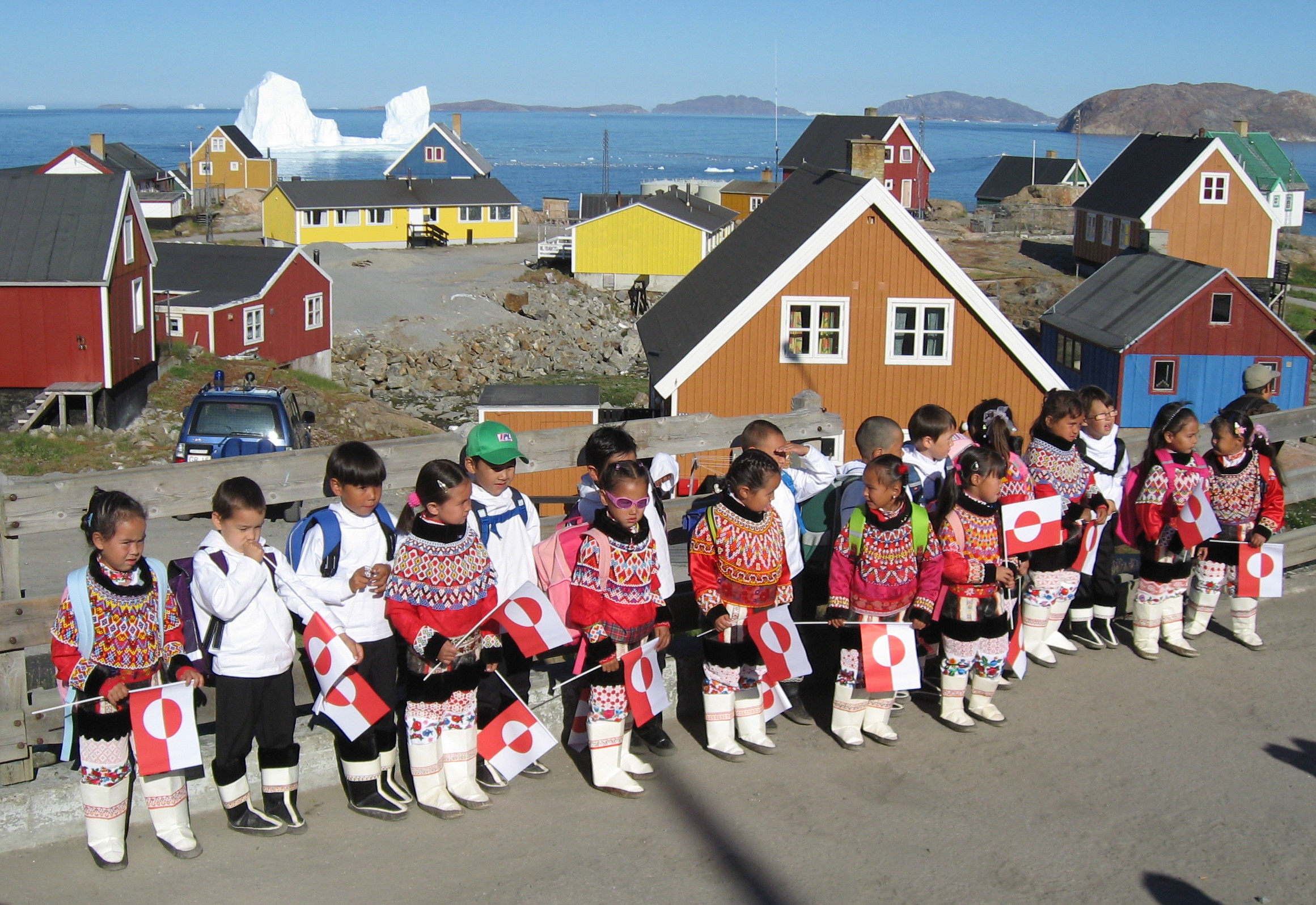
Main articles: Culture of Greenland and Music of Greenland School children in Upernavik start their first day of school wearing traditional Greenlandic costumes
Greenland's culture began with settlement in the second millennium BC by the Dorset Inuits, shortly after the end of the ice age.
In the 10th century, Norwegian Vikings settled in the southern part of the island, while the Thule Inuit culture was introduced in the north of the island and expanded southward. The culture clash between two peoples is attested by the discovery of a fragment of chain mail Viking at high latitude of the island, while a figurine carved from walrus ivory Inuit clear assignment was found in Bergen, Norway. Both objects must be understood as a clear testimony of the trade between the two peoples.
Inuit culture dominated the island from the end of the Middle Ages to the recolonisation in the early 18th century, where European culture was reintroduced.
Today Greenlandic culture is a blending of traditional Inuit (Kalaallit) and Scandinavian culture. Inuit, or Kalaallit, culture has a strong artistic tradition, dating back thousands of years. The Kalaallit are known for an art form of figures called tupilak or an "evil spirit object." Traditional art-making practices thrive in the Ammassalik.[63] Sperm whale ivory remains a valued medium for carving.[64]
Greenland also has a successful, albeit small, music culture. Some popular Greenlandic bands and artists include Chilly Friday (rock), Siissisoq (rock), Nuuk Posse (hip hop) and Rasmus Lyberth, who performed in the 1979 Eurovision Song Contest, performing in Greenlandic. The music culture of Greenland also includes traditional Inuit music, largely based around singing and drums.
Sport
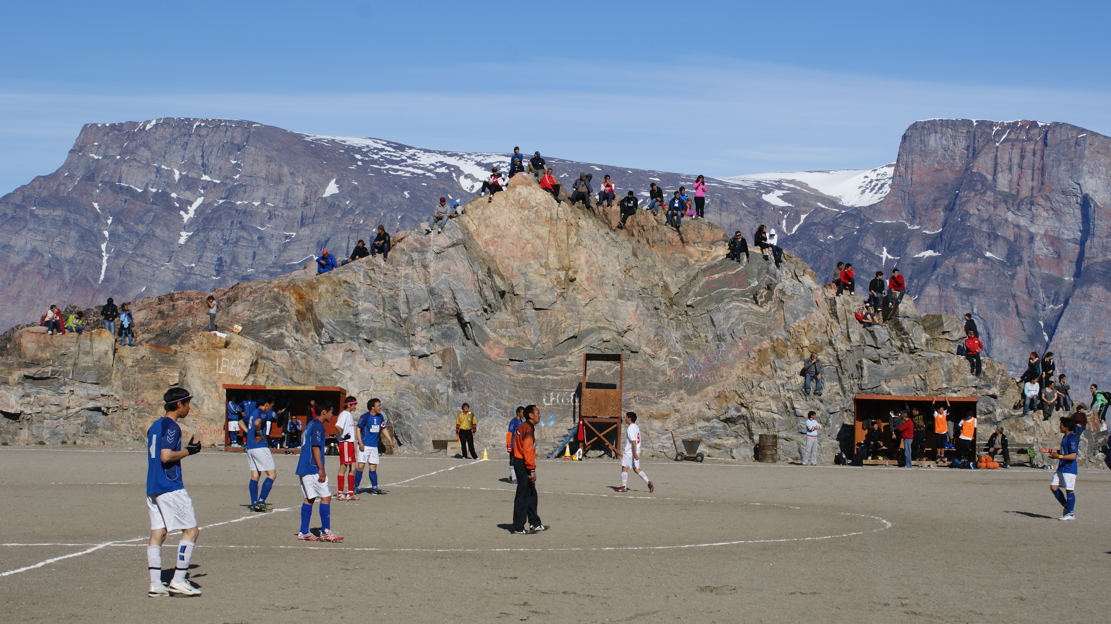
See also: Football in Greenland Football match in Uummannaq
Association football is the national sport of Greenland. The governing body, the Football Association of Greenland (Kalaallit Nunaanni Arsaattartut Kattuffiat), is not yet a member of FIFA because it cannot grow grass for regulation grass pitches. However it is the 17th member of the N.F.-Board ([1]).
In January 2007, Greenland took part in the World Men's Handball Championship in Germany, finishing 22nd in a field of 24 national teams.
Greenland competes in the biennial Island Games, as well as the biennial Arctic Winter Games. In 2002 Nuuk hosted the AWG in conjunction with Iqaluit, Nunavut.[65] Also in 2002 and previously in 1994 they won the Hodgson Trophy for fair play.[66]
See also
- Outline of Greenland
- Index of Greenland-related articles
Footnotes
- ^ "Self-rule introduced in Greenland". BBC News. 2009-06-21. http://news.bbc.co.uk/2/hi/8111292.stm. Retrieved 2010-05-04.
- ^ Statistics Greenland, Greenland in Figures, 2010
- ^ "United Nations Island Directory". Islands.unep.ch. http://islands.unep.ch/CTP.htm. Retrieved 2010-09-06.
- ^ Stern, Pamela (July 2004). "The Dictionary". Historical dictionary of the Inuit. Lanham, Maryland: The Scarecrow Press, Inc.. p. 89. ISBN 0810850583. OCLC 54768167.
- ^ "The history of Greenland – From dog sled to snowmobile". Greenland.com. http://www.greenland.com/en/about-greenland/kultur-sjael/historie.aspx. Retrieved 2011-09-10.
- ^ "Migration to Greenland - the history of Greenland". Greenland.com. http://www.greenland.com/en/about-greenland/kultur-sjael/historie/indvandringerne-til-groenland.aspx. Retrieved 2011-09-10.
- ^ "Joshua Calder's World Island Info". Worldislandinfo.com. http://www.worldislandinfo.com. Retrieved 2010-09-06.
- ^ "The 2008 Revision Population Database". Esa.un.org. 2009-03-11. http://esa.un.org/unpp/. Retrieved 2010-09-06.
- ^ "Retrieved 12-Feb-2007". Gutenberg.org. 2006-03-08. http://www.gutenberg.org/files/17946/17946-h/17946-h.htm. Retrieved 2010-09-06.
- ^ Þorgilsson, Ari. "Íslendingabók." from Íslendinga Sögur. Reykjavik: Sigurður Kristjánsson, 1891. p. 10, Retrieved 29-May-2009
- ^ The Fate of Greenland's Vikings, by Dale Mackenzie Brown, Archaeological Institute of America, February 28, 2000
- ^ Boraas, Tracey (2002). Sweden. Capstone Press. p. 24. ISBN 0-7368-0939-2.
- ^ a b c Diamond, Jared M. (2006). Collapse: how societies choose to fail or succeed. Harmondsworth [Eng.]: Penguin. ISBN 0-14-303655-6.
- ^ Arnold C. Cold did in the Norse. Earth Magazine June 2010, pg 9.
- ^ "Kulturgeschichte des Klimas: Von der Eiszeit zur globalen Erwärmung: Amazon.de: Wolfgang Behringer: Bücher". Amazon.de. 2009-09-09. http://www.amazon.de/gp/product/340652866X?ie=UTF8&tag=scieskepblog-21&linkCode=as2&camp=1638&creative=19454&creativeASIN=340652866X%22. Retrieved 2010-09-06.
- ^ Alley P, Mayewski P, Peel D, Stauffer B (1996). "Twin Ice Cores From Greenland Reveal History of Climate Change, More". Earth in Space 9 (2): 12–13. http://www.agu.org/journals/ABS/1996/96EO00142.shtml.
- ^ Inuit and Norsemen in Arctic Canada 1000 to 1400 AD[dead link]
- ^ Arneborg, J.; Heinmeier, J.; Lynnerup, N.; Nielsen, H. L.; Rud, N.; Sveinbjörnsdóttir, Á. E. (2002). C-14 dating and the disappearance of Norsemen from Greenland. Europhysics news.
- ^ Nebenzahl, Kenneth. Rand McNally Atlas of Columbus and The Great Discoveries (Rand McNally & Company; Genoa, Italy; 1990); The Cantino Planisphere, Lisbon, 1502, pp. 34–37.
- ^ Legal Status of Eastern Greenland, PCIJ Series A/B No. 53 (1933)
- ^ In Danger Undaunted: The Anti-Interventionist Movement of 1940–1941 by Justus D. Doenecke:. Books.google.com. 1941-07-08. ISBN 9780817988418. http://books.google.com/?id=Bhnf0fxI260C&pg=PA331&lpg=PA331&dq=%22United+States+occupation+of+Greenland%22#v=onepage&q=%22United%20States%20occupation%20of%20Greenland%22&f=false. Retrieved 2010-09-06.
- ^ Speer, Albert Inside the Third Reich 1971
- ^ "Deepfreeze Defense". Time Magazine. 1947-01-27. http://www.time.com/time/magazine/article/0,9171,778870,00.html.
- ^ Miller, John J. (2001-05-07). "Let's Buy Greenland! — A complete missile-defense plan". National Review's National Political Reporter (National Review). http://www.nationalreview.com/nr_comment/nr_comment050701b.shtml.
- ^ Stern, 2004, pp. 55–56
- ^ Cowell, Alan (2008-11-26). "Greenland Vote Favors Independence". New York Times. http://www.nytimes.com/2008/11/27/world/europe/27greenland.html. Retrieved 2010-05-04.
- ^ "Vejledende folkeafstemning om selvstyre ? 25-11-2008" (in Greenlandic). SermitValg. 2008-11-26. http://www.valg.gl/. Retrieved 2008-11-26.
- ^ "'''Draft''' Act on Greenland Self-Government" (PDF). http://www.amblissabon.um.dk/NR/rdonlyres/EDC5978E-71C2-467E-974A-598A01EEA562/0/DraftActonGreenlandSelfGovernment.pdf. Retrieved 2011-08-06.
- ^ "Self-rule introduced in Greenland". BBC News. 2009-06-21. http://news.bbc.co.uk/2/hi/europe/8111292.stm. Retrieved 2009-06-21.
- ^ "Nearly independent day". The Economist. 2009-06-20. http://www.economist.com/world/europe/displayStory.cfm?story_id=13854765. Retrieved 2009-06-20.
- ^ "Greenland set for self-rule". The Australian. 2009-06-19. http://www.theaustralian.news.com.au/story/0,25197,25659553-26040,00.html. Retrieved 2009-06-20.[dead link]
- ^ Boswell, Randy (2009-06-19). "Greenland takes big step towards full independence". Canwest News Services. Canada.com. http://www.canada.com/news/Greenland+takes+step+towards+full+independence/1713910/story.html. Retrieved 2009-06-20.
- ^ Hansen, Jesper (2008-05-07). "Greenland on the Self-Rule-Road". Arctic-council.org. http://arctic-council.org/article/2008/5/greenland_on_the_self-rule-road. Retrieved 2010-09-06.
- ^ (PDF) Demographic Yearbook—Table 3: Population by sex, rate of population increase, surface area and density. United Nations Statistics Division. 2008. http://unstats.un.org/unsd/demographic/products/dyb/dyb2008/Table03.pdf. Retrieved 2010-09-24
- ^ San Francisco Chronicle: "Greenland's Huge Ice Sheet Is Melting Far Faster Than Scientists Expected"
- ^ Ellensburg Daily Record (Google News): Greenland Icecap Bridges Three Islands
- ^ U.S. Climate Emergency Council: "Greenland's Ice Sheet Is Slip-Sliding Away"[dead link]
- ^ "IPCC Climate Change 2001: Working Group I: The Scientific Basis". Grida.no. http://www.grida.no/climate/ipcc_tar/wg1/412.htm#tab113. Retrieved 2010-09-06.
- ^ "map (map on p. 4)". http://nia.ecsu.edu/ur/0708/07summerinterns/smith_cresis_greenland.ppt. Retrieved 2010-09-06.
- ^ a b DK Atlas, 2001.
- ^ "Greenland Melt May Swamp LA, Other Cities, Study Says". News.nationalgeographic.com. http://news.nationalgeographic.com/news/2004/04/0408_040408_greenlandicemelt.html. Retrieved 2010-09-06.
- ^ Alley, 2000
- ^ Roach, John (February 16, 2006). "Greenland Glaciers Losing Ice Much Faster, Study Says". National Geographic. http://news.nationalgeographic.com/news/2006/02/0216_060216_warming.html. Retrieved 2006-09-13.
- ^ Climate variability and trends along the western slope of the Greenland ice sheet during 1991–2004 Konrad Steffen, University of Colorado, Boulder, Colorado, USA Nicloas Cullen, and Russell Huff University of Innsbruck, Innsbruck, Austria
- ^ Satellite shows Greenland's ice sheets getting thicker The Register, 7th November 2005
- ^ Willerslev, E.; et al. (2007). "Ancient biomolecules from deep ice cores reveal a forested southern Greenland". Science 317 (5834): 111–4. doi:10.1126/science.1141758. PMC 2694912. PMID 17615355. http://www.pubmedcentral.nih.gov/articlerender.fcgi?tool=pmcentrez&artid=2694912.
- ^ McCarthy, Michael (2007-04-24). "An island made by global warming". The Independent (London). http://news.independent.co.uk/environment/climate_change/article2480994.ece. Retrieved 2010-05-04.
- ^ "Place of the Year". Blog.oup.com. 2007-12-03. http://blog.oup.com/2007/12/place_of_the_year. Retrieved 2010-09-06.
- ^ Revkin, Andrew C. (2008-04-28). "Arctic Explorer Rebuts 'Warming Island' Critique". Dotearth.blogs.nytimes.com. http://dotearth.blogs.nytimes.com/2008/04/28/arctic-explorer-rebuts-critique-of-warming-island/. Retrieved 2010-09-06.
- ^ Schneider D (2003). "American Scientist Online — Greenland or Whiteland?". Sigma Xi. http://www.americanscientist.org/issues/pub/2003/9/greenland-or-whiteland. Retrieved 2008-03-03.
- ^ "Historical Maiden Flight US-Greenland — Official national guide by Greenland Tourism and Business Council". Greenland.com. http://www.greenland.com/content/english/tourist/news/news_archive/historical_maiden_flight_us-greenland. Retrieved 2010-09-06.
- ^ "News — Air Greenland". Airgreenland.com. http://www.airgreenland.com/nyhed/?newsid=666. Retrieved 2010-09-06.
- ^ "Air Iceland to open new route to Ilulissat in 2009, The Official Tourism and Business Site of Greenland". Greenland.com. http://www.greenland.com/content/english/tourist/news/news_archive/air_iceland_to_open_new_route_to_ilulissat_in_2009. Retrieved 2010-09-06.
- ^ a b "Greenland". CIA World Factbook. 2009-10-28. https://www.cia.gov/library/publications/the-world-factbook/geos/gl.html. Retrieved 2009-11-05.
- ^ "Greenland". Stalvik.com. http://www.stalvik.com/Engelska/laegreenland.htm. Retrieved 2010-09-06.
- ^ Joshua Project. "Joshua Project". Joshua Project. http://www.joshuaproject.net/countries.php?rog3=GL. Retrieved 2010-09-06.
- ^ Leif Kiil Sørensen (29 November 2000). "Grønlandsk bibel præsenteret | Kristeligt Dagblad". Kristeligt-dagblad.dk. http://www.kristeligt-dagblad.dk/artikel/225350:Kirke---tro--Groenlandsk-bibel-praesenteret. Retrieved 2010-09-06.
- ^ "Bells ring a wake-up call for climate justice." World Council of Churches. 14 December 2010 (retrieved 30 August 2010)
- ^ "Effective on 21 June". BBC News. 2008-11-27. http://news.bbc.co.uk/2/hi/europe/7752660.stm. Retrieved 2010-09-06.
- ^ Philippe Mennecier: Le tunumiisut, dialecte inuit du Groenland oriental : description et analyse, Collection linguistique, 78, Societé de linguistique de Paris, 1978.
- ^ "Sermersooq will secure Eastern Greenlandic" (in Danish). Kalaallit Nunaata Radioa. 2010-01-06. http://www.knr.gl/index.php?id=6700&tx_ttnews%5Btt_news%5D=51930&tx_ttnews%5BbackPid%5D=6702&cHash=b321fb7a1d. Retrieved 2010-05-19.
- ^ "Greenland Representation to the EU, Greenland Home Rule Government". Eu.nanoq.gl. http://eu.nanoq.gl/Emner/About%20Greenland/Travelling%20in%20Greenland.aspx. Retrieved 2010-09-06.
- ^ Hessel, 20
- ^ Hessel, 21
- ^ "Arctic Winter Games". Gif.gl. http://www.gif.gl/program/index.php?sprog=3&t_id=113&keyword=&action=none&skiftsprog&music=1&nyhed_id=2. Retrieved 2011-08-06.
- ^ "Hodgson Trophy Winners". Arcticwintergames.org. http://www.arcticwintergames.org/Hodgson_Trophy.html. Retrieved 2011-08-06.
References
- Alley, Richard B. The Two-Mile Time Machine: Ice Cores, Abrupt Climate Change, and Our Future. Princeton University Press, 2000, ISBN 0-691-00493-5.
- Bardarson, I. (ed. Jónsson, F.) "Det gamle Grønlands beskrivelse af Ívar Bárðarson (Ivar Bårdssön)", (Copenhagen, 1930).
- CIA World Factbook, 2000.
- Lund, S. 1959. The Marine Algae of East Greenland. 1. Taxonomical Part. Meddr Gronland. 156(1), pp. 1–245.
- Lund, S. 1959. The Marine Algae of East Greenland. 11. Geographic Distribution. Meddr Gronland. 156, pp. 1–70.
- Steffen, Konrad, N. Cullen, and R. Huff (2005). "Climate variability and trends along the western slope of the Greenland Ice Sheet during 1991–2004," Proceedings of the 85th American Meteorological Society Annual Meeting (San Diego).
- Stern, Pamela R. Historical dictionary of the Inuit. Scarecrow Press, 2004. ISBN 978-0810850583
External links
- Government
- Greenland Home Rule official government website (in English)
- Greenland.com from the Greenland Tourism & Business Council
- Statistics Greenland
- General information
- Greenland entry at The World Factbook
- Greenland at the Open Directory Project
- Wikimedia Atlas of Greenland
- Greenland travel guide from Wikitravel
- Greenland-wiki
Coordinates: 72°00′N 40°00′W / 72°N 40°W
Greenland Part of the Kingdom of Denmark Politics High Commissioner · Prime Minister · Parliament · Elections · Political parties · Military · Coat of arms · Foreign relations · Law enforcement · Administrative divisions · Territorial claims in the Arctic · Greenland and the EU
History Paleo-Eskimo · Dorset culture · Thule people · Colonisation · Skræling · World War II · Erik the Red's Land · Thulegate · Home rule · Autonomy · Cartographic expeditionsGeography Geology · Greenland ice sheet · Climate · Climate change · National park · Islands · Mountains · Glaciers · Rivers · Fjords · Wildlife · Towns and villagesEconomy Central bank · Mining · Tourism · Companies · Communications · Transport · Airports · Reindeer huntingSociety Culture · Demographics · Kalaallit · Language · Music · Cuisine · Sports · Public holidays · Religion · Inuit mythology · Flag · AnthemOutline · Index Administrative divisions of Greenland (since 2009) Municipalities 
Unincorporated Areas Pituffik (Thule Air Base) · Northeast Greenland National ParkDependencies of European Union states 
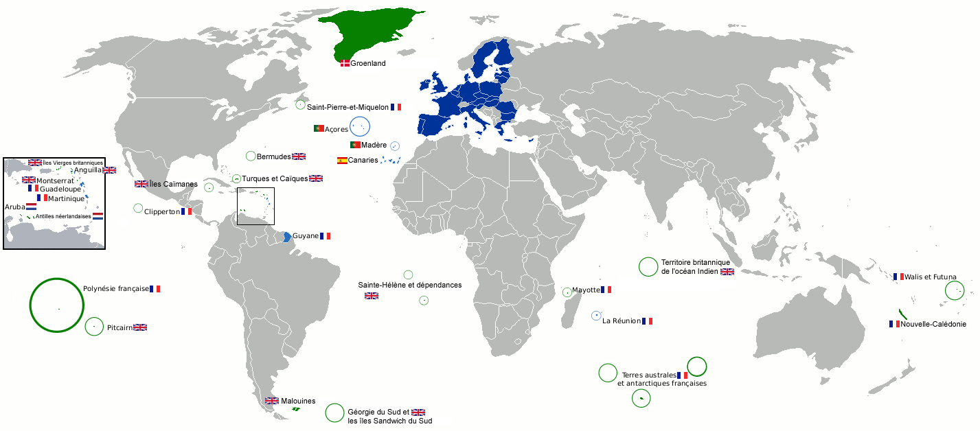
Denmark Faroe Islands · Greenland
France United Kingdom Anguilla · Bermuda · British Antarctic Territory · British Indian Ocean Territory · British Virgin Islands · Cayman Islands · Falkland Islands · Gibraltar · Montserrat · Pitcairn Islands · Saint Helena, Ascension and Tristan da Cunha · South Georgia and the South Sandwich Islands · Turks and Caicos IslandsCountries and dependencies of North America Sovereign states - Antigua and Barbuda
- Bahamas
- Barbados
- Belize
- Canada
- Costa Rica
- Cuba
- Dominica
- Dominican Republic
- El Salvador
- France
- (Guadeloupe
- Martinique)
- Grenada
- Guatemala
- Haiti
- Honduras
- Jamaica
- Mexico
- Nicaragua
- Netherlands
- (Bonaire
- Saba
- Sint Eustatius)
- Panama
- St. Kitts and Nevis
- Saint Lucia
- St. Vincent and the Grenadines
- Trinidad and Tobago
- United States
Dependencies DenmarkGreenlandFranceNetherlandsUnited KingdomUnited States International membership Danish overseas colonies and territories Former colonies 
Current overseas
territoriesFaroe Islands · GreenlandSee also Danish East India Company · Danish West India Company Outlying territories of European countries Territories under European sovereignty but closer to or on continents other than Europe (see inclusion criteria for further information) Denmark GreenlandFrance Italy Netherlands Norway Portugal Spain United
KingdomAnguilla · Bermuda · British Virgin Islands · Cayman Islands · Falkland Islands · Montserrat · Saint Helena, Ascension and Tristan da Cunha · Turks and Caicos Islands · British Antarctic Territory · British Indian Ocean Territory · Pitcairn Islands · South Georgia and the South Sandwich IslandsWest Nordic Council Nordic Council Members 
Associates  Åland Islands
 Faroe Islands
 Greenland
Categories:- Former Danish colonies
- Greenland
- Countries bordering the Arctic Ocean
- Countries bordering the Atlantic Ocean
- Danish dependencies
- Danish-speaking countries
- Dependent territories in North America
- European dependencies
- Former Norwegian colonies
- Inuit territories
- Nordic countries
- Island countries
- Northern American countries
- Regions of the Arctic
- Special territories of the European Union
- States and territories established in 1979
- Outline of Greenland


Wikimedia Foundation. 2010.