- Outer Pennine Ring
-
Outer Pennine Ring Highgate Bridge near Gargrave, on one of the remote sections of the Leeds and Liverpool Canal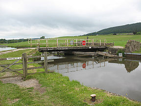
Locks 209 Length 175 miles (282 km) Status Canal ring Navigation authority British Waterways, Manchester Ship Canal The Outer Pennine Ring is a canal ring which crosses the pennines between Manchester and Leeds.
Contents
History
The concept of a canal ring was created in 1965, as part of a campaign by the Inland Waterways Association to prevent the complete closure of the Rochdale Canal. Initially the canal was described as part of the "Cheshire Canal Ring", which was soon shortened to the "Cheshire Ring". It described a series of interconecting canals which could be navigated, usually in a week or two, without having to cover any section twice, and has subsequently been applied to several other such routes.[1] The Outer Pennine Ring is a recent addition, as it was only with the restoration of the Huddersfield Narrow Canal in 2001 that the ring became a possibility.
The term was coined by enthusiasts as an adjunct to the South Pennine Ring, devised as a marketing tool by British Waterways.
Route
The Outer Pennine Ring covers eight canals. Working clockwise from Castlefield Junction in Manchester these are:
- Bridgewater Canal
- Leeds and Liverpool Canal
- Aire and Calder Navigation
- Calder and Hebble Navigation
- Huddersfield Broad Canal
- Huddersfield Narrow Canal
- Ashton Canal
- Rochdale Canal
Bridgewater Canal
Beginning at Castlefield Junction, the Bridgewater Canal heads south-east through the urban expanse of Manchester. There are no locks on this section of canal, although after 1.2 miles (1.9 km) Pomona Dock is reached, which leads to a lock through which access can be gained to the Manchester Ship Canal. After 2.8 miles (4.5 km), the canal arrives at Waters Meeting, a junction where the main line turns to the left and the Stretford and Leigh Branch turns to the right. The ring continues along the branch for 10.8 miles (17.4 km) to arrive at Leigh, where there is an end-on junction with the Leeds and Liverpool Leigh Branch. On its way, the Barton Swing Aqueduct carries it across the Manchester Ship Canal. The structure was designed by Sir Edward Leader Williams in the 1890s, and allows a 235-foot (72 m) section of the canal, weighing 1450 tons, to move out of the way of ships using the ship canal. The Bridgewater Canal is owned by the Manchester Ship Canal, although boats with a British Waterways licence may use it for up to seven days without further payment.[2][3]
Leigh Branch
The Leigh Branch of the Leeds and Liverpool Canal runs for 7.3 miles (11.7 km), mostly through a landscape which has been severely affected by mining. For most of its length, the canal is on top of an embankment, which has been repeatedly built up with mining waste as the land on either side has been affected by subsidence. The region has been restored as parkland, and now offers a haven for wildlife. There was originally a lock at Plank Lane and another two at the Dover Lock Inn, but all three have been removed and replaced by the two Poolstock locks, situated just before the branch joins the main line at Wigan. At Wigan Junction, the main line to Liverpool turns to the left, while the ring turns to the right and follows the main line to Leeds.[4][5]
Leeds and Liverpool Canal
Almost immeditately after the junction, 21 locks raise the level of the canal by 215 feet (66 m). At the top of the flight is a T-junction. This section of canal was built by the Lancaster Canal, but was never connected to the northern section except by a tramway. The right hand branch is just a stub, and the ring turns to the left. The pound is level for 9 miles (14 km), and the next locks start where the Lancaster Canal Walton Summit Branch turned to the north. The seven Johnson's Hill Locks raise the level of the canal by another65.5 feet (20.0 m). As the canal continues to the east, there is a mix of industrial development, green fields and wild moorlands. Above Blackburn, the route twists tortuously to negotiate a series of hills.[6]
On the outskirts of Burnley, the canal passes through the 559-yard (511 m) Gannow Tunnel, before turning to the north. At Barrowford, another flight of seven locks raise the canal by 69 feet (21 m) to the summit level. Barrowford Reservoir holds surplus water from the summit level. Soon, Foulridge Tunnel burrows through the hillside for 1,640 yards (1,500 m). It was the scene of a famous incident in 1912 when a cow fell into the canal, and proceeded to swim through to Foulridge, where it was given alcohol to revive it. The summit is only level for 6.1 miles (9.8 km), before the descent towards Leeds begins.[7][5]
Above Gargrave, the canal crosses the River Aire, and the canal follows the river valley all the way to Leeds. At Skipton, the canal is joined by the short Springs Branch or Thanet Canal, named after the Earl of Thanet who built it and who owned Skipton Castle, which overlooks it. The canal runs level for 16.8 miles (27.0 km) from Gargrave to Bingley, after which tow staircases of locks, the Bingley Five Rise and the Bingley Three Rise lower the level by 90 feet (27 m). Shortly afterwards, the canal crosses the Aire, and remains to its south for the rest of its route. Several more locks, grouped in twos and threes, with some single ones, continue to lower the level until Leeds is reached, where River Lock connects the canal to the River Aire and the Aire and Calder Canal. Between Wigan junction and Leeds, the canal covers 92 miles (148 km) and there are 85 locks, 41 to the west of the summit and 44 to the east.[8][5]
See also
Bibliography
- Cumberlidge, Jane (2009). Inland Waterways of Great Britain (8th Ed.). Imray Laurie Norie and Wilson. ISBN 978-1-84623-010-3.
- Nicholson (2006). Nicholson Waterways Guide (Vol 5): North West and the Pennines. Harper Collins. ISBN 0-00-721113-9.
- Shead, Jim (March 2004). "The Cheshire Ring". Waterways World. ISSN 0309-1422. http://www.jim-shead.com/waterways/Articles.php?wpage=91.
References
- ^ Shead 2004
- ^ Nicholson 2006, pp. 30-39
- ^ Cumberlidge 2009, pp. 84-85
- ^ Nicholson 2006, pp. 97-99
- ^ a b c Cumberlidge 2009, pp. 175-176
- ^ Nicholson 2006, pp. 100-109
- ^ Nicholson 2006, pp. 110-117
- ^ Nicholson 2006, pp. 118-133
Categories:- Canals in England
- Canal rings in the United Kingdom
- United Kingdom canal stubs

Wikimedia Foundation. 2010.