- Chilcomb
-
Coordinates: 51°03′12″N 1°16′36″W / 51.0534°N 1.2767°W
Chilcomb 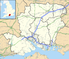
 Chilcomb
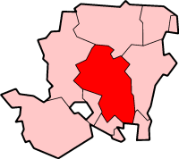
Chilcomb shown within HampshirePopulation 90 OS grid reference SU507284 District City of Winchester Shire county Hampshire Region South East Country England Sovereign state United Kingdom Post town WINCHESTER Postcode district SO21 Dialling code 01962 Police Hampshire Fire Hampshire Ambulance South Central EU Parliament South East England UK Parliament Winchester List of places: UK • England • Hampshire Chilcomb is a small village and civil parish in the English county of Hampshire. It is located very close to the city of Winchester (around 3.5 miles) and is on the South Downs Way long distance footpath.
The parish had a population of 91 at the 2001 Census.[1]
Contents
The Village
The village itself is nestled in a bowl surrounded by chalk downs. The village has a small Norman church which has a graveyard with views over Winchester. Church services run roughly every other week and there is an annual church féte.
Location
The north of the parish is crossed by the A31 between Winchester and Alresford. The M3 motorway runs close to the west of the parish. Southampton is approximately 12 miles away. The village is based around a no through road which ends at the top of the hill. The INTECH science centre is located on the northern edge of the parish.
Chilcomb Range
Chilcomb range is a Ministry of Defence range to the south of the village. The range has 12 lanes and firing points from 50m to 500m. Targets are both manual and automatic with the ETR coffins in front of the mantlet.
The range is used by British Army and Royal Navy units for personal weapon training in daylight and at night.
Geology
Chilcombe lies within the heart of the Winchester anticline, an up-fold in the rocks with older beds exposed in the centre. This is surrounded by outcrops of successively younger beds forming an enclosing ring of steep hills broken only by the Itchen Valley. In the centre a valley running east-west from Chilcomb to Bar End lies on the Zig Zag Chalk formation, grey chalk of Cenomanian age. This is surrounded successively by narrow, elliptical belts of the much harder Holywell Nodular Chalk, the New Pit Chalk (forming St. Catherine's Hill) and the Lewes Nodular Chalk, forming the peaks of Twyford Down and Deacon hill to the south, Winchester's West Hill and Sleepers Hill to the west, Magdalen Hill Down to the north and Telegraph Hill to the east. Beyond lies a further ring of the Seaford Chalk.[2]
References
- ^ "This source does not currently display Chilcomb CP when searched but population can be shown by bringing up a neighbouring CP, displaying as a map and hovering the mouse over Chilcomb CP". Neighbourhood Statistics. Office for National Statistics. http://neighbourhood.statistics.gov.uk/dissemination/LeadTableView.do?a=3&b=795220&c=Owslebury&d=16&e=15&g=453134&i=1001x1003x1004&m=0&r=1&s=1205166628545&enc=1&dsFamilyId=779. Retrieved 2008-03-10.
- ^ British Geological Survey (2002), Winchester. England and Wales Sheet 299. Solid and Drift Geology, 1:50,000 Series geological map, Keyworth, Nottingham: British Geological Survey, ISBN 0-7518-3340-1
External links
 Media related to Chilcomb at Wikimedia CommonsCategories:
- Villages in Hampshire
- Civil parishes in Winchester

Wikimedia Foundation. 2010.