- Oye-Plage
-
Oye-Plage
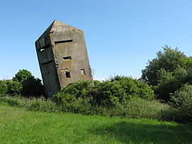
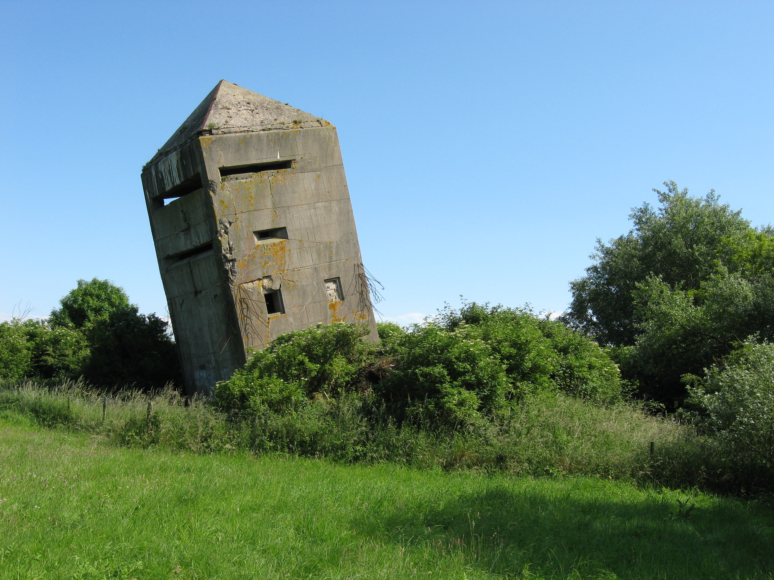
La tour penchée, a blockhouse in Oye-Plage 
 Oye-PlageLocation within Nord-Pas-de-Calais region
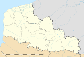 Oye-Plage
Administration Country France Region Nord-Pas-de-Calais Department Pas-de-Calais Arrondissement Saint-Omer Canton Audruicq Intercommunality Communauté de communes de la Région d'Audruicq Mayor Olivier Majewicz
(2008–2014)Statistics Elevation 0–14 m (0–46 ft)
(avg. 4 m/13 ft)Land area1 33.86 km2 (13.07 sq mi) Population2 5,844 (2006) - Density 173 /km2 (450 /sq mi) INSEE/Postal code 62645/ 62215 1 French Land Register data, which excludes lakes, ponds, glaciers > 1 km² (0.386 sq mi or 247 acres) and river estuaries. 2 Population without double counting: residents of multiple communes (e.g., students and military personnel) only counted once. Coordinates: 50°58′43″N 2°02′42″E / 50.9786111111°N 2.045°E
Oye-Plage is a commune in the Pas-de-Calais department in the Nord-Pas-de-Calais region of France.
Contents
Geography
Oye-Plage lies about 7 miles (12 km) east of Calais, on the junction of the D219 and the D940. The commune is nearly a mile from the English Channel.
History
The commune has ancient origins. The name is first recorded as Ogia in the 8th century, which means 'island' (< Protogermanic *aujō), was used for those islands that survived high tides.
The Vikings landed here in 879 with the aim of invading Moriny.
In the county of Boulogne until 1259, Oye belonged to the counts of Artois until 1346, the English until 1558 and to the Kings of France since that date, under the name of Oye county.
It was at Oye chateau that a peace treaty was signed on July 6, 1439 between France and England. There is nothing left of the castle and adjacent forts which were tasked to block the road against first the Flemish and then the Spanish.
The only witness to the past, the church tower, restored in 1953, was built by the English in 1553 under the reign of Mary Tudor. In the church, dedicated to Saint-Médard, were buried many English killed during the siege of Calais in 1346, and the dead of the French army killed while taking Calais at the Battle of Gravelines (1558).
The port gradually silted-up and was finally closed in the eighteenth century.
Population
Population history 1962 1968 1975 1982 1990 1999 2006 2317 2326 2482 4479 5678 5882 5844 Census count starting from 1962: Population without duplicates Places of interest
- La Tour Penchée : A blockhouse built in the shape of a church steeple. Its purpose was to deceive the Allied airmen who were bombing targets in Germany, as they often used visual cues for directions. This false tower could be confused with that of the town situated a few kilometres further south. When the war ended, they tried to destroy the building with explosives. It was not enough. Now the tower leans about twenty degrees, hence its name (penchée = leaning).
- The modern church of St.Médard.
- The remains of the château, which was subject to many invasions, (by the Comte de Flandres, the Duke de Bourgogne etc.) and was razed in 1558.
- A brick-built windmill.
- The 391 hectares Nature Reserve of the Platier d'Oye, created in 1987.
- The 9 km beach.
- The war memorial, built in 1920.
See also
References
External links
- Official commune website (French)
- Oye-Plage on the Quid website (French)
Categories:- Communes of Pas-de-Calais
- Inclined towers
- Pas-de-Calais geography stubs


Wikimedia Foundation. 2010.