- Mühl Rosin
-
Mühl Rosin 
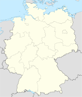
 Mühl RosinLocation of Mühl Rosin within Rostock district
Coordinates 53°46′0″N 12°13′0″E / 53.766667°N 12.216667°ECoordinates: 53°46′0″N 12°13′0″E / 53.766667°N 12.216667°E Administration Country Germany State Mecklenburg-Vorpommern District Rostock Municipal assoc. Güstrow-Land Mayor Eckhard Buchholz Basic statistics Area 24.29 km2 (9.38 sq mi) Elevation 12 m (39 ft) Population 1,084 (31 December 2010)[1] - Density 45 /km2 (116 /sq mi) Other information Time zone CET/CEST (UTC+1/+2) Licence plate GÜ Postal code 18276 Area code 03843 Website www.amt-guestrow-land.de Mühl Rosin is a municipality in the Rostock district, in Mecklenburg-Vorpommern, Germany.
References
- ^ "Bevölkerungsentwicklung der Kreise und Gemeinden" (in German). Statistisches Amt Mecklenburg-Vorpommern. 31 December 2010. http://service.mvnet.de/statmv/daten_stam_berichte/e-bibointerth01/bevoelkerung--haushalte--familien--flaeche/a-i__/a123__/2010/daten/a123-2010-22.pdf.
Categories:- Municipalities in Mecklenburg-Vorpommern
- Rostock (district) geography stubs


Wikimedia Foundation. 2010.