- Olathe, Kansas
-
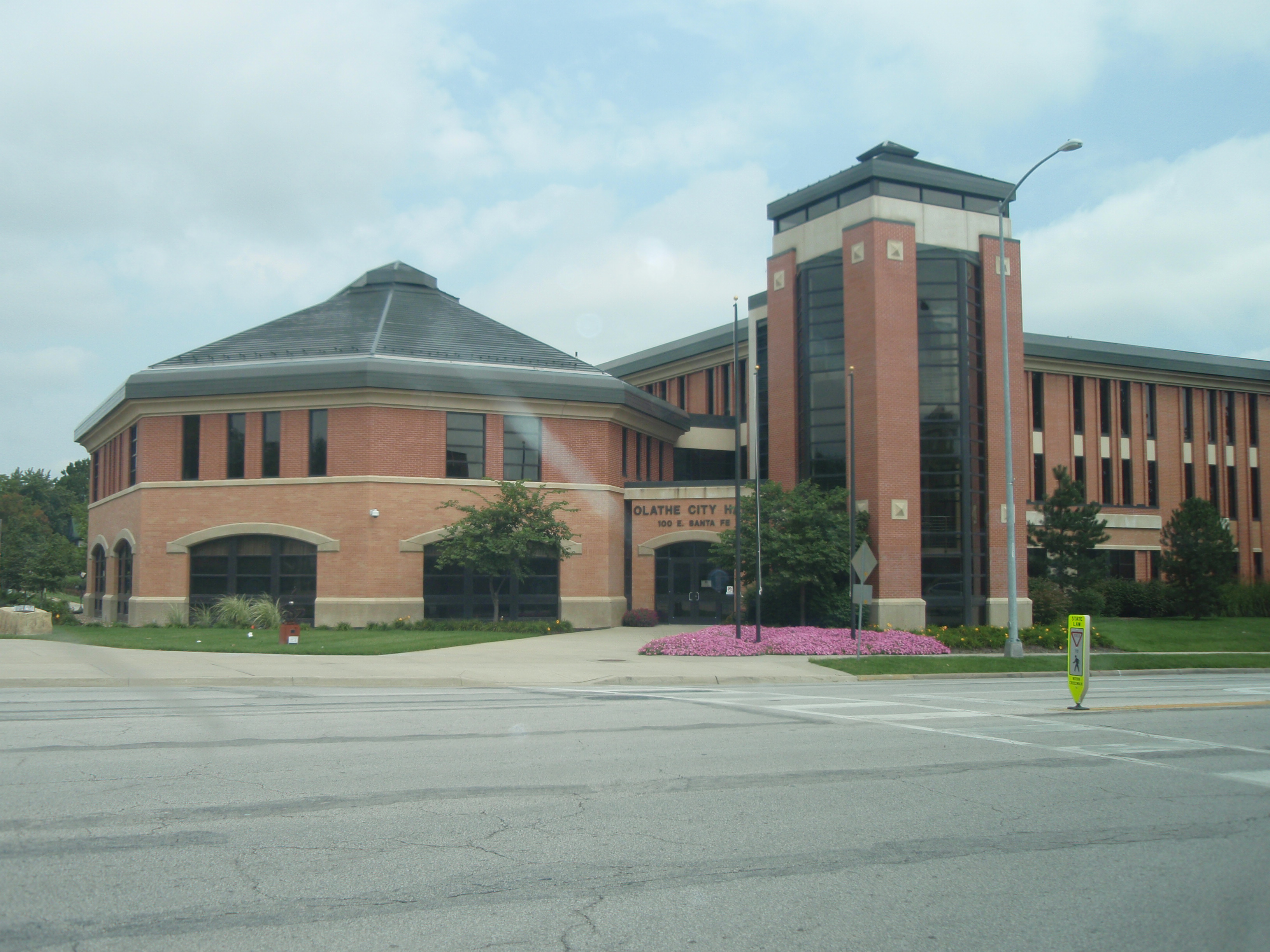
Olathe, Kansas — City — Olathe City Hall Location of Olathe in Kansas.
Coordinates: 38°52′51″N 94°48′11″W / 38.88083°N 94.80306°WCoordinates: 38°52′51″N 94°48′11″W / 38.88083°N 94.80306°W Country United States State Kansas County Johnson Founded 1857[1] Government – Type Mayor–Council – Mayor Michael Copeland Area – Total 54.5 sq mi (141.1 km2) – Land 54.2 sq mi (140.3 km2) – Water 0.3 sq mi (0.8 km2) 0.55% Elevation 1,050 ft (315 m) Population (2010)[2] – Total 125,872 – Density 2,309.6/sq mi (891.7/km2) Time zone CST (UTC-6) – Summer (DST) CDT (UTC-5) ZIP code 66051,66061,66062,66063 Area code(s) 913 FIPS code 20-52575[3] GNIS feature ID 0479198[4] Website www.OlatheKS.org Olathe (
 /oʊˈleɪθə/ oh-lay-thə) is a city in and the county seat of Johnson County, Kansas, United States.[5] Located in northeastern Kansas, it is also the fifth most populous city in the state, with a population of 125,872 at the 2010 census.[2] As a suburb of Kansas City, Missouri, Olathe is the fourth-largest city in the Kansas City Metropolitan Area. It is bordered by the cities of Lenexa to the north, Overland Park to the east, and Gardner to the southwest. In 2008, the US Census Bureau ranked Olathe the 24th fastest-growing city in the nation.[6][7] The same year, CNN/Money and Money magazine ranked Olathe #11 on its list of the "100 Best Cities to Live in the United States."[8]
Contents
History
Olathe was founded by Dr. John T. Barton in the spring of 1857. He rode to the center of Johnson County, Kansas, and staked two quarter sections of land as the town site. He later described his ride to friends: "...the prairie was covered with verbena and other wild flowers. I kept thinking the land was beautiful and that I should name the town Beautiful."[citation needed] Purportedly, Barton asked a Shawnee interpreter how to say "Beautiful" in his native language. The interpreter responded, "Olathe."[citation needed]
Olathe was not the first city established in Johnson County, but it quickly became the largest and was named the county seat in October 1859 [1]. The city's early days were filled with violence, as pro-slavery forces from nearby Missouri often clashed with local abolitionists. These conflicts were known on a large scale as Bleeding Kansas.
As the 1850s came to a close, and as Kansas entered the Union as a free state in 1861, the violence lessened. However, a year later Confederate guerrillas from Missouri led by William Quantrill surprised the residents and raided the city on September 7, 1862, killing a half dozen men, robbing numerous businesses and private homes, and destroying most of the city. Quantrill launched the raid because the people of Olathe were known for their abolitionism.[citation needed]
Olathe served as a stop on the Oregon Trail, the California Trail, and the Santa Fe Trail. Catering to travelers was the main source of income for local stores and businesses. The Mahaffie House, a popular resupply point for wagons headed westward, is today a registered historical site maintained by the City of Olathe. The staff wears period costumes, and stagecoach rides and farm animals make the site a favorite among children. Visitors participate a Civil War re-enactment, Wild West Days, and other activities there.[citation needed]
After the construction of the transcontinental railroad, the trails to the west lost importance, and Olathe faded into obscurity and remained a small, sleepy prairie town.
In the 1950s, the construction of the Interstate Highway system and, more directly, I-35, linked Olathe directly to nearby Kansas City. The result was tremendous residential growth as Olathe became a part of the Kansas City Metro Area. In the 1980s, Olathe experienced tremendous commercial growth, which also drew more residents. It is estimated that Olathe's population surpassed 100,000 in 2001, and current projections show Olathe's growth continuing as the city expands into the farm fields south, west and north of town.[citation needed]
Geography
Olathe is located at 38°52′51″N 94°48′11″W / 38.88083°N 94.80306°W[9]. 2003 Orthophoto Aerial According to the United States Census Bureau, the city has a total area of 54.5 square miles (141 km2), of which 54.2 square miles (140 km2) is land and 0.3 square miles (0.78 km2), or 0.55%, is water. Olathe has two public lakes: Lake Olathe with 172 acres (0.70 km2) of water surface and Cedar Lake with 45 acres (0.18 km2).
Climate
Olathe has a humid-continental climate, with frigid winters and hot summers. Temperatures range from an average high of 40 °F (4 °C) and low 18 °F (−8 °C) in January to an average high of nearly 90 °F (32 °C) in July. The temperature reaches 90 °F (32 °C) an average of 36 days per year and 100 °F (38 °C) an average of 3 days per year. The minimum temperature falls below freezing (32°F) an average of 102 days per year, but rarely drops below 10 °F (−12 °C). Typically the first frost occurs between mid-October and the first week of November, and the last frost occurs between the end of March and the third week of April.
The area receives over 40 inches (1,000 mm) of precipitation during an average year with the largest share being received in May and June—the April–June period averages 30 days of measurable precipitation. During a typical year the total amount of precipitation may be anywhere from 28½ to almost 53 inches. There are on average 96 days of measurable precipitation per year. Winter snowfall averages about 17 inches, but the median is 11 inches (280 mm). Measurable snowfall occurs an average of 10 days per year with at least an inch of snow being received on seven of those days. Snow depth of at least an inch occurs an average of 25 days per year.
Source: Monthly Station Climate Summaries, 1971–2000, U.S. National Climatic Data Center Month Jan Feb Mar Apr May Jun Jul Aug Sep Oct Nov Dec Year Temperatures (°F) Mean high 40.1 44.8 56.1 66.7 75.6 84.3 89.4 87.8 80.1 69.3 53.8 43.0 65.7 Mean low 18.4 25.3 34.7 44.8 54.9 63.8 68.5 66.5 58.3 47.3 34.8 24.2 45.3 Highest recorded 72
(1950)81
(1972)85
(1995)91
(1987)95
(1956)105
(1980)114
(1954)107
(2000)106
(2000)98
(1939)84
(1978)76
(1939)114
(1954)Lowest recorded −18
(1943)−12
(1982)−8
(1978)13
(1975)30
(1976)43
(1982)48
(1972)46
(1986)30
(1942)18
(1993)1
(1959)−22
(1989)−22
(1989)Precipitation (inches) Median 1.20 1.15 2.12 3.52 4.97 4.96 3.42 3.07 3.76 3.59 2.77 1.45 41.07 Mean number of days 6.0 5.7 8.6 9.8 11.4 9.2 8.2 8.4 7.7 7.7 7.2 6.5 96.4 Highest monthly 3.31
(1982)3.94
(1997)10.41
(1973)10.11
(1994)12.35
(1990)13.40
(1984)15.59
(1993)7.76
(1985)14.65
(1986)7.82
(1985)8.51
(1992)4.89
(1992)Snowfall (inches) Median 4.3 3.3 1.3 0.0 0.0 0.0 0.0 0.0 0.0 0.0 0.5 1.8 11.2 Mean number of days 3.0 2.4 1.4 0.2 0.0 0.0 0.0 0.0 0.0 0.1 0.8 2.1 10.0 Highest monthly 20.5
(1979)14.0
(1993)13.5
(1978)3.0
(1979)0.0 0.0 0.0 0.0 0.0 4.5
(1996)8.0
(1975)11.3
(1983)Notes: Temperatures are in degrees Fahrenheit. Precipitation includes rain and melted snow or sleet in inches; median values are provided for precipitation and snowfall because mean averages may be misleading. Mean and median values are for the 30-year period 1971–2000; temperature extremes are for the station's period of record (1939–2001). The station is located three miles (5 km) east of Olathe at 38°53′N 94°46′W, elevation 1,055 feet (322 m). Climate data for Olathe, Kansas Month Jan Feb Mar Apr May Jun Jul Aug Sep Oct Nov Dec Year Average high °F (°C) 41.3
(5.2)44.8
(7.1)56.1
(13.4)66.7
(19.3)75.6
(24.2)84.3
(29.1)89.4
(31.9)87.8
(31.0)80.1
(26.7)69.3
(20.7)53.8
(12.1)43.0
(6.1)65.7 Average low °F (°C) 22.9
(−5.1)25.3
(−3.7)34.7
(1.5)44.8
(7.1)54.9
(12.7)63.8
(17.7)68.5
(20.3)66.5
(19.2)58.3
(14.6)47.3
(8.5)34.8
(1.6)24.2
(−4.3)45.3 [citation needed] Demographics
Historical populations Census Pop. %± 1870 1,817 — 1880 2,285 25.8% 1890 3,294 44.2% 1900 3,451 4.8% 1910 3,272 −5.2% 1920 3,268 −0.1% 1930 3,656 11.9% 1940 3,979 8.8% 1950 5,593 40.6% 1960 10,987 96.4% 1970 17,921 63.1% 1980 37,258 107.9% 1990 63,440 70.3% 2000 92,962 46.5% 2010 125,872 35.4% U.S. Decennial Census As of the census of 2000,[3] there were 92,962 people, 32,314 households, and 24,623 families residing in the city. The population density was 1,716.4 people per square mile (662.7/km²). There were 33,343 housing units at an average density of 615.6 per square mile (237.7/km²). The racial makeup of the city was 88.63% White, 3.70% African American, 0.43% Native American, 2.74% Asian, 0.05% Pacific Islander, 2.64% from other races, and 1.80% from two or more races. Hispanic or Latino of any race were 5.44% of the population. 26.1% were of German, 11.0% Irish, 10.7% English and 9.6% American ancestry according to Census 2000.
There were 32,314 households out of which 45.1% had children under the age of 18 living with them, 63.8% were married couples living together, 9.0% had a female householder with no husband present, and 23.8% were non-families. 18.4% of all households were made up of individuals and 3.7% had someone living alone who was 65 years of age or older. The average household size was 2.83 and the average family size was 3.24.
In the city the population was spread out with 30.8% under the age of 18, 9.2% from 18 to 24, 36.7% from 25 to 44, 18.1% from 45 to 64, and 5.2% who were 65 years of age or older. The median age was 31 years. For every 100 females there were 99.4 males. For every 100 females age 18 and over, there were 96.1 males.
The median income for a household in the city was $61,111, and the median income for a family was $68,498 (these figures had risen to $72,634 and $82,747 respectively as of a 2007 estimate[10]). Males had a median income of $45,699 versus $30,217 for females. The per capita income for the city was $24,498. About 2.4% of families and 4.1% of the population were below the poverty line, including 4.1% of those under age 18 and 4.1% of those age 65 or over.
Economy
Olathe's commercial and industrial parks are home to many companies, including Honeywell, Husqvarna, ALDI, Garmin, Grundfos, and Farmers Insurance Group. Although Farmers Insurance is based in Los Angeles California, Olathe has more Farmers employees than any other city in the United States.
The United States Department of Transportation administers and maintains an Air Route Traffic Control Center in Olathe, designated ZKC. The ZKC control center is one of 20 regional centers that cover United States airspace. Johnson County maintains an airport in Olathe, Johnson County Executive Airport, which is located on about 500 acres (2.0 km2) of land with a 4,100-ft (1250-m) runway, parallel taxiways, and a Federal contract air traffic control tower. The airport is the second-busiest in the state.[11]
Education
The city of Olathe is served by the Olathe School District and Blue Valley School District. As of 2008, there are 26,894 students enrolled in the Olathe School District.[12] The Olathe School District has 34 elementary schools, 9 middle schools, and 4 high schools: Olathe North, Olathe South, Olathe East, and Olathe Northwest.
Olathe is the home of MidAmerica Nazarene University and the Kansas State School For the Deaf (established in 1866).
Transportation
 Johnson County Executive Airport (KOJC) Tower (2004)
- Johnson County Transit operates a bus system throughout the county, including Olathe.
Notable people
- Willie Aames, actor
- John Anderson, Jr., Governor of Kansas (1961–1965)
- Manute Bol, NBA player (1985–1994)
- George Washington Carver, botanist and prominent African American leader
- Stevana Case, professional video gamer
- Adam Jamal Craig, Actor on several television shows. Currently on NCIS: Los Angeles
- Johnny Dare, Kansas City radio personality
- Matthew Creed, Former Kansas City radio personality and actor (started as the youngest on-air DJ in top 30 cities in the United States)
- Don Davis, former NFL player
- Mike Gardner, collegiate football coach
- Herbert S. Hadley, former Missouri Governor and chancellor of Washington University in St. Louis
- Mark Parkinson, Governor of Kansas (2009–2011)
- Larry Parks, actor
- Rob Pope, emo band The Get Up Kids[13]
- Ryan Pope, emo band The Get Up Kids
- Richie Pratt, professional musician, professional football player
- J. Wayne Reitz, President of the University of Florida (1955–1967)
- Charles "Buddy" Rogers, actor
- Vince Snowbarger, US Congressmen (1997–1999)
- Darren Sproles, NFL player, with the New Orleans Saints
- John St. John, Governor of Kansas (1879–1883), Prohibition Party Presidential candidate (1884)
- Jim Suptic, emo band The Get Up Kids
Sister cities

Friendship cities
References
- ^ “Olathe was incorporated in 1857 under a charter from the ‘Bogus Legislature.’ ... Some doubts existed as to the legality of the incorporation and it was re-incorporated in 1868 as a city of the third class....” —Blackmar, Frank W., ed. “Olathe”. Kansas: a cyclopedia of state history, embracing events, institutions, industries, counties, cities, towns, prominent persons, etc. ... Vol. II. Standard Pub. Co. (Chicago: 1912) pp. 386–387.
- ^ a b "2010 City Population and Housing Occupancy Status". U.S. Census Bureau. http://factfinder2.census.gov/faces/tableservices/jsf/pages/productview.xhtml?pid=DEC_10_PL_GCTPL2.ST13&prodType=table. Retrieved March 6, 2011.
- ^ a b "American FactFinder". United States Census Bureau. http://factfinder.census.gov. Retrieved 2008-01-31.
- ^ "US Board on Geographic Names". United States Geological Survey. 2007-10-25. http://geonames.usgs.gov. Retrieved 2008-01-31.
- ^ "Find a County". National Association of Counties. http://www.naco.org/Counties/Pages/FindACounty.aspx. Retrieved 2011-06-07.
- ^ Olathe cracks top 25 in fastest-growing U.S. cities
- ^ Roberts, Sam (June 28, 2007). "Biggest Urban Growth Is in South and West". The New York Times. http://query.nytimes.com/gst/fullpage.html?res=9B06E0DC163EF93BA15755C0A9619C8B63. Retrieved May 20, 2010.
- ^ "Best places to live 2008". CNN. http://money.cnn.com/magazines/moneymag/bplive/2008/snapshots/PL2052575.html. Retrieved May 20, 2010.
- ^ "US Gazetteer files: 2010, 2000, and 1990". United States Census Bureau. 2011-02-12. http://www.census.gov/geo/www/gazetteer/gazette.html. Retrieved 2011-04-23.
- ^ http://factfinder.census.gov/servlet/ACSSAFFFacts?_event=Search&geo_id=16000US2039350&_geoContext=01000US%7C04000US20%7C16000US2039350&_street=&_county=olathe&_cityTown=olathe&_state=04000US20&_zip=&_lang=en&_sse=on&ActiveGeoDiv=geoSelect&_useEV=&pctxt=fph&pgsl=160&_submenuId=factsheet_1&ds_name=ACS_2007_3YR_SAFF&_ci_nbr=null&qr_name=null®=null%3Anull&_keyword=&_industry=
- ^ "Johnson County Airports Among Busiest in Kansas". The Olathe News via AirportBusiness.com. 12 January 2011. http://www.airportbusiness.com/web/online/Top-News-Headlines/Johnson-County-Airports-Among-Busiest-in-Kansas/1$5689. Retrieved 6 July 2011.
- ^ "District History - Enrollment Growth". Olathe School District. http://www.olatheschools.com/index.php?option=com_content&task=view&id=209&Itemid=26. Retrieved 15 September 2010.
- ^ Get Up Kids Bio
Further reading
- History of the State of Kansas; William G. Cutler; A.T. Andreas Publisher; 1883. (Online HTML eBook)
- Kansas : A Cyclopedia of State History, Embracing Events, Institutions, Industries, Counties, Cities, Towns, Prominent Persons, Etc; 3 Volumes; Frank W. Blackmar; Standard Publishing Co; 944 / 955 / 824 pages; 1912. (Volume1 - Download 54MB PDF eBook),(Volume2 - Download 53MB PDF eBook), (Volume3 - Download 33MB PDF eBook)
External links
Official sites
- City of Olathe
- Olathe - Directory of Public Officials
- Olathe Public Library
- Olathe Public Schools U.S.D 233
Additional information

Lenexa 
Overland Park  Olathe

Gardner Municipalities and communities of Johnson County, Kansas County seat: OlatheCities Bonner Springs‡ | De Soto‡ | Edgerton | Fairway | Gardner | Lake Quivira‡ | Leawood | Lenexa | Merriam | Mission | Mission Hills | Mission Woods | Olathe | Overland Park | Prairie Village | Roeland Park | Shawnee | Spring Hill‡ | Westwood | Westwood Hills

Townships Aubry | Gardner | Lexington | McCamish | Olathe | Oxford | Shawnee | Spring Hill
Unincorporated
communityFootnotes ‡This populated place also has portions in an adjacent county or counties
Kansas City Metropolitan Area's cities and counties Central city 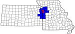
Largest cities (over 100,000 in 2000) Medium-sized cities (10,000 to 100,000 in 2000) Blue Springs • Belton • Excelsior Springs • Gladstone • Grandview • Lansing • Leawood • Leavenworth • Lee's Summit • Lenexa • Liberty • Merriam • Ottawa • Prairie Village • Raymore • Raytown • ShawneeCounties Categories:- Olathe, Kansas
- Cities in Kansas
- County seats in Kansas
- Populated places in Johnson County, Kansas
- Kansas City metropolitan area
- Bleeding Kansas


Wikimedia Foundation. 2010.