- Cobbins Brook
-
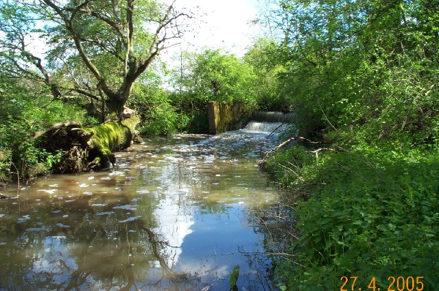
 Weir on Cobbins Brook at Warlies Park, Upshire.
Cobbins Brook is a minor tributary of the River Lea. It forms at the north of Epping, Essex and flows past Epping Uplands, Waltham Abbey until it joins the River Lee Flood Relief Channel below the M25 near Rammey Marsh.
Queen Boudica
A local legend claims Boudica's rebellion against the Romans ended in the Waltham Abbey neighbourhood when she poisoned herself with hemlock gathered from the banks of Cobbins Brook[1].
External links
- British history online
- Cobbins Brook flood alleviation scheme Retrieved 19 May, 2010
References
Counties: Bedfordshire · Essex · Hertfordshire · Greater London · Mouth: River Thames
Settlements: Luton · Harpenden · Wheathampstead · Welwyn Garden City · Hertford · Ware · Stanstead Abbotts · Hoddesdon · Broxbourne · Cheshunt
Waltham Abbey · Ponders End · Edmonton · Tottenham · Upper Clapton · Hackney Wick · Stratford · Bromley-by-Bow · Canning Town · Leamouth
Major tributaries: River Ash · River Beane · River Ching · River Mimram · River Moselle · River Rib · River Stort
Minor tributaries: Bayford Brook · Broxbourne Mill Stream · Cobbins Brook · Coppermill Stream · Cornmill Stream • Cuffley Brook · Dagenham Brook ·
Hackney Brook · Millhead Stream • Pymmes Brook · Rags Brook • River Lynch · Salmons Brook
Small River Lea & Turnford Brook · Spital Brook · Theobalds Brook · Turkey Brook · Woollens Brook · Wormleybury BrookCategories:- Essex geography stubs
- Rivers of Essex
Wikimedia Foundation. 2010.