- Google Maps
-
Google Maps 
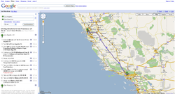
Screenshot of Google Maps showing a route from San Francisco to Los Angeles on Interstate 5.URL maps.google.com Type of site Web mapping Registration Optional, included with a Google Account Available language(s) Multilingual Owner Google Created by Google Launched February 8, 2005 Current status Active Google Maps (formerly Google Local) is a web mapping service application and technology provided by Google, free (for non-commercial use), that powers many map-based services, including the Google Maps website, Google Ride Finder, Google Transit,[1] and maps embedded on third-party websites via the Google Maps API.[2] It offers street maps, a route planner for traveling by foot, car, bike (beta) or public transport and an urban business locator for numerous countries around the world. Google Maps satellite images are not updated in real time; they are several months or years old.[3]
Google Maps uses a close variant of the Mercator projection, so it cannot show areas around the poles. A related product is Google Earth, a stand-alone program which offers more globe-viewing features, including showing polar areas.
Contents
Satellite view
Google Maps provides high-resolution aerial or satellite images for most urban areas in the United States (including Hawaii, Alaska, Puerto Rico, and the U.S. Virgin Islands), Canada, and the United Kingdom, as well as parts of Australia and many other countries. The high-resolution imagery has been used by Google Maps to cover all of Egypt's Nile Valley, Sahara desert and Sinai. Google Maps also covers many cities in the English speaking areas. However, Google Maps is not solely an English maps service, since its service is intended to cover the world. Various governments have complained about the potential for terrorists to use the satellite images in planning attacks.[4][dead link] Google has blurred some areas for security (mostly in the United States),[5] including the U.S. Naval Observatory area (where the official residence of the Vice President is located), and previously[6] the United States Capitol and the White House. Other well-known government installations, including Area 51 in the Nevada desert, are visible. Not all areas on satellite images are covered in the same resolution; less populated areas usually get less detail. Some areas may be obscured by patches of clouds.[7][8] With the introduction of an easily pannable and searchable mapping and satellite imagery tool, Google's mapping engine prompted a surge of interest in satellite imagery. Sites were established which feature satellite images of interesting natural and man-made landmarks, including such novelties as "large type" writing visible in the imagery, as well as famous stadia and unique geological formations. Although Google uses the word satellite, most of the high-resolution imagery of cities is aerial photography taken from aircraft flying at 800–1500 feet rather than from satellites; while most of the rest of the imagery is in fact from satellites.[9]
Although the aerial views images are undated, they occasionally coincide with known events. For example, as of Oct. 8, 2011, the aerial view of the Hollywood region of Los Angeles shows the street-closures and temporary structures related to the 2011 Academy Awards ceremony.
Directions
 Contiguous regions on Google Maps
Google Maps provides a route planner under "Get Directions". Up to four modes of transportation are available depending on the area: driving, public transit (see the Google Transit section below), walking, and bicycling. Driving directions are available:
- Contiguously in Europe, the Middle East, South and Southeast Asia and the African Mainland (with the exception of Egypt and Lesotho): Afghanistan, Andorra, Albania, Armenia, Austria, Azerbaijan, Bahrain, Bangladesh, Belgium, Belarus, Bhutan, Bulgaria, Cambodia, Croatia, Czech Republic, Denmark (excluding the Faroe Islands), Estonia, France, Finland, Georgia, Germany, Greece, Gibraltar, Hungary, India, Iran, Iraq, Ireland, Italy, Kazakhstan, Kuwait, Kyrgyzstan, Laos, Latvia, Liechtenstein, Lithuania, Luxembourg, Macedonia, peninsular Malaysia, Moldova, Monaco, Montenegro, Myanmar, Nepal, The Netherlands, Norway (excluding Svalbard), Pakistan, Poland, Portugal (excluding the Azores and Madeira), Qatar, Romania, Kaliningrad Oblast of Russia, San Marino, Saudi Arabia, Singapore, Slovakia, Slovenia, Serbia, Spain (including the Canary Islands and Ceuta and Melilla), Sweden, Switzerland, Syria, Tajikistan, Thailand, Turkey, Turkmenistan, Ukraine, United Arab Emirates, United Kingdom, Uzbekistan, Vatican City, Vietnam and Yemen
- Contiguously in North and Central America: Belize, Canada, Costa Rica, El Salvador, Guatemala, Honduras, Mexico, Nicaragua, Panama and the United States
- Contiguously in South America: Argentina, Bolivia, Brazil, Chile, Ecuador, Paraguay, Peru (most parts, except e.g. Iquitos and other places in the Loreto region) and Uruguay
- In certain noncontiguous countries and regions: Australia, Barbados, China, Colombia, Comoros, Cuba, Egypt, Fiji, French Guiana, Guyana, Hawaii, Hispaniola (the Dominican Republic and Haiti), Hong Kong, Iceland, Indonesia (Bali, Borneo, Java, Lombok, Madura, Sulawesi and Sumatra), Israel (and parts of the West Bank), Jamaica, Japan, Jordan, Lebanon, Macau, Madagascar, Malta, Mauritius, Mongolia, New Caledonia, New Zealand, Papua New Guinea (mainland in development), Puerto Rico, Qatar, Réunion, Russia (Moscow area only), Sabah, Sarawak, Seychelles, Sri Lanka, Suriname, Taiwan, Timor-Leste (eastern half only), Turks and Caicos Islands, Upolu (Samoa), the US Virgin Islands and Venezuela.
In addition, public transit directions are available in South Korea.
Implementation
Like many other Google web applications, Google Maps uses JavaScript extensively. As the user drags the map, the grid squares are downloaded from the server and inserted into the page. When a user searches for a business, the results are downloaded in the background for insertion into the side panel and map; the page is not reloaded. Locations are drawn dynamically by positioning a red pin (composed of several partially-transparent PNGs) on top of the map images.
A hidden IFrame with form submission is used because it preserves browser history. The site also uses JSON for data transfer rather than XML, for performance reasons. These techniques both fall under the broad Ajax umbrella.
In October 2011, Google announced MapsGL, a WebGL version of Maps with better renderings and smoother transitions.[10]
Extensibility and customization
As Google Maps is coded almost entirely in JavaScript and XML, some end users have reverse-engineered the tool and produced client-side scripts and server-side hooks which allowed a user or website to introduce expanded or customized features into the Google Maps interface.
Using the core engine and the map/satellite images hosted by Google, such tools can introduce custom location icons, location coordinates and metadata, and even custom map image sources into the Google Maps interface. The script-insertion tool Greasemonkey provides a large number of client-side scripts to customize Google Maps data.
Combinations with photo sharing websites, such as Flickr, are used to create "memory maps".[clarification needed What are memory maps?] Using copies of the Keyhole satellite photos, users have taken advantage of image annotation features to provide personal histories and information regarding particular points of the area.
Google Maps API
After the success of reverse-engineered mashups such as chicagocrime.org and housingmaps.com, Google launched the Google Maps API in June 2005[11] to allow developers to integrate Google Maps into their websites. It is a free service, and currently[update] does not contain ads, but Google states in their terms of use that they reserve the right to display ads in the future.[12]
By using the Google Maps API, it is possible to embed Google Maps site into an external website, on to which site specific data can be overlaid. Although initially only a JavaScript API, the Maps API has since expanded to include an API for Adobe Flash applications, a service for retrieving static map images, and web services for performing geocoding, generating driving directions, and obtaining elevation profiles. Over 350,000[13] web sites use the Google Maps API, making it the most heavily used web application development API.[14]
The Google Maps API is free for commercial use providing that the site on which it is being used is publicly accessible and does not charge for access, and is not generating more than 25 000 map accesses a day.[15][16] Sites that do not meet these requirements can purchase Google Maps API Premier.[17]
The success of the Google Maps API has spawned a number of competing alternatives, including the Yahoo! Maps API, Bing Maps Platform, MapQuest Development Platform, and OpenLayers.
In September 2011, Google announced it would discontinue a number of its products, including Google Maps API for Flash.[18]
Google Maps for Mobile
In 2006, Google introduced a Java application called Google Maps for Mobile, intended to run on any Java-based phone or mobile device. Many of the web-based site's features are provided in the application.[19]
On November 28, 2007, Google Maps for Mobile 2.0 was released. It introduced a GPS-like location service that does not require a GPS receiver. The "my location" feature works by utilizing the GPS location of the mobile device, if it is available. This information is supplemented by the software determining the nearest wireless networks and cell sites. The software then looks up the location of the cell site using a database of known wireless networks and cell sites. The Cell-site location method is used by triangulating the different signal strengths from different cell transmitters and then using their location property (retrieved from the online cell site database) to aid My Location in determining the user's current location. Wireless network location method is calculated by discovering the nearby WiFi hotspots and using their location property (retrieved from the online WiFi database, in the same way as the cell site database) to further discover the user's location. The order in which these take precedence is:
- GPS-based services
- WLAN-, WiFi-based services
- Cell transmitter-based services
The software plots the streets in blue that are available with a yellow icon and a green circle around the estimated range of the cell site based on the transmitter's rated power (among other variables). The estimate is refined using the strength of the cell phone signal to estimate how close to the cell site the mobile device is.
As of December 15, 2008[update], this service is available for the following platforms:[20]
- Android
- iOS (iPhone, iPod Touch, iPad)
- Windows Mobile (NOT Windows Phone 7 as of October 21, 2011[update])
- Nokia/Symbian (S60 3rd edition only)
- Symbian OS (UIQ v3)
- BlackBerry
- Phones with Java-Platform (MIDP 2.0 and up), for example the Sony Ericsson K800i
- Palm OS (Centro and newer)
- Palm webOS (Palm Pre and Palm Pixi)
On November 4, 2009, Google Maps Navigation was released in conjunction with Google Android OS 2.0 Eclair on the Motorola Droid, adding voice commands, traffic reports, and street view support.[21] The initial release was limited to the United States.[22] The service was launched in the UK on 20 April 2010 and in large parts of continental Europe on June 9, 2010 (including Austria, Belgium, Canada, Denmark, France, Germany, Italy, the Netherlands, Portugal, Spain, and Switzerland).[23]
In March 2011, Google Vice President of Location Service, Marissa Mayer announced that Google provides map services to 150 millions users.[24]
Google Maps Android 2.0
 Google Maps for Android
Cell phones are being increasingly used for navigation assistance. Google Maps Navigation for Android 2.0 is free.
Features provided in the application:
- Search in plain English
- Search by voice
- Traffic view
- Search along route
- Satellite view
- Street View
- Car dock mode
Impact
Google Maps Navigation is free. A potential drawback of Google Maps for Android is that maps are not included in the application file. An internet connection is required to get maps and related information from Google Maps, just like with iPhone’s Google Maps application.[25] This drawback is mitigated by an automatic map caching feature which temporarily stores recently-viewed areas. There is also a 'Download Map Area' feature in the Labs section of Google Maps. The 'Download Map Area' feature enables the user to download the road map and landmark data for an area of 10 square miles (26 km2) around any point. The user can do this action multiple times to cover as much area as desired. Google suggests that users can make use of this feature to download the map of a foreign city before traveling to visit it, so that once the user arrives in the city, they can refer to the pre-downloaded road map without needing to use expensive international roaming data. However, the downloaded map area only includes the basic road map and its landmark labels. Google notes that even after you download a map area, "you still need a data connection to see satellite view and 3D buildings, search for Places and get directions."[26]
Google Maps parameters
In Google Maps, URL parameters are sometimes data-driven in their limits and the user interface presented by the web may or may not reflect those limits. In particular, the zoom level (denoted by the z parameter) supported varies. In less populated regions, the supported zoom levels might stop at around 18. In earlier versions of the API, specifying these higher values might results in no image being displayed. In Western cities, the supported zoom level generally stops at about 20. In some isolated cases, the data supports up to 23 or greater, as in these elephants or this view of people at a well in Chad, Africa. Different versions of the API and web interfaces may or may not fully support these higher levels.
As of October 2010, the Google map viewer updates its zoom bar to allow the user to zoom all the way when centered over areas that support higher zoom levels.
History
Acquisition
Google Maps first started as a C++ program designed by two Danish brothers Lars and Jens Rasmussen at the Sydney-based company Where 2 Technologies. It was first designed to be separately downloaded by users but the company later pitched the idea for a purely Web-based product to Google management, changing the method of distribution.[27] In October 2004 the company was acquired by Google Inc[28] where it transformed into the web application Google Maps. The application was first announced on the Google Blog on February 8, 2005,[29] and was located at Google. It originally only supported users of Internet Explorer and Mozilla web browsers, but support for Opera and Safari was added on February 25, 2005, but currently[when?] Opera is removed from the system requirements list. As of December 2010[update] Internet Explorer 7.0+, Firefox 3.6+, Safari 3.1+, and Google Chrome are supported.[30] It was in beta for six months before becoming part of Google Local on October 6, 2005.
2005
In April 2005, Google created Google Ride Finder using Google Maps. In June 2005, Google released the Google Maps API. In July 2005, Google began Google Maps and Google Local services for Japan, including road maps. On July 22, 2005, Google released "Hybrid View". Together with this change, the satellite image data was converted from plate carrée to Mercator projection, which makes for a less distorted image in the temperate climes latitudes. In July 2005, in honor of the thirty-sixth anniversary of the Apollo Moon landing, Google Moon was launched. In September 2005, in the aftermath of Hurricane Katrina, Google Maps quickly updated its satellite imagery of New Orleans to allow users to view the extent of the flooding in various parts of that city. (Oddly, in March 2007, imagery showing hurricane damage was replaced with images from before the storm; this replacement was not made on Google Earth, which still uses post-Katrina imagery).[31][32]
2006
From January 2006, Google Maps featured road maps for the United States, Puerto Rico, Canada, the United Kingdom, Japan, and certain cities in the Republic of Ireland. Coverage of the area around Turin was added in time for the 2006 Winter Olympics. On January 23, 2006, Google Maps was updated to use the same satellite image database as Google Earth. On March 12, 2006, Google Mars[33] was launched, which features a draggable map and satellite imagery of the planet Mars. In April 2006, Google Local was merged into the main Google Maps site. On April 3, 2006, version 2 of the Maps API was released.[34][dead link] On June 11, 2006, Google added geocoding capabilities to the API, satisfying the most developer-requested feature for this service.[35] On June 14, 2006, Google Maps for Enterprise was officially launched.[36] As a commercial service, it features intranet and advertisement-free implementations. In July 2006 Google started including Google Maps business listings in the form of Local OneBoxes in the main Google search results.[37] On December 9 Google integrates the PlusBox in the main search results.[38] On December 19 Google added a feature that lets you add multiple destinations to your driving directions.[39] Beginning in February 2007, buildings and subway stops are displayed in Google Maps "map view" for parts of New York City, Washington, D.C., London, San Francisco, and some other cities.[40]
2007
On January 29, 2007 Local Universal results were upgraded and more data included in the main Google results page.[41] On February 28, 2007, Google Traffic info was officially launched to automatically include real-time traffic flow conditions to the maps of 30 major cities of the United States.[42] On March 8, 2007, the Local Business Center was upgraded.[43] On May 16, 2007 Google rolled out Universal search results, including more Map information on the main Google results page.[44] On May 18, 2007 Google added neighborhood search capabilities.[45] On May 29, 2007, Google driving directions support was added to the Google Maps API.[46] On May 29, 2007, Street View was added, giving a ground-level 360-degree view of streets in some major cities in United States.[47] On June 19, 2007, reviews were allowed to be added directly to businesses on Google Maps.[48] On June 28, 2007, draggable driving directions were introduced.[49] On July 31, 2007, support for the hCard microformat was announced.[50] Unfortunately, the implementation is broken.[citation needed] On August 21, 2007, Google announced a simple way to embed Google Maps into other websites.[51] On September 13, 2007, 54 new countries were added to Google Maps in Latin America and Asia.[52] On October 3, 2007, Google Transit was integrated into Google Maps making public transportation routing possible on Google Maps.[53] On October 27, 2007, Google Maps started mapping the geoweb and showing the results in Google Maps.[54] On October 27, 2007, Google Maps added a searchable interface for coupons in the business listings.[55] On November 27, 2007, "Terrain" view showing basic topographic features was added. The button for "Hybrid" view was removed, and replaced with a "Show labels" checkbox under the "Satellite" button to switch between "Hybrid" and "Satellite" views.[citation needed]
2008
On January 22, 2008, Google expanded the Local Onebox from 3 business listings to 10.[56] On February 20, 2008, Google Maps allowed searches to be refined by User Rating & neighborhoods.[57] On March 18, 2008, Google allowed end users to edit business listings and add new places.[58] On March 19, 2008, Google added unlimited category options in the Local Business Center.[59] On April 2, 2008, Google added contour lines to the Terrain view.[60] In April 2008, a button to view recent Saved Locations was added to the right of the search field.[citation needed] In May 2008, a "More" button was added alongside the "Map", "Satellite", and "Terrain" buttons, permitting access to geographically-related photos on Panoramio and articles on Wikipedia.[citation needed] On May 15, 2008, Google Maps was ported to Flash and ActionScript 3 as a foundation for richer internet applications.[citation needed] On July 15, 2008, walking directions were added.[61] On August 4, 2008, Street View launched in Japan and Australia.[61] On August 5, 2008, the user interface was redesigned.[61] On August 29, 2008, Google signed a deal under which GeoEye would supply them with imagery from a satellite,[62] and introduced the Map Maker tool, which allows any user to improve the map data seen by all.[61] On September 9, 2008, a reverse business lookup feature was added.[61] On September 23, 2008, information for the New York City Metropolitan Transit Authority was added.[61] On October 7, 2008, GeoEye-1 took its first image, a bird's-eye view of Kutztown University in Pennsylvania.[63] On October 26, 2008, reverse geocoding was added to the Maps API.[61] On November 11, 2008, Street View in Spain, Italy, and France was introduced.[61] On November 23, 2008, AIR support for the Maps API for Flash was added.[61] On November 25, 2008, a new user interface for Street View was introduced.[61] On November 27, 2008, maps, local business information, and local trends for China were introduced.[61] On December 9, 2008, 2x Street View coverage was introduced.[61]
2009-10
In May, 2009, a new Google Maps logo was introduced.[64] In early October 2009, Google replaced Tele Atlas as their primary supplier of geospatial data in the U.S. version of Maps and use their own data.[65] In October 2009, the railroads were redone, featuring a slightly new look and updated, removing older lines.[citation needed] Also in the same month, maps in several areas were changed to include paper streets and other odd roads that don't exist, as well as lot lines showing up on the map interface.[citation needed] On February 11, 2010, Google Maps Labs was added. On March 11, 2010, Street View in the United Kingdom, Hong Kong, Macau, and more locations in Japan were launched. On May 25, 2010, public transportation routing for Denmark was added by integrating with Rejseplanen.dk.[66]
Google's use of Google Maps
The main Google Maps site includes a local search feature (now deprecated), which can be used to locate businesses of a certain type in a geographic area. The functionality of the deprecated Google Local Search API is now contained in the Google Places API, currently in developer preview.
Google Ditu
Google Ditu (谷歌地图 lit. "Google Maps") was released to the public on February 9, 2007, and replaced the old Google Bendi (谷歌本地 lit. "Google Local"). This is the Chinese localized version of Google Maps and Google Local services.
In order to be compliant with the requirements of Chinese law, Google had to remove or modify some Google Maps features in Google Ditu:
- Google Ditu does not allow overlay of user-generated content from Panoramio, YouTube, Wikipedia and webcams.
- Google Ditu shows the disputed border areas between China and India as being part of China, while on Google Maps those disputed areas are shown inside dotted lines.
Google Moon
Main article: Google Moon Google Moon
In honor of the 36th anniversary of the Apollo 11 moon landing on July 20, 1969, Google took public domain imagery of the Moon, integrated it into the Google Maps interface, and created a tool called Google Moon.[67] By default this tool, with a reduced set of features, also displays the points of landing of all Apollo spacecraft to land on the Moon. It also included an easter egg, displaying a Swiss cheese design at the highest zoom level, which Google has since removed.[citation needed] A recent collaborative project between NASA Ames Research Center and Google is integrating and improving the data that is used for Google Moon. This is the Planetary Content[68] Project. Google Moon was linked from a special commemorative version of the Google logo displayed at the top of the main Google search page for July 20, 2005 (UTC).[69]
Google Mars
Main article: Google Mars Google Mars
Google Mars provides a visible imagery view, like Google Moon, as well as infrared imagery and shaded relief (elevation) of the planet Mars. Users can toggle between the elevation, visible, and infrared data, in the same manner as switching between map, satellite, and hybrid modes of Google Maps. In collaboration with NASA scientists at the Mars Space Flight Facility located at Arizona State University, Google has provided the public with data collected from two NASA Mars missions, Mars Global Surveyor and 2001 Mars Odyssey.[70]
Now, with Google Earth 5 it is possible to access new improved Google Mars data at a much higher resolution, as well as being able to view the terrain in 3D, and viewing panoramas from various Mars landers in a similar way to Google Street View.
Google Sky
Main article: Google SkyOn August 27, 2007, Google introduced Google Sky, an online space mapping tool that allows users to pan through a map of the visible universe, using photographs taken by the Hubble Space Telescope.
Google Ride Finder
Google launched an experimental Google Maps-based tool called Ride Finder, tapping into in-car GPS units for a selection of participating taxi and limousine services. The tool displays the current location of all supported vehicles of the participating services in major U.S. cities, including Chicago and San Francisco, on a Google Maps street map. As of 2009[update] the tool seems to be discontinued. Not to be confused with carpooling.
Google Transit
In December 2005, Google launched public transport route planner Google Transit on Google Labs, a 20% project of Chris Harrelson and Avichal Garg.[71] Google Transit launched initially with support for Portland, Oregon, and now includes hundreds of cities in the United States, Canada, Europe, Asia, Africa, Australia, India (Pune & Delhi,NCR) New Zealand. The service calculates route, transit time and cost, and can compare the trip to one using a car. In October 2007 Google Transit graduated from Google Labs and became fully integrated into Google Maps.[72]
The coverage of Google Transit is publicly available. It is spread worldwide, in hundreds of cities and sometimes in entire countries such as China, Japan, Switzerland. The coverage of major cities in the United States and in Canada is almost exhaustive.
In some areas, such as the United Kingdom, Google Transit covers only part of the transit agencies.
In other areas, Google Transit does not provide public transit directions, but still provides the Transit Layer which overlays the schematic of the transit lines on the map. Notable examples include Paris, Berlin, Mexico City and many other capitals around the world.
Google Biking directions
On March 10, 2010, Google added the possibility to search for biking directions on Google Maps. Optimal routes are calculated from traffic, elevation change, bike paths, bike lanes, and preferred roads for biking. An optional layer also shows different types of biking paths, from bike-only trails to preferred roads. This service is available in the US[73][74] and Canada,[75] and is in beta testing in some other countries such as Singapore.
Google My Maps
In April 2007, My Maps was a new feature added to Google's local search maps. My Maps lets users and businesses create their own map by positioning markers, polylines and polygons onto a map. The interface is a straightforward overlay on the map. A set of eighty-four pre-designed markers is available, ranging from bars and restaurants to webcam and earthquake symbols. Polyline and Polygon color, width and opacity are selectable. Maps modified using My Maps can be saved for later viewing and made public or marked as unlisted, in which case a user will need the saved URL with a 42 character unique ID.
Each element added to a My Map has an editable tag. This tag can contain text, rich text or HTML. Embeddable video and other content can be included within the HTML tag.
Upon the launch of My Maps there was no facility to embed the created maps into a webpage or blog. A few independent websites have now produced tools to let users embed maps and add further functionality to their maps.[76] This has been resolved with version 2.78.[citation needed]
Google Street View
Main article: Google Street ViewOn May 25, 2007, Google released Street View, a new feature of Google Maps which provides 360° panoramic street-level views of various U.S. cities. On this date, the feature only included five cities, but has since expanded to thousands of locations around the world.
Google Street View is currently available in parts of the following countries and regions:
In August 2008, Australia was added to the Street View feature with nearly all Australian highways, roads and streets having the feature. In addition in that month Japan was added and the Tour de France route was added on July 2 of that year. In December 2008, New Zealand was added to street view. The United Kingdom, Australia and New Zealand are the only countries to date with almost all roads and highways featured.
July 2009, Google begins mapping college campuses and surrounding paths and trails. Mexico's main cities and tourist points are added to Street View.
Street View garnered much controversy after its release because of privacy concerns about the uncensored nature of the panoramic photographs.[77][78] Since then, Google has begun blurring faces through automatic face detection.[79]
Google Aerial View
In December 2009 Google released Aerial View, consisting of angled aerial imagery, offering a "bird's eye view" of cities. The first cities available were San Jose and San Diego. This feature was available only to developers via the Google Maps API.[80] In February 2010 it was introduced as an experimental feature in Google Maps Labs.[81]
In July 2010 Aerial View was made available in Google Maps in select cities in the United States and worldwide.[82]
The complete list of cities available (as of March 2011) is:[83]
- Chile: Santiago and Valparaíso.
- Germany: Dortmund and Stuttgart.
- Hungary: Budapest.
- Italy: Rome and Venice.
- New Zealand: Hamilton.
- South Africa: Bloemfontein, Cape Town, Durban, Johannesburg, Nelspruit, Polokwane, Port Elizabeth, Pretoria and Rustenburg Surrounding Area.
- Spain: Seville.
- United States: Albuquerque, Auburn, Austin, Boulder City, Contra Costa County, Escondido, Fresno, Galt, Honolulu, Lake Forest, Lake Tahoe, Long Beach, New Orleans, Norfolk, Oakland Area, Oklahoma City, Oxnard, Palm Springs, Phoenix, Placerville, Portland, Oregon Area, Sacramento Area, Salt Lake City, San Antonio, San Diego Area, San Jose Area, Santa Clara Area, Santa Cruz Area, Sausalito, St. Louis, St. Petersburg, Tucson and Van Nuys.
Google Latitude
Main article: Google LatitudeGoogle Latitude is a feature from Google that lets users share their physical locations with other people. This service is based on Google Maps, specifically on mobile devices. There's an iGoogle widget for Desktops and Laptops as well.[84] Some concerns have been expressed about the privacy issues raised by the use of the service.[85]
Google Flu Shot Finder
Google Flu Shot Finder allows users in the United States to identify locations where both the pandemic H1N1/09 virus and seasonal flu vaccines are available near a given address or ZIP code.
Monopoly City Streets
Monopoly City Streets is a live worldwide version of the game Monopoly using Google Maps as the game board. It was created by Google and Hasbro. The game has now ended.[86]
Mashups
Main article: Mashup (web application hybrid)Google maps links to the geo-tags placed in Wikipedia articles. It also links to photos with GPS tags from Panoramio.[citation needed]
Globe Genie displays Google Street View imagery associated with a random location. Users can share notable locations with a public mapping function based on Google Maps.
Copyright
The Google Maps terms and conditions[87] state that usage of material from Google Maps is regulated by Google Terms of Service[88] and some additional restrictions. Google has either purchased local map data from established companies, or has entered into lease agreements to use copyrighted map data. The owner of the copyright is listed at the bottom of zoomed maps. For example street maps in Japan are leased from Zenrin. Street maps in China are leased from Mapabc. Russian street maps are leased from Geocentre Consulting and Tele Atlas. Data are unavailable for North Korea, so the country is blank, though the companion project Google Map Maker shows some information.
Errors
Fixing & Reporting Errors
In areas where Google Map Maker is available, for example, much of Asia, Africa, Latin America and East Europe as well as the United States, anyone who logs into their Google account can directly improve the map by fixing incorrect driving directions, adding biking trails, or adding a missing hospital. General map errors in Australia, Austria, Belgium, Canada, Denmark, France, Lichtenstein, Netherlands, New Zealand, Norway, South Africa, Switzerland, and the United States can be reported using the Report a Problem link in Google Maps and will be updated by Google.[89] For areas where Google uses Tele Atlas data, map errors can be reported using Tele Atlas map insight.[90]
If imagery is missing, outdated, misaligned, or generally incorrect, you can notify Google through their contact request form. People can also choose to receive email notification of when imagery gets updated in their area using the Follow Your World application.
Maps Data
Google Maps has difficulty processing road data when dealing with cross-boundary situations. For example, users are unable to obtain a route from Hong Kong to Shenzhen via Shatoujiao, because Google Maps does not display and plan the road map of two overlapping places.[91]
Sometimes the names of geographical locations are inaccurate. An example of this type of error may be found in Google Maps Laona, Wisconsin. In this instance Google Maps identifies one of the town's two major lakes as "Dawson Lake";[92] the USGS, State of Wisconsin, and local government maps all identify that map feature as "Scattered Rice Lake".[93] Another example is Samoa, labeled with "Western Samoa", accurate only as recently as 1997.
Business Listings
Google collates business listings from multiple on-line and off-line sources. To reduce duplication in the index, Google's algorithm combines listings automatically based on address, phone number, or geocode,[94] but sometimes information for separate businesses will be inadvertently merged with each other, resulting in listings inaccurately incorporating elements from multiple businesses.[95]
Google has also recruited volunteers to check and correct ground truth data.[96]
Imagery
Street map overlays, in some areas, may not match up precisely with the corresponding satellite images. The street data may be entirely erroneous, or simply out of date: "The biggest challenge is the currency of data, the authenticity of data," said Google Earth representative Brian McClendon. As a result, in March 2008 Google added a feature to edit the locations of houses and businesses.[97][98]
Restrictions have been placed on Google Maps through the apparent censoring of locations deemed potential security threats. In some cases the area of redaction is for specific buildings, but in other cases, such as Washington, D.C.,[99] the restriction is to use outdated imagery. These locations are fully listed on Satellite map images with missing or unclear data.
Different Domains
There are some differences in frontier alignments between Google Ditu and Google Maps. On Google Maps, sections of the Chinese border with India and Pakistan are shown with dotted lines, indicating areas or frontiers in dispute. However, Google Ditu shows the Chinese frontier strictly according to Chinese claims with no dotted lines indicating the border with India and Pakistan. For example, the South Tibet region claimed by China but administered by India as a large part of Arunachal Pradesh is shown inside the Chinese frontier by Google Ditu, with Indian highways ending abruptly at the Chinese claim line. Google Ditu also shows Taiwan and the South China Sea Islands as part of China. As of May 2009[update], Google Ditu's street map coverage of Taiwan also omits major state organs, such as the Presidential Palace, the five Yuans, and the Supreme Court.
There are some differences between ditu.google.cn and ditu.google.com. For example, the former does not feature My Maps. On the other hand, while the former displays virtually all text in Chinese, the latter displays most text (user-selectable real text as well as those on map) in English. This behavior of displaying English text is not consistent but intermittent – sometimes it is in English, sometimes it is in Chinese. The criteria for choosing which language is displayed is not known.
Miscellaneous
The Wikipedia option of Google Maps has introduced interesting errors by incorporating incorrect or wildly misleading data:
- Chennai district of India found in the Arctic's Kara Sea
- Giraavaru (Kaafu Atoll) in the Arctic instead of Male' Atoll in the Indian Ocean
- South Magnetic Pole located very near the North Magnetic Pole
In October 2010, Nicaraguan military commander Edén Pastora stationed Nicaraguan troops on the Isla Calero (in the delta of the San Juan River), justifying his action on the border delineation given by Google Maps. Bing Maps depicts the island to be on the Costa Rican side of the border. Google has since updated its data which it found to be incorrect.[100]
Map projection
Google Maps is based on a close variant of the Mercator projection. If the earth were perfectly spherical, the projection would be the same as the Mercator. Google Maps uses the formulæ for the spherical Mercator, but the coordinates of features on Google Maps are the GPS coordinates based on the WGS 84 datum. The difference between a sphere and the WGS 84 ellipsoid causes the resultant projection not to be precisely conformal. The discrepancy is meaningless at the global scale but causes maps of local areas to deviate slightly from true ellipsoidal Mercator maps at the same scale.
Because the Mercator projects the poles at infinity, Google Maps cannot show the poles. Instead it cuts off coverage at 85° north and south. This is not considered a limitation, given the purpose of the service. There are no roads at those latitudes.
Comparable services
- Bing Maps – Microsoft's mapping service with road maps and aerial/satellite imagery
- TerraServer-USA – Now MSRMaps.Com public domain (older than five years) satellite imagery and USGS Topographic maps via Microsoft servers
- Bing Maps for Enterprise – formerly Microsoft Virtual Earth
- Géoportail – a French rival offering detailed aerial photographs of French territories
- MapQuest
- Multimap.com – acquired by Microsoft, and now merged in to Bing Maps.
- NearMap - Australia specific aerial photography, regularly updated.
- OpenStreetMap – a royalty free, editable map of the world
- Nokia Maps – a service offered by Nokia that allows synchronizing with user's mobile phones
- Pictometry International – a birdseye imagery provider which can be integrated into all mapping programs
- Seat Pagine Gialle – an Italian competitor offering detailed satellite pictures of Italian territories and navigable street level panoramas of Rome (similar to Street View)
- Terralink International
- ViaMichelin
- Waze
- Yahoo! Maps
- ABmaps
See also
- Bhuvan
- Comparison of web map services
- Google Maps Road Trip (live-streaming documentary)
- Historypin
- lmx filetype
- Open Street Map
- Placeopedia
- PlaceSpotting
- Ship location mapping service
- WikiMapia, a mashup combining Google Maps and a wiki aimed at "describing the whole planet earth"
- Wikipediavision
References
- ^ "Google Transit: A Great Asset to ‘Google Maps’". http://www.techpluto.com/google-transit-benefits/.
- ^ "What is the Google Maps API?". http://code.google.com/apis/maps/.
- ^ "K2 and Karakorum by climbers, news". K2climb.net. May 11, 2006. http://www.k2climb.net/news.php?id=1964. Retrieved January 13, 2010.
- ^ "Google Earth prompts security fears.". ABC News Online. August 8, 2005. http://www.abc.net.au/news/indepth/featureitems/s1432602.htm.
- ^ "Blurred Out: 51 Things You Aren't Allowed to See on Google Maps". http://www.itsecurity.com/features/51-things-not-on-google-maps-071508/.
- ^ Google Maps: The White House. "Google Maps: The White House — Elliott C. Back". Elliottback.com. http://elliottback.com/wp/archives/2005/04/08/google-maps-the-white-house/. Retrieved 2010-08-27.
- ^ Google support forum Clouds over Delhi
- ^ "Hows does Google Maps work". Techpogo.com. 2009-01-25. http://www.techpogo.com/2009/01/hows-does-google-maps-work.html. Retrieved 2010-01-12.
- ^ "Blurry or Outdated Imagery". http://earth.google.com/support/bin/answer.py?hl=en&answer=21417.
- ^ Step inside the map with Google MapsGL
- ^ "Official Google Blog: The world is your JavaScript-enabled oyster". http://googleblog.blogspot.com/2005/06/world-is-your-javascript-enabled_29.html.
- ^ "Google Maps API – Terms of use". http://www.google.com/apis/maps/terms.html.
- ^ "Google Geo Developers Blog: Big Birthday... Google Maps API Turns 5!". code.google.com. 2010-05-29. http://googlegeodevelopers.blogspot.com/2010/06/big-birthday-google-maps-api-turns-5.html.
- ^ "ProgrammableWeb API dashboard". www.programmableweb.com. http://www.programmableweb.com/apis.
- ^ "Google Maps API FAQ". http://code.google.com/apis/maps/faq.html#tos_commercial.
- ^ "Google Maps API FAQ Usage Limits". http://code.google.com/apis/maps/faq.html#usagelimits.
- ^ "Google Maps API Premier". http://www.google.com/enterprise/earthmaps/maps.html.
- ^ Alan Eustace (September 2, 2011). "A fall spring-clean". Google. http://googleblog.blogspot.com/2011/09/fall-spring-clean.html. Retrieved September 2, 2011.
- ^ "in-depth review". Mobilitynow.org. 2007-05-08. http://mobilitynow.org/2007/05/08/google-maps-for-mobile-indepth-review/. Retrieved 2010-01-12.
- ^ "Google Maps on your phone". Google.com. http://www.google.com/mobile/gmm/stp-js.html. Retrieved 2010-01-12.
- ^ Arrington, Michael (2009-10-28). "Google Redefines GPS Navigation Landscape: Google Maps Navigation For Android 2.0". Techcrunch.com. http://www.techcrunch.com/2009/10/28/google-redefines-car-gps-navigation-google-maps-navigation-android/. Retrieved 2010-01-12.
- ^ "Google Maps for mobile announce Navigation Beta for Android 2.0 – GSMArena.com news". Gsmarena.com. http://www.gsmarena.com/google_maps_for_mobile_anounce_navigation_beta_for_android_20-news-1216.php. Retrieved 2010-01-12.
- ^ "Fun on the Autobahn: Google Maps Navigation in 11 more Countries". Googlemobile.blogspot.com. 2010-06-09. http://googlemobile.blogspot.com/2010/06/fun-on-autobahn-google-maps-navigation.html. Retrieved 2011-02-26.
- ^ "Google VP lays down mobile stats, boasts 150 million Maps users". EnGadget. March 14, 2011. http://www.engadget.com/2011/03/14/google-vp-lays-down-mobile-stats-boasts-150-million-maps-users/.
- ^ Ito, Keith (2009-10-28). "Blogspot.com". Googleblog.blogspot.com. http://googleblog.blogspot.com/2009/10/announcing-google-maps-navigation-for.html. Retrieved 2010-01-12.
- ^ http://googlemobile.blogspot.com/2011/07/download-map-area-added-to-labs-in.html
- ^ "http://news.cnet.com/Google-mapper-Take-browsers-to-the-limit/2100-1038_3-5808658.html – CNet". cnet.com. June 28, 2005. http://news.cnet.com/Google-mapper-Take-browsers-to-the-limit/2100-1038_3-5808658.html. Retrieved October 30, 2010.
- ^ "Secrets of a nimble giant – guardian.co.uk". Guardian. June 17, 2009. http://www.guardian.co.uk/technology/2009/jun/17/google-sergey-brin. Retrieved October 30, 2010.
- ^ "Google Maps announcement on Google Blog". Googleblog.blogspot.com. http://googleblog.blogspot.com/2005/02/mapping-your-way.html. Retrieved January 12, 2010.
- ^ "Google Maps Help". Maps.google.com. http://maps.google.com/support/bin/answer.py?answer=16532. Retrieved January 12, 2010.
- ^ "Google accused of airbrushing Katrina history". msnbc. March 30, 2007. http://www.msnbc.msn.com/id/17880969/.
- ^ "Google Restores Katrina's Scars To Google Earth". Information Week. April 2, 2007. http://www.informationweek.com/news/internet/search/showArticle.jhtml?articleID=198701867.
- ^ "Google Mars". Mars.google.com. http://mars.google.com/. Retrieved January 12, 2010.
- ^ [1][dead link]
- ^ "Geocoding at Last". http://googlemapsapi.blogspot.com/2006/06/geocoding-at-last.html. Retrieved August 25, 2010.
- ^ "Google Maps for Enterprise". http://googlemapsapi.blogspot.com/2006/06/google-maps-for-enterprise.html. Retrieved August 25, 2010.
- ^ "The prodigal son of a search engine comes home". blumenthals.com. http://blumenthals.com/blog/2006/12/28/the-prodigal-son-of-a-search-engine-comes-home/.
- ^ "New Google UI feature: Plus Box". Matt Cutts. http://www.dullest.com/blog/new-google-ui-feature-plus-box/.
- ^ "Google Maps With Multiple Destinations". Philipp Lenssen. http://blogoscoped.com/archive/2006-12-19.html#n36.
- ^ "Google Maps adds subway stops, building outlines to cities". CNET. http://news.com.com/2061-10812_3-6160719.html.
- ^ "Find and Compare Local Businesses". http://googleblog.blogspot.com/2007/01/find-and-compare-local-businesses.html. Retrieved August 25, 1010.
- ^ "Stuck in Traffic?". http://googleblog.blogspot.com/2007/02/stuck-in-traffic.html. Retrieved August 25, 2010.
- ^ "Google Upgrades Local Business Center". http://blumenthals.com/blog/2007/03/08/google-upgrades-local-business-center/. Retrieved August 25, 2010.
- ^ "Local Businesses in Universal Search". http://google-latlong.blogspot.com/2007/05/local-businesses-in-universal-search.html. Retrieved August 25, 2010.
- ^ "Neighborhood Search Capability". http://google-latlong.blogspot.com/2007/05/posted-by-david-tussey-product-manager.html. Retrieved August 25, 2010.
- ^ "Driving Directions Support Added to Google Maps". http://googlemapsapi.blogspot.com/2007/05/driving-directions-support-added-to.html. Retrieved August 25, 2010.
- ^ "Google Maps Launches Street View". http://blumenthals.com/blog/2007/05/29/google-maps-launches-street-view/. Retrieved August 25, 2010.
- ^ "Add Your Reviews to Businesses on Google Maps". http://google-latlong.blogspot.com/2007/06/add-your-reviews-to-businesses-on.html. Retrieved August 25, 2010.
- ^ "It's Click and Drag Situation". http://google-latlong.blogspot.com/2007/06/its-click-drag-situation.html. Retrieved August 25, 2010.
- ^ "Microformats in Google Maps". http://googlemapsapi.blogspot.com/2007/06/microformats-in-google-maps.html. Retrieved August 25, 2010.
- ^ "Google announces a simple new way to embed Google Maps". http://www.google.com/intl/en/press/annc/embed_maps.html. Retrieved August 25, 2010.
- ^ "More of the World for You to Explore". http://google-latlong.blogspot.com/2007/09/more-of-world-for-you-to-explore.html. Retrieved August 25, 2010.
- ^ "Google Transit Graduates from Labs". http://google-latlong.blogspot.com/2007/10/google-transit-graduates-from-labs.html. Retrieved August 25, 2010.
- ^ "Community Maps in your Search Results". http://google-latlong.blogspot.com/2007/10/community-maps-in-your-search-results_1522.html. Retrieved August 25, 2010.
- ^ "Google Coupons Now Has Searchable Interface". http://blumenthals.com/blog/2007/10/27/google-coupons-now-has-searchable-interface/. Retrieved August 25, 2010.
- ^ "Google Maps New Local Onebox 10 Pack Now Live". http://blumenthals.com/blog/2008/01/22/google-maps-new-local-onebox-10-pack-now-live/. Retrieved August 25, 2010.
- ^ "Google Maps Offers Refine by User Rating Option". http://blumenthals.com/blog/2008/02/20/google-maps-offers-refine-by-user-rating-option/. Retrieved August 25, 2010.
- ^ "It's Your World, Map It". http://google-latlong.blogspot.com/2008/03/its-your-world-map-it.html. Retrieved August 25, 2010.
- ^ "Google Local Business Center Upgrade: Unlimited Category Options". http://blumenthals.com/blog/2008/03/19/google-local-business-center-upgrade-unlimited-category-options/. Retrieved August 25, 2010.
- ^ "Last Summer Somewhere in Adirondacks". http://google-latlong.blogspot.com/2008/04/last-summer-somewhere-in-adirondacks.html. Retrieved August 25, 2010.
- ^ a b c d e f g h i j k l "Do you know how many Maps features have been launched in the past 6 months?". Google Maps Water Cooler. January 13, 2009. http://maps-forum-announcements.blogspot.com/2009/01/do-you-know-how-many-maps-features-have.html. Retrieved May 10, 2009.
- ^ Shankland, Stephen (August 29, 2008). "Google to buy GeoEye satellite imagery | Digital Media – CNET News". News.cnet.com. http://news.cnet.com/8301-1023_3-10028842-93.html. Retrieved January 12, 2010.
- ^ "Google’s Super Satellite Captures First Image | Wired Science | Wired.com". Blog.wired.com. October 8, 2008. http://blog.wired.com/wiredscience/2008/10/geoeye-1-super.html. Retrieved January 12, 2010.
- ^ "New logo look". http://googleblog.blogspot.com/2009/05/new-logo-look.html.
- ^ "Google Replaces Tele Atlas Data in US with Google StreetView Data". blumenthals.com. October 12, 2009. http://blumenthals.com/blog/2009/10/12/google-replaces-tele-atlas-data-in-us-with-google-data/.
- ^ "Nu kan du tage bussen med Google Maps i Danmark" (in Danish). http://www.version2.dk/artikel/14959-nu-kan-du-tage-bussen-med-google-maps-i-danmark.
- ^ "Google Moon". Moon.google.com. http://moon.google.com. Retrieved January 12, 2010.
- ^ "Intelligent Systems Division | Project". Ti.arc.nasa.gov. http://ti.arc.nasa.gov/tech/asr/intelligent-robotics/planetary/. Retrieved January 12, 2010.
- ^ "Google". Archived from the original on July 20, 2005. http://web.archive.org/web/20050720082857/http://www.google.com/.
- ^ "About Google Mars". Google.com. http://www.google.com/mars/about.html. Retrieved January 12, 2010.
- ^ Chan, Sewell (September 23, 2008). "Google Transit Expands to New York - City Room Blog - NYTimes.com". Cityroom.blogs.nytimes.com. http://cityroom.blogs.nytimes.com/2008/09/23/google-tool-gives-new-york-transit-help/. Retrieved January 12, 2010.
- ^ "Google LatLong: Google Transit Graduates from Labs". Google-latlong.blogspot.com. October 3, 2007. http://google-latlong.blogspot.com/2007/10/google-transit-graduates-from-labs.html. Retrieved January 12, 2010.
- ^ Guymon, Shannon. "Biking directions added to Google Maps". Googleblog.blogspot.com. http://googleblog.blogspot.com/2010/03/biking-directions-added-to-google-maps.html. Retrieved 2010-08-27.
- ^ Leen, John (2010-03-10). "It's time to bike". Google-latlong.blogspot.com. http://google-latlong.blogspot.com/2010/03/its-time-to-bike.html. Retrieved 2010-08-27.
- ^ Guymon, Shannon (2010-12-01). "Gearing up: Biking directions added to Google Maps for Canada". google-latlong.blogspot.com. http://google-latlong.blogspot.com/2010/12/gearing-up-biking-directions-added-to.html. Retrieved 2011-01-21.
- ^ "embed my maps – Google Search". Google.co.uk. http://www.google.co.uk/search?q=embed+my+maps. Retrieved January 12, 2010.
- ^ "The Google 'ick' factor". July 15, 2007. http://ifpandnpthenwe.gnn.tv/headlines/14488/The_Google_ick_factor.
- ^ "Want Off Street View?". Wired. July 15, 2007. http://blog.wired.com/27bstroke6/2007/06/want_off_street.html.
- ^ "Google begins blurring faces in Street View". CBS Interactive Inc. May 13, 2008. http://news.cnet.com/8301-10784_3-9943140-7.html.
- ^ Wilson, Randy (2009-12-08). "Google LatLong: Changing your perspective". Google-latlong.blogspot.com. http://google-latlong.blogspot.com/2009/12/changing-your-perspective.html. Retrieved 2010-09-18.
- ^ Mitchell, Thor (2010-02-12). "Google LatLong: Introducing Google Maps Labs, your passport to a world of new features". Google-latlong.blogspot.com. http://google-latlong.blogspot.com/2010/02/introducing-google-maps-labs-your.html. Retrieved 2010-09-18.
- ^ Wilson, Randy (2010-07-09). "Google LatLong: Changing your perspective, once again". Google-latlong.blogspot.com. http://google-latlong.blogspot.com/2010/07/changing-your-perspective-once-again.html. Retrieved 2010-09-18.
- ^ "45° Imagery on Google Maps – Google Maps". Maps.google.com. 1970-01-01. http://maps.google.com/maps/ms?ie=UTF8&hl=en&msa=0&msid=112099477591857711257.00048ad05c320f746f5c2&t=h&ll=8.787199,-45.827047&spn=85.447389,153.703486&dap=&source=embed. Retrieved 2010-09-18.
- ^ "See where your friends are with Google Latitude". February 4, 2009. http://googleblog.blogspot.com/2009/02/see-where-your-friends-are-with-google.html.
- ^ "Privacy fears over Google tracker". BBC News. February 5, 2009. http://news.bbc.co.uk/1/hi/technology/7872026.stm. Retrieved February 16, 2009.
- ^ Logged in as click here to log out (September 7, 2009). "New online Monopoly game is streets ahead | Technology | guardian.co.uk". London: Guardian. http://www.guardian.co.uk/technology/gamesblog/2009/sep/07/1. Retrieved January 12, 2010.
- ^ "Google Maps Terms". Maps.google.com. http://maps.google.com/help/terms_maps.html. Retrieved January 13, 2010.
- ^ "Google Terms of Service". Google.com. 2007-04-16. http://www.google.com/terms_of_service.html. Retrieved 2010-01-13.
- ^ "Fix an error on Google Maps". www.google.com. http://maps.google.com/support/bin/answer.py?hl=en&answer=98014. Retrieved August 11, 2011.
- ^ "Tele Atlas Map Insight map feedback". Tele Atlas. http://mapinsight.teleatlas.com/. Retrieved August 11, 2011.
- ^ "Map of Shatoujiao that stretch across the border of Hong Kong and Shenzhen". Google Maps. http://maps.google.com/maps?ll=22.568374,114.252405&spn=0.3,0.3&t=h&q=22.568374,114.252405. Retrieved December 5, 2008.
- ^ Google Maps Laona, Wisconsin
- ^ State of Wisconsin DNR Scattered Rice Lake
- ^ "The Google Local map results have "merged" our listing with another in the same building – Maps Help". Google.com. April 22, 2009. http://www.google.com/support/forum/p/maps/thread?tid=11f2347bf1317b74&hl=en. Retrieved January 13, 2010.
- ^ "Google Maps Merging Mania Due to Algo-Change". April 29, 2009. http://blumenthals.com/blog/2009/04/29/google-maps-merging-mania-due-to-algo-change/.
- ^ New York Times, 2009-11-17 Google volunteers
- ^ "Improve information in Google Maps for the world to see". www.google.com. Unknown Publish Date. http://maps.google.com/help/maps/edit/.
- ^ Balakrishnan, Ramesh (March 18, 2008). "Google LatLong: It's your world. Map it". Google-latlong.blogspot.com. http://google-latlong.blogspot.com/2008/03/its-your-world-map-it.html. Retrieved January 13, 2010.
- ^ Johnson, Jenna (July 22, 2007). "Google's View of D.C. Melds New and Sharp, Old and Fuzzy". Washington Post. http://www.washingtonpost.com/wp-dyn/content/article/2007/07/21/AR2007072101296.html. Retrieved May 3, 2010.
- ^ CNN: "Google Maps border becomes part of international dispute"
External links
- Google Maps
- Google Maps Development
- Google Maps parameters
- Javascript-less Google Maps interface
- Fix an error on Google Maps
- Tele Atlas Map Insight
- Desktop client for Mars provided by NASA.
- Mars maps provided by the Mars Space Flight Facility Arizona State University
Google Maps Mapping sites Street View Street View locations United States · Canada · Latin America · Europe · Asia · Africa · OceaniaOther Earth-related topics History Geography
and geologyArt and
civilization- Earth in culture
- History of the world
- International law
- Landscape art
- Etymology of the word "Earth"
- List of countries
- World economy
Ecology In fiction - Hollow Earth
- A Journey to the Center of the Earth
Spiritual - Earth Mother
- Gaia (Ancient Greece)
- Tellus Mater (Ancient Rome)
- Planetary Logos (Theosophy)
- New Age Gaian
Teleology Imaging - Bhuvan
- Bing Maps
- Google Earth
- Google Maps
- NASA World Wind
- Remote sensing
- OpenStreetMap
- Ovi Maps
- Yahoo! Maps
- WikiMapia
- Earth sciences portal
- Solar System portal
Categories:- Google Maps
- Android software
- BigTable implementations
- Google services
- Internet properties established in 2005
- BlackBerry software
- IOS software
- Java platform software
- Symbian software
- Keyhole Markup Language
- Pocket PC software
- Route planning software
- Web 2.0
- Web mapping
- Web Map Services
- Websites which use Wikipedia
- Windows Mobile Standard software


Wikimedia Foundation. 2010.