- Downs Link
-
Downs Link 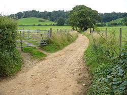
Length 37 mi (60 km) Location Surrey and West Sussex, England Trailheads St. Martha's Hill
51°13′31″N 0°31′23″W / 51.2253°N 0.5230°W
Shoreham-by-Sea
50°50′26″N 0°17′12″W / 50.8405°N 0.2868°WUse Hiking, Cycling, Horseriding The Downs Link is a 36.7-mile (58.7 km) footpath and bridleway linking the North Downs Way at St. Martha's Hill in Surrey with the South Downs Way near Steyning in West Sussex and on via the Coastal Link to Shoreham-by-Sea.
Contents
History
 Downs Link Route Map
The Downs Link follows for much of its route the course of two dismantled railways - the Cranleigh Line and the Steyning Line - both of which closed in the 1960s as a result of the Beeching Axe. Between 1965 and 1970 the track was lifted and much of the track ballast was removed. The coppiced woodland along many of the cuttings and embankment sides remained unmanaged until 2 April 1970 when ownership of much of the track was sold by the British Railways Board to Surrey County Council and Hambleton Rural District Council (which became Waverley Borough Council in 1974) for £17,500. The local authorities managed the land until 1984, clearing scrub to allow the general public to use it as a recreational facility.[1]
In 1984, the local authorities working together with other authorities and the Manpower Services Commission established the Downs Link, a 30-mile (48 km) long footpath and bridleway connecting the North and South Downs National Trails. The Link was opened on 9 July 1984 by the Mayor of Waverley, Anne Hoath, at Baynards station; it subsequently received a commendation in the National Conservation Award Scheme jointly organised by The Times newspaper and the Royal Institution of Chartered Surveyors.[2]
Present day
The Downs Link is not a National Trail within the meaning of the National Parks and Access to the Countryside Act 1949, but a trail of regional importance supported by three local authorities - Surrey County Council, West Sussex County Council and Waverley Borough Council.
The route of the Link deviates from the original railway alignment between Slinfold and Christ's Hospital for some two miles (3 km) where a section of the old line has been sold to an adjacent landowner. Attempts to establish a right of way across this section have been resisted by the owner, and the Link is re-routed along the main road.[3] Nevertheless, another missing section in the Downs Link was filled in April 2007 with the granting of a new right of way from Baystone Bridge, along the route of the old railway line, to a point near Christ's Hospital station.[4]
References
- ^ Waverley Borough Council (June 2004). "Downs Link Management Plan". Archived from the original on 2009-10-26. http://www.webcitation.org/query?url=http://www.geocities.com/link2parts/DownsLink.htm&date=2009-10-26+01:51:08. Retrieved 2008-01-03.
- ^ The Times, "'Industry should copy example of the trail-setters'; Councils capture conservation awards", 8 October 1985.
- ^ CTC Forum, 7 September 2007
- ^ Planning Inspectorate Decision, 24 April 2007.
External links
- West Sussex County Council Page
- Downs Link: A Six Stage Route Guide (2009)
- Downs Link: A Six Stage Route Guide (2003)
- Downs Link (West Sussex County Council)
- The Downs Link Route Map
- Downs Link - General Information
Coordinates: 51°02′20″N 0°22′13″W / 51.0388°N 0.3704°W
Surrey Hills Area of Outstanding Natural Beauty North Downs Botley Hill · Box Hill · Combe Bottom · Gatton Park · Hackhurst and White Downs · Headley Heath · Hog's Back · Mole Gap to Reigate Escarpment · Newlands Corner · Norbury Park · Ranmore Common · Seale Chalk Pit · Woldingham and Oxted DownsGreensand Ridge Albury Heath · Blackheath · Colyers Hanger · Devil's Jumps · Devil's Punch Bowl · Frensham Common · Gibbet Hill · Gong Hill · Hankley Common · Hankley Farm · Holmbury Hill · Leith Hill · Moor Park · Oxmoor Copse · Puttenham & Crooksbury Commons · St. Martha's Hill · Stockstone Quarry · Thursley Common · Winterfold Forest · Witley CommonLow Weald Rivers Lakes and ponds Frensham Ponds · Silent PoolLong Distance Paths Downs Link · Greensand Way · Mole Gap Trail · North Downs Way · Thames Down Link · Vanguard Way · Wey South PathNational Cycle Routes Categories:- Rail trails in England
- Long-distance footpaths in England
- Transport in Surrey
- Transport in West Sussex


Wikimedia Foundation. 2010.