- Bywater, New Orleans
Geobox Neighborhood
name = Bywater
native_name =
other_name =
other_name1 =
category = New Orleans Neighborhood
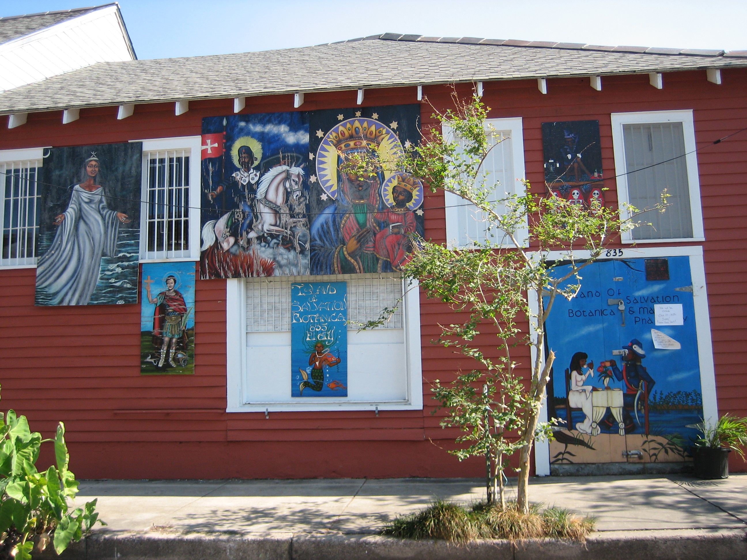
image_caption = Island of Salvation Botanica on Piety Street offersVoodoo supplies and artwork by local artist/priestessSallie Ann Glassman
flag_size =
symbol =
symbol_size =
etymology_type =
etymology =
nickname =
motto =
country = United States
state = Louisiana
region_type = City
region = New Orleans
district_type = Planning District
district = District 7, Bywater District
area_imperial = 1.33
area_land_imperial = 0.94
area_water_imperial = 0.39
area_water_percentage = auto
area_percentage_round = 2
area_round = 1
location =
lat_d = 29
lat_m = 57
lat_s = 46
lat_NS = N
long_d = 90
long_m = 02
long_s = 24
long_EW = W
elevation_imperial = 3
elevation_round = 1
population_as_of = 2000
population = 5096
population_density_imperial = auto
established_type =
established =
mayor =
timezone = CST
utc_offset = -6
timezone_DST = CDT
utc_offset_DST = -5
postal_code =
postal_code_type = ZIP Codes
area_code = 504
area_code_type =
code2_type =
code2 =
free_type =
free =
free1_type =
free1 =
map_size =
map_caption =
map_locator =
map_locator_x =
map_locator_y =
website =Bywater is a neighborhood of the city of New Orleans. A subdistrict of the Bywater District Area, its boundaries as defined by the City Planning Commission are: Florida Avenue to the north, the
Industrial Canal to the east, theMississippi River to the south and Franklin Avenue, St. Claude Avenue Avenue, Clouet, Burgundy, Lesseps, North Galvez and Mazant Streets to the west. Bywater is part of theNinth Ward of New Orleans , but it is located along the natural levee of the Mississippi River, sparing the area of significant flooding.During
Mardi Gras theSociety of Saint Anne marchingkrewe starts their procession onMardi Gras morning in Bywater and gathers marchers as it travels through theFrench Quarter and ends at Canal Street. This walking parade of local residents, artists and performers, is preceded by the Bywater Bone Boys Social Aid and Pleasure Club (founded 2005) an early rising skeleton krewe made up of writers, tattoo artists, painters, set designers, musicians, and numerous other pre-7 a.m. revelers.After
Hurricane Katrina , many survivors flocked to this area as it was less affected by the storm due to the slightly higher elevation closer to the Mississippi river. Bywater became part of what was known as "the sliver by the river" of neighborhoods that saw no flooding includingFaubourg Marigny ,the French Quarter , Irish Channel Area, and parts of the lower Garden District includingSt. Charles Avenue .Geography
Bywater is located at coor dms|29|57|46|N|90|02|24|W|city GR|1 and has an elevation of convert|3|ft|1GR|3. According to the
United States Census Bureau , the district has a total area of convert|1.33|sqmi|1. convert|0.94|sqmi|1 of which is land and convert|0.39|sqmi|1 (29.32%) of which is water.Adjacent Neighborhoods
* Desire Area (north)
* Lower Ninth Ward (east)
* Holy Cross (east)
*Mississippi River (south)
* Marigny (west)
* St. Claude (west)
* Florida Area (west)
*Florida Projects (west)Boundaries
The City Planning Commission defines the boundaries of Bywater as these streets: Florida Avenue, the Industrial Canal, the Mississippi River, Franklin Avenue, St. Claude Avenue Avenue, Clouet Street, Burgundy Street, Lesseps Street, North Galvez Street and Mazant Street. [cite web|url=http://gnocdc.org/orleans/7/19/index.html|title=Bywater Neighborhood|author=Greater New Orleans Community Data Center|accessdate=2008-06-21]
Locals more commonly designate more simple boundaries; the Mississippi River to St. Claude Avenue, and the railroad tracks along Press Street to the Industrial Canal.
Demographics
As of the
census GR|2 of 2000, there were 5,096 people, 2,263 households, and 1,030 families residing in the neighborhood. Thepopulation density was 5,421 /mi² (2,123 /km²).History
The area now known as Bywater was mostly plantation land in the Colonial era, with significant residential development beginning the first decade of the 19th century as part of what was known as "Faubourg Washington", part of the predominantly Francophone "Downtown" section of New Orleans. Many people from the French
Caribbean settled here, especially refugees from the revolution inHaiti . During the century it grew with both white and free colored Creoles, joined by immigrants fromGermany andIreland .There was little division between this area and what became known as the
Lower 9th Ward until theIndustrial Canal was dredged through the area in the early 20th century.A generation knew the area as the "Upper 9th Ward", but as other areas of the 9th Ward above the Canal further from the River became developed, a more specific name was needed. Inspired by the local
telephone exchange designation of BYwater which fit the neighborhood's proximity to the River and the Canal, the neighborhood was known as "Bywater" by the 1940s.Development and speculation surrounding the
1984 World's Fair prompted many long termFrench Quarter residents to move down river, at first into Marigny; by the late 1990s the bohemian artistic type of communities of the type found in the Quarter mid-century had spread down to Bywater, and many long neglected 19th century houses were refurbished.As the portion of Bywater on the river side of St. Claude Avenue was one of the few portions of the 9th Ward to escape flooding in the aftermath of
Hurricane Katrina , it has made steady progress toward recovery, more so than many other parts of the city.ee also
*
New Orleans neighborhoods References
External links
* [http://www.nolacemeteries.com/roch.html Famous St. Roch Cemetery in the Bywater]
* [http://bywaternola.com/ Bywater Civic Association]
* [http://www.bywaterneighbors.com/ Bywater Neighborhood Association]
* [http://www.scadnola.com] St. Claude Arts District
* [http://wikitravel.org/en/New_Orleans/Bywater Wikitravel New Orleans/Bywater]
* [http://www.marigny-bywater.org marigny-bywater.org] Marigny/Bywater Neighborhood News
* [http://www.faubourgmarigny.org Faubourg Marigny Improvement Association] Faubourg Marigny Improvement Association
Wikimedia Foundation. 2010.