- Crestwood, Kentucky
-
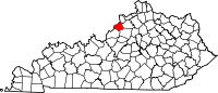
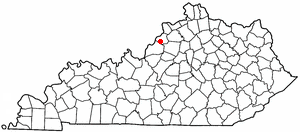
Crestwood, Kentucky — City — Location of Crestwood, Kentucky
Coordinates: 38°19′28″N 85°29′0″W / 38.32444°N 85.483333°WCoordinates: 38°19′28″N 85°29′0″W / 38.32444°N 85.483333°W Country United States State Kentucky County Oldham Area – Total 3.6 sq mi (9.3 km2) – Land 3.6 sq mi (9.3 km2) – Water 0.0 sq mi (0.0 km2) Elevation 784 ft (239 m) Population (2000) – Total 1,999 – Density 554.5/sq mi (214.1/km2) Time zone Eastern (EST) (UTC-5) – Summer (DST) EDT (UTC-4) ZIP code 40014 Area code(s) 502 FIPS code 21-18496 GNIS feature ID 0490334 Crestwood is a city in Oldham County, Kentucky, United States just outside of Louisville, Ky's Northeast End. The population was 1,999 at the 2000 census. CNN listed it as the 52nd best place to live in America in 2005.[1] It was first settled in the early 19th century and renamed Crestwood in 1909.
Contents
Geography
Crestwood is located at 38°19′28″N 85°29′0″W / 38.32444°N 85.483333°W (38.324557, -85.483300)[2].
According to the United States Census Bureau, the city has a total area of 3.6 square miles (9.3 km2), all of it land.
Demographics
Historical populations Census Pop. %± 2000 1,999 — Est. 2006 2,313 15.7% http://ukcc.uky.edu/~census/21111.txt 
As of the census[3] of 2000, there were 1,999 people, 811 households, and 548 families residing in the city. The population density was 554.5 people per square mile (214.4/km²). There were 860 housing units at an average density of 238.6 per square mile (92.2/km²). The racial makeup of the city was 94.80% White, 2.15% African American, 0.35% Native American, 0.60% Asian, 1.10% from other races, and 1.00% from two or more races. Hispanic or Latino of any race were 3.15% of the population.
There were 811 households out of which 33.9% had children under the age of 18 living with them, 51.5% were married couples living together, 12.9% had a female householder with no husband present, and 32.4% were non-families. 26.8% of all households were made up of individuals and 7.4% had someone living alone who was 65 years of age or older. The average household size was 2.45 and the average family size was 3.02.
In the city the population was spread out with 25.9% under the age of 18, 9.0% from 18 to 24, 32.6% from 25 to 44, 23.1% from 45 to 64, and 9.5% who were 65 years of age or older. The median age was 35 years. For every 100 females there were 89.8 males. For every 100 females age 18 and over, there were 87.9 males.
The median income for a household in the city was $42,619, and the median income for a family was $55,000. Males had a median income of $37,250 versus $23,984 for females. The per capita income for the city was $21,569. About 6.6% of families and 7.4% of the population were below the poverty line, including 7.6% of those under age 18 and 8.7% of those age 65 or over.
Lifestyle
Crestwood was recently ranked 52nd overall on a CNNMoney.com survey for "The Best Places to Live, 2005." This was the highest ranking given to any city in the state of Kentucky. The report also revealed that Crestwood had one of the lowest crime rates among the places studied.
References
- ^ money.cnn.com 2005
- ^ "US Gazetteer files: 2010, 2000, and 1990". United States Census Bureau. 2011-02-12. http://www.census.gov/geo/www/gazetteer/gazette.html. Retrieved 2011-04-23.
- ^ "American FactFinder". United States Census Bureau. http://factfinder.census.gov. Retrieved 2008-01-31.
External links
- "Crestwood: Rails Put Farming Community on the Track to Commercial and Residential Development" — Article by Kim Chappell of The Courier-Journal
Municipalities and communities of Oldham County, Kentucky Cities Crestwood | Goshen | La Grange | Orchard Grass Hills | Pewee Valley | Prospect | River Bluff
CDP Unincorporated
communitiesBallardsville | Brownsboro | Centerfield | Floydsburg
Categories:- Cities in Kentucky
- Populated places in Oldham County, Kentucky
- Louisville metropolitan area


Wikimedia Foundation. 2010.