- San Antonio, Oakland, California
-
Coordinates: 37°48′3.24″N 122°14′26.71″W / 37.8009°N 122.2407528°W
San Antonio — Neighborhood of Oakland — Location within Oakland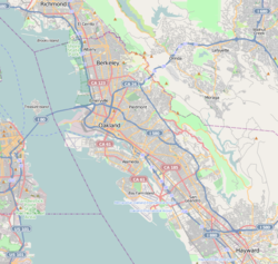
 San Antonio
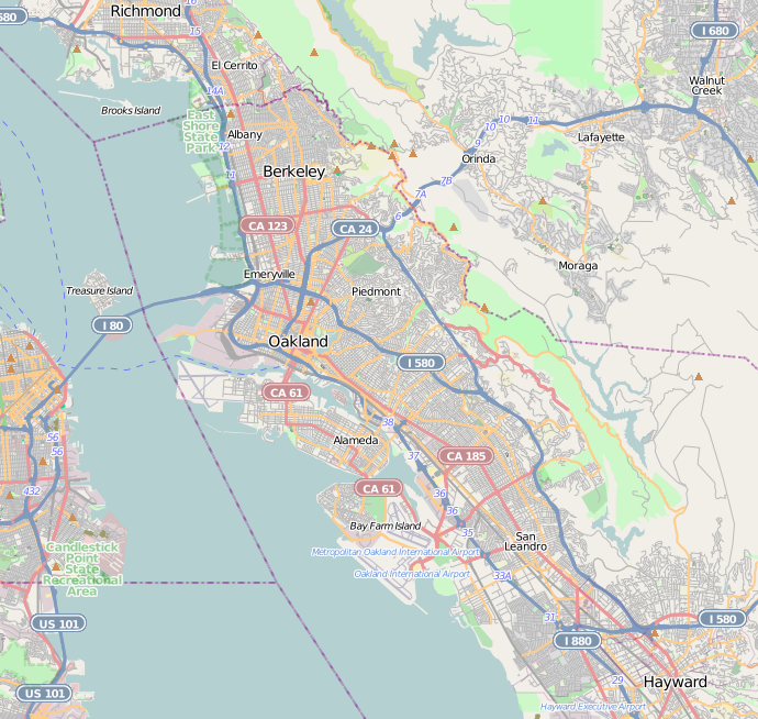
Coordinates: 37°48′03″N 122°14′27″W / 37.8009°N 122.240753°W Country United States State California County Alameda City Oakland San Antonio is a large district in Oakland, California, encompassing the land east of Lake Merritt to Sausal Creek. It is one of the most diverse areas of the city.[1] It takes its name from Rancho San Antonio, the name of the land as granted to Luís María Peralta by the last Spanish governor of California.
Contents
History
The settlement that became San Antonio began in 1851 when J.B. Larue purchase Peralta's land west of San Antonio Creek.[2] The site was west of Clinton.[2] Larue built a store and wharf and the community grew up around them.[2] The San Francisco and Oakland Railroad built a station at San Antonio.[2] When the Central Pacific Railroad took over the line in 1870, the name was changed to Brooklyn.[2] When the Southern Pacific Railroad took over the line in 1883, the name was changed to East Oakland.[2]
Clinton and San Antonio joined in 1856 to form a new town called Brooklyn named after the ship that had brought Mormon settlers to California in 1846.[2] Brooklyn joined with nearby Lynn to incorporate in 1870 under the name Brooklyn.[2] In 1872, Brooklyn voters approved their city's annexation by Oakland.[2]
Neighborhoods
The district is made up of a number of smaller neighborhoods, each with its own distinct personality, history and demographics.[3]
- Lynn
- Tuxedo
- Reservoir Hill
- Cleveland Heights
- Bella Vista
- Highland Park
- Highland Terrace
- Meadow Brook
- Ivy Hill
- Clinton
- Rancho San Antonio
- Oak Tree
- Merritt
- East Peralta/Eastlake
- Jingletown
Cleveland Heights
Cleveland Heights, also known as Haddon Hill by local realtors, is located at the northwestern corner of the San Antonio district, perched on a hill overlooking Lake Merritt. It was formerly the township of Brooklyn prior to its annexation by Oakland in 1909. The neighborhood is commonly known as the area encompassed by Lakeshore Ave on Lake Merritt, East 18th Street, Park Blvd, and Macarthur Blvd/I-580 Macarthur Freeway. The neighborhood includes Oakland High School in the east corner of the neighborhood. It is commonly known as China Hill because of the large Chinese population that lives there.
Eastlake
The Eastlake district, formerly known as East Peralta,[citation needed] comprises the area along International Blvd. between 1st and 14th Avenues. It is currently the site of an ethnic enclave, housing many immigrants of southeast asian origin.
Highland Park
Highland Park is the area immediately surrounding Highland Hospital, loosely bounded by 14th Ave. on the south, E. 31st St. to the north, and 13th Avenue to the west. It is known as Funktown to Oakland residents. The name Funktown derives from the name of a local gang Funktown USA that once occupied the area. The gang was a notorious rival of Felix Mitchell's 6-9 Mob as the two struggled for control over the East Oakland drug trade. As Funktown USA's membership dwindled in the late 80's. East Oakland residents simply referred to the Highland Park and China Hill neighborhoods as "Funktown". Funktown's boundaries are east of 7th Avenue and west of 19th Avenue, South of E.31st Street and North of International Blvd.[citation needed]
The majority of Highland Park's residents are ethnic minorities, with a relatively even split between Latinos, Asians, and African-Americans.
Jingletown
Main article: JingletownThe subsection of the neighborhood adjacent to the Oakland Estuary is called Jingletown, also called "JT" by East Oakland natives.[4]
Lynn
Lynn was an early settlement, located northeast of Brooklyn.[2] In 1870, Lynn and Brooklyn incorporated as Brooklyn[2] In 1872, voters approved the annexation by Oakland.[2] Lynn hosted a large shoe and boot factory, and was named after Lynn, Massachusetts which also had a large footwear industry.[2]
The Twomps
"The Twomps" is a local name for the neighborhood between 20th and 29th Avenues.[5][6] It is also known as "The Rolling '20s",[6] "The Roaring '20s",[7] or "Murder Dubbs",[6][8] references to its history of drug trafficking and gang violence.[6][7][9][10] The area was known as The Twomps in the 1980s, but became known as Murder Dubs in the early 1990s due to a dramatic rise in drug-related violence.[6]
The landmark avenue for the Twomps is 23rd Avenue, which also serves as the primary thoroughfare for which Twomps residents get to other main city boulevards. 23rd Avenue is heavily traveled on for its numerous stores, laundromats, and other neighborhood services.
References
- ^ Marech, Rona (May 31, 2002). "Of Race and Place". San Francisco Chronicle. http://sfgate.com/cgi-bin/article.cgi?f=/c/a/2002/05/31/EB175201.DTL. Retrieved 2007-09-17.
- ^ a b c d e f g h i j k l m Durham, David L. (1998). California's Geographic Names: A Gazetteer of Historic and Modern Names of the State. Quill Driver Books. p. 674. ISBN 9781884995149.
- ^ "Neighborhood Search Map". Oakland Museum of California. Archived from the original on 2009-04-30. http://web.archive.org/web/20090430211848/http://collections.museumca.org/search_map.jsp. Retrieved 2011-07-29.
- ^ Jingletown Arts and Business Community
- ^ "An Abridged Guide to Yay Area Slang.". East Bay Express. http://www.eastbayexpress.com/music/an_abridged_guide_to_yay_area_slang/Content?oid=287431. Retrieved 2008-01-05. "Twomps, the (n. pl.): Neighborhood in Oakland between 20th and 29th avenues"
- ^ a b c d e "Turf's up.". San Francisco Bay Guardian. http://www.sfbg.com/2006/09/12/turfs. Retrieved 2007-10-31. "First nicknamed the Rolling 20s in the ’70s, then the Twomps in the ’80s, the group of East Oakland avenues below MacArthur and between 19th and Fruitvale avenues received its present designation, the Murder Dubs, in the early ’90s, when a neighborhood hustler named P-Dub began a lethal reign of terror in an effort to control the local drug trade."
- ^ a b "Of Race and Place: San Antonio/Oakland. Flavors meld in community east of lake.". Rona Marech, Chronicle Staff Writer. May 31, 2002. http://www.sfgate.com/cgi-bin/article.cgi?f=/c/a/2002/05/31/EB175201.DTL. Retrieved 2007-11-07.
- ^ Zamorra, Jim Herron (August 22, 2006). "Athletes Mourn a Slain Friend". San Francisco Chronicle. http://sfgate.com/cgi-bin/article.cgi?f=/c/a/2006/08/22/BAGS2KMQ6Q1.DTL&hw=oakland&sn=003&sc=691. Retrieved 2007-09-17.
- ^ "Busts ramp up city's anti-drug effort.". Oakland Tribune. 2005-03-31. http://nl.newsbank.com/nl-search/we/Archives?p_product=OKTB&p_theme=oktb&p_action=search&p_maxdocs=200&p_topdoc=1&p_text_direct-0=109316D9C0922AF7&p_field_direct-0=document_id&p_perpage=10&p_sort=YMD_date:D&s_trackval=GooglePM. Retrieved 2007-10-31. "... they’ll also hit an area in East Oakland along The avenues called The Twomps, and parts of West Oakland known as Ghost Town and Ghost Nuts ..."
- ^ "Drugs suspected in slaying". Oakland Tribune. Archived from the original on 2007-11-15. http://web.archive.org/web/20071115232157/http://findarticles.com/p/articles/mi_qn4176/is_20030916/ai_n14556867. Retrieved 2007-10-31. "For one, the area where the shooting happened, which many refer to as "The Twomps," has a history of drug sales and related violence."
Oakland, California neighborhoods Downtown / Lake Merritt Adams Point · Chinatown · City Center · Civic Center · Crocker Highlands · Grand Lake · Jack London District · Jack London Square · Lakeside Apartments District · Old Oakland · Trestle Glen · Uptown · Cleveland Heights
East Oakland Dimond District · Eastmont · Elmhurst · Fruitvale · Glenview · Grass Valley · Havenscourt · Laurel · Millsmont · Maxwell Park · Peralta Hacienda · Redwood Heights · Ridgemont · San Antonio · Seminary · Sequoyah Heights · Sobrante Park
North Oakland Bushrod Park · Golden Gate · Koreatown · Longfellow · Piedmont Avenue · Rockridge · Santa Fe · Temescal
West Oakland Oakland Hills Claremont · Montclair · Piedmont Pines · Oakmore · Joaquin Miller Park · Mountain View Cemetery · Sequoyah Heights · Panoramic Hill
Categories:- Neighborhoods in Oakland, California
- Populated places established in 1851
- El Camino Viejo
Wikimedia Foundation. 2010.