- Clarks, Louisiana
-
Village Settlement Country United States State Louisiana Parish Caldwell Elevation 141 ft (43 m) Coordinates 32°01′35″N 92°08′22″W / 32.02639°N 92.13944°W Area 1.0 sq mi (2.6 km2) - land 1.0 sq mi (3 km2) - water 0.0 sq mi (0 km2), 0% Population 1,071 (2000) Density 1,112.7 / sq mi (429.6 / km2) Timezone CST (UTC-6) - summer (DST) CDT (UTC-5) Area code 318 
 Location of Clarks in Louisiana
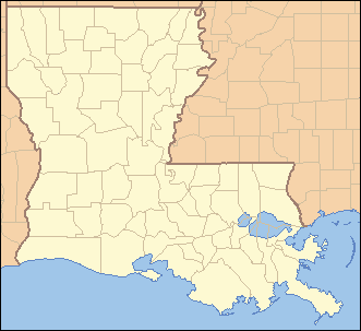
 Location of Louisiana in the United States
Clarks is a rural village in Caldwell Parish, Louisiana, United States. The population was 1,071 at the 2000 census. Clarks is the largest community in Caldwell Parish.
Eugene Eason, a member of the Louisiana House of Representatives from Webster Parisn, was born in Clarks in 1928.
Geography
Clarks is located at 32°1′35″N 92°8′22″W / 32.02639°N 92.13944°W (32.026445, -92.139516)[1].
According to the United States Census Bureau, the village has a total area of 1.0 square mile (2.6 km2), all land.
Demographics
As of the census[2] of 2000, there were 1,071 people, 246 households, and 160 families residing in the village. The population density was 1,112.7 inhabitants per square mile (430.7/km²). There were 270 housing units at an average density of 280.5 per square mile (108.6/km²). The racial makeup of the village was 48.74% White, 47.90% African American, 1.21% Native American, 0.09% Asian, 1.40% from other races, and 0.65% from two or more races. Hispanic or Latino of any race were 2.24% of the population.
There were 246 households out of which 29.3% had children under the age of 18 living with them, 47.6% were married couples living together, 12.6% had a female householder with no husband present, and 34.6% were non-families. 30.1% of all households were made up of individuals and 17.5% had someone living alone who was 65 years of age or older. The average household size was 2.39 and the average family size was 2.98.
In the village the population was spread out with 14.0% under the age of 18, 21.8% from 18 to 24, 38.1% from 25 to 44, 17.2% from 45 to 64, and 9.0% who were 65 years of age or older. The median age was 31 years. For every 100 females there were 200.8 males. For every 100 females age 18 and over, there were 225.4 males.
The median income for a household in the village was $19,583, and the median income for a family was $27,083. Males had a median income of $22,500 versus $18,438 for females. The per capita income for the village was $7,039. About 19.9% of families and 27.1% of the population were below the poverty line, including 26.9% of those under age 18 and 38.2% of those age 65 or over.
References
- ^ "US Gazetteer files: 2010, 2000, and 1990". United States Census Bureau. 2011-02-12. http://www.census.gov/geo/www/gazetteer/gazette.html. Retrieved 2011-04-23.
- ^ "American FactFinder". United States Census Bureau. http://factfinder.census.gov. Retrieved 2008-01-31.
Municipalities and communities of Caldwell Parish, Louisiana Town 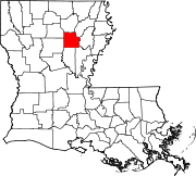
Villages Clarks | Grayson
Unincorporated
communityCategories:- Populated places in Caldwell Parish, Louisiana
- Villages in Louisiana


Wikimedia Foundation. 2010.