- Metairie, Louisiana
-
Metairie Census-designated place 
Country United States State Louisiana Parish Jefferson Elevation 3 ft (0.9 m) Coordinates 29°59′52″N 90°10′39″W / 29.99778°N 90.1775°W Area 23.3 sq mi (60.3 km2) - land 22.2 sq mi (57 km2) - water 0.1 sq mi (0 km2), 0.43% Population 138,481 (2010) Density 6,237.9 / sq mi (2,408.5 / km2) Timezone CST (UTC-6) - summer (DST) CDT (UTC-5) ZIP Codes 70001-3, 70002-6 Area code 504 
 Location of Metairie in Louisiana
 Location of Louisiana in the United States
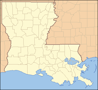
Metairie (local pronunciation /ˈmɛtəri/ (MET-uh-ree)) is a census-designated place (CDP) in Jefferson Parish, Louisiana, United States and is a major part of the New Orleans Metropolitan Area. Metairie is the largest community in Jefferson Parish. It is an unincorporated area that would be larger than most of the state's cities if it were incorporated.[1][2] The zip codes that serve the community are 70001-70006.
Métairie is the French language term for a tenant farm which paid the landlord with a share of the produce (sharecropping); this was the main activity of original French denizens of the area in the 1760s, and indeed, was true of the majority of the community's inhabitants until the 1910s.
Contents
History
Metairie was first settled by the French in the 1720s along an area known as Metairie Ridge, a natural levee formed by an ancient branch of the Mississippi River which flowed through modern day River Ridge, Metairie, Gentilly, and New Orleans East. It emptied into Mississippi Sound. The Acolapissa Native Americans used this ridge as a road, and is the oldest road in the New Orleans area. Today, this road, which was paved in the 1920s, is called Metairie Road. An electric streetcar was installed running along Metairie Road in the late 1910s, opening the area to greater development. Upscale housing tracts were constructed off the road in the 1920s; this area is now known as "Old Metairie." It is today the most prestigious area of Metairie. The areas to the north and northwest of Metairie Road were not developed until after World War II. The land between Metairie Ridge and Lake Pontchartrain, which was cypress swamps and marshlands, was drained with the Wood pump. With this new land, Metairie's population grew in the 1940s as a result of cheaper land, lower taxes, and larger lots than in Orleans Parish. In 1990, Metairie made history when one of its districts elected white supremacist David Duke to the Louisiana state legislature for a single term. Hurricane Katrina caused a new migration from Orleans Parish. This migration resulted from the need of housing. It has been a racially neutral migration, with equal numbers of black and white residents moving to Jefferson Parish. The 2010 Census showed that Metairie has increasingly become more diverse
Veterans Boulevard was laid out alongside a drainage canal, and became a commercial center of the region. The Central Business District of Metairie is located on Causeway Blvd near Lake Ponchartrain. Metairie also has one of the handful of major malls located in the New Orleans metro area. Lakeside Shopping Center is the highest grossing mall in the New Orleans metropolitan area. In the 1970s and early 1980s, an area of bars and nightclubs opened in a section of Metairie known as "Fat City." Fat City is now the most racially diverse area in the New Orleans Metropolitan Area and is home to a vibrant restaurant scene. Metairie has a large Mardi Gras season that touts itself as a more family-friendly version of the New Orleans Mardi Gras.
Fort Lauderdale Hurricane
The 1947 Fort Lauderdale Hurricane with winds of 125 mph (195 km/h) directly hit Metairie. Much of the community was under six feet of water.
Hurricane Betsy
Hurricane Betsy, a category three storm, hit the area in 1965, causing extensive wind damage and moderate flooding.
Flood of 1995
The May 8th 1995 Louisiana Flood, which dumped upwards of twenty inches of rain into Metairie in a twelve-hour period, flooded some parts of the region, especially areas south and west of Metairie, including Kenner, Harahan, and River Ridge.
Hurricane Katrina
See also: Effect of Hurricane Katrina on New Orleans The intersection of Clearview and Veterans the day after Katrina
 Evacuees at Causeway and I-10 waiting to leave two days after the storm
On August 29, 2005, Metairie was hit hard by the devastating effects of Hurricane Katrina, including widespread wind damage and flooding. There were 29 reported deaths related to Katrina in Metairie. According to satellite images and flood maps, upwards of 75% of Metairie flooded. Initial insured damages in Metairie are between 3 and 5 billion US dollars. The death toll and damage were less in Metairie than in bordering Orleans Parish, largely because the Metairie side of the 17th Street Canal did not breach and most residents had already evacuated.
Residents were given a mandatory evacuation on August 28, 2005, the first time one has ever been ordered. Residents were not allowed to return until September 4. However, residents were only allowed to quickly visit their homes or business between 7AM and 6PM. Residents were not allowed to return after that until September 15, 2005. This period of over two weeks in exile angered many residents, especially those whose homes flooded. As they were unable to empty the houses of water, they suffered more damage.
Metairie was used as a staging area to evacuate people from New Orleans. The most organized effort took place where Causeway intersects I-10. There evacuees gathered or were brought to wait for buses.
The flooding in Metairie had three causes:
- Lake Ponchartrain backflow into canals: Jefferson Parish President Aaron Broussard evacuated all pumping station operators from their posts to Washington Parish (seventy-five miles away) in anticipation of the hurricane. Normally, the machines would be on, not only preventing the Lake from flowing into the drainage canals, but also pumping the rain waters out. Lack of pumping led to severe flooding of Metairie in most areas north of Interstate 10.
- Rain waters: Because almost all of Metairie is between two and seven feet below sea level, all rain water was captured in the Metairie "bowl." Unable to return for nearly two days, the pump operators could not turn the pumps on to pump out any of the rain water or backflow.
- 17th Street Canal breach: There was no breach on the Metairie side of the canal; however, water crept into Metairie through Airline Highway. The narrow high ground of Metairie Road and some elevated railroad tracks partially contained the area of flooding. This water chiefly caused the flooding in the southern part of Old Metairie. There was a breach alongside the Lake Villa canal located in Metairie, Where water poured over the top of the levee alongside the pumping station.
Many Metairie residents are joining a class action lawsuit against Aaron Broussard because of his removal of pump operators. Other residents have attempted to recall and remove Broussard as Parish President for what they see as negligence, but they failed to get the support and signatures needed.
Broussard resigned his position on January 8, 2010 in the face of a grand jury investigation of his staff.
Sports and recreation
Metairie is home to the New Orleans Zephyrs baseball team. The minor league club formerly played its home games at Privateer Park, home to the University of New Orleans' NCAA baseball team, from 1992 through 1996. Since 1997, they have played their games at Zephyr Field and are a member of Triple-A (baseball)'s Pacific Coast League.
Jefferson Parish has created many parks in Metairie. Many of these playgrounds have organized sports leagues such as American football, baseball, and basketball. Some of them also have other programs, such as low cost piano lessons. For more information, please see the Metairie.com recreation page
- Lafreniere Park
- Delta Playground
- Pontiff Playground
- Miley Playground
- Girard Playground
- Doe Playground
- Johnny Bright Playground
- Lakeshore Playground
- Jim O'Ryan Playground
- Cleary Playground
Education
Primary and secondary schools
Metairie's public schools are operated by the Jefferson Parish Public School System.[3] There are two public high schools in Metairie:
- East Jefferson High School
- Grace King High School
- Haynes Academy for Advanced Studies(grades 6-12) [1]
- Patrick F. Taylor Science and Math Academy
Public Middle Schools Include:
- John Q. Adams Middle [2]
- Bunche Accelerated Academy for High School Preparation [3] (formerly Ralph J. Bunche Middle)
- T.H. Harris Middle School, named for the Louisiana state superintendent of education, 1908-1940 [4]
- J.D. Meisler Middle [5]
Catholic, Private, & ISAS Member elementary, middle, and preparatory schools include:
- Archbishop Chapelle High School
- Archbishop Rummel High School
- Atonement Lutheran School [6]
- Crescent City Christian School [7]
- Ecole Classique [8]
- Heritage Academy
- Kehoe-France School [9]
- Lutheran High School [10]
- Memorial Baptist Christian School [11]
- Metairie Park Country Day School
- New Orleans Jewish Day School [12]
- Our Lady of Divine Providence School [13]
- Ridgewood Preparatory School
- St. Angela Merici School [14]
- St. Ann School [15]
- St. Benilde School [16]
- St. Catherine of Siena School
- St. Christopher School [17]
- St. Clement of Rome School [18]
- St. Edward the Confessor School [19]
- St. Francis Xavier School [20]
- St. Louis King of France School [21]
- St. Martin's Episcopal School
- St. Mary Magdalen School [22]
- St. Philip Neri School [23]
- Torah Academy [24]
- Victory Christian Academy [25]
Public libraries
Jefferson Parish Library operates public libraries.[3] The East Bank Regional Library, which houses the library system's headquarters, is in Metairie.[4] Other public libraries in Metairie include the Lakeshore Library,[5] the Old Metairie Library,[6] and the Wagner Library.[7]
Religion
In Metairie, 56.87% of its citizens identify themselves with some religion. There are 41.47% Roman Catholics, 12.77% Protestants, 0.39% Latter Day Saints, 0.97% of another Christian Faith, 0.64% are Muslim, 0.61% are Jewish, 0.02% are of an Eastern faith.
Metairie is home to Congregation Gates of Prayer, a Reform synagogue, which is currently sharing its building with Congregation Beth Israel, the oldest Orthodox congregation in the New Orleans region. Beth Israel's building in Lakeview, New Orleans was destroyed by Hurricane Katrina.
Metairie's Catholic churches are also part of the Archdiocese of New Orleans. Metairie is home to 13 Catholic parishes and schools.
Geography
Metairie is located in eastern Jefferson Parish and its boundaries include New Orleans to the east, Kenner to the west, Lake Pontchartrain to the north, and Airline Highway to the south. South of Airline Highway from Metairie are River Ridge, Harahan, Elmwood, and Jefferson.
 The Metairie Central Business District along Causeway Blvd.
The 17th Street Canal forms the border between Metairie and New Orleans to the east.
Metairie is located at 29°59′52″N 90°10′39″W / 29.99778°N 90.1775°W (29.997797, -90.177473)[8] and has an elevation of 3 feet (0.9 m)[9]. According to the United States Census Bureau, the CDP has a total area of 23.3 square miles (60.2 km²), of which, 23.2 square miles (60.1 km²) of it is land and 0.1 square miles (0.1 km²) of it (0.22%) is water.
Climate
Climate data for Metairie, Louisiana Month Jan Feb Mar Apr May Jun Jul Aug Sep Oct Nov Dec Year Record high °F (°C) 82
(28)85
(29)88
(31)93
(34)96
(36)99
(37)101
(38)103
(39)101
(38)97
(36)87
(31)84
(29)103
(39)Average high °F (°C) 63
(17)66
(19)73
(23)79
(26)85
(29)90
(32)92
(33)92
(33)88
(31)81
(27)72
(22)65
(18)78.8
(26.0)Average low °F (°C) 45
(7)48
(9)55
(13)60
(16)68
(20)73
(23)75
(24)75
(24)72
(22)62
(17)54
(12)48
(9)61.3
(16.3)Record low °F (°C) 16
(−9)20
(−7)28
(−2)37
(3)51
(11)54
(12)64
(18)64
(18)50
(10)37
(3)29
(−2)12
(−11)12
(−11)Precipitation inches (mm) 5.52
(140.2)4.66
(118.4)5.28
(134.1)4.99
(126.7)5.07
(128.8)6.29
(159.8)6.97
(177)6.34
(161)6.04
(153.4)2.90
(73.7)5.02
(127.5)4.65
(118.1)63.73
(1,618.7)Source: The Weather Channel.[10] Transportation
The most common method of transportation within Metairie is the automobile. Mass transit is provided by "JeT" (Jefferson Transit), but it does not run on Sundays, holidays, or late at night, unlike many lines of New Orleans' RTA.
Interstate 10 runs east-west through Metairie.
Major east-west roads (starting from north to south) include West Esplanade Avenue, Veterans Memorial Boulevard, West Napoleon Avenue, West Metairie Avenue, Metairie Road, Airline Drive (which is part of U.S. Highway 61) and Jefferson Highway (which is part of U.S. Highway 90). The Earhart Expressway, running east-west immediately south of Airline Drive, is the only other freeway entering New Orleans from the west, but it ends as an expressway soon after crossing the parish line and well before downtown (in Central City.)
Multi-line, continuous north-south roads (starting from west to east) include Power Boulevard/David Drive/Hickory Avenue, Transcontinental Drive, Clearview Parkway, Causeway Boulevard, and Bonnabel Boulevard.
The Lake Pontchartrain Causeway's southern end lies in this city.
Demographics
Historical populations Census Pop. %± 1970 146,477 — 1980 194,160 32.6% 1990 219,428 13.0% 2000 146,136 −33.4% 2010 138,481 −5.2% As of the 2010 census[11], there were 138,481 people living in Metairie.[2] The racial makeup of Metairie is:
- 75.10% White
- 12.59% Hispanic or Latino of any race
- 10.37% African American
- 3.25% Asian
- 3.97% from other races
- 2.01% from two or more races.
- 0.3% Native American
- 0.04% Pacific Islander
Other statistics
As of the 2000 Census, there were 39,073 families residing in Metairie. The population density was 6,296.7 people per square mile (2,431.0/km²). There were 67,225 housing units, at an average density of 2,896.6 per square mile (1,118.3/km²). There were 63,741 households out of which 25.3% had children under the age of 18 living with them, 46.1% were married couples living together, 11.4% had a female householder with no husband present, and 38.7% were non-families. 32.9% of all households were made up of individuals and 11.3% had someone living alone who was 65 years of age or older. The average household size was 2.28 and the average family size was 2.93. In Metairie the population is spread out with 20.6% under the age of 18, 8.4% from 18 to 24, 29.6% from 25 to 44, 24.9% from 45 to 64, and 16.4% who were 65 years of age or older. The median age was 40 years. For every 100 females there were 91.4 males. For every 100 females age 18 and over, there were 88.1 males. The median income for a household in Metairie is $41,265, and the median income for a family was $52,555. Males had a median income of $37,371 versus $27,057 for females. The per capita income for Metairie is $24,771. About 6.2% of families and 8.9% of the population were below the poverty line, including 11.2% of those under age 18 and 7.2% of those age 65 or over.
Notable people
- Phil Anselmo — former Pantera singer, currently with the band Down
- Conrad Appel - state senator
- Brendan Benson — musician, member of The Raconteurs
- Al Copeland — founder of Popeye's Chicken franchises and Copeland's
- Roger Dawson — jazz musician, composer, radio personality
- Ellen DeGeneres — comedian, talk show host
- David Duke — politician
- Pete Fountain — clarinetist
- Danny Granger — professional basketball player, forward for the Indiana Pacers
- Salman Khan (educator) - founder of Khan Academy - a website highly regarded for its educational videos
- Charles D. Lancaster, Jr. - attorney and former state representative
- Tony Ligi - state representative
- Blanche Long — First Lady of Louisiana (1939–1940, 1948–1952, and 1956–1960)
- Joseph Lopinto - state representative
- Paul Mares — jazz musician
- Stanton Moore — jazz musician
- Wardell Quezergue - R&B producer, arranger and band leader
- Edwin Rodriguez — Florida Marlins manager, Former New Orleans Zephyrs manager, former New York Yankees second basemen
- Louis J. Roussel, Jr. - businessman and political donor
- Candice Stewart — first African-American woman to represent Louisiana in the Miss USA pageant
- Michael Stutes — relief pitcher for the Philadelphia Phillies
- David C. Treen — former governor practiced law in Metairie prior to 1973
- John S. Treen — retired homebuilder and politician
- Tom Willmott - state representative
- Reese Witherspoon — actress
See also
References
- ^ "Metairie, Louisiana (LA) Detailed Profile" (notes), City Data, 2007, webpage: C-Metr.
- ^ a b "Census 2000 Data for the State of Louisiana" (town list), US Census Bureau, May 2003, webpage: C2000-LA.
- ^ a b "Metairie CDP, Louisiana." U.S. Census Bureau. Retrieved on September 29, 2010.
- ^ "East Bank Regional and library headquarters." Jefferson Parish Library. Retrieved on September 28, 2010.
- ^ "Lakeshore Library." Jefferson Parish Library. Retrieved on September 28, 2010.
- ^ "Old Metairie Library." Jefferson Parish Library. Retrieved on September 28, 2010.
- ^ "Wagner Library." Jefferson Parish Library. Retrieved on September 28, 2010.
- ^ "US Gazetteer files: 2010, 2000, and 1990". United States Census Bureau. 2011-02-12. http://www.census.gov/geo/www/gazetteer/gazette.html. Retrieved 2011-04-23.
- ^ "US Board on Geographic Names". United States Geological Survey. 2007-10-25. http://geonames.usgs.gov. Retrieved 2008-01-31.
- ^ "MONTHLY AVERAGES for Metairie, LA". The Weather Channel. http://www.weather.com/weather/wxclimatology/monthly/USLA0314. Retrieved September 5, 2008.
- ^ "American FactFinder". United States Census Bureau. http://factfinder.census.gov. Retrieved 2008-01-31.
External links
- Metairie's Community's Website
- Jefferson Parish Convention and Visitors Bureau - Tourism
- Lafreniere Park Photo Gallery
Municipalities and communities of Jefferson Parish, Louisiana Parish seat: Gretna Cities 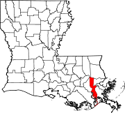
Towns CDPs Avondale | Barataria | Bridge City | Elmwood | Estelle | Harvey | Jefferson | Lafitte | Marrero | Metairie | River Ridge | Terrytown | Timberlane | Waggaman | Woodmere
Categories:- Places affected by Hurricane Katrina
- Census-designated places in Louisiana
- Populated places in Jefferson Parish, Louisiana
- Greater New Orleans


Wikimedia Foundation. 2010.