- Scarriff
Infobox Irish Place
name = Scariff
gaeilge = An Scairbh
crest
motto =
map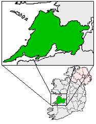
pin coords = left: 148px; top: 56px
north coord = 52.91
west coord = 8.53
irish grid = R639845
area =
elevation =
province =Munster
county =County Clare
town pop = 798
rural pop =
census yr = 2006
web = www.scariff.com
|Scarriff
Central Statistics Office , Census 2002, [http://www.cso.ie/census/documents/vol1_t5.pdf Population of Towns ordered by County and size, 1996 and 2002] .] or Scariff Irish place name|An Scairbh|The Rocky ford) is atown Central Statistics Office , Census 2002, [http://www.cso.ie/census/documents/vol1_t5.pdf Population of Towns ordered by County and size, 1996 and 2002] .] in eastCounty Clare , Ireland, situated in the midwest ofIreland . The town is on the West end of Lough Derg and is best known for its harbour. The Scarriff Market House is easily recognisable, and it is therefore often used to represent the town. [http://www.scariff.com/ Official Scariff Website] (top-left), Scariff News, [http://www.scariff.com/SNOCT07.pdf October 2007] (top-right, example - [http://www.scariff.com/scariffnews.html see the archive for more examples] ).]History
Little is known of the Scariff area in pre-christian times. However, the presence of the remains of a wedge tomb at Cappabane tells us that the area has been inhabited for at least 4000 years.
The name Scariff is derived from the Gaelic "Scairbh" which means a rocky ford or crossing place. Long before the present town came into being the area was of great strategic importance to those who held the territory about and to those who sought to hold it - the presence of the great river Shannon on the one hand and the mountainous terrain on the other rendered this Scairbh a most important crossing point on a journey north or south.
The name Scariff is first mentioned in 1315 in connection with a battle fought there during the civil wars of the period. The chipboard factory now occupies the site of the conflict. By the end of the fourteenth century, the Scariff area was under the control of the O'Grady clan. To maintain their dominance three castles or fortified houses were built, one at Tuamgraney (which still stands), one near the bridge at the Scairbh which no longer exists and a third, smaller building, at Moynoe. The earliest account of Scariff castle is from 1564.
Scariff as a town developed around the castle and its growth was helped by the presence of a smelting furnace which operated there. It is shown on a map of the Down survey in 1655. The town grew gradually in the following centuries, its fortunes generally in line with those of the country as a whole. In penal times Mass was celebrated at the Mass Rock at Cappabane. Scariff suffered greatly during the Famine in the nineteenth century - a workhouse was built in 1841 at Drewsboro to provide some relief for the poor.
The last century however saw the town begin to prosper. New roads were built. It had a bank, a Police station, flour mills and a Market House reflecting its growing importance as a market town. As well as improved road connections, the Dock provided vital trade links and Scariff enjoyed its position as the business centre of north-east Clare. Two of the more prominent buildings - the workhouse and the Police station - were destroyed in the War of Independence. A large
chipboard factory can now be found in ScarriffScariff News, [http://www.scariff.com/SNAPR07.pdf April 2007] .] , but the town no longer has a bakery and the dock no longer operates as in former times. It’s role now as a stopping point for pleasure crafts is perhaps indicative of the possibilities which exist for Scariff as a tourist centre.Festivals
There are a number of festivals and shows in Scarriff every year, including the Scariff Show (started in
1944 ), the Scariff Harbour Festival (started in2003 ) and the Clare Drama Festival (started in1947 ). [http://www.scariffshow.com/ Scariff Agricultural Show Website] ] [http://www.scariff.com/SHF2007a.html Scariff Harbour Festival, Background and rationale] ] [http://www.adci.ie/clare.htm The Amateur Drama Council of Ireland - Clare Drama Festival] .]Nearby Places
*
Tuamgraney References
External links
* [http://www.scariff.com/ Official Scariff Website]
* [http://www.scariffparish.com/ Scariff Parish Website]
* [http://www.esatclear.ie/~hurlingclub/ Scariff GAA Website]
* [http://www.scariffshow.com/ Scariff Agricultural Show Website]ee also
*
List of towns in the Republic of Ireland
*Market Houses in the Republic of Ireland
*Scariff GAA
Wikimedia Foundation. 2010.