- Edgecomb, Maine
-
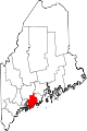
Edgecomb, Maine — Town — Location within the state of Maine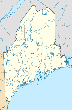
 Edgecomb, Maine
Coordinates: 43°58′25″N 69°38′7″W / 43.97361°N 69.63528°W Country United States State Maine County Lincoln Area – Total 20.8 sq mi (53.8 km2) – Land 18.1 sq mi (46.8 km2) – Water 2.7 sq mi (7.0 km2) Elevation 82 ft (25 m) Population (2000) – Total 1,090 – Density 60.3/sq mi (23.3/km2) Time zone Eastern (EST) (UTC-5) – Summer (DST) EDT (UTC-4) ZIP code 04556 Area code(s) 207 FIPS code 23-22675 GNIS feature ID 0582462 Website http://www.edgecomb.org/ Edgecomb is a town in Lincoln County, Maine, United States. The population was 1,090 at the 2000 census. The town was named for Lord Edgecomb, a supporter of the colonists.[1] Fort Edgecomb is a Maine State Historic Site.
Contents
Geography
According to the United States Census Bureau, the town has a total area of 20.8 square miles (54 km2), of which, 18.1 square miles (47 km2) of it is land and 2.7 square miles (7.0 km2) of it is water.
Demographics
As of the census[2] of 2000, there were 1,090 people, 466 households, and 328 families residing in the town. The population density was 60.3 people per square mile (23.3/km²). There were 572 housing units at an average density of 31.6 per square mile (12.2/km²). The racial makeup of the town was 98.72% White, 0.28% Native American, 0.18% Asian, and 0.83% from two or more races. Hispanic or Latino of any race were 0.09% of the population.
There were 466 households out of which 29.8% had children under the age of 18 living with them, 60.1% were married couples living together, 6.7% had a female householder with no husband present, and 29.6% were non-families. 25.5% of all households were made up of individuals and 12.7% had someone living alone who was 65 years of age or older. The average household size was 2.34 and the average family size was 2.78.
In the town the population was spread out with 23.0% under the age of 18, 3.7% from 18 to 24, 25.4% from 25 to 44, 31.5% from 45 to 64, and 16.4% who were 65 years of age or older. The median age was 44 years. For every 100 females there were 93.6 males. For every 100 females age 18 and over, there were 93.3 males.
The median income for a household in the town was $43,833, and the median income for a family was $49,861. Males had a median income of $32,321 versus $24,474 for females. The per capita income for the town was $23,788. About 2.8% of families and 4.3% of the population were below the poverty line, including 2.0% of those under age 18 and 4.5% of those age 65 or over.
Notable people
- Earl Cunningham, folk art painter.
References
- ^ "Profile for Edgecomb, Maine". ePodunk. http://www.epodunk.com/cgi-bin/genInfo.php?locIndex=2112. Retrieved 2010-05-03.
- ^ "American FactFinder". United States Census Bureau. http://factfinder.census.gov. Retrieved 2008-01-31.
External links
Municipalities and communities of Lincoln County, Maine Towns Alna | Boothbay Harbor | Boothbay | Bremen | Bristol | Damariscotta | Dresden | Edgecomb | Jefferson | Newcastle | Nobleboro | Somerville | South Bristol | Southport | Waldoboro | Westport Island | Whitefield | Wiscasset
Plantation Gore CDPs Other
villagesCoordinates: 43°57′30″N 69°37′50″W / 43.95833°N 69.63056°W
Categories:- Towns in Lincoln County, Maine


Wikimedia Foundation. 2010.