- Muchelney
-
Coordinates: 51°01′16″N 2°48′55″W / 51.021075°N 2.815183°W
Muchelney 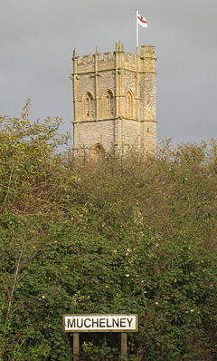
The tower of St Peter and St Paul church rises above Muchelney
 Muchelney
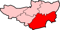
Muchelney shown within SomersetPopulation 210 [1] OS grid reference ST429249 District South Somerset Shire county Somerset Region South West Country England Sovereign state United Kingdom Dialling code 01458 Police Avon and Somerset Fire Devon and Somerset Ambulance South Western EU Parliament South West England UK Parliament Somerton and Frome List of places: UK • England • Somerset Muchelney is a village and civil parish in Somerset, England, on the River Parrett, 1.5 miles (2.4 km) south of Huish Episcopi and 5.5 miles (8.9 km) miles south west of Somerton in the South Somerset district. The village has a population of about 210.[1]
Adjacent to Muchelney are the hamlets of Thorney and Muchelney Ham.
Contents
History
The village was recorded as Micelenie in the Domesday book meaning 'the increasingly great island' from the Old English miclian and from the Norsk Øe.[2] The -ey or -y suffix served as the old English designation for "island", and thus is common to many of the villages in this area of the Somerset Levels, which stood as islands just above the marshes, which have since been drained.
The parish of Muchelney was part of the Pitney Hundred.[3]
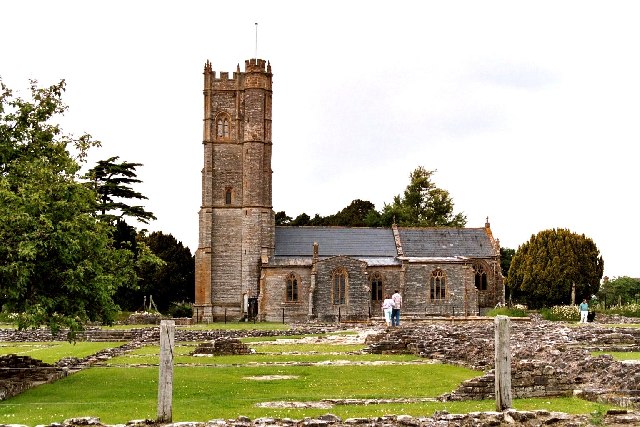
The village is best known as the site of Muchelney Abbey, a Benedictine abbey founded by King Athelstan in 939, and largely demolished in the Dissolution of the Monasteries. Architectural details of houses in the surrounding area are thought to incorporate fragments scavenged when the Abbey was destroyed.[4]
The remains of Muchelney Abbey, including Tudor monks' quarters, and exhibits, are managed by English Heritage. Other tourist attractions in Muchelney include the parish church of St Peter and St Paul; the Priest's House (built in 1308 and now managed by the National Trust), and the pottery of artist John Leach.
Governance
The parish council has responsibility for local issues, including setting an annual precept (local rate) to cover the council’s operating costs and producing annual accounts for public scrutiny. The parish council evaluates local planning applications and works with the local police, district council officers, and neighbourhood watch groups on matters of crime, security, and traffic. The parish council's role also includes initiating projects for the maintenance and repair of parish facilities, as well as consulting with the district council on the maintenance, repair, and improvement of highways, drainage, footpaths, public transport, and street cleaning. Conservation matters (including trees and listed buildings) and environmental issues are also the responsibility of the council.
The village falls within the non-metropolitan district of South Somerset, which was formed on April 1, 1974 under the Local Government Act 1972, having previously been part of Langport Rural District.[5] The district council is responsible for local planning and building control, local roads, council housing, environmental health, markets and fairs, refuse collection and recycling, cemeteries and crematoria, leisure services, parks, and tourism.
Somerset County Council is responsible for running the largest and most expensive local services such as education, social services, libraries, main roads, public transport, policing and fire services, trading standards, waste disposal and strategic planning.
It is also part of the Somerton and Frome county constituency represented in the House of Commons of the Parliament of the United Kingdom. It elects one Member of Parliament (MP) by the first past the post system of election, and part of the South West England constituency of the European Parliament which elects seven MEPs using the d'Hondt method of party-list proportional representation.
Geography
To the east is Wet Moor, a biological Site of Special Scientific Interest, which forms part of the extensive grazing marsh grasslands and ditch systems of the Somerset Levels and Moors.[6]
Religious sites
St Peter and St Paul Parish Church, adjacent to Muchelney Abbey, has a ceiling enlivened with Jacobean paintings of bare-breasted angels, their nudity thought to symbolize innocent purity. It has a three-stage Somerset tower supported by pairs of full-height corner buttresses. The south-east octagonal stair turret leads to an outer door.[7]
Culture
A highlight of the summer in Muchelney and adjacent Thorney is the Lowland Games, a light-hearted adaptation of the Highland games. Events over the years have included (hay) bale racing, raft racing, ferret racing, wellie tossing, a dog show, equestrian exhibitions, mud wrestling, and a battle of the bands (with the winning act getting a gig at the Glastonbury Festival).
-

Ruins of Muchelney Abbey
-

Muchelney parish church of St Peter and St Paul
-

Unusual bare-breasted Jacobean angels on the ceiling of Muchelney parish church
References
- ^ a b "South Somerset population estimates for 2002". Somerset County Council. http://www.webcitation.org/5lRyCVNCk. Retrieved 27 December 2009.
- ^ Robinson, Stephen (1992). Somerset Place Names. Wimborne, Dorset: Dovecote Press. ISBN 1874336032.
- ^ "Somerset Hundreds". GENUKI. http://www.genuki.org.uk/big/eng/SOM/Miscellaneous/. Retrieved 18 October 2011.
- ^ The Buildings of England, South and West Somerset, by Nikolaus Pevsner. Penguin Books 1958; Reprinted by Yale Univ Press, 2003, page 251.
- ^ A Vision of Britain Through Time : Langport Rural District
- ^ "Wet Moor" (PDF). English Nature. http://www.english-nature.org.uk/citation/citation_photo/1004500.pdf. Retrieved 2006-09-09.
- ^ "Church of SS Peter and Paul, Muchelney". Images of England. http://www.imagesofengland.org.uk/Details/Default.aspx?id=263267. Retrieved 2007-09-25.
External links
Categories:- Villages in South Somerset
- Somerset Levels
- Civil parishes in Somerset
-


Wikimedia Foundation. 2010.