- Newfield, Maine
-
Newfield, Maine — Town — Town Hall and Schoolhouse c. 1915 Location within the state of Maine
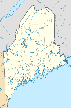
 Newfield, Maine
Coordinates: 43°38′33″N 70°54′44″W / 43.6425°N 70.91222°W Country United States State Maine County York Incorporated 1794 Area - Total 33.5 sq mi (86.7 km2) - Land 32.3 sq mi (83.7 km2) - Water 1.2 sq mi (3.0 km2) Elevation 446 ft (136 m) Population (2000) - Total 1,328 - Density 41.1/sq mi (15.9/km2) Time zone Eastern (EST) (UTC-5) - Summer (DST) EDT (UTC-4) ZIP code 04056 Area code(s) 207 FIPS code 23-48750 GNIS feature ID 0582618 Website http://www.maine.gov/local/york/newfield Newfield is a town in York County, Maine, United States. The population was 1,328 at the 2000 census. Home to Willowbrook Museum Village, Newfield is part of the Portland–South Portland–Biddeford metropolitan statistical area.
Contents
History
This was part of the large tract sold on November 28, 1668 by Newichawannock Indian Chief Sunday (or Wesumbe) to Francis Small, a Kittery trader. The price was two large Indian blankets, two gallons of rum, two pounds of gunpowder, four pounds of musket balls and twenty strings of beads.[1] The township was surveyed and first settled as Washington Plantation in 1778. A number of settlers had been soldiers in the Revolutionary War. It was incorporated as Newfield on February 25, 1794, and by 1859, the population was 1,418.[1]
The Little Ossipee River runs through Newfield village and once provided water power to operate two gristmills, two lumber mills, a barrel stave mill, a shook mill, a planing mill and a carding mill. West Newfield had a sawmill, gristmill and stave mill. There was an attempt in the community to mine silver and iron, but it was not profitable. By 1880, the population was 995.[2] Newfield would be heavily damaged by the Great Fires of 1947.
Don King of Topsfield, Massachusetts bought an old farm at Newfield in 1965, marking the beginning of what would become Willowbrook Museum Village, a re-created 19th-century village. Other properties and historic buildings were added, together with a collection of early farm implements, tools, carriages and sleighs. The museum is now a tourist attraction.[3]
On March 17, 2009, Newfield adopted a local law to stop Nestlé and other corporations from taking over their groundwater. The volunteer community organization, Protecting Our Water and Wildlife Resources (POWWR), with the assistance of Community Environmental Legal Defense Fund (CELDF) who drafted the ordinance, were responsible for advocating the legislation.[4]
Geography
According to the United States Census Bureau, the town has a total area of 33.5 square miles (87 km2), of which, 32.3 square miles (84 km2) of it is land and 1.1 square miles (2.8 km2) of it is water. The total area is 3.44% water. Newfield is drained by the Little Ossipee River.
The town is crossed by state routes 11 and 110. Newfield borders the towns of Parsonsfield to its north, Limerick and Waterboro to its east, Wakefield, New Hampshire to its west, and Acton and Shapleigh to its south.
Demographics
 Town center in 1915
As of the census[5] of 2000, there were 1,328 people, 496 households, and 370 families residing in the town. The population density was 41.1 people per square mile (15.9/km²). There were 939 housing units at an average density of 29.1 per square mile (11.2/km²). The racial makeup of the town was 97.89% White, 0.08% African American, 0.90% Native American, 0.08% Asian, 0.15% from other races, and 0.90% from two or more races. Hispanic or Latino of any race were 0.68% of the population.
There were 496 households out of which 35.5% had children under the age of 18 living with them, 63.7% were married couples living together, 6.9% had a female householder with no husband present, and 25.4% were non-families. 19.2% of all households were made up of individuals and 6.9% had someone living alone who was 65 years of age or older. The average household size was 2.67 and the average family size was 3.02.
 Little Ossipee River c. 1915
In the town the population was spread out with 26.4% under the age of 18, 6.3% from 18 to 24, 29.0% from 25 to 44, 27.1% from 45 to 64, and 11.3% who were 65 years of age or older. The median age was 39 years. For every 100 females there were 106.5 males. For every 100 females age 18 and over, there were 105.5 males.
The median income for a household in the town was $38,654, and the median income for a family was $41,563. Males had a median income of $30,403 versus $24,688 for females. The per capita income for the town was $16,280. About 8.0% of families and 10.4% of the population were below the poverty line, including 10.0% of those under age 18 and 11.8% of those age 65 or over.
Education
The children of Newfield that are in grades K-5 attend Line Elementary School which is a part of Regional School Unit 57, on the Newfield-Limerick border shared with Limerick. Students in grades 6-8 attend Massabesic Middle School and students in grades 9-12 attend Massabesic High School in Waterboro.
Sites of interest
Notable residents
- Nathan Clifford, statesman, diplomat and jurist
- Horace Parnell Tuttle, astronomer
References
- ^ a b Coolidge, Austin J.; John B. Mansfield (1859). A History and Description of New England. Boston, Massachusetts. p. 225. http://books.google.com/books?id=OcoMAAAAYAAJ&lpg=PA9&dq=coolidge%20mansfield%20history%20description%20new%20england%201859&pg=PA225#v=onepage&q=&f=false.
- ^ Varney, George J. (1886), Gazetteer of the state of Maine. Newfield, Boston: Russell, http://history.rays-place.com/me/newfield-me.htm
- ^ Willowbrook History
- ^ Community Environmental Legal Defense Fund
- ^ "American FactFinder". United States Census Bureau. http://factfinder.census.gov. Retrieved 2008-01-31.
External links
- Newfield Village Library/Reading Room
- Willowbrook Village Museum
- Francis Small Heritage Trust
- Epodunk town profile
- Maine Genealogy: Newfield, York County, Maine
Municipalities and communities of York County, Maine Cities 
Towns CDPs Berwick | Cape Neddick | Kennebunk | Kennebunkport | Kittery | Kittery Point | Lake Arrowhead | North Berwick | Sanford | South Eliot | South Sanford | Springvale | West Kennebunk | York Harbor
Other
villagesCoordinates: 43°38′53″N 70°50′49″W / 43.64806°N 70.84694°W
Categories:- Populated places established in 1794
- Portland – South Portland – Biddeford metropolitan area
- Towns in York County, Maine


Wikimedia Foundation. 2010.