- Wells, Maine
-
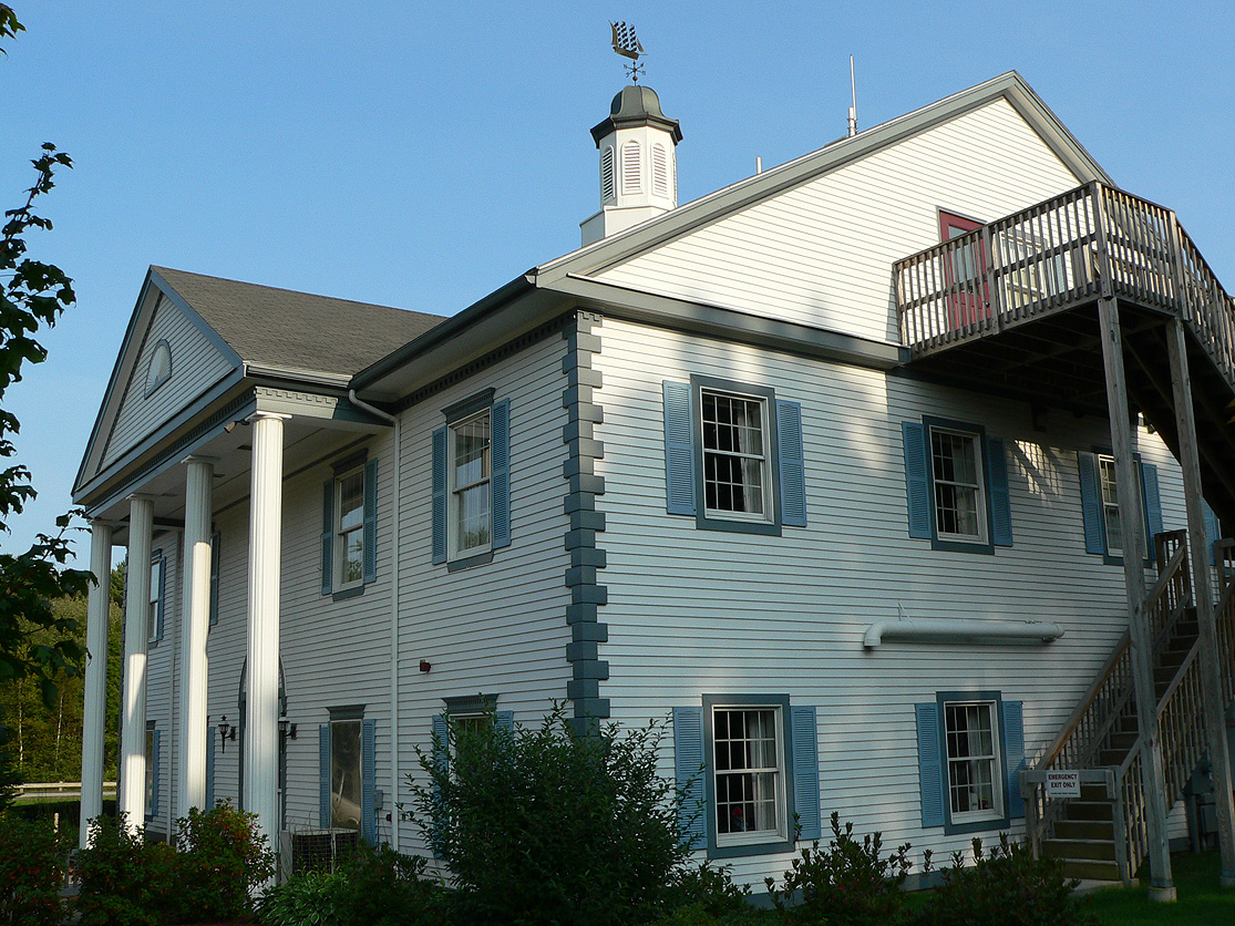
Wells, Maine — Town — Town Hall

Flag
SealMotto: The Friendliest Town In Maine Location within the state of Maine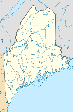
 Wells, Maine
Coordinates: 43°19′13″N 70°36′42″W / 43.32028°N 70.61167°WCoordinates: 43°19′13″N 70°36′42″W / 43.32028°N 70.61167°W Country United States State Maine County York Founded 1643 Incorporated 1653 Government – Type Town Meeting, Board of Selectmen, Town Manager – Town Manager Jane Duncan Area – Total 58.2 sq mi (150.6 km2) – Land 57.6 sq mi (149.3 km2) – Water 0.5 sq mi (1.3 km2) Elevation 177 ft (54 m) Population (2000) – Total 9,400 – Density 163.1/sq mi (63.0/km2) Time zone Eastern (EST) (UTC-5) – Summer (DST) EDT (UTC-4) ZIP code(s) 04054 (Moody), 04090 (Wells) Area code(s) 207 FIPS code 23-81475 GNIS feature ID 0582799 Website www.wellstown.org Wells is a town in York County, Maine, United States. Founded in 1643, it is one of the oldest towns in Maine. The population was 9,400 at the 2000 census. Wells Beach is a popular summer destination.
Contents
History
The Abenaki Indians called the area Webhannet, meaning "at the clear stream," a reference to the Webhannet River. In 1622, the Plymouth Company in England awarded to Sir Ferdinando Gorges, Lord Proprietor of Maine, territory which included the Plantation of Wells. His young cousin, Thomas Gorges, acting as deputy and agent, in 1641 granted to Rev. John Wheelwright and other settlers from Exeter, New Hampshire the right to populate the land from northeast of the Ogunquit River to southwest of the Kennebunk River. Following the death of the elder Gorges in 1647, the Massachusetts Bay Colony laid claim to Maine. In 1653, Wells was incorporated, the third town in Maine to do so, and named after Wells, England, a small cathedral city in the county of Somerset. It then included Kennebunk, set off the year Maine became a state in 1820, and Ogunquit, designated a village within Wells by the legislature in 1913, then set off in 1980.[1]
Wells was the resilient northeastern frontier of English settlement. Except for a few forts and garrisons, early attempts to colonize Maine above Wells were abandoned because of attacks by Native Americans allied with New France, which resented encroachment by New England in territory it considered its own, Acadia. Wells endured three major attacks, most famously the Raid on Wells in 1692. The region became less dangerous, however, after the Battle of Louisburg in 1745.[1]
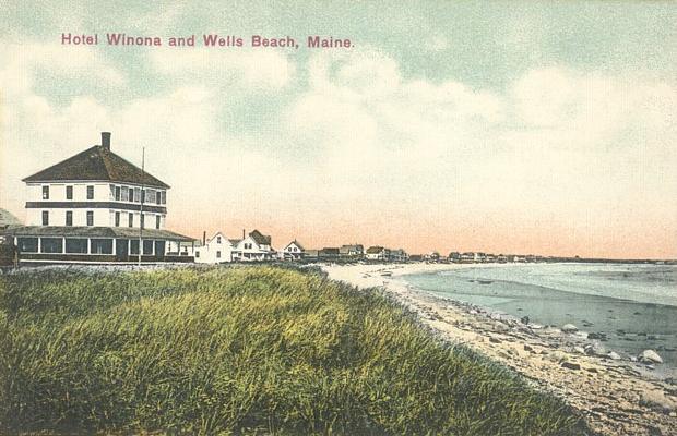
The town developed as a farming community, producing hay and vegetables. Other industries included shipbuilding and fisheries. In the 19th century, with the arrival of the railroad, the town's beautiful beaches attracted tourists. Many inns and hotels were built along the seashore. Today, tourism remains important to the economy.[2]
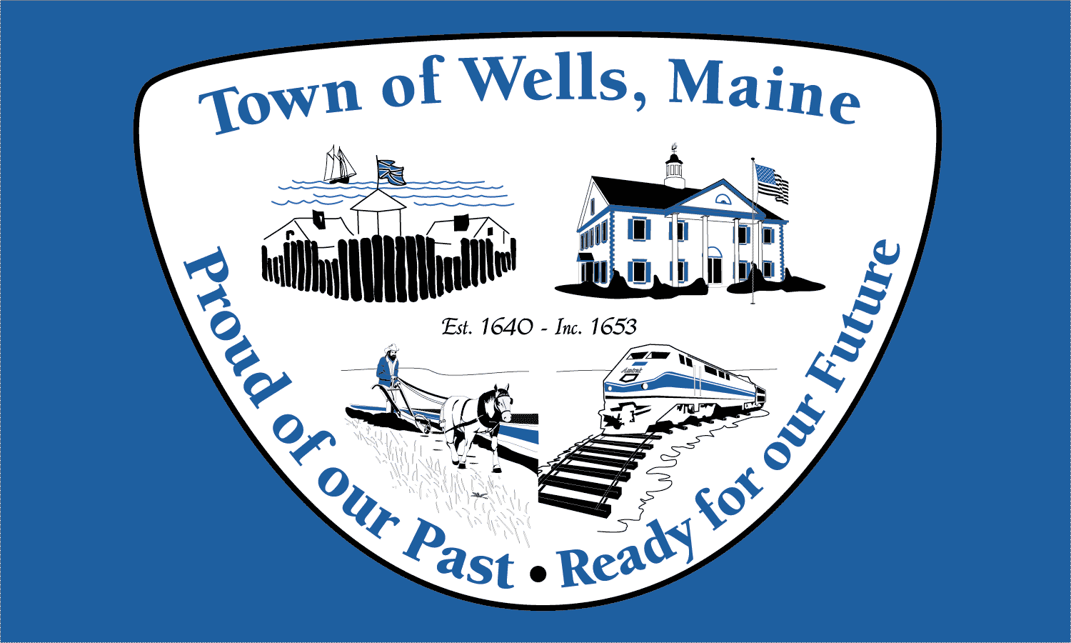
Wells celebrated its 350th anniversary in 2003.[3] The year-long celebration included a New Year's Eve party with fireworks, parade, a visit by the traveling Russian circus, concerts, historical reenactments, and more. The town commissioned a member of the celebration committee, Kristi Borst, to design a town flag. Her design portrays historic aspects of the Town's settlement and agriculture as well as the 2003 Town Hall and focus on tourism represented by a train. Also included is the motto she penned for the project: "Proud of our Past, Ready for our Future." [4]
Geography
Wells is on the southern coast of Maine, surrounded by Kennebunk to the northeast; Sanford to the northwest; North Berwick to the west; South Berwick to the southwest; and Ogunquit to the south.
Wells is part of the Portland-South Portland-Biddeford Metropolitan Statistical Area.
There are several ways to get into and out of Wells, including:
- Maine State Route 9
- Maine State Route 9A
- Maine State Route 109
- U.S. Route 1
- Interstate 95 (Maine Turnpike Exit 19)
- Amtrak passenger rail service via the Downeaster train, which operates over Pan Am Railways (formerly the Boston & Maine Railroad)
See also: Wells Regional Transportation CenterAccording to the United States Census Bureau, the town encompasses 58.2 square miles (151 km2), of which 57.6 square miles (149 km2) is land and 0.5 square miles (1.3 km2) (0.88%) is water. Wells is drained by the Webhannet River.
Demographics
As of the 2000 United States Census,[5] there were 9,400 people, 4,004 households, and 2,690 families residing in the town. The population density was 163.1 people per square mile (63.0/km²). There were 7,794 housing units at an average density of 135.2 per square mile (52.2/km²). The racial makeup of the town was 98.18% White, 0.23% African American, 0.20% Native American, 0.48% Asian, 0.01% Pacific Islander, 0.14% from other races, and 0.76% from two or more races. Hispanic or Latino of any race were 0.64% of the population.
There were 4,004 households out of which 25.6% had children under the age of 18 living with them, 57.7% were married couples living together, 6.7% had a female householder with no husband present, and 32.8% were non-families. 26.3% of all households were made up of individuals and 11.0% had someone living alone who was 65 years of age or older. The average household size was 2.35 and the average family size was 2.85.
In the town the population was spread out with 21.0% under the age of 18, 5.6% from 18 to 24, 26.4% from 25 to 44, 30.2% from 45 to 64, and 16.9% who were 65 years of age or older. The median age was 43 years. For every 100 females there were 94.8 males. For every 100 females age 18 and over, there were 92.0 males.
The median income for a household in the town was $46,314, and the median income for a family was $53,644. Males had a median income of $39,682 versus $28,463 for females. The per capita income for the town was $23,130. About 3.1% of families and 5.4% of the population were below the poverty line, including 3.8% of those under age 18 and 5.6% of those age 65 or over.
Education
Main article: Wells-Ogunquit Community School DistrictSee also: York County Community CollegePoints of interest
 Wells Beach in 1908
- Historical Society of Wells & Ogunquit - Meetinghouse Museum & Library - located on the premises of what was originally the First Congregational Church of Wells
- Rachel Carson National Wildlife Refuge
- Division 9 Schoolhouse Museum
- Wells Auto Museum
- Wells Harbor Community Park
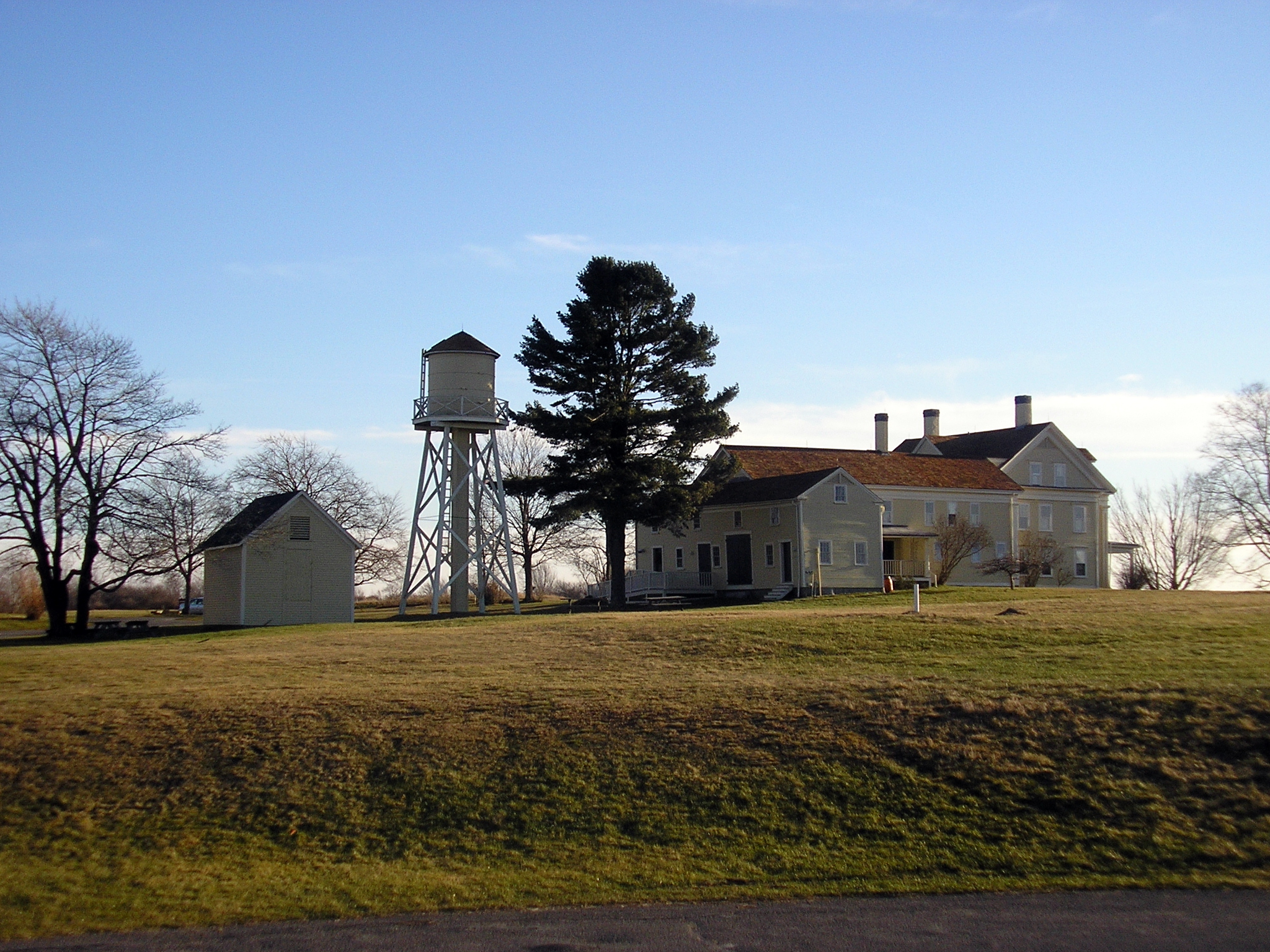
- Wells National Estuarine Research Reserve and Historic Laudholm Farm
- Wells Public Library
- Miles of public beaches with public parking areas: Drakes Island Beach, East Shore Beach, and Wells Beach, as well as the privately-held Moody Beach.
Images
-

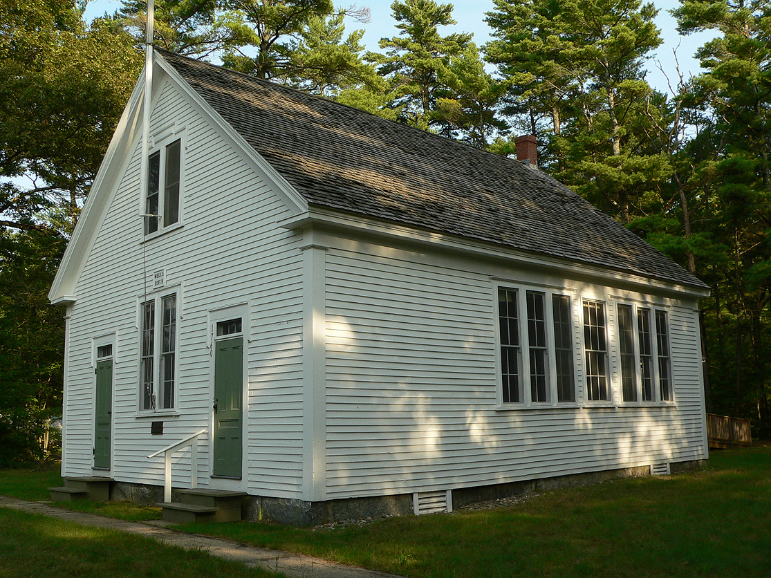
One of Wells' many one-room schools, preserved as a museum.
-

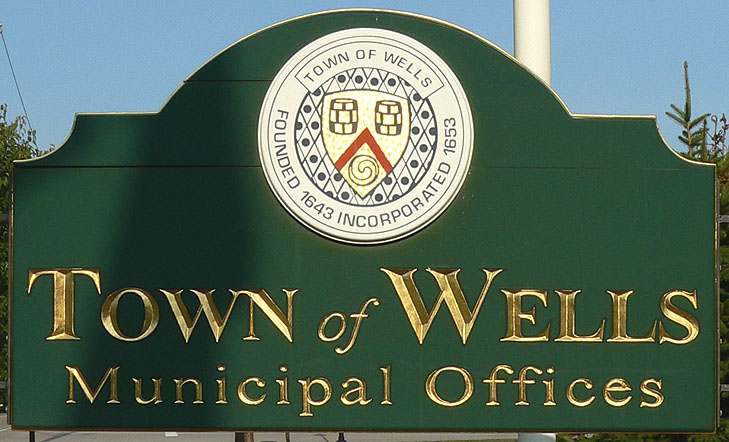
Sign at town hall
-

Freight train at Wells Industrial Park
-

Memorial clock near train station
-

Downeaster passing former Wells Beach depot
-

Laudholm main building
-

First Parish Unitarian-Universalist Church, Kennebunk, built in 1749 when Kennebunk was still part of Wells.
Notable people
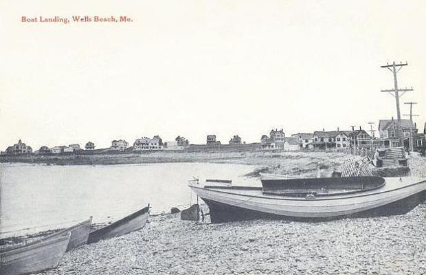
 Boat landing in 1916
- George Burroughs, clergyman, victim of the Salem witch trials
- Kathleen Chase, state representative
- Ronald F. Collins, state senator
- Nathan Dingle, NFL football player[6]
- Daniel W. Gooch, U.S. congressman
- Ivory Kimball, judge
- Steve Lavigne, comic book illustrator
- Nathaniel Littlefield, U.S. congressman
- Ryan Peters (stage name Spose), musician
- John Fairfield Scamman, U.S. congressman
- John Wheelwright, clergyman, original settler of Wells
References
- ^ a b Coolidge, Austin J.; John B. Mansfield (1859). A History and Description of New England. Boston, Massachusetts. pp. 349–353. http://books.google.com/books?id=OcoMAAAAYAAJ&lpg=PA9&ots=cUndZkVSIF&dq=coolidge%20mansfield%20history%20description%20new%20england%201859&pg=PA349#v=onepage&q&f=false.
- ^ Varney, George J. (1886), Gazetteer of the state of Maine. Wells, Boston: Russell, http://history.rays-place.com/me/wells-me.htm
- ^ Hagan, Jennifer (1 January 2004). "Kids Circus fitting finale for celebration". York County Coast Star. http://archive.seacoastonline.com/2003news/yorkstar/ys1_1a.htm. Retrieved 27 July 2010.
- ^ Hope M. Shelley, "A History of Wells, Maine
- ^ "American FactFinder". United States Census Bureau. http://factfinder.census.gov. Retrieved 2008-01-31.
- ^ databaseFootball.com
Further reading
- Wright, Virginia. "Shifting Sands: Wells". Down East: The Magazine of Maine (November 2007).
External links
- Town of Wells, Maine
- Wells Public Library
- Wells Chamber of Commerce
- Wells-Ogunquit Community School District
- York County Community College
- Trailblazers Family Club
- Maine Genealogy: Wells, York County, Maine
Municipalities and communities of York County, Maine Cities 
Towns CDPs Berwick | Cape Neddick | Kennebunk | Kennebunkport | Kittery | Kittery Point | Lake Arrowhead | North Berwick | Sanford | South Eliot | South Sanford | Springvale | West Kennebunk | York Harbor
Other
villagesCategories:- Wells, Maine
- Populated places established in 1641
- Towns in York County, Maine
- Portland – South Portland – Biddeford metropolitan area


Wikimedia Foundation. 2010.