- Blythe Ferry
Infobox nrhp
name = Blythe Ferry
nrhp_type =
caption = Blythe Ferry site
location =N of Birchwood on TN-60 at Tennessee River
nearest_city =
lat_degrees =
lat_minutes =
lat_seconds =
lat_direction =
long_degrees =
long_minutes =
long_seconds =
long_direction =
area =
built = 1809
architect =William Blythe
architecture =
added =January 5 ,1983
visitation_num =
visitation_year =
refnum = 83003055
mpsub = Meigs County, Tennessee MRA
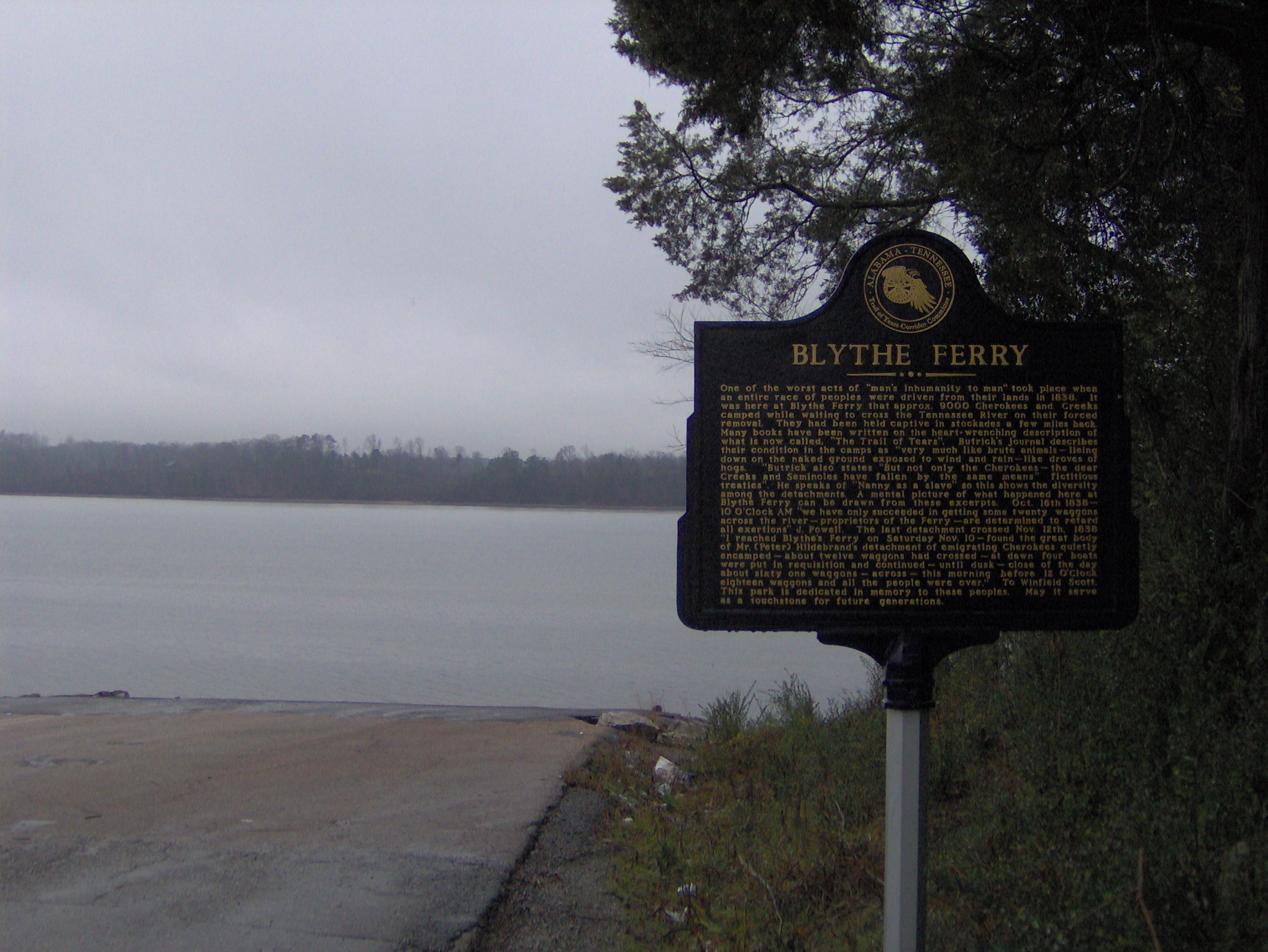
governing_body =Blythe Ferry was a
ferry across theTennessee River in Meigs County,Tennessee . In 1838, the ferry served as a gathering point and crossing for the Cherokee Removal, commonly called theTrail of Tears , in which thousands ofCherokee were forced to move west toOklahoma from their homeland in the southeastern United States.While the ferry no longer exists, the ferry site is now part of the Cherokee Removal Memorial Park, which was dedicated in 2005 and was still under development in 2007. The park comprises a section of the Hiwassee Wildlife Refuge, which is managed by the
Tennessee Wildlife Resources Agency .Geographical setting
The Blythe Ferry site is situated along the eastern bank of the
Chickamauga Lake impoundment of the Tennessee River, just south of the mouth of theHiwassee River . The site is located near a point where Meigs County, Rhea County, and Hamilton County meet. Tennessee State Route 60, which formerly crossed the river at the ferry, connects the area to Cleveland to the east and Decatur to the northwest. The unincorporated community of Birchwood is located just to the southeast.History
Blythe Ferry was established by William Blythe and his Cherokee wife, Nancy Fields, around 1809. The ferry was an important river crossing on the "Great Road" between Chattanooga and Knoxville. Blythe sold the ferry in 1825, and the Blythe family would make the trek west with the Cherokee in the 1830s. [" [http://www.tngenweb.org/meigs/blythe_ferry.html William Blythe Had Early Ferry] ." TNGenWeb.org, 7 February 2006. Retrieved: 23 January 2008.]
In 1836, the
Treaty of New Echota was ratified, transferring all Cherokee lands east of theMississippi River to the United States. The treaty called for a general relocation of the Cherokee Nation to the Oklahoma Territory. In 1838, PresidentMartin Van Buren ordered GeneralWinfield Scott to round up all Cherokees who had not voluntarily made the trek to Oklahoma and commence a forced removal. By the Fall of the that year, some 9000 Cherokee and 300 Creek had been imprisoned in stockades in Bradley County, a few miles to the east. It took several weeks to move the entire contingent across the river, with the last detachment crossing onNovember 12 ,1838 . [Ben McClary, " [http://tennesseeencyclopedia.net/imagegallery.php?EntryID=T104 Trail of Tears] ." "The Tennessee Encyclopedia of History and Culture, 2002. Retrieved: 23 January 2008.] [Information obtained from Trail of Tears Corridor Committee marker at Blythe Ferry site, 29 December 2007.]Blythe Ferry operated until the mid-1990s, when a bridge was built spanning the river immediately downstream. The ferry site was placed on the
National Register of Historic Places in 1982. [" [http://www.tngenweb.org/meigs/blythe_ferry.html William Blythe Had Early Ferry] ." TNGenWeb.org, 7 February 2006. Retrieved: 23 January 2008.]References
Wikimedia Foundation. 2010.