- Cresaptown-Bel Air, Maryland
-
Cresaptown-Bel Air, Maryland — CDP — Location of Cresaptown-Bel Air, Maryland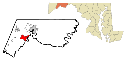
Coordinates: 39°35′14″N 78°50′33″W / 39.58722°N 78.8425°WCoordinates: 39°35′14″N 78°50′33″W / 39.58722°N 78.8425°W Country United States State Maryland County Allegany Area – Total 7.4 sq mi (19.3 km2) – Land 7.4 sq mi (19.3 km2) – Water 0.0 sq mi (0.0 km2) Population (2000) – Total 5,884 – Density 790.1/sq mi (305.1/km2) Time zone Eastern (EST) (UTC-5) – Summer (DST) EDT (UTC-4) FIPS code 24-20530 Cresaptown-Bel Air is a census-designated place in Allegany County, Maryland, United States. The population was 5,884 at the 2000 census.
It is a combination of the communities of Cresaptown and Bel Air recognized as a unit by the Census Bureau.
Cresaptown-Bel Air is part of the Cumberland, MD-WV Metropolitan Statistical Area.
Contents
Geography
Cresaptown-Bel Air is located at 39°35′14″N 78°50′33″W / 39.58722°N 78.8425°W (39.587355, -78.842582)[1].
According to the United States Census Bureau, the CDP has a total area of 7.4 square miles (19 km2), all of it land.
Demographics
As of the census[2] of 2000, there were 5,884 people, 1,765 households, and 1,251 families residing in the CDP. The population density was 790.1 people per square mile (304.9/km²). There were 1,876 housing units at an average density of 251.9/sq mi (97.2/km²). The racial makeup of the CDP was 78.21% White, 20.73% African American, 0.05% Native American, 0.51% Asian, 0.14% from other races, and 0.36% from two or more races. Hispanic or Latino of any race were 0.44% of the population.
There were 1,765 households out of which 31.7% had children under the age of 18 living with them, 58.8% were married couples living together, 9.1% had a female householder with no husband present, and 29.1% were non-families. 24.9% of all households were made up of individuals and 12.0% had someone living alone who was 65 years of age or older. The average household size was 2.41 and the average family size was 2.88.
In the CDP the population was spread out with 17.1% under the age of 18, 7.4% from 18 to 24, 39.9% from 25 to 44, 22.9% from 45 to 64, and 12.7% who were 65 years of age or older. The median age was 38 years. For every 100 females there were 164.3 males. For every 100 females age 18 and over, there were 176.5 males.
The median income for a household in the CDP was $40,693, and the median income for a family was $46,563. Males had a median income of $39,397 versus $22,170 for females. The per capita income for the CDP was $20,279. About 4.0% of families and 6.5% of the population were below the poverty line, including 7.8% of those under age 18 and 5.5% of those age 65 or over.
See also
- Category:Businesses located in Cumberland, MD-WV
References
- ^ "US Gazetteer files: 2010, 2000, and 1990". United States Census Bureau. 2011-02-12. http://www.census.gov/geo/www/gazetteer/gazette.html. Retrieved 2011-04-23.
- ^ "American FactFinder". United States Census Bureau. http://factfinder.census.gov. Retrieved 2008-01-31.
Municipalities and communities of Allegany County, Maryland Cities 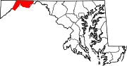
Towns Barton | Lonaconing | Luke | Midland | Westernport
CDPs Cresaptown-Bel Air | La Vale
Other
communitiesAmcelle | Barrelville | Bel Air | Bellegrove | Bier | Borden Shaft | Bowling Green | Carlos | Clarysville | Corriganville | Cresaptown | Danville | Dawson | Detmold | Dickens | Eckhart Mines | Ellerslie | Evitts Creek | Flintstone | Franklin | George's Creek | Klondike | Little Orleans | McCoole | McKenzie | Mexico | Midlothian | Moscow | Mount Savage | Narrows Park | Nikep | North Branch | Oldtown | Pekin | Pinto | Pleasant Valley | Potomac Park | Rawlings | Spring Gap | Town Creek | Vale Summit | Woodland | Zihlman
Categories:- Unincorporated communities in Maryland
- Populated places in Allegany County, Maryland
- Census-designated places in Maryland
- Cumberland, MD-WV MSA


Wikimedia Foundation. 2010.