- Crownsville, Maryland
-
Crownsville, Maryland — CDP — Location of Crownsville, Maryland
Coordinates: 39°1′27″N 76°35′54″W / 39.02417°N 76.59833°WCoordinates: 39°1′27″N 76°35′54″W / 39.02417°N 76.59833°W Country United States State Maryland County Anne Arundel Area - Total 5.6 sq mi (14.4 km2) - Land 5.6 sq mi (14.4 km2) - Water 0.0 sq mi (0.0 km2) Elevation 121 ft (37 m) Population (2000) - Total 1,670 - Density 300.7/sq mi (116.1/km2) Time zone Eastern (EST) (UTC-5) - Summer (DST) EDT (UTC-4) ZIP code 21032 Area code(s) 410 FIPS code 24-21075 GNIS feature ID 0590052 Crownsville is a census-designated place (CDP) in Anne Arundel County, Maryland, United States. The population was 1,670 at the 2000 census. It hosts the Anne Arundel County Fair each September, as well as the annual Maryland Renaissance Festival for several summer weekends. A state psychiatric hospital was formerly in Crownsville. The area offers waterfront scenery and easy access to urban metropolitan areas and culture.
Contents
Geography
Crownsville is located at 39°1′27″N 76°35′54″W / 39.02417°N 76.59833°W (39.024149, -76.598295)[1].
According to the United States Census Bureau, the CDP has a total area of 5.6 square miles (15 km2), all of it land.
Demographics
As of the census[2] of 2000, there were 1,670 people, 485 households, and 392 families residing in the CDP. The population density was 300.7 people per square mile (116.2/km²). There were 516 housing units at an average density of 92.9/sq mi (35.9/km²). The racial makeup of the CDP was 80.36% White, 15.45% African American, 0.78% Native American, 1.50% Asian, 0.06% Pacific Islander, 0.66% from other races, and 1.20% from two or more races. Hispanic or Latino of any race were 1.62% of the population.
There were 485 households out of which 31.5% had children under the age of 18 living with them, 70.5% were married couples living together, 7.6% had a female householder with no husband present, and 19.0% were non-families. 14.6% of all households were made up of individuals and 4.1% had someone living alone who was 65 years of age or older. The average household size was 2.65 and the average family size was 2.90.
In the CDP the population was spread out with 19.4% under the age of 18, 7.4% from 18 to 24, 32.0% from 25 to 44, 32.6% from 45 to 64, and 8.6% who were 65 years of age or older. The median age was 41 years. For every 100 females there were 111.9 males. For every 100 females age 18 and over, there were 110.3 males.
The median income for a household in the CDP was $91,180, and the median income for a family was $99,553. Males had a median income of $87,035 versus $32,344 for females. The per capita income for the CDP was $37,509. About 4.3% of families and 11.2% of the population were below the poverty line, including none of those under age 18 and 18.1% of those age 65 or over.
Local Schools
private and public included
- Indian Creek School (Pre-K through 12th grade) [1] (Private)
- South Shore Elementary School (K through 5th grade) [2] (Anne Arundel County Public School)
- Millersvile Elementary (K through 5th grade) (Anne Arundel County Public School)
Government
State government
The Maryland Department of Housing and Community Development is headquartered at 100 Community Place in the Crownsville CDP.[3][4]
Points of interest
In September 1989, Jeff Arch began working on a script for TriStar Pictures based on An Affair to Remember. Attracted by the local area, Arch originally placed the main protagonist as a resident in Crownsville in the initial draft. Tristar insisted that Arch choose a different location that would be more well-known to the American movie-going population. After several attempts to please TriStar, Arch finalised on Seattle. The reason often cited by Arch for the change of location was they could not think of a better title than Sleepless in Seattle.
References
- ^ "US Gazetteer files: 2010, 2000, and 1990". United States Census Bureau. 2011-02-12. http://www.census.gov/geo/www/gazetteer/gazette.html. Retrieved 2011-04-23.
- ^ "American FactFinder". United States Census Bureau. http://factfinder.census.gov. Retrieved 2008-01-31.
- ^ Home page. Maryland Department of Housing and Community Development. Retrieved on March 23, 2009.
- ^ "Crownsville CDP, Maryland." U.S. Census Bureau. Retrieved on March 23, 2009.
Municipalities and communities of Anne Arundel County, Maryland County seat: Annapolis City 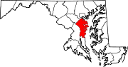
Town CDPs Arden-on-the-Severn | Arnold | Brooklyn Park | Cape St. Claire | Crofton | Crownsville | Deale | Ferndale | Fort Meade | Glen Burnie | Green Haven | Herald Harbor | Hillsmere Shores | Jessup‡ | Lake Shore | Linthicum | Londontowne | Maryland City | Mayo | Naval Academy | Odenton | Parole | Pasadena | Pumphrey | Riva | Riviera Beach | Selby-on-the-Bay | Severn | Severna Park | Shady Side | South Gate
Other
communitiesArundel on the Bay | Beverly Beach | Bristol | Churchton | Davidsonville | Fairhaven | Fairview | Franklin Manor-on-the-Bay | Friendship | Gambrills | Galesville | Germantown | Gibson Island | Hanover | Harmans | Harundale | Harwood | Iglehart | Jacobsville | Jennings | Lothian | Millersville | Orchard Beach | Owensville | Piney Orchard | Riverdale | Rose Haven | Russett | Saunders Point | Seven Oaks | Sherwood Forest | Skidmore | South River | Sudley | Tall Timbers | Tracys Landing | West River | Winchester-on-the-Severn | Woodland Beach | Woodwardville
Footnotes ‡This populated place also has portions in an adjacent county or counties
Categories:- Unincorporated communities in Maryland
- Populated places in Anne Arundel County, Maryland
- Census-designated places in Maryland


Wikimedia Foundation. 2010.