- Linthicum, Maryland
-
"Linthicum" redirects here. For other uses, see Linthicum (disambiguation).
Linthicum, Maryland — CDP — Location of Linthicum, Maryland
Coordinates: 39°12′14″N 76°39′38″W / 39.20389°N 76.66056°WCoordinates: 39°12′14″N 76°39′38″W / 39.20389°N 76.66056°W Country United States State Maryland County Anne Arundel Area – Total 4.2 sq mi (10.9 km2) – Land 4.2 sq mi (10.9 km2) – Water 0.0 sq mi (0.0 km2) Elevation 138 ft (42 m) Population (2000) – Total 7,539 – Density 1,793.1/sq mi (692.3/km2) Time zone Eastern (EST) (UTC-5) – Summer (DST) EDT (UTC-4) ZIP code 21090 Area code(s) 410 FIPS code 24-47125 GNIS feature ID 1710221 U.S. Registered Historic District Linthicum is a census-designated place (CDP) and an unincorporated community in Anne Arundel County, Maryland, United States. The population was 7,539 at the 2000 census. It is the approximate location of Baltimore-Washington International Thurgood Marshall Airport (BWI). Designated as "Linthicum Heights" and zip code 21090 by the US Postal Service, Linthicum has been traditionally divided into two distinct communities each with its own community association and identity. These two communities, split by the Baltimore Beltway in 1957, are Linthicum and North Linthicum (or, alternatively, Linthicum-Shipley and North Linthicum.) Both communities developed as a result of their locations adjacent to the Baltimore and Annapolis Short Line railroad which brought commuters to the original truck faming community.
As a developed community, Linthicum began with the 1908 founding of the "Linthicum Heights Company", though a "Linthicum" or "Linthicum's" station on the 1887 Annapolis and Baltimore Short Line railroad existed at least as early as 1889. The community's name was from the area's primary land-owning family since an 1801 purchase by Abner Linthicum. [1] The Linthicum Heights Historic District was listed on the National Register of Historic Places in 2006.[2]
Contents
Geography
Linthicum is located at 39°12′14″N 76°39′38″W / 39.20389°N 76.66056°W (39.203876, -76.660506)[3].
According to the United States Census Bureau, the CDP has a total area of 4.2 square miles (11 km2), all of it land.
Demographics
As of the census[4] of 2000, there were 7,539 people, 2,877 households, and 2,206 families residing in the CDP. The population density was 1,793.1 people per square mile (693.1/km²). There were 2,950 housing units at an average density of 701.6/sq mi (271.2/km²). The racial makeup of the CDP was 94.39% White, 1.76% African American, 0.24% Native American, 2.44% Asian, 0.15% Pacific Islander, 0.23% from other races, and 0.80% from two or more races. Hispanic or Latino of any race were 0.89% of the population.
There were 2,877 households out of which 28.3% had children under the age of 18 living with them, 64.3% were married couples living together, 8.7% had a female householder with no husband present, and 23.3% were non-families. 19.5% of all households were made up of individuals and 10.5% had someone living alone who was 65 years of age or older. The average household size was 2.61 and the average family size was 2.98.
In the CDP the population was spread out with 21.3% under the age of 18, 6.2% from 18 to 24, 25.5% from 25 to 44, 26.4% from 45 to 64, and 20.6% who were 65 years of age or older. The median age was 43 years. For every 100 females there were 93.0 males. For every 100 females age 18 and over, there were 91.7 males.
The median income for a household in the CDP was $61,479, and the median income for a family was $72,821. Males had a median income of $46,586 versus $35,104 for females. The per capita income for the CDP was $27,559. About 2.0% of families and 3.6% of the population were below the poverty line, including 3.1% of those under age 18 and 7.8% of those age 65 or over.
Economy
Ciena is among the companies based in Linthicum.
Public transportation
Linthicum is served by bus and three stops on the Baltimore Light Rail:
- Nursery Road, 6825 Baltimore-Annapolis Boulevard
- North Linthicum, 450 N. Camp Meade Road, Linthicum Heights
- Linthicum, 308 S. Camp Meade Road, Linthicum Heights
From 1887 to February 1950, Linthicum was served by the now-defunct Baltimore and Annapolis Railroad's line between Baltimore and Annapolis, Maryland.
North Linthicum
The community of North Linthicum is defined by the North Linthicum Improvement Association as the area bounded by the Patapsco River from the Baltimore Beltway (I-695) to Old Annapolis Rd., Old Annapolis Rd. from the Patapsco River to the Baltimore Beltway, the Baltimore Beltway from Old Annapolis Road to the Baltimore-Washington Parkway, the Baltimore-Washington Parkway from the Baltimore Beltway to Hammonds Ferry Road, and Hammonds Ferry Road from the Baltimore-Washington Parkway to the Patapsco River.
Points of interest
- National Electronics Museum
- William P. Didusch Center for Urologic History
- Benson-Hammond House
- Friendship Church of the Brethren
- Overlook Elementary School
- Linthicum Elementary School
- St. Philip Neri School
- Hutman Artistic "Environment", a library and car art studio
- The Performing Arts Association of Linthicum
Notable residents and natives
- John Charles Linthicum (1867–1932), U.S. Congressman, 1911-1932
- G. E. Lowman (1897-1965), national radio evangelist
- Leonard T. "Max" Schroeder Jr. (1918-2009), U.S. Army colonel, first American soldier ashore on D-Day in World War II
- Jim Spencer (1947-2002), Major League Baseball player 1968 - 1982, 1973 Major League Baseball All-Star Game
- Pamela Beidle (born 1951), Maryland House of Delegates member since 2007
- John C. Inglis (born 1954), National Security Agency Deputy Director since 2006
- Dorothy Mays (born 1957), Playboy July 1979 Playmate of the Month
- Robert A. Costa (born 1958), Maryland House of Delegates member since 2003
- Rafael Alvarez (born 1958), journalist, author, television writer
- Donald E. Murphy (born 1960), Maryland House of Delegates member 1995-2003
- Michael Orzechowski (born 1990), Playwright
References
- ^ Booth, Oscar "Skip" (2008). The Train Passes Through It: A Collective History of Linthicum Heights. Linthicum Centennial Committee. pp. xi-xii; 3-4.
- ^ Andrea F. Siegel (December 23, 2007). "'Country suburb' close, accessible". The Baltimore Sun.
- ^ "US Gazetteer files: 2010, 2000, and 1990". United States Census Bureau. 2011-02-12. http://www.census.gov/geo/www/gazetteer/gazette.html. Retrieved 2011-04-23.
- ^ "American FactFinder". United States Census Bureau. http://factfinder.census.gov. Retrieved 2008-01-31.
External links
- Linthicum-Shipley Improvement Association website
- North Linthicum website
- Where We Live: A Small Town Few Want to Leave, Though Near BWI Linthicum Has a Neighborhood Feel, The Washington Post, July 11, 2009.
U.S. National Register of Historic Places Topics Lists by states Alabama • Alaska • Arizona • Arkansas • California • Colorado • Connecticut • Delaware • Florida • Georgia • Hawaii • Idaho • Illinois • Indiana • Iowa • Kansas • Kentucky • Louisiana • Maine • Maryland • Massachusetts • Michigan • Minnesota • Mississippi • Missouri • Montana • Nebraska • Nevada • New Hampshire • New Jersey • New Mexico • New York • North Carolina • North Dakota • Ohio • Oklahoma • Oregon • Pennsylvania • Rhode Island • South Carolina • South Dakota • Tennessee • Texas • Utah • Vermont • Virginia • Washington • West Virginia • Wisconsin • WyomingLists by territories Lists by associated states Other Municipalities and communities of Anne Arundel County, Maryland City 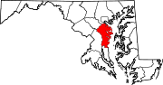
Town CDPs Arden-on-the-Severn | Arnold | Brooklyn Park | Cape St. Claire | Crofton | Crownsville | Deale | Ferndale | Fort Meade | Glen Burnie | Green Haven | Herald Harbor | Hillsmere Shores | Jessup‡ | Lake Shore | Linthicum | Londontowne | Maryland City | Mayo | Naval Academy | Odenton | Parole | Pasadena | Pumphrey | Riva | Riviera Beach | Selby-on-the-Bay | Severn | Severna Park | Shady Side | South Gate
Other
communitiesArundel on the Bay | Beverly Beach | Bristol | Churchton | Davidsonville | Fairhaven | Fairview | Franklin Manor-on-the-Bay | Friendship | Gambrills | Galesville | Germantown | Gibson Island | Hanover | Harmans | Harundale | Harwood | Iglehart | Jacobsville | Jennings | Lothian | Millersville | Orchard Beach | Owensville | Piney Orchard | Riverdale | Rose Haven | Russett | Saunders Point | Seven Oaks | Sherwood Forest | Skidmore | South River | Sudley | Tall Timbers | Tracys Landing | West River | Winchester-on-the-Severn | Woodland Beach | Woodwardville
Footnotes ‡This populated place also has portions in an adjacent county or counties
Categories:- Unincorporated communities in Maryland
- Populated places in Anne Arundel County, Maryland
- Census-designated places in Maryland


Wikimedia Foundation. 2010.