- Owings, Maryland
-
Not to be confused with Owings Mills, Maryland.
Owings, Maryland — CDP — Location of Owings, Maryland
Coordinates: 38°42′43″N 76°36′14″W / 38.71194°N 76.60389°WCoordinates: 38°42′43″N 76°36′14″W / 38.71194°N 76.60389°W Country United States State Maryland County Calvert Area – Total 3.9 sq mi (10.2 km2) – Land 3.9 sq mi (10.2 km2) – Water 0.0 sq mi (0.0 km2) Elevation 89 ft (27 m) Population (2000) – Total 1,325 – Density 337.2/sq mi (130.2/km2) Time zone Eastern (EST) (UTC-5) – Summer (DST) EDT (UTC-4) ZIP code 20736 Area code(s) 301, 410 FIPS code 24-59375 GNIS feature ID 0590959 Owings is a census-designated place (CDP) in Calvert County, Maryland, United States. The population was 1,325 at the 2000 census.
Contents
Geography
Owings is located at 38°42′43″N 76°36′14″W / 38.71194°N 76.60389°W (38.711919, -76.603901)[1].
According to the United States Census Bureau, the CDP has a total area of 3.9 square miles (10 km2), all of it land.
Owings' center is just east of the Maryland Route 2 and Maryland Route 260 intersection. The area is considered exurban by the Washington Post. It includes a mix of farmland, single-family detached homes and sub-divisions. Aerial maps show that about 50% of the Owings CDP is wooded. The place center lies on the former Chesapeake Beach Railway line, which was converted to the roadway Maryland Route 260. Route 260 extends from Maryland Route 4 to Chesapeake Beach, Maryland. Owings was a stop on the railway local service. Hall Creek originates in the Owings vicinity, forms about half of the CDPs northern border and winds west until it empties into the Patuxent River. The creek bed cuts a significant valley across the hilly central ridge of the Calvert County peninsula, until it reaches the flood plains of the on the Patuxent's East banks, where it becomes more marshy. The Owings CDP is within Calvert County, hugging a truncated 90° corner of the southern border of Anne Arundel County.
Demographics
As of the census[2] of 2000, there were 1,325 people, 426 households, and 356 families residing in the CDP. The population density was 337.2 people per square mile (130.2/km²). There were 443 housing units at an average density of 112.7/sq mi (43.5/km²). The racial makeup of the CDP was 86.87% White, 11.47% African American, 0.15% Native American, 0.60% Asian, 0.45% from other races, and 0.45% from two or more races. Hispanic or Latino of any race were 0.75% of the population.
There were 426 households out of which 42.3% had children under the age of 18 living with them, 71.8% were married couples living together, 8.2% had a female householder with no husband present, and 16.4% were non-families. 10.8% of all households were made up of individuals and 3.5% had someone living alone who was 65 years of age or older. The average household size was 3.06 and the average family size was 3.30.
In the CDP the population was spread out with 29.7% under the age of 18, 5.5% from 18 to 24, 29.9% from 25 to 44, 25.9% from 45 to 64, and 9.1% who were 65 years of age or older. The median age was 38 years. For every 100 females there were 96.6 males. For every 100 females age 18 and over, there were 89.4 males.
The median income for a household in the CDP was $74,150, and the median income for a family was $74,702. Males had a median income of $49,250 versus $31,204 for females. The per capita income for the CDP was $27,287. About 2.5% of families and 3.5% of the population were below the poverty line, including none of those under age 18 and 9.5% of those age 65 or over.
History
Originally the Chesapeake Beach Railway station at the line's intersection with Solomons Island Road was known as "Friendship." David Moffatt, president of the railway, renamed the station to "Owings" in order to avoid conflict with the town of West Friendship, Maryland. The name was a tribute to Harry P. Owings, a one time member of the State Legislature and Calvert County resident, who was also a local farmer and real estate agent. In August 1900, Harry P. Owings requested the position of station manager. The station was already known as Owings at the time of the request.
Maidstone was listed on the National Register of Historic Places in 1971.[3]
Community resources
Owings has a single convenience store–gas station, two childcare centers, at least one church and a handful of other small businesses clustered around its center. A medical office building with a pharmacy is at the South-East corner of the Route 2 and Route 260 intersection. A small industrial site has a concrete provider and an automotive shop. The Owings US post office is at 9440 Old Solomon's Island Road approximately 0.4 miles south of the place center. There is a funeral home near the southern limits of the place border. Windy Hill Elementary and Windy Hill Middle School are at the eastern edge of the CDP on a contiguous campus.
Owings has a Boys & Girls Club affiliate, the "Owings Outlaws" with teams participating in football and basketball.
Sub-divisions include: Cabin Branch, Cross Point, Grover's Summit, Sycamore Ridge, the three Quince Views and Amber Woods.
References
- ^ "US Gazetteer files: 2010, 2000, and 1990". United States Census Bureau. 2011-02-12. http://www.census.gov/geo/www/gazetteer/gazette.html. Retrieved 2011-04-23.
- ^ "American FactFinder". United States Census Bureau. http://factfinder.census.gov. Retrieved 2008-01-31.
- ^ "National Register Information System". National Register of Historic Places. National Park Service. 2008-04-15. http://nrhp.focus.nps.gov/natreg/docs/All_Data.html.
External links
- Remembering Harry P. Owings of Owings
- Sawmill in Owings
- Windy Hill Elementary School
- Windy Hill Middle School
Municipalities and communities of Calvert County, Maryland Towns 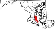
CDPs Calvert Beach-Long Beach | Chesapeake Ranch Estates-Drum Point | Dunkirk | Huntingtown | Lusby | Owings | Prince Frederick | St. Leonard | Solomons
Other
communitiesAdelina | Barstow | Bowens | Broomes Island | Chaneyville | Chesapeake Ranch Estates | Dares Beach | Dowell | Johnstown | Lower Marlboro | Mutual | Parran | Pleasant Valley | Port Republic | Scientists Cliffs | Stoakley | Sunderland | Wallville
Categories:- Populated places in Calvert County, Maryland
- Census-designated places in Maryland


Wikimedia Foundation. 2010.