- Manchester, Maryland
-
Manchester, Maryland — Town — Looking north in downtown Manchester, Maryland

SealLocation of Manchester, Maryland
Coordinates: 39°39′42″N 76°53′17″W / 39.66167°N 76.88806°WCoordinates: 39°39′42″N 76°53′17″W / 39.66167°N 76.88806°W Country United States State Maryland County Carroll Area – Total 1.9 sq mi (5.0 km2) – Land 1.9 sq mi (5.0 km2) – Water 0.0 sq mi (0.0 km2) Elevation 991 ft (302 m) Population (2010) – Total 4,808 – Density 1,713.4/sq mi (661.5/km2) Time zone Eastern (EST) (UTC-5) – Summer (DST) EDT (UTC-4) ZIP codes 21088, 21102 Area code(s) 410 FIPS code 24-49950 GNIS feature ID 0590726 Manchester, Maryland, is a small incorporated town in Northeastern Carroll County, Maryland located on the Eastern coast of the United States of America just South of the Pennsylvania State line and North of Baltimore, Maryland. The population was 4,808 at the 2010 census making it the 21st most populous town in Maryland.[1]
Manchester was incorporated in 1834 and is the second oldest incorporated area in Carroll County after Westminster, Maryland, which was incorporated in 1818.[2] The town was originally formed as a part of Baltimore County, Maryland, before the creation of Carroll County in 1837. It is governed by an elected mayor and an elected five person town council.
Manchester lies in the humid continental climate region, marked by cold and snowy winters but humid and hot summers. This climate is ideal for growing farmed crops in the summer such as sweet corn and squash,[3] leaving much of the outlying area marked with large tracts of farmland. Manchester is a rural commuting town where residents travel to work in the greater Baltimore Metropolitan Area and the greater Washington Metropolitan Area.
Contents
History
The Town of Manchester, officially incorporated in 1834,[4] was originally known as "Manchester Germantown", however the name Germantown referred to a community west of Manchester that was later incorporated with the town.[5] The town was originally laid out in Baltimore County, Maryland, and remained apart of the county until the creation of Carroll County, Maryland, on January 19, 1837.[6]
Previous to European colonization, the people of Susquehannock occupied the territory within the borders of Manchester.[7] At the center of town stands an intersection of what were once two important Native American trails.[8] One part of the trail connected the Potomac and Susquehanna rivers, and the other ran from the Conewago River to the Patapsco River (Hanover, Pennsylvania to Baltimore, Maryland).[9] The latter trail was laid out in 1737 as the first public road in what is now Carroll County by Robert Owings.[10]
The first land grant of 150 acres (0.61 km2) in the area was given to Samuel Stevens, known as "Steven's Hope," it was laid at the intersection of present day Lineboro Rd.[11] The first settlers were English but later immigration brought people of German descent. There were many early land grants, the first one touching the present confines of town was made in 1758, issued to "German Churche".[12] In 1765 Captain Richard Richards was granted a tract of 67 acres (0.27 km2) of land which was named "New Market", adjoining the existing land grant of "German Churche." Richards laid out the town of Manchester, naming it after his home town in England.[13]
 North Main St, circa 1900
From the 18th century until the earliest parts of the 20th century, the primary languages spoken by the residents were German, or Pennsylvania Dutch. The custom of the German residents of making noodles and stringing them on lines outside their homes would give the town the nickname, "Noodle Doosey." Later, Manchester would receive another nickname when the German custom of making ginger cakes brought on "Gingercake Town."[11] Manchester was also a relatively large cigar manufacturing town. Beginning after the American Civil War until around 1930 when the mass production of cigars made the manual method in use in the town less economical.[14]
Manchester was the home of one of the first colleges in Carroll County when, in 1858, Irving College, named after poet Washington Irving, was established by Dr. Ferdinand Dieffenbach. During the American Civil War the success of the school was greatly hampered with the death of Dr. Dieffenbach and the low number of young men returning from the front lines. The school changed its name to Irving Institute in 1886 and finally ceased operation by 1893.[15][16]
During the American Civil War, Manchester was used as a camping area for the Union Sixth Army Corps under General John Sedgwick on July 1, 1863.[17] The next day, the army made its march to the Battle of Gettysburg.
Manchester has had three newspapers. The first called the Manchester Gazette began publishing weekly in 1870 and ceased in 1872. The second went into print on December 11, 1880 called the Manchester Enterprise and in 1888 the Telephone Messenger was established.[18]
 "Lutheran White Oak"
The official seal of the town of Manchester is a church steeple in the foreground and the likeness of a leaf-less tree in the background with the text "Founded 1765 Incorporated 1834".
The image of the tree is a representation of a White Oak and is considered the town symbol. The "Lutheran White Oak", as it has come to be known, is estimated at 320 years old.[19] The large oak became a fixture of the town when, in 1758, King George III granted a charter to German colonists to erect a church near the tree. The town newsletter was named "Oaknotes" as an homage to the large White Oak tree.[20]
Manchester is a typical "Main Street" town that continues expanding to accommodate a growing population. Manchester has its own post office[21] and home mail delivery is available to most residents. A majority, an estimated 95%, of town residents commute to work.[22] There are no large employers inside the town limits but there are many small businesses.[23] Manchester is mostly residential buildings with some restaurants, a bank and other small retail store fronts. A large portion of the businesses are located on or around Main Street which Maryland Route 30 becomes once entering "downtown" Manchester.
Demographics
As of the census[24] of 2010, there were 4,808 people, 1,632 households, and 1,269 families residing in the town. The population density was 2,530.5 people per square mile (981.2/km²). There were 1,713 housing units at an average density of 901.6 per square mile (349.6/km²). The racial makeup of the town was 90.6% White, 3.07% African American, 0.02% Native American, 1.58% Asian, 1.64% from other races, and 1.51% from two or more races. Hispanic or Latino of any race were 3.09% of the population.
There were 1,134 households out of which 44% had children under the age of 18 living with them, 64.9% were married couples living together, 10.0% had a female householder with no husband present, and 21.9% were non-families. 18.3% of all households were made up of individuals and 6.6% had someone living alone who was 65 years of age or older. The average household size was 2.83 and the average family size was 3.24.
In the town the population was spread out with 28.3% under the age of 18, 7.8% from 18 to 24, 31.6% from 25 to 44, 20.5% from 45 to 64, and 11.8% who were 65 years of age or older. The median age was 36 years. For every 100 females there were 95.8 males. For every 100 females age 18 and over, there were 89.5 males.
The median income for a household in the town was $57,390, and the median income for a family was $62,679. Males had a median income of $37,794 versus $29,118 for females. The per capita income for the town was $20,956. About 0.9% of families and 2.1% of the population were below the poverty line, including 2.1% of those under age 18 and 4.7% of those age 65 or over.
Geography
 Piedmont plateau region (shaded)
Topography
Manchester is located at 39°39′42″N 76°53′17″W / 39.66167°N 76.88806°W (39.661762, -76.888014)[25]. According to the United States Census Bureau, the town has a total area of 1.9 square miles (4.9 km2), all of it land.
Manchester is located within the Piedmont Plateau, west of the coastal lowlands of the Chesapeake Bay, rolling upland with many deep gorges eroded by rivers.[26] Manchester's environs are the highest point in the state of Maryland east of the Appalachian Mountains.
Climate
Manchester lies in the humid continental climate zone, and experiences higher annual snowfall and colder temperatures than the southern half of Maryland, which has a humid subtropical climate.
The hottest summer month is July where temperatures average a high of 87 °F (31 °C) and average low of 63 °F (17 °C). The coldest month is January with an average high of 38 °F (3 °C) and average low of 21 °F (-6 °C)[27] Manchester has an annual precipitation of 43.67 inches (110.9 cm).[28]
Month Jan Feb Mar Apr May Jun Jul Aug Sep Oct Nov Dec Avg high °F (°C) 38 (3) 43 (6) 53 (12) 65 (18) 75 (24) 83 (28) 87 (31) 85 (29) 78 (26) 67 (19) 54 (12) 43 (6) Avg low temperature °F (°C) 21 (−6) 22 (−6) 30 (−1) 39 (4) 49 (9) 58 (14) 63 (17) 61 (16) 55 (13) 42 (6) 34 (1) 26 (−3) Precip in In.(mm.) 3.64 (92) 2.90 (73) 3.77 (95) 3.45 (87) 4.28 (108) 3.62 (92) 3.57 (90) 3.71 (94) 4.14 (105) 3.44 (87) 3.61 (91) 3.54 (89) Events
Every year in early summer a date is chosen to celebrate Manchester Day. Events such as a Flea Market with vendor's selling different items, food stands as well as games, rides and live entertainment.[29]
During the summer Manchester hosts the Manchester Volunteer Fire Department Carnival. The carnival lasts several nights and usually coincides with Independence Day. A fireworks display is set off as well to celebrate the holiday.[30]
Once a year a female member of the Manchester Community is chosen as "Miss Manchester Fire Queen".[31]
Parks
 Pine Valley Park
Manchester has three major parks, totaling 82 acres (0.33 km2) of developed and undeveloped land. Manchester has the most park area of any other town in Carroll County.[32]
- Christmas Tree Park is located in the north eastern part of Manchester and has the largest developed park land in the area. It is also the home of several baseball diamonds, three tennis courts, multiple playgrounds for children and picnic and grilling areas. In the less developed and wooded area there are three small to large ponds. The park is mostly populated with pine trees that resemble Christmas Trees.
- Pine Valley Park, located in the northern part of town, has more than 60 acres (0.24 km2) of land and over 4.5 miles (7.2 km) of trails, a natural spring, a pond and pine and hardwood forests.[33] Opened in July 1995 it was created as an "open classroom" for nearby Manchester Elementary School. The school students voted and selected the name Charlotte's Quest for the classroom as a tribute to Charlotte B. Collett, the then Town Councilwoman who oversaw the project.[34]
- Westside Memorial Park is a small park running parallel with Maryland Route 27 located in the western part of town. The park has the only Skateboard facility within the town.[35]
Government
 Town Office
Manchester has a democratically elected mayor and town council. The mayor and individual councilors are elected for a term of four years.[36] In 2011 Mayor Ryan Warner was elected for the first time, previously serving as a Town Council member.
Members of the town council are Todd A. Benner (2013), Douglas Myers (2013), Daniel C. Riley (2013), Tammy Black (2015), Vincent C. Pacelli.
Manchester is in Maryland District 5A and is represented in the Maryland House of Delegates by Justin D. Ready (R) and Nancy R. Stocksdale (R). In the Maryland State Senate residents are represented by Joseph M. Getty (R).[37]
At the federal level Manchester is located in the Sixth Congressional District of Maryland and is represented by Roscoe Bartlett (R) in the United States House of Representatives.[38]
Education
 Manchester Elementary School
Manchester hosts three public schools. Two of which are primary schools and the other is a secondary school.
Manchester Elementary School was originally built in 1932 as Manchester High School. The school's current population is 604 students in pre-kindergarten, kindergarten, first grade, second grade, third grade, fourth grade and fifth grade.[39]
Ebb Valley Elementary School opened in August 2008 with a student population of 467. Ebb Valley is a two story school accommodating kindergarten through fifth grade students.[40]
Manchester Valley High School opened in August 2009 to help alleviate overpopulation at North Carroll High School in Hampstead, Maryland.[41] Teaching ninth grade, tenth grade, eleventh grade and twelfth grade students; it's first graduating class will be on June 1, 2011.[42]
Infrastructure
Transportation
Manchester has three state designated highways within the town limits.
Traffic congestion is high, southbound, in the morning as commuters make their way to the greater Baltimore, area. Traffic is also high, northbound, in the evening as commuters make their way to Pennsylvania via Pennsylvania Route 94 and Westminster, Maryland, via Maryland Route 27.[43] There are plans to introduce a Manchester bypass relocating Route 30 outside of town limits.[44]
Utilities
In 1907, AT&T was granted rights to operate a telegraph and telephone line in Manchester but telephone service was not utilized until 1921.[45] Land line based telephone service has been provided by Verizon since its creation on June 30, 2000.
Glen Rock Electric Light and Power Company first ran electric lines through town in 1922.[45] In 1999, Maryland deregulated the electricity industry. As the result, residents of Manchester may choose from eleven electricity suppliers in the Baltimore Gas & Electric service area.[46]
Cable television is provided to residents by Comcast inside Carroll County.[47] Comcast began operations in the county after purchasing the now defunct Adelphia Communications Corporation on July 31, 2006.
Water is provided to town residents by the town's Public Works Department.[48]
Notable natives
- Doug Flutie was born in Manchester, Maryland, on October 23, 1962.[49] Flutie, a Heisman Trophy winner, played college football at Boston College, and played professionally in the National Football League, Canadian Football League, and United States Football League.
Media
A video depicting some of the main streets in Manchester
See also
- Incorporated town
- Lineboro, Maryland
- List of incorporated places in Maryland
- Mason-Dixon Line
- Millers, Maryland
References
- ^ "Total Population for Maryland's Incorporated Places: 2000 & 1990". http://www.mdp.state.md.us/msdc/census/cen2000/PL94-171/ByCIP/cip0090t.pdf. Retrieved 2009-08-14.
- ^ "Caroll County, Maryland Municipalities". http://www.msa.md.gov/msa/mdmanual/36loc/carr/html/carrmu.html. Retrieved 2009-08-14.
- ^ "Carroll County Department of Economic Development - Agriculture". http://www.carrollag.org/html/harvestdates.html. Retrieved 2009-08-14.
- ^ "Manchester History". http://www.manchesterconnection.com/history/. Retrieved 2009-07-29.
- ^ Schkichter, Harvey G. (1984). Two Centuries of Grace and Growth in Manchester. p. 227.
- ^ "Manchester History". http://www.manchesterconnection.com/history/. Retrieved 2009-07-29.
- ^ Sarah Trump, Adda L. Trump, Kathryn L, Riley (2000). Two Hundred Fortieth Anniversy of Immanual Evangelical Luetheran Church. p. 31.
- ^ Ashcraft, Mary Ann (2009-03-23). "Manchester a Strategic Travel Location". http://www.carrollcounty.com/articles/2009/02/23/features/in_focus/columns/carroll_yesteryears/yester955.txt. Retrieved 2009-07-29.
- ^ Schkichter, Harvey G. (1984). Two Centuries of Grace and Growth in Manchester. p. 222.
- ^ Baty, Catherine (2006). Carroll County. United States. p. 7. ISBN 9780738543024.
- ^ a b Schkichter, Harvey G. (1984). Two Centuries of Grace and Growth in Manchester. p. 223.
- ^ Nancy M. Warner, Ralph B. Levering, Margaret Taylor Woltz (1976). Carroll County, Maryland : a history, 1837-1976. United States. p. 27.
- ^ Nancy M. Warner, Ralph B. Levering, Margaret Taylor Woltz (1976). Carroll County, Maryland : a history, 1837-1976. United States. p. 35.
- ^ Schkichter, Harvey G. (1984). Two Centuries of Grace and Growth in Manchester. p. 241.
- ^ Getty, Joe (1990-06-10). "Manchester School Dedication". Carroll County Times. http://hscc.carr.org/research/yesteryears/cct1990/900610.htm. Retrieved 2009-08-01.
- ^ Schkichter, Harvey G. (1984). Two Centuries of Grace and Growth in Manchester. p. 236.
- ^ Frank Moore, Alexander Hay Ritchie, George Edward Perine, John Chester Buttre, Henry Bryan Hall (1864). The Portrait Gallery of the War, Civil, Military, and Naval. United States. p. 171. ISBN 9781432816926.
- ^ "Maryland State Archives, Guide to special collections". http://speccol.mdarchives.state.md.us/msa/speccol/catalog/newspapers/cfm/dsp_countyresults.cfm?county=cr. Retrieved 2009-08-02.
- ^ Krueger, Jeff (2001). "Historic Tree:List of Trees; Maryland". http://home.earthlink.net/~jeffkrueger/treelist.html. Retrieved 2009-07-29.
- ^ "Official Manchester Newsletter" (PDF). http://manchestermd.org/Newsletter.html. Retrieved 2009-07-29.
- ^ "USPS PO Search". http://webpmt.usps.gov/pmt003.cfm?PostOfficeName=Manchester&stat_state_name=MARYLAND. Retrieved 2009-07-29.
- ^ "Manchester, Maryland Facts, Schools, Colleges, Weather, Zip Code, and More". http://www.citytowninfo.com/places/maryland/manchester. Retrieved 2009-07-29.
- ^ "MAMA Businesses". http://www.manchesterareamerchantsassoc.org/directory.htm. Retrieved 2009-07-29.
- ^ "American FactFinder". United States Census Bureau. http://factfinder.census.gov. Retrieved 2008-01-31.
- ^ "US Gazetteer files: 2010, 2000, and 1990". United States Census Bureau. 2011-02-12. http://www.census.gov/geo/www/gazetteer/gazette.html. Retrieved 2011-04-23.
- ^ "Maryland - Topography". http://www.city-data.com/states/Maryland-Topography.html. Retrieved 2009-07-29.
- ^ "Manchester, MD Typical Weather". http://www.accuweather.com/us/md/manchester/21102/forecast-normals.asp?partner=netweather&traveler=0&zipChg=1&metric=0. Retrieved 2009-07-29.
- ^ "Manchester Weather". http://www.idcide.com/weather/md/manchester.htm. Retrieved 2009-07-29.
- ^ "Manchester Day". http://www.manchestervfd.org/manchesterday1.htm. Retrieved 2009-07-29.
- ^ "Manchester Carnival". http://www.manchestervfd.org/carnival1.htm. Retrieved 2009-07-29.
- ^ "List of Manchester Fire Queens". http://www.manchestervfd.org/Queens1.htm. Retrieved 2009-07-29.
- ^ "Parks & Recreation". http://manchestermd.org/Parks&Rec.html. Retrieved 2009-07-27.
- ^ "About Pine Valley". http://www.charlottesquestnaturecenter.com/aboutus.html. Retrieved 2009-07-27.
- ^ "Charolotte's Quest History". http://www.charlottesquestnaturecenter.com/history.html. Retrieved 2009-07-27.
- ^ "Healthy Carroll" (PDF). p. 13. http://www.healthycarroll.org/02_2009/HealthyCarrollWEB.pdf. Retrieved 2009-07-27.
- ^ "Manchester's Elected Officials". http://manchestermd.org/ElectedOfficials.html. Retrieved 2009-07-27.
- ^ "Maryland Election Districts - Find Districts For Address". http://mdelect.net/electedofficials/search.asp?command=find&map_option=loc_and_site&state=MD&zipcode=&street=3177+Main+St&city=Manchester&SUBMIT=Find+Street. Retrieved 2009-07-28.
- ^ "Representative Roscoe Bartlett". http://bartlett.house.gov/. Retrieved 2009-07-28.
- ^ "Manchester Elementary School History". http://www.carrollk12.org/man/welcome/history/default.asp. Retrieved 2009-07-29.
- ^ "Ebb Valley Elementary School". http://www.carrollk12.org/eve/question/default.asp. Retrieved 2009-07-29.
- ^ Knauer, Carrie Ann (2007-03-06). "School board approves budget". Carroll County Times. http://www.carrollcountytimes.com/articles/2009/03/06/news/local_news/newsstory7.txt. Retrieved 2009-07-29.
- ^ "Manchester Valley High School FAQ". http://www.carrollk12.org/mvh/faq/default.asp. Retrieved 2009-07-29.
- ^ Leiter, Kathryn (2007-06-06). "Traffic concerns residents". Carroll County Times. http://www.carrollcountytimes.com/articles/2007/07/06/news/local_news/newsstory3.txt. Retrieved 2009-07-29.
- ^ Marshall, Ryan (2007-05-26). "Plan calls for improvement in transportation". Carroll County Times. http://www.carrollcountytimes.com/articles/2009/05/26/news/local_news/5_carroll_pathways.txt. Retrieved 2009-07-29.
- ^ a b Schkichter, Harvey G. (1984). Two Centuries of Grace and Growth in Manchester. p. 278.
- ^ "Maryland Electricity Supplier Search". http://webapp.psc.state.md.us/intranet/supplierinfo/electricsupplier_new.cfm. Retrieved 2009-08-14.
- ^ Schutt, Bryan (2008-07-06). "Competition lacking in cable service industry". Carroll County Times. http://www.carrollcountytimes.com/articles/2008/07/06/news/local_news/newsstory2.txt. Retrieved 2009-08-14.
- ^ "Manchester, Maryland Public Works". http://manchestermd.org/PublicWorks.html. Retrieved 2009-08-14.
- ^ Worst State for Football: Maryland?; Retrieved January 5, 2009
External links
Municipalities and communities of Carroll County, Maryland Cities 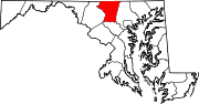
Towns Hampstead | Manchester | Mount Airy‡ | New Windsor | Sykesville | Union Bridge
CDP Other
communitiesAlesia | Carrollton | Carrolltowne | Detour | Fairhaven | Finksburg | Frizzelburg | Gaither | Gamber | Greenmount | Harney | Henryton | Houcksville | Keymar | Keysville | Jasontown | Lineboro | Linwood | Louisville | Mayberry | Mexico | Middleburg | Millers | New Mexico | Patapsco | Pleasant Valley | Silver Run | Union Mills | Uniontown | Woodbine | Woodstock
Footnotes ‡This populated place also has portions in an adjacent county
Categories:- Towns in Maryland
- Populated places in Carroll County, Maryland


Wikimedia Foundation. 2010.