- Ellicott City, Maryland
Infobox Settlement
official_name = Ellicott City, Maryland
settlement_type = CDP
nickname =
motto =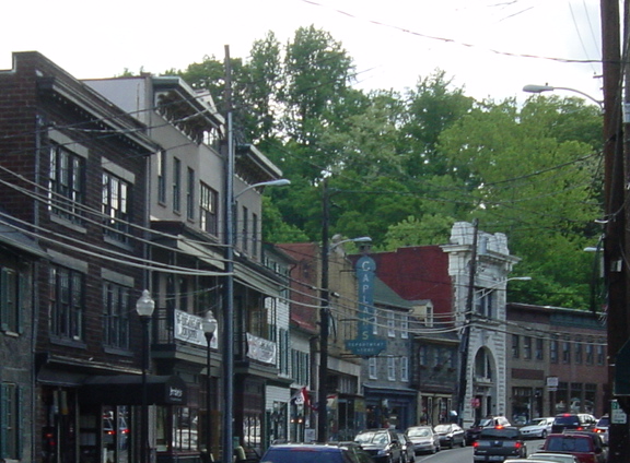
imagesize = 250px
image_caption = Main Street, Ellicott City Historic District
image_
image_
mapsize = 250x200px
map_caption = Location of Ellicott City, Maryland
mapsize1 =
map_caption1 =subdivision_type = Country
subdivision_name =United States
subdivision_type1 = State
subdivision_name1 =Maryland
subdivision_type2 = County
subdivision_name2 = Howard
government_footnotes =
government_type =
leader_title =
leader_name =
leader_title1 =
leader_name1 =
established_title =
established_date =unit_pref = Imperial
area_footnotes =area_magnitude =
area_total_km2 = 83.1
area_land_km2 = 83.0
area_water_km2 = 0.2
area_total_sq_mi = 32.1
area_land_sq_mi = 32.0
area_water_sq_mi = 0.1population_as_of = 2000
population_footnotes =
population_total = 56397
population_density_km2 = 679.9
population_density_sq_mi = 1760.9timezone = Eastern (EST)
utc_offset = -5
timezone_DST = EDT
utc_offset_DST = -4
elevation_footnotes =
elevation_m = 55
elevation_ft = 180
latd = 39 |latm = 16 |lats = 9 |latNS = N
longd = 76 |longm = 49 |longs = 50 |longEW = Wpostal_code_type =
ZIP code s
postal_code = 21041-21043
area_code = 410, 443
blank_name = FIPS code
blank_info = 24-26000
blank1_name = GNIS feature ID
blank1_info = 0584282
website =
footnotes =Ellicott City is an
unincorporated community andcensus-designated place in Howard County,Maryland ,United States . The population was 56,397 at the 2000 census. It is thecounty seat of Howard County.GR|6 Founded in 1772, the town features theBaltimore and Ohio Railroad [http://www.ecborail.org Station Museum] ,built in 1830, a downtown historic district ,which is a very popular destination amongantiques shoppers, with restaurants, eclectic boutique shops, coffee shops, a tea room and many historic sites. As of the 2000 Census, Ellicott City surpassed Towson, Maryland, as the largest unincorporatedcounty seat in the country.In July 2005, Ellicott City was ranked the 20th Best Place to Live in the United States by [http://money.cnn.com/magazines/moneymag/bplive/2005/index.html/ CNN/Money and "Money" magazine] .
In July 2006, Ellicott City/Columbia was ranked the 4th Best Place to Live in the United States by [http://money.cnn.com/magazines/moneymag/bplive/2006/index.html/ CNN/Money and "Money" magazine] .
In July 2008, Ellicott City/Columbia was ranked the 8th Best Place to Live in the United States by [http://money.cnn.com/magazines/moneymag/bplive/2008/snapshots/PL2426000.html CNN/Money and Money magazine] .
Ellicott City is listed amongst America's most affluent communities and is located in Howard County, the third wealthiest county in the United States according to the U.S. Census Bureau. [ [http://www.visithowardcounty.com/press/index.html Howard County Tourism Home Page ] ]
The downtown area is often called "Historic Ellicott City" or "Old Ellicott City", to distinguish it from the unincorporated area that extends north to the
Baltimore County line, south to Columbia, and west to West Friendship.History
In 1772, three
Quaker brothers fromBucks County, Pennsylvania , chose the picturesque wilderness, upriver from Elk Ridge Landing (known today asElkridge, Maryland ) to establish aflour mill. John, Andrew, and Joseph Ellicott founded Ellicott's Mills, which became one of the largest milling and manufacturing towns in the East.The Ellicott brothers helped revolutionize farming in the area by persuading farmers to plant
wheat instead oftobacco and also by introducing fertilizer to revitalize depleted soil. Charles Carroll, a signer of the Declaration of Independence and wealthy landowner, was an early influential convert from tobacco to wheat.In 1830, Ellicott's Mills became the first terminus of the
Baltimore and Ohio Railroad outside Baltimore. The station, built of huge blocks of locally quarried granite, stands today as a living history museum, and has been designated aNational Historic Landmark by theU.S. Department of the Interior . It bears the designation as the "Oldest surviving railroad station in America". The famous race between Peter Cooper's iron engine, the Tom Thumb, and a horse-drawn carriage took place at Relay on the return trip from Ellicott's Mills in August 1830. Even though the horse won the race due to a broken drive belt, steam engines steadily improved, and the railroad became a vital link in the town's economy.By 1861, Ellicott's Mills was a prosperous farming and manufacturing area. The site of the courthouse, which was built from 1840-1843 when the Howard District of
Anne Arundel County, Maryland , was so designated in 1839.Howard County, Maryland , became an official independent jurisdiction in 1851. On July 10, 1864 Federal troops under the command of GeneralLew Wallace retreated down theNational Pike from theBattle of Monocacy to the Baltimore and Ohio Railroad Ellicott's Mills station. Homes and churches in Ellicott's Mills were temporarily used as hospitals for the Union wounded. In 1867, a city charter was secured for Ellicott's Mills, and the name was changed to "Ellicott City." The only chartered city in the county, Ellicott City lost its charter in 1935 and was designated an historic district by the county in 1973. Ellicott City today serves as the county seat for Howard County.In the early summer of 1972, the historic downtown Main Street area was extensively flooded by
Hurricane Agnes .Historic Main Street has also been the site of several devastating fires, most notably in November 1984 and again on
November 9 ,1999 . The former was started by Leidig's Bakery's faulty air conditioning unit and destroyed six buildings; the latter, a 6-alarm blaze which destroyed five businesses and caused an estimated $2 million in damage, was accidentally started behind a restaurant by a discarded cigarette.The Ellicott City area was the home to the
fairy tale -themed amusement park known as the Enchanted Forest. The park has been closed to the general public since the early 1990s, and a shopping center (called the Enchanted Forest Shopping Center) was built on its parking lot. Many of the attractions have been moved to Clark's Elioak Farm in Ellicott City, where they are being restored. The Enchanted Forest was featured in the 1990 John Waters-directed film "Cry-Baby ", starringRicki Lake andJohnny Depp . Clark's Elioak Farm is a petting zoo/farm that is open to the public during the summer.Ellicott City has been called one of the most
haunted small towns on the east coast. The Howard County Tourism Council runs a [http://ellicottcity.net/tourism/haunted/ghost_tour/ Ghost Tour] that visits several places with reputations forparanormal activity. Among these are the mansions Lilburn, Hayden House, and Mt. Ida; the B&O railroad bridge that crosses over Main Street in the center of the town; the old Ellicott City Firehouse; and thePatapsco Female Institute . Proud Ellicott City residents use this haunted history to bring their small town into the spotlight.Geography
Ellicott City is located at coor dms|39|16|9|N|76|49|50|W|city (39.269257, -76.830545)GR|1.
According to the
United States Census Bureau , the CDP has a total area of 32.1square mile s (83.1km² ), of which, 32.0 square miles (83.0 km²) of it is land and 0.1 square miles (0.2 km²) of it (0.19%) is water.Like
Rome , Ellicott City is claimed to be built on seven hills. These hills lie southeast of the Historic District, which is on the banks of the Patapsco River. Continuing the Rome analogy, the small tributary of the Patapsco that forms the narrow valley followed by Main Street is named the Tiber River.Culture and attractions
* [http://www.ecborail.org The B&O Railroad Museum: Ellicott City Station]
*The Chesapeake Shakespeare Company
* [http://www.hocoarts.org/center.htm Howard County Center for the Arts]
* [http://www.ellicottcity.net/ Historic Main Street]
* [http://www.theenchantedforest.info/ The Enchanted Forest]
* [http://www.companionsofstanthony.org/index.htm The Shrine of St Anthony]Demographics
As of the
census GR|2 of 2000, there were 56,397 people, 20,250 households, and 15,288 families residing in the CDP. Thepopulation density was 1,760.9 people per square mile (679.8/km²). There were 20,789 housing units at an average density of 649.1/sq mi (250.6/km²). The racial makeup of the CDP was 78.33% White, 7.34% African American, 0.15% Native American, 11.90% Asian, 0.02% Pacific Islander, 0.55% from other races, and 1.71% from two or more races. Hispanic or Latino of any race were 2.14% of the population.There were 20,250 households out of which 41.2% had children under the age of 18 living with them, 65.3% were married couples living together, 7.6% had a female householder with no husband present, and 24.5% were non-families. 19.6% of all households were made up of individuals and 5.7% had someone living alone who was 65 years of age or older. The average household size was 2.76 and the average family size was 3.22.
In the CDP the population was spread out with 28.5% under the age of 18, 6.0% from 18 to 24, 30.8% from 25 to 44, 25.2% from 45 to 64, and 9.6% who were 65 years of age or older. The median age was 37 years. For every 100 females there were 95.9 males. For every 100 females age 18 and over, there were 91.9 males.
The median income for a household in the CDP was $79,031, and the median income for a family was $91,968. Males had a median income of $63,938 versus $41,721 for females. The
per capita income for the CDP was $29,287. About 2.2% of families and 3.3% of the population were below thepoverty line , including 3.3% of those under age 18 and 4.9% of those age 65 or over.Education and schools
There are eight public high schools that serve the Ellicott City area:
*Centennial High School
*Howard High School
*Long Reach High School
*Marriotts Ridge High School
*Mount Hebron High School
*River Hill High School
*Wilde Lake High School
*Glenelg High School
*Homewood Center --An alternative school for Howard County students that have experienced crisis.All of the above are part of the Howard County Public School System.While these public schools are available in the area,
Glenelg Country School is also located in Ellicott City.Families who elect not to attend public school in the area typically send their children to private schools such asMcDonogh School inOwings Mills ,Notre Dame Preparatory School inTowson ,Mount de Sales Academy inCatonsville ,Mount Saint Joseph High School inBaltimore ,Loyola Blakefield inTowson , andOur Lady of Good Counsel High School inOlney .Notable People
*
Thomas Watkins Ligon , 30th Governor of Maryland, died in Ellicott City in 1881, buried at St. John's Cemetery.
*Benjamin Banneker , the African-American self-educated scientist, astronomer, inventor, writer, and antislavery publicist was born in Ellicott's Mills, November 9, 1731.
*James A. Clark , president of theMaryland State Senate from 1979 to 1983.
*Babe Ruth , baseball player, was married in Ellicott City toHelen Woodford on October 17, 1914.
*Suzanne Malveaux , CNN reporter went to high school in Ellicott City.
* Divine briefly rented an apartment in Ellicott City as a young adult.References
External links
Wikimedia Foundation. 2010.