- Clarksburg, Maryland
-
Clarksburg, Maryland — CDP — Clarksburg, Maryland Location of Clarksburg, Maryland
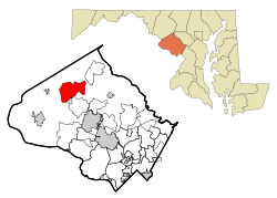
Coordinates: 39°13′10″N 77°17′17″W / 39.21944°N 77.28806°WCoordinates: 39°13′10″N 77°17′17″W / 39.21944°N 77.28806°W Country United States State Maryland County Montgomery Area - Total 8.3 sq mi (21.3 km2) - Land 8.2 sq mi (21.2 km2) - Water 0.1 sq mi (0.1 km2) Elevation 663 ft (202 m) Population (2010) - Total 13,677 - Density 4,319.9/sq mi (1,667.9/km2) Time zone Eastern (EST) (UTC-5) - Summer (DST) EDT (UTC-4) ZIP code 20871 Area code(s) 301 FIPS code 24-17350 GNIS feature ID 0583799 Clarksburg is a census-designated place and an unincorporated area in Northern Montgomery County, Maryland, United States, located along the Interstate 270 technology corridor about 4 miles north of Germantown, MD. As of Census 2010 its population is 13,766.
Contents
Geography
As an unincorporated area, Clarksburg's boundaries are not officially defined. Clarksburg is, however, recognized by the United States Census Bureau as a Census-designated Place, and by the United States Geological Survey as a populated place located at 39°13′10″N 77°17′17″W / 39.21944°N 77.28806°W (39.219488, -77.288001)[1].
According to the United States Census Bureau, it has a total area of 8.3 square miles (21 km2), of which, 8.2 square miles (21 km2) of it is land and 0.1 square miles (0.26 km2) of it (1.82%) is water.
Demographics
As of the 2010 census[2], there were 13,766 people and 4,352 households residing in the area. The population density was 1,667.9 people per square mile (51.2/km²). The population is roughly 44.1% White, 14.7% African-American, 0.1% American Indian or Alaska Native, 33.6% Asian, 0.1% Native Hawaiian or Pacific Islander, including 9.8% of the population Hispanic or Latino origin of any race.
In 2000 there were 604 households, out of which 42.1% had children under the age of 18 living with them, 72.0% were married couples living together, 6.6% had a female householder with no husband present, and 17.5% were non-families. 13.9% of all households were made up of individuals and 4.6% had someone living alone who was 65 years of age or older. The average household size was 3.04 and the average family size was 3.34.
In the area, the population was spread out with 29.3% under the age of 18, 4.8% from 18 to 24, 29.7% from 25 to 44, 27.4% from 45 to 64, and 8.8% who were 65 years of age or older. The median age was 38 years. For every 100 females there were 100.2 males. For every 100 females age 18 and over, there were 103.6 males.
The median income for a household in the CDP was $88,419, and the median income for a family was $91,216. Males had a median income of $63,125 versus $42,283 for females. The per capita income for the area was $33,174. About 3.4% of families and 4.6% of the population were below the poverty line, including 6.3% of those under age 18 and 6.8% of those age 65 or over.
History
Clarksburg is named for Native American trader John Clarke, and was established at the intersection of the main road between Georgetown and Frederick and an old Seneca trail. One of its earliest white inhabitants was a man named Ashford Dowden, who in 1752 received a patent for 40 acres (160,000 m2) from the colonial government, and two years later permission to build an inn. The inn itself is a footnote in history, hosting the army of General Edward Braddock during the French and Indian War, serving as a meeting place for local Sons of Liberty in the years before the American Revolution, and possibly serving dinner to President Andrew Jackson on his way to his inauguration. Jamie, grandson of the trader, built a general store in the area around 1770, and over the next thirty years enough people moved to the area that Clark was appointed postmaster for the community. By 1875, Clarksburg was a major town in the northern part of the county, but the construction of the Baltimore and Ohio Railroad undermined its economy, and by the late 20th century Clarksburg was barely a shell of its former self. Most of the original buildings are gone, but the area has been rebuilt as a suburban bedroom community, and is again a major population center.[3]
Development
Since 2000 there has been major growth in the area of Clarksburg. A new town center is being built in the heart of Clarksburg, near the historic center. 2010 Census data show that there are now over 13,677 residents and 4,352 households currently residing in Clarksburg, which consists of a diverse population with a high level of education attainment. Several public parks [4] and schools have also been developed to help accommodate the growth. In recent years it was discovered that many new houses have had been built closer together than the minimum distance required by zoning laws, roads built too narrow for firetrucks to pass, homes and community facilities built without adequate permits or approvals by local authorities. This was found to be the fault of inadequate county oversight and lax enforcement of building codes and laws combined with a building boom in the early 2000s.
School enrollment issue
School Name School Enrollment Capacity School Enrollment As of 2006-2007
Projected Enrollment (2011–2012) According to MCPS
Percent Increase From '06-'07 to '11-'12
Percent Above/Below School Enrollment Capacity For 2011-2012
Clarksburg Elementary School [5] 335 students 385 students 469 students 21.8% increase 40.0% above capacity Clarksburg High School [6] 1629 students 999 students 1479 students 48.0% increase 10.1% below capacity Little Bennett Elementary School [7] 685 students 531 students 1174 students 121.1% increase 71.4% above capacity Rocky Hill Middle School [8] 956 students 977 students 1250 students 27.9% increase 30.8% above capacity The table shows that the two newest schools, Little Bennett Elementary School and Clarksburg High School, have the largest increase of students, with Little Bennett at 71.4% above building capacity in the projections of 2011-2012. This has led to a moratorium in issuance of permits for new projects, but not issuance of permits in existing projects, for new homes in the Clarksburg, MD area.[9] The majority of planned housing units will be built in existing projects. All four of the largest neighborhoods are exempt from the moratorium.
Notable business headquarters
- Eastman Strings [10]
- Thales Communications
External links
References
- ^ "US Gazetteer files: 2010, 2000, and 1990". United States Census Bureau. 2011-02-12. http://www.census.gov/geo/www/gazetteer/gazette.html. Retrieved 2011-04-23.
- ^ "American FactFinder". United States Census Bureau. http://factfinder.census.gov. Retrieved 2008-01-31.
- ^ Offutt, William; Sween, Jane (1999). Montgomery County: Centuries of Change. American Historical Press. pp. 164–165.
- ^ Ovid Hazen Wells Recreational Park
- ^ "Clarksburg ES at a Glance (PDF)". http://www.mcps.k12.md.us/departments/regulatoryaccountability/glance/currentyear/schools/02101.pdf.
- ^ "Clarksburg HS at a Glance (PDF)". http://www.mcps.k12.md.us/departments/regulatoryaccountability/glance/currentyear/schools/04249.pdf.
- ^ "Little Bennett ES at a Glance (PDF)". http://www.mcps.k12.md.us/departments/regulatoryaccountability/glance/currentyear/schools/02336.pdf.
- ^ "Rocky Hill MS at a Glance (PDF)". http://www.mcps.k12.md.us/departments/regulatoryaccountability/glance/currentyear/schools/03707.pdf.
- ^ "County puts hold on new projects". http://www.gazette.net/stories/112107/montnew213933_32386.shtml.
- ^ "Eastman Strings". http://www.eastmanstrings.com/.
Municipalities and communities of Montgomery County, Maryland County seat: Rockville Cities 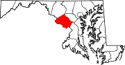
Towns Villages &
Special Tax DistrictsCDPs Ashton-Sandy Spring | Aspen Hill | Bethesda | Brookmont | Burtonsville | Cabin John | Calverton‡ | Chevy Chase | Clarksburg | Cloverly | Colesville | Damascus | Darnestown | Fairland | Forest Glen | Friendship Village | Germantown | Hillandale‡ | Kemp Mill | Montgomery Village | North Bethesda | North Kensington | North Potomac | Olney | Potomac | Redland | Rossmoor | Silver Spring | South Kensington | Travilah | Wheaton–Glenmont | White Oak
Other
communitiesAshton | Beallsville | Boyds | Brinklow | Carderock | Carole Highlands | Comus | Dawsonville | Derwood | Dickerson | Ednor | Fairview | Glenmont | Hyattstown | Kentlands | Norbeck | North Bethesda Market | Seneca | Sandy Spring | Shady Grove | Sherwood Forest | Spencerville | Wheaton
Footnotes ‡This populated place also has portions in an adjacent county or counties
Categories:- Census-designated places in Maryland
- Populated places in Montgomery County, Maryland
- Unincorporated communities in Maryland


Wikimedia Foundation. 2010.