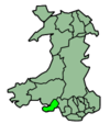
- Oystermouth
-
Oystermouth Ward 
Ordnance Survey OS grid reference: Maps for SS6188 Geography Principal locality Mumbles Total population 4,315 (2001 census) Land area (km²) 2.01 (2001 census) Administration Local council: City and County of Swansea Number of councillors: 1 Nation: Wales Post office and telephone Postcode(s): SA3 Dialling code: +44-1792 Politics Welsh Assembly: Gower UK Parliament: Gower European Parliament: Wales Oystermouth (a corruption of the Welsh name Ystum Llwynarth or Ystumllwynarth) is an electoral ward and a village in the Mumbles community and also the City and County of Swansea, Wales. The village of Oystermouth is more commonly known as the Mumbles.
The electoral ward consists of some or all of the following areas: Oystermouth, the Mumbles, Thistleboon, Limeslade, in the parliamentary constituency of Gower. The ward is bounded by Newton to the west, West Cross to the north and Swansea Bay to the south and east.
Description
The ward consists of suburban housing stretching from the northwest to the south east. It is surrounded by the sea to the east and south. Two hills at Rams Tor and Mumbles Hill have little development. Mumbles Hill is now a protected nature reserve managed by the local council. The boundaries of Mumbles community and the Oystermouth ward are clearly defined. However, in the public mind, the separation between villages of Oystermouth and Mumbles is not clear. Local buses to the area are signed as Oystermouth, however most people from the area would say they are living in Mumbles.
Local beaches include the southern tip of Swansea Bay, Bracelet Bay and Limeslade Bay. From the Mumbles Head area there are views towards Swansea, Port Talbot and the hills of the South Wales Coalfield.
As well as being a local service centre, Oystermouth Castle is well preserved, in grounds with views over Swansea Bay.
Oystermouth was served by one of the very earliest passenger rail services, along a shoreline railway used in the 19th century to transport limestone and coal. The long-disused (since the 1960s) route remains as a cycle/footpath.
2008 local council elections
For the 2008 local council elections, electorate turnout was 42.91%. The election results were:
Candidate Party Votes Status Anthony Colburn Conservative 556 Conservative gain Roger Barnabas Beynon Liberal Democrats 436 Rhodri Griffiths Green Party 263 Joan Thyrza Gwenllian Peters Independents 241 Categories:- Villages in Swansea
- Swansea electoral wards
Wikimedia Foundation. 2010.

