- Montague, Massachusetts
-
Montague, Massachusetts — Town — Town Hall, built in 1858 Location in Franklin County in Massachusetts
Coordinates: 42°32′08″N 72°32′08″W / 42.53556°N 72.53556°WCoordinates: 42°32′08″N 72°32′08″W / 42.53556°N 72.53556°W Country United States State Massachusetts County Franklin Settled 1715 Incorporated 1754 Government – Type Representative town meeting Area – Total 31.4 sq mi (81.4 km2) – Land 30.4 sq mi (78.7 km2) – Water 1.0 sq mi (2.6 km2) Elevation 235 ft (72 m) Population (2000) – Total 8,489 – Density 279.2/sq mi (107.8/km2) Time zone Eastern (UTC-5) – Summer (DST) Eastern (UTC-4) ZIP code 01351 Area code(s) 413 FIPS code 25-42285 GNIS feature ID 0618171 Montague is a town in Franklin County, Massachusetts, United States. The population was 8,489 at the 2000 census. It is part of the Springfield, Massachusetts metropolitan statistical area.
The villages of Montague Center, Montague City, Lake Pleasant, Millers Falls, and Turners Falls are located in the town of Montague.
Contents
History
Originally inhabited by the Pocomtuc tribe, the area was known as Peskeompskut. Montague was first settled in 1715 and was incorporated in 1754. The town has five villages within it: Montague Center, Montague City, Turners Falls, Millers Falls, and Lake Pleasant. The Turners Falls Canal through Montague was one of the first canals in the United States, and important in early transport along the Connecticut River[citation needed], and Lake Pleasant was a prominent spiritualist campground.
-

Montague Center in 1907
-

Montague City in 1907
-

Old Red Bridge in 1907
Geography
According to the United States Census Bureau, the town has a total area of 31.4 square miles (81 km2), of which, 30.4 square miles (79 km2) is land and 1.0 square mile (2.6 km2) (3.22%) is water. Bounded on the west by the Connecticut River, Montague is drained by the Millers River.
The town is served by state routes 2, 47 and 63.
Demographics
Historical populations Year Pop. ±% 1850 1,518 — 1860 1,593 +4.9% 1870 2,224 +39.6% 1880 4,875 +119.2% 1890 6,296 +29.1% 1900 6,150 −2.3% 1910 6,866 +11.6% 1920 7,675 +11.8% 1930 8,081 +5.3% 1940 7,582 −6.2% 1950 7,812 +3.0% 1960 7,836 +0.3% 1970 8,451 +7.8% 1980 8,011 −5.2% 1990 8,316 +3.8% 2000 8,489 +2.1% 2001* 8,457 −0.4% 2002* 8,462 +0.1% 2003* 8,424 −0.4% 2004* 8,386 −0.5% 2005* 8,351 −0.4% 2006* 8,276 −0.9% 2007* 8,227 −0.6% 2008* 8,202 −0.3% 2009* 8,161 −0.5% 2010 8,437 +3.4% * = population estimate.
Source: United States Census records and Population Estimates Program data.[1][2][3][4][5][6][7][8][9][10]As of the census[11] of 2000, there were 8,489 people, 3,616 households, and 2,169 families residing in the town. The population density was 279.2 people per square mile (107.8/km²). There were 3,844 housing units at an average density of 126.4 per square mile (48.8/km²). The racial makeup of the town was 95.13% White, 0.84% African American, 0.39% Native American, 0.93% Asian, 0.11% Pacific Islander, 0.68% from other races, and 1.92% from two or more races. Hispanic or Latino of any race were 2.56% of the population.
There were 3,616 households out of which 28.7% had children under the age of 18 living with them, 42.9% were married couples living together, 12.4% had a female householder with no husband present, and 40.0% were non-families. 31.9% of all households were made up of individuals and 13.5% had someone living alone who was 65 years of age or older. The average household size was 2.31 and the average family size was 2.90.
In the town the population was spread out with 23.0% under the age of 18, 7.8% from 18 to 24, 29.3% from 25 to 44, 23.4% from 45 to 64, and 16.5% who were 65 years of age or older. The median age was 39 years. For every 100 females there were 90.4 males. For every 100 females age 18 and over, there were 88.6 males.
The median income for a household in the town was $33,750, and the median income for a family was $43,194. Males had a median income of $33,705 versus $27,303 for females. The per capita income for the town was $17,794. About 9.1% of families and 13.1% of the population were below the poverty line, including 17.5% of those under age 18 and 10.1% of those age 65 or over.
See also
- Bookmill
- Canalside Rail Trail
- Canalside Rail Trail Bridge
- General Pierce Bridge
- Montague Center Historic District
- Montague Nuclear Power Plant
- Springfield Terminal railroad bridge
- Turners Falls Road Bridge
- Deerfield Massacre
Notable residents
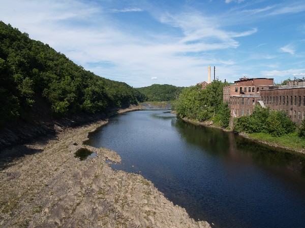
 Connecticut River at Turners Falls
- Christopher Baldwin, illustrator and author
- BOBBY, a group of indie folk musicians[12][13]
- Rico Brogna, first baseman
- Eric Chester, author, activist and professor
- Cornelia Clapp, zoologist
- Philip H. Hoff, governor of Vermont
- Howes Brothers, photographers
- Samuel L. Montague, politician
- Isaac Morley, religious leader
- Charles Boudinot Root, silversmith and businessman
- Sidney Root, businessman
- Luther Severance, congressman
- Doug Smith, relief pitcher
- Tommy "Foghorn" Tucker, 3rd all-time for hit-by-pitch in major league baseball
References
- ^ "TOTAL POPULATION (P1), 2010 Census Summary File 1, All County Subdivisions within Massachusetts". United States Census Bureau. http://factfinder2.census.gov/bkmk/table/1.0/en/DEC/10_SF1/P1/0400000US25.06000. Retrieved September 13, 2011.
- ^ "Massachusetts by Place and County Subdivision - GCT-T1. Population Estimates". United States Census Bureau. http://factfinder.census.gov/servlet/GCTTable?_bm=y&-geo_id=04000US25&-_box_head_nbr=GCT-T1&-ds_name=PEP_2009_EST&-_lang=en&-format=ST-9&-_sse=on. Retrieved July 12, 2011.
- ^ "1990 Census of Population, General Population Characteristics: Massachusetts". US Census Bureau. December 1990. Table 76: General Characteristics of Persons, Households, and Families: 1990. 1990 CP-1-23. http://www.census.gov/prod/cen1990/cp1/cp-1-23.pdf. Retrieved July 12, 2011.
- ^ "1980 Census of the Population, Number of Inhabitants: Massachusetts". US Census Bureau. December 1981. Table 4. Populations of County Subdivisions: 1960 to 1980. PC80-1-A23. http://www2.census.gov/prod2/decennial/documents/1980a_maABC-01.pdf. Retrieved July 12, 2011.
- ^ "1950 Census of Population". Bureau of the Census. 1952. Section 6, Pages 21-10 and 21-11, Massachusetts Table 6. Population of Counties by Minor Civil Divisions: 1930 to 1950. http://www2.census.gov/prod2/decennial/documents/23761117v1ch06.pdf. Retrieved July 12, 2011.
- ^ "1920 Census of Population". Bureau of the Census. Number of Inhabitants, by Counties and Minor Civil Divisions. Pages 21-5 through 21-7. Massachusetts Table 2. Population of Counties by Minor Civil Divisions: 1920, 1910, and 1920. http://www2.census.gov/prod2/decennial/documents/41084506no553ch2.pdf. Retrieved July 12, 2011.
- ^ "1890 Census of the Population". Department of the Interior, Census Office. Pages 179 through 182. Massachusetts Table 5. Population of States and Territories by Minor Civil Divisions: 1880 and 1890. http://www2.census.gov/prod2/decennial/documents/41084506no553ch2.pdf. Retrieved July 12, 2011.
- ^ "1870 Census of the Population". Department of the Interior, Census Office. 1872. Pages 217 through 220. Table IX. Population of Minor Civil Divisions, &c. Massachusetts. http://www2.census.gov/prod2/decennial/documents/1870e-05.pdf. Retrieved July 12, 2011.
- ^ "1860 Census". Department of the Interior, Census Office. 1864. Pages 220 through 226. State of Massachusetts Table No. 3. Populations of Cities, Towns, &c.. http://www2.census.gov/prod2/decennial/documents/1860a-08.pdf. Retrieved July 12, 2011.
- ^ "1850 Census". Department of the Interior, Census Office. 1854. Pages 338 through 393. Populations of Cities, Towns, &c.. http://www2.census.gov/prod2/decennial/documents/1850c-11.pdf. Retrieved July 12, 2011.
- ^ "American FactFinder". United States Census Bureau. http://factfinder.census.gov. Retrieved 2008-01-31.
- ^ "BOBBY, 'Sore Spores' -- Free MP3 Download". Spinner. March 7, 2011. http://www.spinner.com/2011/03/07/bobby-sore-spores-free-mp3-download/. Retrieved 2011-05-24. "Artist: BOBBY Hail From: Montague, Mass...."
- ^ "BOBBY". Jazner. March 28th, 2011. http://jazner.com/?tag=partisan-records. Retrieved 2011-05-24. "Sore Spores"
External links
- Town of Montague, Massachusetts
- Turners Falls Water Department
- Turners Falls Fire Department
- Montague Library System
- Montague Center Library
- MontagueMA.net, a community website running since 1999
- A local political blog
- PowerTowneDistro.com a local political blog and forum
- Great Falls Discovery Center - Turner's Falls MA
Municipalities and communities of Franklin County, Massachusetts City 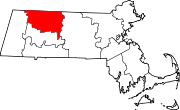
Towns Ashfield | Bernardston | Buckland | Charlemont | Colrain | Conway | Deerfield | Erving | Gill | Hawley | Heath | Leverett | Leyden | Monroe | Montague | New Salem | Northfield | Orange | Rowe | Shelburne | Shutesbury | Sunderland | Warwick | Wendell | Whately
CDPs Other
villagesLake Pleasant | Satans Kingdom | Zoar
Categories:- Montague, Massachusetts
- Towns in Franklin County, Massachusetts
- Springfield, Massachusetts metropolitan area
- Populated places on the Connecticut River
-


Wikimedia Foundation. 2010.