- Montgomery, Massachusetts
-
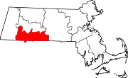
Montgomery, Massachusetts — Town — Montgomery Town Offices Location in Hampden County in Massachusetts
Coordinates: 42°12′N 72°48′W / 42.2°N 72.8°WCoordinates: 42°12′N 72°48′W / 42.2°N 72.8°W Country United States State Massachusetts County Hampden Settled 1767 Incorporated 1780 Government – Type Open town meeting Area – Total 15.2 sq mi (39.3 km2) – Land 15.1 sq mi (39.0 km2) – Water 0.1 sq mi (0.3 km2) Elevation 1,049 ft (320 m) Population (2010) – Total 838 – Density 55.1/sq mi (21.3/km2) Time zone Eastern (UTC-5) – Summer (DST) Eastern (UTC-4) ZIP code 01085 Area code(s) 413 FIPS code 25-42530 GNIS feature ID 0618189 Montgomery is a town in Hampden County, Massachusetts, United States. The population was 838 at the 2010 census. It is part of the Springfield, Massachusetts Metropolitan Statistical Area.
Contents
History
Montgomery was first settled in 1767 and was officially incorporated in 1780. The town was named after General Richard Montgomery, who died in the Battle of Quebec.[1]
Geography
According to the United States Census Bureau, the town has a total area of 15.2 square miles (39 km2), of which, 15.1 square miles (39 km2) of it is land and 0.1 square miles (0.26 km2) of it (0.86%) is water. Montgomery is bordered by Southampton to the northeast, Westfield to the southeast, Russell to the southwest, and Huntington to the northwest.
Demographics
Historical populations Year Pop. ±% 1850 393 — 1860 371 −5.6% 1870 318 −14.3% 1880 303 −4.7% 1890 266 −12.2% 1900 273 +2.6% 1910 217 −20.5% 1920 229 +5.5% 1930 141 −38.4% 1940 178 +26.2% 1950 157 −11.8% 1960 333 +112.1% 1970 446 +33.9% 1980 637 +42.8% 1990 759 +19.2% 2000 654 −13.8% 2001* 672 +2.8% 2002* 693 +3.1% 2003* 707 +2.0% 2004* 719 +1.7% 2005* 722 +0.4% 2006* 725 +0.4% 2007* 736 +1.5% 2008* 724 −1.6% 2009* 729 +0.7% 2010 838 +15.0% * = population estimate.
Source: United States Census records and Population Estimates Program data.[2][3][4][5][6][7][8][9][10][11]As of the census[12] of 2000, there were 654 people, 253 households, and 200 families residing in the town. The population density was 43.4 people per square mile (16.8/km²). There were 257 housing units at an average density of 17.1 per square mile (6.6/km²). The racial makeup of the town was 98.01% White, 0.31% Native American, 0.31% Asian, 0.31% from other races, and 1.07% from two or more races. Hispanic or Latino of any race were 0.76% of the population.
There were 253 households out of which 29.2% had children under the age of 18 living with them, 71.9% were married couples living together, 5.1% had a female householder with no husband present, and 20.6% were non-families. 15.8% of all households were made up of individuals and 3.6% had someone living alone who was 65 years of age or older. The average household size was 2.58 and the average family size was 2.84.
In the town the population was spread out with 22.9% under the age of 18, 4.4% from 18 to 24, 27.5% from 25 to 44, 34.4% from 45 to 64, and 10.7% who were 65 years of age or older. The median age was 42 years. For every 100 females there were 104.4 males. For every 100 females age 18 and over, there were 104.0 males.
The median income for a household in the town was $59,063, and the median income for a family was $66,250. Males had a median income of $46,406 versus $37,125 for females. The per capita income for the town was $25,942. About 1.0% of families and 2.9% of the population were below the poverty line, including none of those under age 18 and 11.1% of those age 65 or over.
Montgomery is a town without its own zip code uses Huntington (01050) and Westfield (01085) for zip codes.
References
- ^ "Profile for Montgomery, Massachusetts". ePodunk. http://www.epodunk.com/cgi-bin/genInfo.php?locIndex=3046. Retrieved 2010-04-24.
- ^ "TOTAL POPULATION (P1), 2010 Census Summary File 1, All County Subdivisions within Massachusetts". United States Census Bureau. http://factfinder2.census.gov/bkmk/table/1.0/en/DEC/10_SF1/P1/0400000US25.06000. Retrieved September 13, 2011.
- ^ "Massachusetts by Place and County Subdivision - GCT-T1. Population Estimates". United States Census Bureau. http://factfinder.census.gov/servlet/GCTTable?_bm=y&-geo_id=04000US25&-_box_head_nbr=GCT-T1&-ds_name=PEP_2009_EST&-_lang=en&-format=ST-9&-_sse=on. Retrieved July 12, 2011.
- ^ "1990 Census of Population, General Population Characteristics: Massachusetts". US Census Bureau. December 1990. Table 76: General Characteristics of Persons, Households, and Families: 1990. 1990 CP-1-23. http://www.census.gov/prod/cen1990/cp1/cp-1-23.pdf. Retrieved July 12, 2011.
- ^ "1980 Census of the Population, Number of Inhabitants: Massachusetts". US Census Bureau. December 1981. Table 4. Populations of County Subdivisions: 1960 to 1980. PC80-1-A23. http://www2.census.gov/prod2/decennial/documents/1980a_maABC-01.pdf. Retrieved July 12, 2011.
- ^ "1950 Census of Population". Bureau of the Census. 1952. Section 6, Pages 21-10 and 21-11, Massachusetts Table 6. Population of Counties by Minor Civil Divisions: 1930 to 1950. http://www2.census.gov/prod2/decennial/documents/23761117v1ch06.pdf. Retrieved July 12, 2011.
- ^ "1920 Census of Population". Bureau of the Census. Number of Inhabitants, by Counties and Minor Civil Divisions. Pages 21-5 through 21-7. Massachusetts Table 2. Population of Counties by Minor Civil Divisions: 1920, 1910, and 1920. http://www2.census.gov/prod2/decennial/documents/41084506no553ch2.pdf. Retrieved July 12, 2011.
- ^ "1890 Census of the Population". Department of the Interior, Census Office. Pages 179 through 182. Massachusetts Table 5. Population of States and Territories by Minor Civil Divisions: 1880 and 1890. http://www2.census.gov/prod2/decennial/documents/41084506no553ch2.pdf. Retrieved July 12, 2011.
- ^ "1870 Census of the Population". Department of the Interior, Census Office. 1872. Pages 217 through 220. Table IX. Population of Minor Civil Divisions, &c. Massachusetts. http://www2.census.gov/prod2/decennial/documents/1870e-05.pdf. Retrieved July 12, 2011.
- ^ "1860 Census". Department of the Interior, Census Office. 1864. Pages 220 through 226. State of Massachusetts Table No. 3. Populations of Cities, Towns, &c.. http://www2.census.gov/prod2/decennial/documents/1860a-08.pdf. Retrieved July 12, 2011.
- ^ "1850 Census". Department of the Interior, Census Office. 1854. Pages 338 through 393. Populations of Cities, Towns, &c.. http://www2.census.gov/prod2/decennial/documents/1850c-11.pdf. Retrieved July 12, 2011.
- ^ "American FactFinder". United States Census Bureau. http://factfinder.census.gov. Retrieved 2008-01-31.
Sean Cook
External links
- Gateway Regional High School
- MHC Survey Reconnaissance Town Report: Montgomery Massachusetts Historical Commission, 1982.
Municipalities and communities of Hampden County, Massachusetts Cities Agawam | Chicopee | Holyoke | Palmer | Springfield | West Springfield | Westfield
Towns CDPs Other
villageFootnotes ‡This populated place also has portions in an adjacent county or counties
Categories:- Towns in Hampden County, Massachusetts
- Springfield, Massachusetts metropolitan area


Wikimedia Foundation. 2010.