- South Lake Tahoe, California
Infobox Settlement
official_name = South Lake Tahoe, California
settlement_type =City 
imagesize =
image_caption =
image_
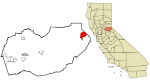
mapsize = 250x200px
map_caption = Location in El Dorado County and the state ofCalifornia
mapsize1 =
map_caption1 =
subdivision_type = Country
subdivision_type1 = State
subdivision_type2 = County
subdivision_name =United States
subdivision_name1 =California
subdivision_name2 = El Dorado
government_type =Mayor-council
leader_title =Mayor
leader_name = Michael Weber
leader_title1 = Senate
leader_name1 =Dave Cox (R)
leader_title2 = Assembly
leader_name2 =Ted Gaines (R)
leader_title3 = U.S. Congress
leader_name3 =John Doolittle (R)
established_date =
area_magnitude =
area_total_km2 = 42.7
area_total_sq_mi = 16.5
area_land_km2 = 26
area_land_sq_mi = 10.1
area_water_km2 = 16.7
area_water_sq_mi = 6.4
elevation_ft = 6237
elevation_m = 1901
population_as_of = 2000
population_footnotes =
population_total = 23609
population_metro =
population_density_km2 = 552.9
population_density_sq_mi = 1430.8
timezone = Pacific (PST)
utc_offset = -8
latd = 38 |latm = 55 |lats = 45 |latNS = N
longd = 119 |longm = 59 |longs = 4 |longEW = W
timezone_DST = PDT
utc_offset_DST = -7
postal_code_type =ZIP code
postal_code = 96150
area_code = 530
blank_name = FIPS code
blank_info = 06-73108
blank1_name = GNIS feature ID
blank1_info = 1659822
footnotes =
website = http://www.cityofslt.us/South Lake Tahoe is a city in El Dorado County,
California , in theSierra Nevada Mountains . The population was 23,609 at the 2000 census. The east end of the city, on theCalifornia -Nevada state line, is mainly geared towards tourism, with T-shirt shops, restaurants, hotels, and theHeavenly Ski Resort with the Nevada casinos just across the state line inStateline, Nevada . The city extends about five miles west-southwest along U.S. Route 50, also known as Lake Tahoe Blvd. The western end of town is mainly residential, and clusters around "The Y", the X-shaped intersection of US 50, State Route 89, and Lake Tahoe Boulevard after it loses its state highway designation.According to the
United States Census Bureau , the city has a total area of 16.5square mile s (42.7km² ), of which, 10.1 square miles (26.1 km²) of it is land and 6.4 square miles (16.7 km²) of it (39.03%) is water. Elevation is 6260 ft.South Lake Tahoe is part of the Sacramento–Arden-Arcade–Roseville Metropolitan Statistical Area.
Demographics
As of the
census GR|2 of 2000, there were 23,609 people, 9,410 households, and 5,391 families residing in the city. Thepopulation density was 2,347.5 people per square mile (906.1/km²). There were 14,005 housing units at an average density of 1,392.5/sq mi (537.5/km²). The racial makeup of the city was 75.73% White, 0.75% Black or African American, 0.97% Native American, 6.01% Asian, 0.17% Pacific Islander, 12.48% from other races, and 3.90% from two or more races. 26.66% of the population were Hispanic or Latino of any race.There were 9,410 households out of which 30.9% had children under the age of 18 living with them, 39.3% were married couples living together, 12.0% had a female householder with no husband present, and 42.7% were non-families. 29.1% of all households were made up of individuals and 7.1% had someone living alone who was 65 years of age or older. The average household size was 2.50 and the average family size was 3.15.In the city the population was spread out with 25.2% under the age of 18, 11.4% from 18 to 24, 33.0% from 25 to 44, 21.9% from 45 to 64, and 8.6% who were 65 years of age or older. The median age was 33 years. For every 100 females there were 107.0 males. For every 100 females age 18 and over, there were 107.4 males.
The median
income for a household in the city was $34,707, and the median income for a family was $40,572. Males had a median income of $26,352 versus $22,280 for females. Theper capita income for the city was $18,452. About 9.1% of families and 12.5% of the population were below thepoverty line , including 13.7% of those under age 18 and 7.0% of those age 65 or over. South Lake Tahoe is located at coor dms|38|55|45|N|119|59|4|W|city (38.929237, -119.984347)GR|1. As its name suggests it is located on the southern shore ofLake Tahoe , right next to theNevada border and the town ofStateline, Nevada .Politics
In the state legislature South Lake Tahoe is located in the 1st Senate District, represented by Republican
Dave Cox , and in the 4th Assembly District, represented by RepublicanTed Gaines . Federally, South Lake Tahoe is located inCalifornia's 4th congressional district , which has a Cook PVI of R +11 [cite web | title = Will Gerrymandered Districts Stem the Wave of Voter Unrest? | publisher = Campaign Legal Center Blog | url=http://www.clcblog.org/blog_item-85.html | accessdate = 2007-10-20] and is represented by RepublicanJohn Doolittle .Angora Fire
On Sunday, June 24th 2007, a
wildfire broke out at theSeneca Pond recreation area ( [http://www.590klbj.com/News/Article.aspx?ID=1165263] ). Known as the Angora Fire, the situation was the worst of its kind in Lake Tahoe history. [cite web | url=http://tahoehomes.wordpress.com/2007/06/25/lake-tahoe-forest-fire-angora-fire/| title=Lake Tahoe Fire-Angora Fire| accessdate=2007-06-29 | publisher=Blog at WordPress.com.]The fire spread through out the region destroying homes and forests. Highway closures followed by evacuations put the city in the direct line of the fire. Hotels in the area responded by opening their doors to the hundreds of evacuees that needed shelter.
On June 25th, a state of emergency was announced by, Lt. Gov.
John Garamendi acting on behalf of the absent GovernorArnold Schwarzenegger who was traveling inEurope . No lives were lost. Over three thousand acres (12.5 square kilometers) were burned with more than 275 structures, including 254 homes and 26 buildings damaged ( [http://sfgate.com/cgi-bin/article.cgi?f=/c/a/2007/06/28/BAG6AQNJD94.DTL] ). On June 27th, GovernorArnold Schwarzenegger , toured the area after he returned to California.Full containment of the fire was announced on July 2nd, 2007, two days before the 4th of July holiday.
References
External links
* [http://www.cityofslt.us/ City Website]
* [http://www.ltcc.edu/ Lake Tahoe Community College]
* [http://www.eldoradocountyweather.com/ El Dorado County Weather]
* [http://www.tahoedetails.com/ South Lake Tahoe Real Estate Stats]
Wikimedia Foundation. 2010.