- Sherborn, Massachusetts
Infobox Settlement
official_name = Sherborn, Massachusetts
nickname =
motto =
imagesize =
image_caption =
image_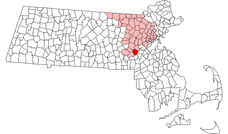
mapsize = 250px
map_caption = Location in Middlesex County in Massachusetts
mapsize1 =
map_caption1 =
subdivision_type = Country
subdivision_name =United States
subdivision_type1 = State
subdivision_name1 =Massachusetts
subdivision_type2 = County
subdivision_name2 = Middlesex
established_title = Settled
established_date = 1652
established_title2 = Incorporated
established_date2 = 1674
established_title3 =
established_date3 =
government_type =Open town meeting
leader_title =
leader_name =
leader_title1 =
leader_name1 =
area_magnitude =
area_total_km2 = 41.9
area_total_sq_mi = 16.2
area_land_km2 = 41.3
area_land_sq_mi = 16.0
area_water_km2 = 0.6
area_water_sq_mi = 0.2
population_as_of = 2007
settlement_type = Town
population_total = 4,217
population_density_km2 = 102.1
population_density_sq_mi = 263.6
elevation_m = 53
elevation_ft = 175
timezone = Eastern
utc_offset = -5
timezone_DST = Eastern
utc_offset_DST = -4
latd = 42 |latm = 14 |lats = 20 |latNS = N
longd = 71 |longm = 22 |longs = 13 |longEW = W
website = http://www.sherbornma.org
postal_code_type = ZIP code
postal_code = 01770
area_code = 508 / 774
blank_name = FIPS code
blank_info = 25-61380
blank1_name = GNIS feature ID
blank1_info = 0618233
footnotes =Sherborn is a town in Middlesex County,
Massachusetts ,United States . It is inarea code 508 and has theZIP code 01770. As of the 2004 annual report, the town population was 4,552. The assessed value of the town for thefiscal year 2005 is $1,008,146,994.Sherborn shares its highly ranked public school system with the town of Dover. In addition to Dover, Sherborn is bordered by the towns of Natick, Framingham, Ashland, Millis, Holliston, and Medfield.
History
Primarily a farming community until the early part of the 20th century, Sherborn now is a bedroom town for Boston and the surrounding hi-tech area.
Indians
Little is known about the local Indians. There appear to have been permanent settlements, for the earliest
deed of one area refers to the "old fields"; and various implements have been both plowed up and found at Rocky Narrows and nearFarm Pond . However, even the name of the tribe is uncertain, for Sherborn seems to have been at the interface between the Massachusetts and theNipmuck tribes. Several Indians kept land in town after its incorporation (e.g. Peter Ephriam on Brush Hill and Thomas Awussamoag); they appear to have been connected with the Natick "Praying Indian" community.English settlement
The whole
Charles River valley from South Natick to the falls atMedway kept its Indian name "Boggestow"; it was sought out by the English because of the abundant marsh grass growing on the wide flood plain. The earliest Sherborn land owned by the English took the form of large (200-1074 acres) grants called "farmes" made by the General Court beginning in the 1640s to individuals for payment of services rendered to the colony. These owners later sold land to settlers, the first resale being to Thomas Holbrook, and Nicholas Wood in 1652. They and successive settlers bought those wilderness lands and lived there while retaining their citizenship in the nearest incorporated town: Medfield.Town
By 1674 Boggestow had grown sufficiently to be incorporated as a new town (i.e. the land had never been part of another town) and was arbitrarily named "Sherborne" by the General Court. The original area was of such an awkward shape that the General Court allowed an exchange of 4000 acres (16 km²) with the Natick Indians in 1679; and it was that new land which formed most of the present town.
In the decade after
King Philip's War (1675-6) Sherborn settlers organized the local government and drew up a Social Covenant, paid the Indians for land title, attracted a saw miller, built a Meeting House and called the first minister, and granted home lots throughout most of the present town. In the second decade they formed a townmilitia company, hired a schoolmaster, and acquired a gristmill. Thus by 1700 they had become an "established" town.General development
Throughout the 17th, 18th and 19th centuries Sherborn remained a small and relatively self-sufficient farming community. Little industry developed because of the lack of good water power, although there continued to be saw and
gristmill s on several of the small, intermittentstreams . However, apples grew well, and there were always small cider mills. With the coming of both the railroad and steam power one mill developed further, until by the 1890s it was advertised as the "largest refined cider mill in the world". At that time it pressed over 1.25 million gallons of cider per season and exported "Champagne" cider as far west asNebraska andTexas and as far East asEngland andBelgium .In the late 18th century and early 19th century several small cottage industries developed, particularly along North Main Street. They produced guns, shoes, willow baskets, whips, pitchforks and edge tools. Cranberries became an important crop, as well as mixed farming and dairying. Crops and crafts were sold in the Boston markets via
stagecoach and laterrailroad .The early 20th century saw several new trends. In the early 1900s several wealthy families moved into different parts of town and built estates for either year-round or summer use. Those remaining today are located primarily along the
Charles River - The area of first settlement. Dairy and poultry raising increased in importance, as did service related jobs.Following
World War II the town began to change rapidly from one with a relatively static population (c. 1500) to a growing and transient one. Developments were built in 1, 2, and convert|3|acre|m2|sing=on zones. The disappearance of family farms accelerated as the town became increasingly suburban; today estate-farms form most of the few farms which remain. Over 50% of the town's area is open space. The town is trying hard to retain its rural character; but that is increasingly difficult as land prices and taxes escalate.In the late 1990s and the early 21st century, the downtown area underwent significant expansion, including the construction of a new fire department, the addition of a
skate park for the towns youth in 2002, and in 2005, new stores in a lot previously occupied by a decrepit, closed gas station.Houses
Because the town was relatively poor in the late 19th century and early 20th century few people "modernized" their old houses by tearing them down and rebuilding. As a result many of the houses built in the 18th century and early 19th century remain, as well as six or more with portions dating from the late 17th century. Two National Register Historic Districts have been established to include the old Town Center and a two-mile (3 km) strip along North Main Street; and scattered individual houses have also been listed: a total of 77 old houses. A very small Town Historic District also exists in the old Town Center. There are many houses that still stand that were built before the Revolutionary War.
The former house of Colonel
Samuel Bullard (1733-1807) has been renovated and is now known as The Sherborn Inn.Government
The town is governed by a combination of elected and appointed volunteers and a few key salaried officials. Since town government was set up c. 1678 it has been run by the Selectmen (3 at present) and the traditional open Town Meeting, at which all citizens vote annually on major expenditures and policies. There is no industry zoned in the town. Property taxes support town government and services. Public services are minimal and homeowners rely on individual wells and septic systems. There are a full full-time
Police Force and Highway Dept. and both a volunteer "call" Fire Dept. and a rescue Squad, all highly trained. The town has three churches and a modernpublic library . The schools are small and excellent; the elementary school is local, whereas the junior and senior high schools are regionalized with Dover, a similar town across the Charles River. Town Boards and other organizations depend almost entirely upon volunteer participation, as they have for over three hundred years.Geography
The town is located convert|18|mi|km southwest of
Boston . According to theUnited States Census Bureau , the town has a total area of 16.2 square miles (41.9 km²), of which, 16.0 square miles (41.3 km²) of it is land and 0.2 square miles (0.6 km²) of it (1.36%) is water. with much of that located in Farm Pond.Demographics
As of the
census GR|2 of 2000, there were 4,200 people, 1,423 households, and 1,222 families residing in the town. Thepopulation density was 263.1 people per square mile (101.6/km²). There were 1,451 housing units at an average density of 90.9/sq mi (35.1/km²). The racial makeup of the town was 96.50% White, 0.38% African American, 0.05% Native American, 2.40% Asian, 0.26% from other races, and 0.40% from two or more races. Hispanic or Latino of any race were 1.12% of the population.There were 1,423 households out of which 46.2% had children under the age of 18 living with them, 77.5% were married couples living together, 6.3% had a female householder with no husband present, and 14.1% were non-families. 12.4% of all households were made up of individuals and 6.0% had someone living alone who was 65 years of age or older. The average household size was 2.95 and the average family size was 3.22.
In the town the population was spread out with 31.9% under the age of 18, 3.2% from 18 to 24, 22.9% from 25 to 44, 30.7% from 45 to 64, and 11.3% who were 65 years of age or older. The median age was 41 years. For every 100 females there were 93.4 males. For every 100 females age 18 and over, there were 89.6 males.
The median income for a household in the town was $121,693, and the median income for a family was $136,211. Males had a median income of $88,677 versus $52,043 for females. The
per capita income for the town was $58,055. About 0.7% of families and 2.3% of the population were below thepoverty line , including 2.4% of those under age 18 and 5.6% of those age 65 or over.Government
Education
Sherborn has a public elementary school and shares a middle and high school with the town of Dover.
Transportation
Notable residents
*
Stan McDonald the well known jazz clarinetist and recording artist lives in Sherborn and regularly performs with his bandThe Blue Horizon Jazz Band at the Sherborn Inn.
*Dan Rea ofCBS 4 Boston lives in Sherborn. He has also appeared in the Academy Award-nominated "Reversal of Fortune."
*Chad Urmston , the former lead singer ofDispatch and current frontman forState Radio attended Dover Sherborn High School.
*Nicholas Terrett, one of the "fathers" of the ED-drugViagra ee also
*
Greater Boston
*List of Registered Historic Places in Sherborn,Massachusetts
*MetroWest
*Open town meeting formatReferences
External links
* [http://www.sherbornma.org/ Sherborn official website]
* [http://www.doversherborn.org/ Dover-Sherborn Regional Schools official website]
* [http://home.comcast.net/~edwperry/1974History_vb.htm Online history of Sherborn]
Wikimedia Foundation. 2010.