- Carver, Massachusetts
-
Town of Carver — Town — Carver Town HallCarver Town Hall
SealLocation in Plymouth County in Massachusetts
Coordinates: 41°53′00″N 70°45′47″W / 41.8833333°N 70.76306°WCoordinates: 41°53′00″N 70°45′47″W / 41.8833333°N 70.76306°W Country United States State Massachusetts County Plymouth Settled 1660 Incorporated 1790 Government – Type Open town meeting Area – Total 39.8 sq mi (103.1 km2) – Land 37.6 sq mi (97.3 km2) – Water 2.3 sq mi (5.9 km2) Elevation 92 ft (28 m) Population (2008[1]) – Total 11,574 – Density 307.8/sq mi (119.0/km2) Time zone Eastern (UTC-5) – Summer (DST) Eastern (UTC-4) ZIP code 02330 Area code(s) 508 / 774 FIPS code 25-11665 GNIS feature ID 0618337 Website www.carverma.org  A sign for Edaville Railroad along Route 58.
Carver is a town in Plymouth County, Massachusetts, United States. The population was 11,163 at the 2000 census, with an estimated 2008 population of 11,574.[1] It is named for John Carver, the first governor of the Plymouth Colony.
Contents
Demographics
Historical populations Year Pop. ±% 1850 1,186 — 1860 1,186 +0.0% 1870 1,092 −7.9% 1880 1,039 −4.9% 1890 994 −4.3% 1900 1,104 +11.1% 1910 1,668 +51.1% 1920 891 −46.6% 1930 1,381 +55.0% 1940 1,469 +6.4% 1950 1,530 +4.2% 1960 1,949 +27.4% 1970 2,420 +24.2% 1980 6,988 +188.8% 1990 10,590 +51.5% 2000 11,163 +5.4% 2001* 11,311 +1.3% 2002* 11,454 +1.3% 2003* 11,484 +0.3% 2004* 11,530 +0.4% 2005* 11,581 +0.4% 2006* 11,645 +0.6% 2007* 11,808 +1.4% 2008* 11,935 +1.1% 2009* 12,041 +0.9% 2010 11,509 −4.4% * = population estimate.
Source: United States Census records and Population Estimates Program data.[2][3][4][5][6][7][8][9][10][11]As of the census[12] of 2000, there were 11,163 people, 3,984 households, and 3,011 families residing in the town. The population density was 297.3 people per square mile (114.8/km²). There were 4,127 housing units at an average density of 109.9 per square mile (42.4/km²). The racial makeup of the town was 95.78% White, 1.22% African American, 0.10% Native American, 0.30% Asian, 0.01% Pacific Islander, 0.96% from other races, and 1.63% from two or more races. Hispanic or Latino of any race were 0.82% of the population.
There were 3,984 households out of which 36.6% had children under the age of 18 living with them, 63.3% were married couples living together, 8.7% had a female householder with no husband present, and 24.4% were non-families. 19.7% of all households were made up of individuals and 11.7% had someone living alone who was 65 years of age or older. The average household size was 2.80 and the average family size was 3.23.
In the town the population was spread out with 27.3% under the age of 18, 6.9% from 18 to 24, 28.3% from 25 to 44, 22.8% from 45 to 64, and 14.8% who were 65 years of age or older. The median age was 37 years. For every 100 females there were 95.6 males. For every 100 females age 18 and over, there were 90.9 males.
The median income for a household in the town was $53,506, and the median income for a family was $61,738. Males had a median income of $46,414 versus $28,336 for females. The per capita income for the town was $20,398. About 4.6% of families and 5.0% of the population were below the poverty line, including 3.1% of those under age 18 and 10.8% of those age 65 or over.
Government
Carver is represented in the Massachusetts House of Representatives as a part of the Second Plymouth district, which also includes Wareham and a portion of Bourne. The town is represented in the Massachusetts Senate as a part of the First Plymouth and Bristol district, which includes Berkley, Bridgewater, Dighton, Marion, Middleborough, Raynham, Taunton and Wareham.[13] The town is patrolled by the Fourth (Middleborough) Barracks of Troop D of the Massachusetts State Police.[14]
On the national level, Carver is a part of Massachusetts's 10th congressional district, and is currently represented by Bill Keating. The state's senior (Class II) member of the United States Senate, re-elected in 2008, is John Kerry. The junior (Class I) senator, elected in 2010, is Scott Brown.
Carver is governed by the open town meeting form of government, led by a town administrator and a board of selectmen. Carver has its own police, ALS ambulance and fire departments, with a central police station, central ambulance station and three on-call firehouses, located in the north, south and center of town. There are also three post offices, each with its own ZIP code for P.O. boxes. The main ZIP code is 02330. The town's public library is located in the center of town, and is a part of the SAILS Library Network.
Education
Carver operates its own school department, led by a school committee and a superintendent of schools. There are two schools, each of which serves specific grade levels. The Carver Elementary serves pre-kindergarten through fifth grades;[15] and the Carver Middle-High School serves sixth through twelfth grades.[16]
In addition to public school, students may also choose to attend Old Colony Regional Vocational Technical High School in Rochester. There are no private schools in the town; the nearest are in Kingston, Lakeville and Taunton.
Transportation
The town is crossed in the north of town by U.S. Route 44, a two-lane divided highway. The highway was recently expanded, so that rather than the highway portion ending at Route 58 (the other main route Municipal Airport), whose right-of-way extends into Carver south of South Meadow Road. The nearest national and international airport is Logan International Airport in Boston.
References
- ^ a b "City-Data: Carver, MA". http://www.city-data.com/city/Carver-Massachusetts.html.
- ^ "TOTAL POPULATION (P1), 2010 Census Summary File 1, All County Subdivisions within Massachusetts". United States Census Bureau. http://factfinder2.census.gov/bkmk/table/1.0/en/DEC/10_SF1/P1/0400000US25.06000. Retrieved September 13, 2011.
- ^ "Massachusetts by Place and County Subdivision - GCT-T1. Population Estimates". United States Census Bureau. http://factfinder.census.gov/servlet/GCTTable?_bm=y&-geo_id=04000US25&-_box_head_nbr=GCT-T1&-ds_name=PEP_2009_EST&-_lang=en&-format=ST-9&-_sse=on. Retrieved July 12, 2011.
- ^ "1990 Census of Population, General Population Characteristics: Massachusetts". US Census Bureau. December 1990. Table 76: General Characteristics of Persons, Households, and Families: 1990. 1990 CP-1-23. http://www.census.gov/prod/cen1990/cp1/cp-1-23.pdf. Retrieved July 12, 2011.
- ^ "1980 Census of the Population, Number of Inhabitants: Massachusetts". US Census Bureau. December 1981. Table 4. Populations of County Subdivisions: 1960 to 1980. PC80-1-A23. http://www2.census.gov/prod2/decennial/documents/1980a_maABC-01.pdf. Retrieved July 12, 2011.
- ^ "1950 Census of Population". Bureau of the Census. 1952. Section 6, Pages 21-10 and 21-11, Massachusetts Table 6. Population of Counties by Minor Civil Divisions: 1930 to 1950. http://www2.census.gov/prod2/decennial/documents/23761117v1ch06.pdf. Retrieved July 12, 2011.
- ^ "1920 Census of Population". Bureau of the Census. Number of Inhabitants, by Counties and Minor Civil Divisions. Pages 21-5 through 21-7. Massachusetts Table 2. Population of Counties by Minor Civil Divisions: 1920, 1910, and 1920. http://www2.census.gov/prod2/decennial/documents/41084506no553ch2.pdf. Retrieved July 12, 2011.
- ^ "1890 Census of the Population". Department of the Interior, Census Office. Pages 179 through 182. Massachusetts Table 5. Population of States and Territories by Minor Civil Divisions: 1880 and 1890. http://www2.census.gov/prod2/decennial/documents/41084506no553ch2.pdf. Retrieved July 12, 2011.
- ^ "1870 Census of the Population". Department of the Interior, Census Office. 1872. Pages 217 through 220. Table IX. Population of Minor Civil Divisions, &c. Massachusetts. http://www2.census.gov/prod2/decennial/documents/1870e-05.pdf. Retrieved July 12, 2011.
- ^ "1860 Census". Department of the Interior, Census Office. 1864. Pages 220 through 226. State of Massachusetts Table No. 3. Populations of Cities, Towns, &c.. http://www2.census.gov/prod2/decennial/documents/1860a-08.pdf. Retrieved July 12, 2011.
- ^ "1850 Census". Department of the Interior, Census Office. 1854. Pages 338 through 393. Populations of Cities, Towns, &c.. http://www2.census.gov/prod2/decennial/documents/1850c-11.pdf. Retrieved July 12, 2011.
- ^ "American FactFinder". United States Census Bureau. http://factfinder.census.gov. Retrieved 2008-01-31.
- ^ Index of Legislative Representation by City and Town, from Mass.gov
- ^ Station D-4, SP Middleborough
- ^ http://www.schooldigger.com/go/MA/schools/0336002661/school.aspx
- ^ Carver Middle/High School Schooldigger.com
External links
Local newspapers: The Patriot Ledger, The Enterprise and The Carver Reporter
- Town of Carver Website
- Carver Public Schools
- Carver Fire Department
- Carver Police Department
- Answer Book/Carver: Everything you need to know
- Edaville Railroad
- King Richard's Faire
Municipalities and communities of Plymouth County, Massachusetts Cities 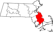
Towns Abington | Carver | Duxbury | East Bridgewater | Halifax | Hanover | Hanson | Hingham | Hull | Kingston | Lakeville | Marion | Marshfield | Mattapoisett | Middleborough | Norwell | Pembroke | Plymouth | Plympton | Rochester | Rockland | Scituate | Wareham | West Bridgewater | Whitman
CDPs Bridgewater | Duxbury | Green Harbor-Cedar Crest | Hanson | Hingham | Kingston | Marion Center | Marshfield | Marshfield Hills | Mattapoisett Center | Middleborough Center | North Lakeville | North Pembroke | North Plymouth | North Scituate | Ocean Bluff-Brant Rock | Onset | Plymouth Center | Scituate | South Duxbury | Wareham Center | West Wareham | Weweantic | White Island Shores
Other
villagesCategories:- Towns in Plymouth County, Massachusetts
- Carver, Massachusetts


Wikimedia Foundation. 2010.