- Ashburnham, Massachusetts
Infobox Settlement
official_name = Ashburnham, Massachusetts
nickname =
motto =
imagesize =
image_caption =
image_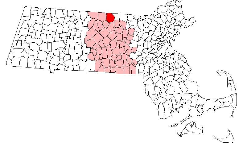
mapsize = 250px
map_caption = Location in Worcester County in Massachusetts
mapsize1 =
map_caption1 =
subdivision_type = Country
subdivision_name =United States
subdivision_type1 = State
subdivision_name1 =Massachusetts
subdivision_type2 = County
subdivision_name2 = Worcester
established_title = Settled
established_date = 1736
established_title2 = Incorporated
established_date2 = 1765
established_title3 =
established_date3 =
government_type =Open town meeting
leader_title =Town Administrator
leader_name = Kevin E. Paicos
leader_title1 =
leader_name1 = Mark Carlisle
Jonathan Dennehy
Christopher Gagnon
area_magnitude =
area_total_km2 = 106.2
area_total_sq_mi = 41.0
area_land_km2 = 100.2
area_land_sq_mi = 38.7
area_water_km2 = 6.0
area_water_sq_mi = 2.3
population_as_of = 2000
settlement_type = Town
population_total = 5546
population_density_km2 = 55.4
population_density_sq_mi = 143.4
elevation_m = 313
elevation_ft = 1028
timezone = Eastern
utc_offset = -5
timezone_DST = Eastern
utc_offset_DST = -4
latd = 42 |latm = 38 |lats = 10 |latNS = N
longd = 71 |longm = 54 |longs = 30 |longEW = W
website = [http://www.ashburnham-ma.gov/ www.ashburnham-ma.gov]
postal_code_type = ZIP code
postal_code = 01430
area_code = 351 / 978
blank_name = FIPS code
blank_info = 25-01885
blank1_name = GNIS feature ID
blank1_info = 0618356
footnotes =Ashburnham is a town in Worcester County,
Massachusetts . At the 2000 census the town population was 5,546. It is home toCushing Academy , a private preparatory school.For geographic and demographic information on the village of South Ashburnham, please see the article South Ashburnham,
Massachusetts .History
Ashburnham was first settled in 1736, and was officially incorporated in 1765. The name is of British origin, possibly drawn from the
Earl of Ashburnham , inPembrey , or theSussex community ofAshburnham .Ashburnam was originally made up of the lands granted to officers and soldiers of a 1690 expedition to Canada. It was called the Plantation of Dorchester-Canada until it was incorporated.
Geography
According to the
United States Census Bureau , the town has a total area of 41.0square mile s (106.2km² ), of which, 38.7 square miles (100.2 km²) of it is land and 2.3 square miles (6.0 km²) of it (5.68%) is water.Demographics
As of the
census GR|2 of 2000, there were 5,546 people, 1,929 households, and 1,541 families residing in the town. Thepopulation density was 143.4 people per square mile (55.4/km²). There were 2,204 housing units at an average density of 57.0/sq mi (22.0/km²). The racial makeup of the town was 97.66% White, 0.22% African American, 0.04% Native American, 0.61% Asian, 0.31% from other races, and 1.17% from two or more races. Hispanic or Latino of any race were 1.66% of the population. 19.5% were of Irish, 15.9% French, 13.7%French Canadian , 9.4% Italian, 7.0% English, 6.6% Finnish and 5.6% American ancestry according toCensus 2000 .There were 1,929 households out of which 42.0% had children under the age of 18 living with them, 66.8% were married couples living together, 9.3% had a female householder with no husband present, and 20.1% were non-families. 15.6% of all households were made up of individuals and 5.4% had someone living alone who was 65 years of age or older. The average household size was 2.87 and the average family size was 3.20.
In the town the population was spread out with 29.0% under the age of 18, 6.7% from 18 to 24, 30.9% from 25 to 44, 24.5% from 45 to 64, and 8.9% who were 65 years of age or older. The median age was 37 years. For every 100 females there were 103.2 males. For every 100 females age 18 and over, there were 99.3 males.
The median income for a household in the town was $55,568, and the median income for a family was $58,993. Males had a median income of $41,980 versus $31,823 for females. The
per capita income for the town was $21,659. About 4.8% of families and 6.4% of the population were below thepoverty line , including 6.8% of those under age 18 and 6.4% of those age 65 or over.Government
Infobox Mass Town Govt
county= Worcester
clerk_courts = Dennis P. McManus (D)
cty_treasurer = Position Eliminated
da = Joseph D. Early, Jr. (D)
deeds = Kathleen R. Daigneault (D)
probate = Stephen Abraham (D)
sheriff = Guy W. Glodis (D)
state_rep = Robert L. Rice (D)
state_sen = Stephen M. Brewer (D)
gov_councilors = Thomas J. Foley (D)
fed_rep =John W. Olver (D-1st District),
fed_sen =Edward Kennedy (D)John Kerry (D)Educational institutions
Private:
*
Cushing Academy Public:
*J.R. Briggs Elementary
*Overlook Middle School
*Oakmont Regional High School Points of interest
Ashburnham is the starting point for the
Wapack Trail andMassachusetts Midstate Trail .References
External links
* [http://www.ashburnham-ma.gov/ Town of Ashburnham]
* [http://www.awrsd.org/oms/JRB J.R. Briggs Elementary]
* [http://www.awrsd.org/oms/ Overlook Middle School]
Wikimedia Foundation. 2010.