- Maple Grove Township, Barry County, Michigan
-
For other places named "Maple Grove" in Michigan, see Maple Grove Township, Michigan.
Maple Grove Township, Michigan — Township — Location within the state of Michigan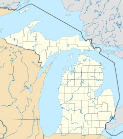
 Maple Grove Township, Michigan
Coordinates: 42°33′8″N 85°7′55″W / 42.55222°N 85.13194°WCoordinates: 42°33′8″N 85°7′55″W / 42.55222°N 85.13194°W Country United States State Michigan County Barry Area - Total 36.0 sq mi (93.1 km2) - Land 35.9 sq mi (93.0 km2) - Water 0.0 sq mi (0.1 km2) Elevation 958 ft (292 m) Population (2000) - Total 1,471 - Density 41.0/sq mi (15.8/km2) Time zone Eastern (EST) (UTC-5) - Summer (DST) EDT (UTC-4) FIPS code 26-50960[1] GNIS feature ID 1626674[2] Maple Grove Township is a civil township of Barry County in the U.S. state of Michigan. The population was 1,471 at the 2000 census. The unincorporated community of Maple Grove is located within the township.
Geography
According to the United States Census Bureau, the township has a total area of 93.1 [36.0 square miles (16 km²). 35.9 square miles (93.0 km²) of it is land and 0.04 square miles (0.1 km²) of it (0.11%) is water.
Demographics
As of the census[1] of 2000, there were 1,471 people, 510 households, and 424 families residing in the township. The population density was 41.0 per square mile (15.8/km²). There were 540 housing units at an average density of 15.0 per square mile (5.8/km²). The racial makeup of the township was 97.89% White, 0.61% African American, 0.07% Native American, 0.54% Asian, 0.14% from other races, and 0.75% from two or more races. Hispanic or Latino of any race were 0.34% of the population.
There were 510 households out of which 38.6% had children under the age of 18 living with them, 75.5% were married couples living together, 3.9% had a female householder with no husband present, and 16.7% were non-families. 14.3% of all households were made up of individuals and 5.3% had someone living alone who was 65 years of age or older. The average household size was 2.86 and the average family size was 3.15.
In the township the population was spread out with 29.2% under the age of 18, 6.4% from 18 to 24, 27.7% from 25 to 44, 27.3% from 45 to 64, and 9.5% who were 65 years of age or older. The median age was 37 years. For every 100 females there were 104.6 males. For every 100 females age 18 and over, there were 104.7 males.
The median income for a household in the township was $51,200, and the median income for a family was $54,432. Males had a median income of $40,625 versus $26,750 for females. The per capita income for the township was $18,512. About 3.4% of families and 5.8% of the population were below the poverty line, including 6.7% of those under age 18 and 2.9% of those age 65 or over.
References
Municipalities and communities of Barry County, Michigan City 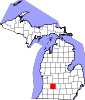
Villages Freeport | Middleville | Nashville | Woodland
Charter
townshipsCivil
townshipsAssyria | Baltimore | Barry | Carlton | Castleton | Hope | Irving | Johnstown | Maple Grove | Orangeville | Prairieville | Thornapple | Woodland | Yankee Springs
Unincorporated
communitiesCloverdale | Delton | Dowling | Hickory Corners
Categories:- Townships in Barry County, Michigan
- Grand Rapids – Wyoming metropolitan area


Wikimedia Foundation. 2010.