- George Washington and Jefferson National Forests
-
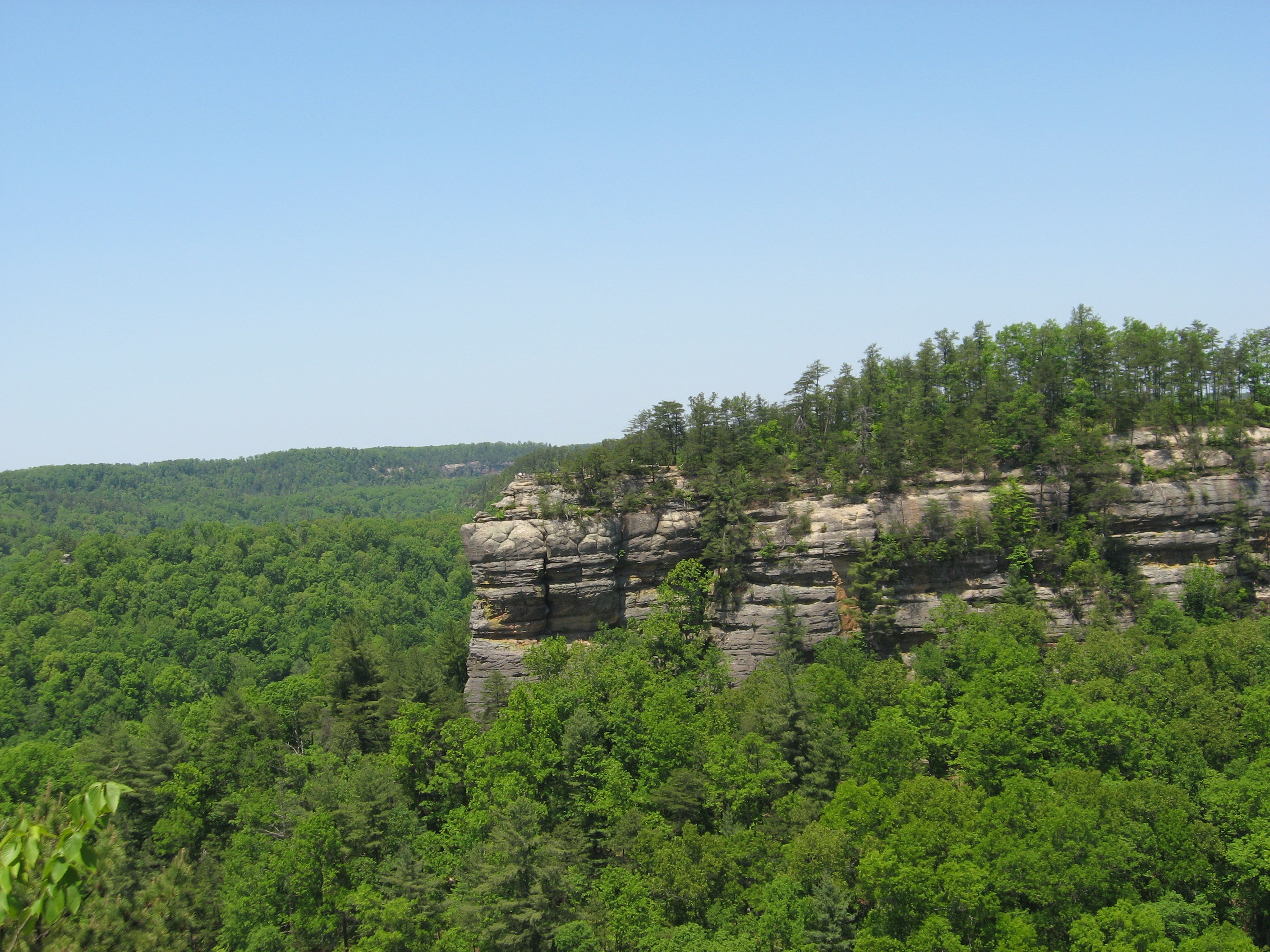
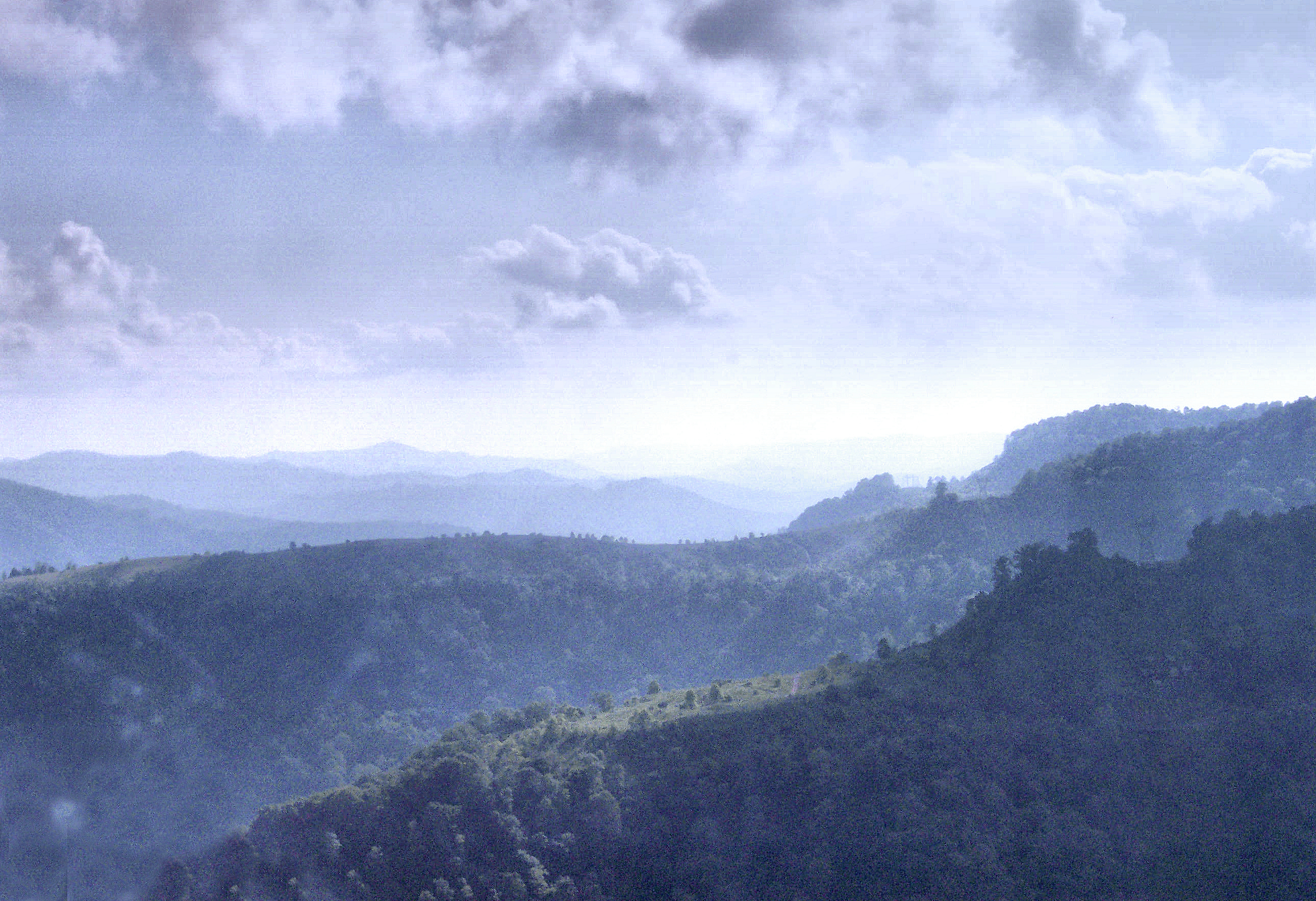
George Washington and Jefferson National Forests U.S. National Forests  White Rocks on Little Sluice Mountain in George Washington National Forest.
Country United States States Kentucky, Virginia, West Virginia Ranger Districts Clinch, Eastern Divide, Glenwood Pedlar, James River, Lee, Mount Rogers, North River, Warm Springs Coordinates 38°30′0″N 79°0′0″W / 38.5°N 79°W Highest point Mount Rogers - location Grayson and Smyth Counties, VA - elevation 5,729 ft (1,746.2 m) - coordinates 36°39′35″N 81°3′41″W / 36.65972°N 81.06139°W Lowest point South Fork Shenandoah River - location southwest of Front Royal, VA - elevation 513 ft (156.4 m) - coordinates 38°52′31″N 78°18′34″W / 38.87528°N 78.30944°W Area 1,788,739 acres (723,877 ha) Established 1995 [1] - George Washington NF 1918-05-16 [2] - Jefferson NF 1936-04-21 [2] Owner US Forest Service IUCN category VI - Managed Resource Protected Area Headquarters Roanoke, Virginia  Location of George Washington and Jefferson National Forests
Wikimedia Commons: George Washington and Jefferson National Forests Website: George Washington and Jefferson National Forests The George Washington and Jefferson National Forests are U.S. National Forests that combine to form one of the largest areas of public land in the Eastern United States. They cover 1.8 million acres (7,300 km2) of land in the Appalachian Mountains of Virginia, West Virginia, and Kentucky. Approximately 1 million acres (4,000 km2) of the forest are remote and undeveloped and 139,461 acres (564 km2)[3] have been designated as wilderness areas, which eliminates future development.
Contents
History
George Washington National Forest was established on May 16, 1918 as the Shenandoah National Forest. The forest was renamed after the first President on June 28, 1932. Natural Bridge National Forest was added on July 22, 1933.[2]
Jefferson National Forest was formed on April 21, 1936 by combining portions of the Unanka and George Washington National Forests with other land.[2] In 1995, the George Washington and Jefferson National Forests were administratively combined.[1] The border between the two forests roughly follows the James River. The combined forest is administered from its headquarters in Roanoke, Virginia.[1]
Notable features
- The northern portion of the Blue Ridge Parkway which is separately administered by the National Park Service runs through the Forest.
- Over 2,000 miles (3,000 km) of hiking trails go through the forest.
- Virginia's highest point, Mount Rogers, is located in the Mount Rogers National Recreation Area that is part of the forest. Other notable mountains include Elliott Knob which has one of the last remaining fire lookout towers in the eastern U.S. and Whitetop Mountain.
- About 230,000 acres (930 km2) of old-growth forests.
Flora and fauna
 A split rail fence at the entrance to Sherando Lake
 Main article: Appalachian-Blue Ridge forests
The Forests' vast and mountainous terrain harbors a great variety of plant life - over 50 species of trees and over 2,000 species of shrubs and herbaceous plants.[4]
The Forests contain some 230,000 acres (930 km2) of old growth forests, representing all of the major forest communities found within them.[5][6] Locations of old growth include Peters Mountain, Mount Pleasant National Scenic Area, Rich Hole Wilderness, Flannery Ridge, Pick Breeches Ridge, and Laurel Fork Gorge, Pickem Mountain, and Mount Rogers National Recreation Area.[7] The Ramsey's Draft and Kimberling Creek Wildernesses in particular are mostly old-growth.[7][8][9]
The black bear is relatively common, enough so that there is a short hunting season to prevent overpopulation. White-tailed deer, bobcat, bald eagles, weasel, otter, and marten are also known to inhabit the forest.
Activities
The forests are popular hiking, mountain biking, and hunting destinations. The Appalachian Trail extends for 330 miles (530 km) from the southern end of Shenandoah National Park through the forest and along the Blue Ridge Parkway. The forest is within a two hour drive to over 10 million people and receives heavy visitation, especially in the region closest to Shenandoah National Park.
The George Washington National Forest is a popular destination for trail runners. It is the location for several Ultramarathons, including the Massanutten Mountain Trails 100 miler, the Old Dominion 100 miler, and the Old Dominion Memorial 100 miler.[10]
George Washington Forest is also the home to Nature Camp, a natural science education-oriented summer camp for youth. The camp is located on national forest land near the town of Vesuvius, Virginia. Nature Camp has operated at this location since the summer of 1953.[11]
Counties
Counties are listed in descending order of forestland area within county. Note that Jefferson National Forest is located in 22 separate counties, more than any other National Forest except Mark Twain National Forest in Missouri, which lies in 29 counties. Note also that Botetourt, Monroe, and Rockbridge counties, at the dividing line between the two forests, include parts of both forests. Thirdly, note that the state of Kentucky actually has very little area, with its two counties bringing up the tail end of Jefferson National Forest. As of September 30, 2007 George Washington National Forest has a total area of 1,065,389 acres (4,311 km2). There are local ranger district offices located in Bridgewater, Covington, Edinburg, Hot Springs, and Staunton. Jefferson National Forest has a total area of 723,350 acres (2,927 km2). [1] There are local ranger district offices located in Blacksburg, Marion, Natural Bridge, New Castle, and Wise.
Wilderness areas
There are 139,461 acres (564 km2)[3] of federally designated wilderness areas in the two forests under the United States National Wilderness Preservation System. All are in the state of Virginia, except as indicated. The largest of these is the Mountain Lake Wilderness, at 16,511 acres (67 km2). There are 17 wildernesses in Jefferson National Forest, second only to Tongass National Forest, which has 19.
George Washington National Forest
- Barbours Creek Wilderness (part)
- Priest Wilderness
- Ramseys Draft Wilderness
- Rich Hole Wilderness
- Rough Mountain Wilderness
- Saint Mary's Wilderness
- Shawvers Run Wilderness (part)
- Three Ridges Wilderness
Jefferson National Forest
- Barbours Creek Wilderness (most)
- Beartown Wilderness
- Brush Mountain East Wilderness
- Brush Mountain Wilderness
- Garden Mountain Wilderness
- Hunting Camp Creek Wilderness
- James River Face Wilderness
- Kimberling Creek Wilderness
- Lewis Fork Wilderness
- Little Dry Run Wilderness
- Little Wilson Creek Wilderness
- Mountain Lake Wilderness (Virginia / West Virginia)
- Peters Mountain Wilderness
- Raccoon Branch Wilderness
- Shawvers Run Wilderness (most)
- Stone Mountain Wilderness
- Thunder Ridge Wilderness
See also
- Great North Mountain
- Massanutten Mountain
- Shenandoah Mountain
- Monongahela National Forest –- adjoining forest in West Virginia
References
- ^ a b c "Forest Facts". George Washington and Jefferson National Forests. Archived from the original on 2009-01-18. http://www.webcitation.org/5duLGPQUq. Retrieved 2009-01-18.
- ^ a b c d Davis, Richard C. (2005-09-29). "The National Forests of the United States" (PDF). The Forest History Society. Archived from the original on 2008-01-17. http://www.webcitation.org/5duNfdCjg. Retrieved 2009-01-18.
- ^ a b Wilderness.net search page
- ^ "George Washington & Jefferson National Forest Trees & Shrubs". George Washington and Jefferson National Forests. Archived from the original on 2009-01-17. http://www.webcitation.org/5duOObfTc. Retrieved 2009-01-17.
- ^ George Washington National Forest 1993 Revised Forest Plan. United States Forest Service. 1993. http://www.fs.fed.us/r8/gwj/forestplan/index.shtml.
- ^ Jefferson National Forest 2004 Revised Forest Plan. United States Forest Service. 2004. http://www.fs.fed.us/r8/gwj/forestplan/index.shtml.
- ^ a b Mary Byrd Davis (23 January 2008). "Old Growth in the East: A Survey. Virginia". http://www.primalnature.org/ogeast/va.pdf.
- ^ Jefferson National Forest South Half. Old Growth Inventory Map.. United States Forest Service, Southern Region. 1997. http://www.fs.fed.us/r8/gwj/forestplan/maps/og_s.pdf.
- ^ Jefferson National Forest South Half. Wilderness, Roadless, and Wild & Scenic Rivers Map.. United States Forest Service, Southern Region. 1997. http://www.fs.fed.us/r8/gwj/forestplan/maps/wrw_s.pdf.
- ^ Run100s ("Run Hundreds") - A Not-For-Profit UltraRunning Corporation
- ^ History of Nature Camp
- Hall, William L. (July 1914). "To Remake The Appalachians: A New Order In The Mountains That is Founded On Forestry -- What The Government's Appalachian Forests Mean To The People In The Mountains And To The Millions Who Want Recreation". The World's Work: A History of Our Time (Doubleday, Page & Co.) XLIV (2): 321–338. http://books.google.com/?id=zegeQtMn9JsC&pg=PA321. Retrieved 2009-08-04.
- Jefferson National Forest: An Appalachian Environmental History. Knoxville: University of Tennessee Pr., 2011.
- Prehistoric Southwest Virginia: Aboriginal Occupation, Land Use, and Environmental Worldview, Smithfield Review 5 (April 2000): 125-151.
- Turnpike Tourism in Western Virginia, Virginia Cavalcade 48:1 (Winter 1998): 14-23.
- The Potts Valley Branch Railroad and Tri-State Incline Lumber Operation in West Virginia and Virginia, 1892-1932, West Virginia History 54 (1995): 42-58.
- The Mount Rogers National Recreation Area and the Rise of Public Involvement in Forest Service Planning, Environmental History Review 28 (Summer 1994): 41-65.
- An Appalachian Forest: Creation of the Jefferson National Forest and its effects on the local community, Forest and Conservation History 37:4 (October 1993): 169-178.
- The Great Anti-Fire Campaign, American Forests, 99:5&6 (May/June 1993): 33-35, 58.
- Green Cove Station: An Appalachian train depot and its community, Virginia Cavalcade, 42:2 (Autumn 1992): 52-61.
- Fisheries and Wildlife Management: part of the history of the Jefferson National Forest, Virginia Forests, 48:2 (Summer 1992): 6-8.
External links
Visitor Attractions of the Eastern Mountain Coal Fields Parks StateBuckhorn Lake • Carr Creek • Carter Caves • Cumberland Falls • Dr. Thomas Walker • Fishtrap Lake • Grayson Lake • Greenbo Lake • Jenny Wiley • Kingdom Come • Levi Jackson Wilderness Road • Natural Bridge • Paintsville Lake • Pine Mountain • Pine Mountain Trail • Yatesville Lake
FederalInterstate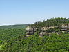


Museums Barthell Coal Mining Camp • Bell County Coal House & Museum • Bell County Historical Society Museum • Big Sandy Heritage Center • Blue Heron Coal Mining Camp • Bobby Davis Museum and Park • Breathitt County Museum • C.B. Caudill Store & History Center • Cloverfork Museum • Coal Miners' Museum • Cumberland Inn Museum • David A. Zegeer Coal-Railroad Museum • East Kentucky Science Center • Elkhorn City Railroad Museum • Harland Sanders Café & Museum • Highlands Museum and Discovery Center • Kentucky Coal Mining Museum • Kentucky Folk Art Center • Knox Historical Museum • Magoffin County Pioneer Village and Museum • Marie Stewart Museum & Craft Shop • McCreary County Museum • Morgan County History Museum • Mountain Homeplace • Mountain Life Museum • Northeastern Kentucky Museum • Swamp Valley Museum • U.S. 23 Country Music Highway Museum • Wolfe County History Museum
Forests Daniel Boone • Dewey Lake • Jefferson • Kentenia • Kentucky Ridge • Robinson • Tygarts
Reservoirs Buckhorn Lake • Carr Creek Lake • Cave Run Lake • Cranks Creek Lake • Lake Cumberland • Dewey Lake • Fishtrap Lake • Grayson Lake • Greenbo Lake • Laurel River Lake • Martins Fork Lake • Paintsville Lake • Yatesville Lake
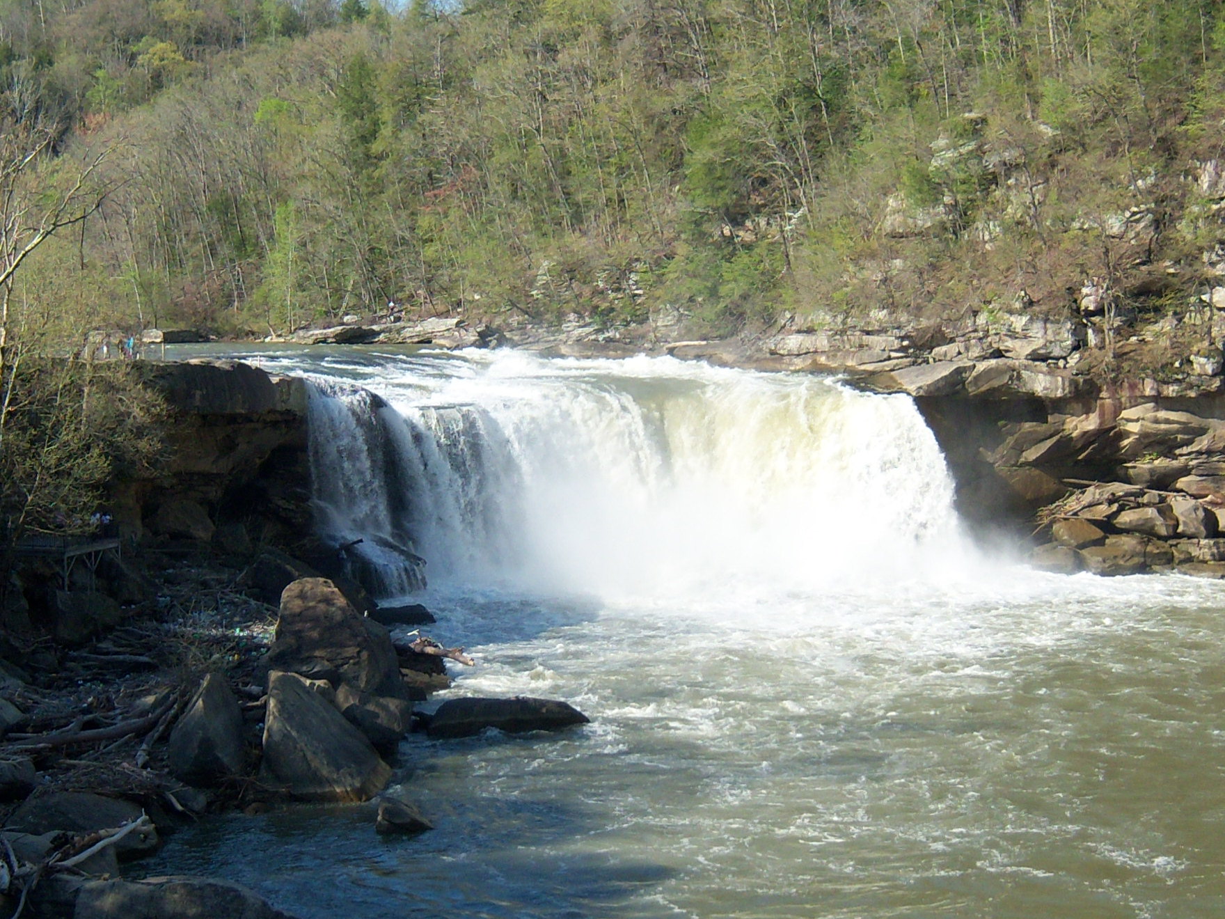
Natural features Black Mountain • Cumberland Falls • Cumberland Gap • Eagle Falls • Middlesboro crater • Pine Mountain • Pound Gap • Raven Rock • Red River Gorge • Tri-State Peak • Yahoo Arch • Yahoo Falls
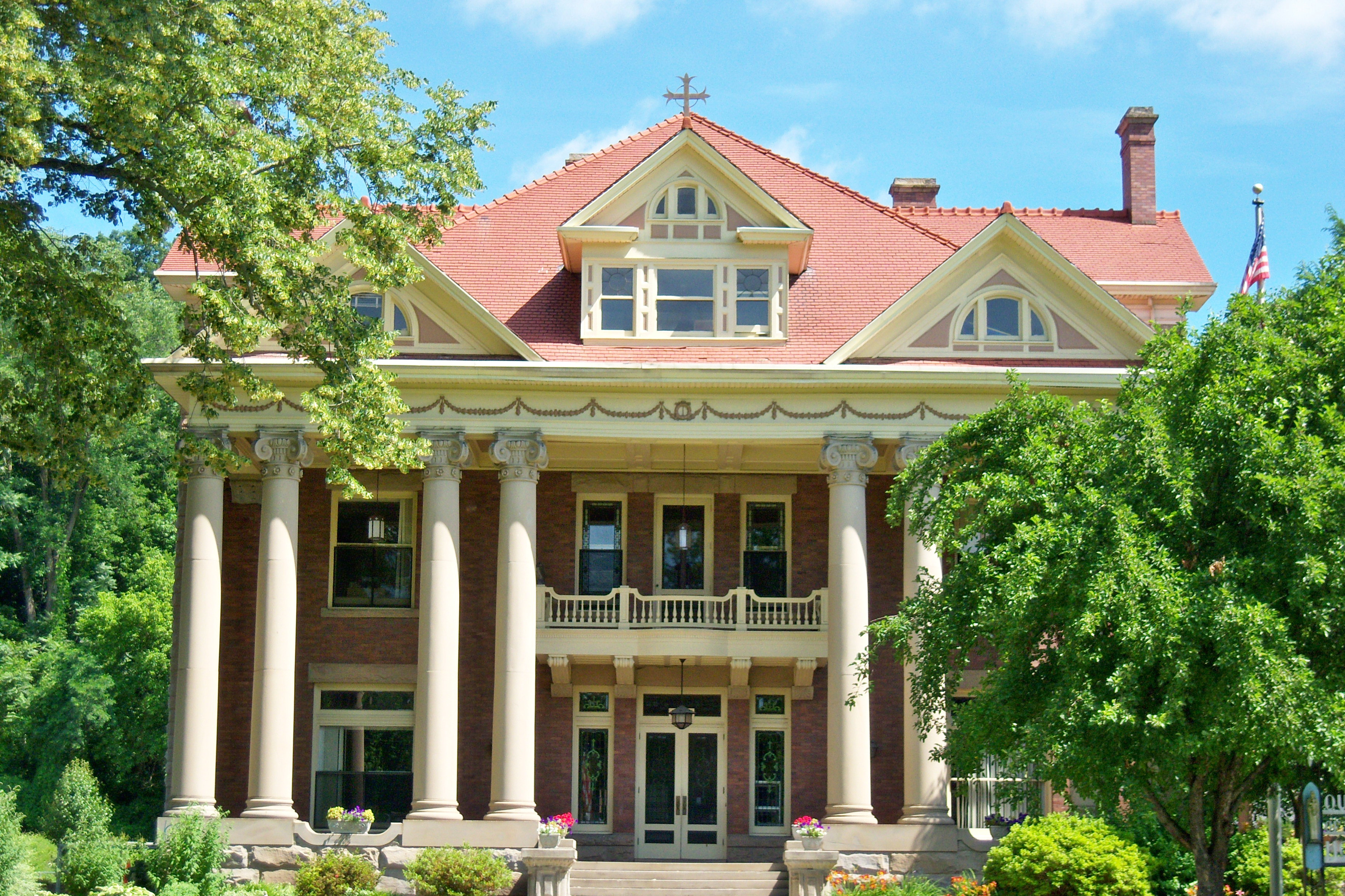
Miscellaneous Bad Branch Falls State Nature Preserve • Bat Cave and Cascade Caverns State Nature Preserves • Big South Fork Scenic Railway • Black Mountain Off-Road Adventure Area • Cumberland Gap Tunnel • Mayo Mansion • Middle Creek Battlefield • Pikeville Cut-Through • Samuel May House • Sheltowee Trace Trail
Protected Areas of Virginia Federal Alexandria · Arlington · Balls Bluff · City Point · Cold Harbor · Culpeper · Danville · Fort Harrison · Fredericksburg · Glendale · Hampton · Hampton VA · Poplar Grove · Quantico · Richmond · Seven Pines · Staunton · Winchester · Yorktown
National TrailsGeorge Washington · Jefferson · Mount Rogers National Recreation Area · Mountain Lake Wilderness · Ramsey's Draft Wilderness · Rough Mountain Wilderness · Saint Mary's Wilderness
State Bear Creek Lake · Belle Isle · Biscuit Run · Breaks Interstate · Caledon Natural Area · Chippokes Plantation · Claytor Lake · Douthat · Fairy Stone · False Cape · First Landing · Grayson Highlands · High Bridge Trail · Holliday Lake · Hungry Mother · James River · Kiptopeke · Lake Anna · Leesylvania · Mason Neck · Natural Tunnel · New River Trail · Occoneechee · Pocahontas · Sailor's Creek Battlefield · Shot Tower · Shenandoah River · Sky Meadows · Smith Mountain Lake · Southwest Virginia Museum · Staunton River · Staunton River Battlefield · Tabb Monument · Twin Lakes · Westmoreland · Wilderness Road · York River
Appomattox-Buckingham · Big Woods · Bourassa · Browne · Channels · Chilton Woods · Conway-Robinson · Crawfords · Cumberland · Devil's Backbone · Dragon Run · Hawks · Lesesne · Matthews · Moore's Creek · Niday Place · Paul · Prince Edward-Gallion · Sandy Point · Whitney · Zoar
Antioch Pines · Bethel Beach · Big Spring Bog · Blackwater · Buffalo Mountain · Bull Run Mountains · Bush Mill Stream · Camp Branch Wetlands · Cape Charles Coastal Habitat · The Cedars · The Channels · Cherry Orchard Bog · Chestnut Creek Wetlands · Chestnut Ridge · Chotank Creek · Chub Sandhill · Cleveland Barrens · Clover Hollow · Cowbane Prairie · Crow's Nest · Cumberland Marsh · Dameron Marsh · Deep Run Ponds · Dendron Swamp · Difficult Creek · Elklick Woodlands · False Cape · Folly Mills Creek Fen · Goshen Pass · Grafton Ponds · Grassy Hill · Grayson Glades · Hickory Hollow · Hughlett Point · Johnsons Creek · Magothy Bay · Mark's and Jack's Island · Mount Joy Pond · Mutton Hunk Fen · Naked Mountain · New Point Comfort · North Landing River · Northwest River · Ogdens Cave · Parkers Marsh · Parramore Island · Pedlars Hill · Pinnacle · Poor Mountain · Red Rock Mountain · Savage Neck Dunes · Unthanks Cave · William B. Trower Bayshore · Wreck Island
Wildlife
Management AreasAmelia · Big Survey · Briery Creek · Chester F. Phelps · Cavalier · Chickahominy · Clinch Mountain · Crooked Creek · Dick Cross · Fairystone Farms · Featherfin · G. Richard Thompson · Game Farm Marsh · Goshen and Little North Mountain · Hardware River · Havens · Hidden Valley · Highland · Hog Island · Horsepen Lake · James River · Land's End · Mockhorn Island · Pettigrew · Powhatan · Princess Anne · Ragged Island · Rapidan · Saxis · Stewarts Creek · T. M. Gathright · Turkeycock · Weston · White Oak Mountain
Other Counties A–B · C · D–G · H–M · N–R · S–Z · Bridges · National Historic Landmarks
Protected Areas of West Virginia Federal George Washington National Forest • Jefferson National Forest • Monongahela National ForestBig Draft Wilderness • Cranberry Wilderness • Dolly Sods Wilderness • Laurel Fork North Wilderness • Laurel Fork South Wilderness • Mountain Lake Wilderness • Otter Creek Wilderness • Roaring Plains Wilderness • Spice Run WildernessState Audra • Babcock • Beartown • Beech Fork • Berkeley Springs • Blackwater Falls • Blennerhassett Island • Bluestone • Cacapon Resort • Camp Creek • Canaan Valley Resort • Carnifex Ferry Battlefield • Cass Scenic Railroad • Cathedral • Cedar Creek • Chief Logan • Droop Mountain Battlefield • Fairfax Stone • Greenbrier River Trail • Hawks Nest • Holly River • Little Beaver • Lost River • Moncove Lake • North Bend Rail Trail • North Bend • Pinnacle Rock • Pipestem Resort • Prickett's Fort • Stonewall Jackson Lake • Tomlinson Run • Tu-Endie-Wei • Twin Falls Resort • Tygart Lake • Valley Falls • Watoga • Watters Smith Memorial
Cabwaylingo • Calvin Price • Camp Creek • Coopers Rock • Greenbrier • Kanawha • Kumbrabow • Seneca
Allegheny • Amherst-Plymouth • Anawalt Lake • Bear Rock Lakes • Becky Creek • Beech Fork Lake • Berwind Lake • Beury Mountain • Big Ditch • Big Ugly • Bluestone • Burches Run • Burnsville Lake • Castleman Run Lake • Cecil H. Underwood • Center Branch • Chief Cornstalk • Conaway Run Lake • Cross Creek • Dents Run • Dunkard Fork • East Lynn Lake • Edwards Run • Elk Creek • Elk River • Fort Mill Ridge • Frozen Camp • Green Bottom • Handley • Hilbert • Hillcrest • Horse Creek • Hughes River • Huttonsville State Farm • Lantz Farm and Nature Preserve • Laurel Lake • Lewis Wetzel • Little Indian Creek • McClintic • Meadow River • Mill Creek • Moncove Lake • Morris Creek • Nathaniel Mountain • Panther • Pedlar • Pleasant Creek • Plum Orchard Lake • Pruntytown State Farm • R.D. Bailey Lake • Ritchie Mines • Sand Hill • Shannondale Springs • Short Mountain • Slatyfork • Sleepy Creek • Smoke Camp • Snake Hill • South Branch • Stonecoal Lake • Stonewall Jackson Lake • Stumptown • Summersville Lake • Tate Lohr • Teter Creek Lake • The Jug • Thorn Creek • Tug Fork • Turkey Run • Upper Deckers Creek • Upper Mud River • Valley Bend Wetlands • Wallback • Widmeyer • Woodrum Lake
West Virginia State Wildlife CenterNon-
governmentalNature
Conservancy
preservesBrush Creek • Bear Rocks • Cranesville Swamp • Greenland Gap • Hungry Beech • Ice Mountain • Mount Porte Crayon • Murphy • Panther Knob • Pike Knob • Slaty Mountain • Upper Shavers Fork • Yankauer
West Virginia Division of Forestry • West Virginia Division of Natural ResourcesCategories:- National Forests of Kentucky
- National Forests of Virginia
- National Forests of West Virginia
- George Washington
- James River (Virginia)
- Thomas Jefferson
- George Washington and Jefferson National Forests
- Blue Ridge Mountains
- Protected areas established in 1918
- Protected areas of Augusta County, Virginia
- Protected areas of Bath County, Virginia
- Protected areas of Alleghany County, Virginia
- Protected areas of Rockingham County, Virginia
- Protected areas of Shenandoah County, Virginia
- Protected areas of Highland County, Virginia
- Protected areas of Amherst County, Virginia
- Protected areas of Hardy County, West Virginia
- Protected areas of Pendleton County, West Virginia
- Protected areas of Rockbridge County, Virginia
- Protected areas of Page County, Virginia
- Protected areas of Nelson County, Virginia
- Protected areas of Botetourt County, Virginia
- Protected areas of Warren County, Virginia
- Protected areas of Frederick County, Virginia
- Protected areas of Hampshire County, West Virginia
- Protected areas of Monroe County, West Virginia
- Protected areas of Craig County, Virginia
- Protected areas of Bland County, Virginia
- Protected areas of Smyth County, Virginia
- Protected areas of Giles County, Virginia
- Protected areas of Wythe County, Virginia
- Protected areas of Wise County, Virginia
- Protected areas of Scott County, Virginia
- Protected areas of Grayson County, Virginia
- Protected areas of Washington County, Virginia
- Protected areas of Montgomery County, Virginia
- Protected areas of Pulaski County, Virginia
- Protected areas of Bedford County, Virginia
- Protected areas of Lee County, Virginia
- Protected areas of Tazewell County, Virginia
- Protected areas of Dickenson County, Virginia
- Protected areas of Carroll County, Virginia
- Protected areas of Roanoke County, Virginia
- Protected areas of Letcher County, Kentucky
- Protected areas of Pike County, Kentucky


Wikimedia Foundation. 2010.